
Belcher Hill and Whippletree Trail
View Photos
Belcher Hill and Whippletree Trail
Difficulty Rating:
The Belcher Hill and Whippletree Trail is an exciting adventure—how could it not be with a name like that? The meadow-cloaked hike reveals expansive views of the Denver cityscape and the shimmering lakes below. Great for hiking and biking, this versatile trail attracts outdoor enthusiasts of all sorts.
Getting there
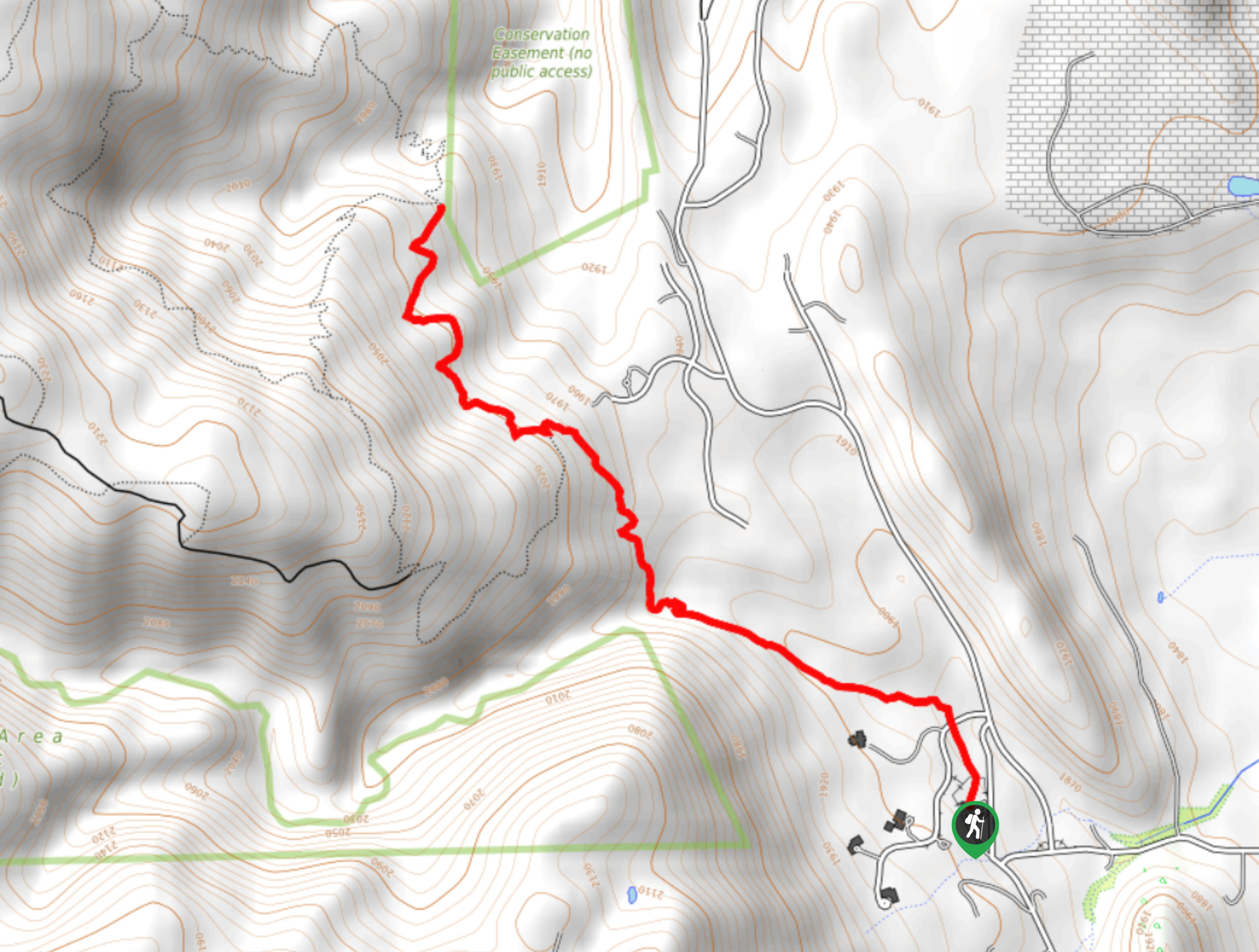
The Belcher Hill and Whippletree Trail departs from the trailhead and parking lot at the intersection of Glencoe Valley Road and Pine Ridge Road.

About
| Backcountry Campground | No |
| When to do | Year-round |
| Pets allowed | Yes - On Leash |
| Family friendly | Yes |
| Route Signage | Average |
| Crowd Levels | Moderate |
| Route Type | Out and back |
Belcher Hill and Whippletree Trail
Elevation Graph
Weather
Belcher Hill and Whippletree Trail Description
The Belcher Hill and Whippletree Trail is a scenic adventure on the border of the state capital. Travel along the meadowed ridge which rewards adventurers with a unique perspective, overlooking the cityscape and the rolling hills. Though the exposed terrain means wonderful views, it also warrants extreme conditions. In the summer months, we highly suggest trekking in the early morning to beat the unbearable afternoon heat. If you are walking this path, be mindful of mountain bikers passing by—for your safety and theirs! It is also worth noting that there are rattlesnakes in the area, so keep an ear and eye out for them as you hike.
Departing from the trailhead, the Belcher Hill and Whippletree Hike follows the Belcher Hill Trail north. Hike this route through the grassy terrain and it will gradually divert northwest. As you ascend the terrain, keep an eye out for grazing elk and deer! Eventually, you will encounter an intersection, stay right here and you will be diverted onto the Whippletree Trail. Hike this route along the exposed ridge that delivers dumbfounding views of the Denver area. Spot Ralston Lake, both Upper and Lower Long Lakes, Tucker Lake, and the Blunn Reservoir below.
You will sadly meet the route’s end at the intersection with the Lower Longhorn Trail. To get back to the trailhead, simply retrace your footing along the path or loop back around on the Lower Longhorn Trail and Belcher Hill Trail.
Similar hikes to the Belcher Hill and Whippletree Trail hike

Singletree and Mayhoffer Trail
The Singletree and Mayhoffer Trail is a scenic adventure that will guide adventurers through the lush meadowlands that reveal sights…
Hidden Fawn Loop Trail
The Hidden Fawn Loop Trail is a lovely meadowland adventure in the Alderfer/Three Sisters Open Space Park. Enjoy sights of…

Mount Galbraith via Cedar Gulch Trail
The Mount Galbraith via Cedar Gulch Trail is a charming adventure near Golden, Colorado that reveals the beauty and diversity…
Comments