
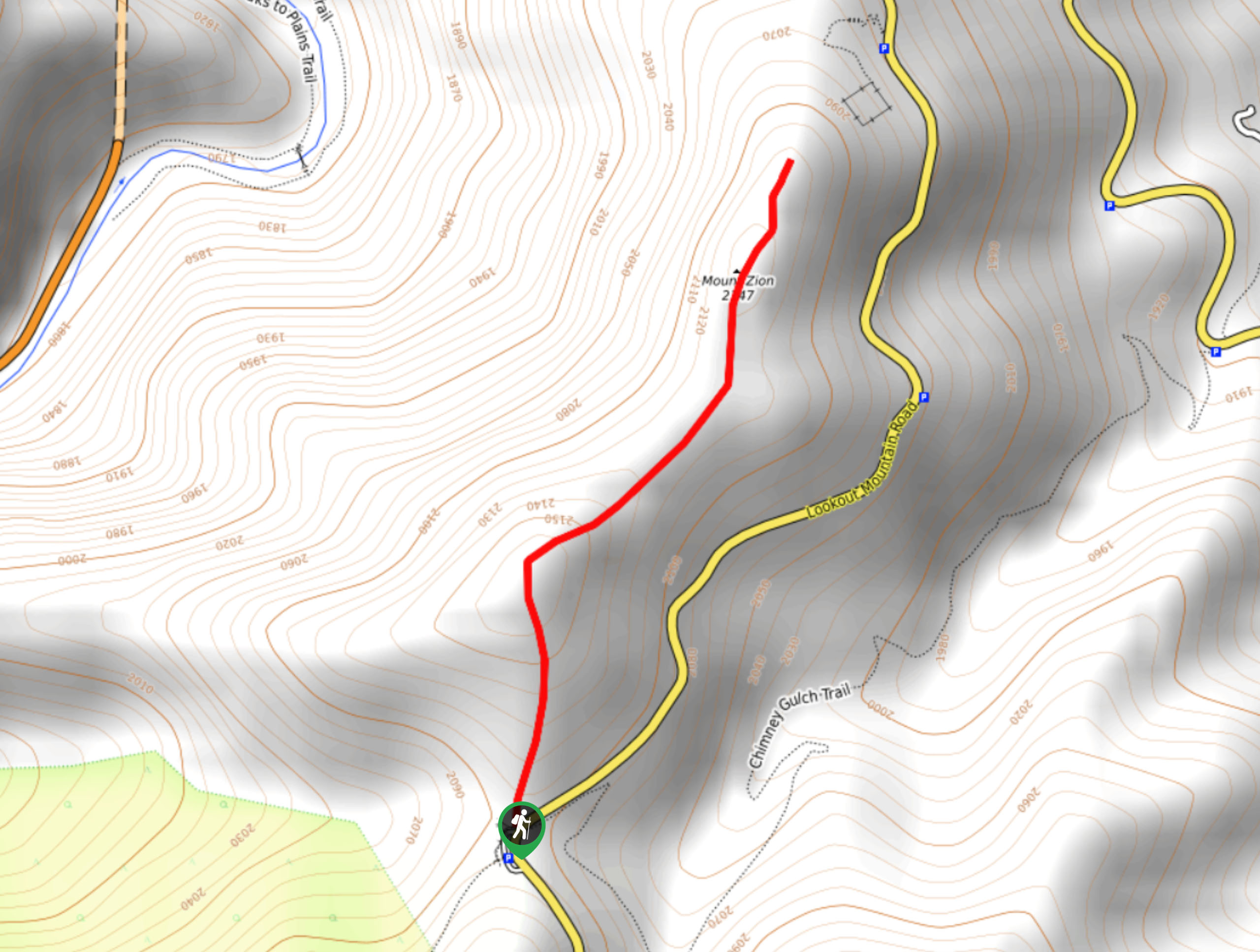
Mount Zion Trail
View Photos
Mount Zion Trail
Difficulty Rating:
The Mount Zion Trail is an epic summit adventure that reveals dumbfounding views that are usually only reserved for technical Front Range hikes. Get in your daily movement and enjoy the stunning scenery that the Colorado wilderness has to offer.
Getting there
The Mount Zion Trail is accessed via the Mount Zion trailhead off Lookout Mountain Road.

About
| Backcountry Campground | No |
| When to do | Year-round |
| Pets allowed | Yes - On Leash |
| Family friendly | Yes |
| Route Signage | Poor |
| Crowd Levels | Moderate |
| Route Type | Out and back |
Mount Zion Trail
Elevation Graph
Weather
Mount Zion Trail Description
The Mount Zion Trail is a short, but sweet hike perfect for a spontaneous adventure near Golden, Colorado. This charming hike travels through the arid, rocky terrain which reveals wonderful views of the Clear Creek Canyon. This path is overgrown in areas, so use the trail GPS to help navigate the uneasy terrain. Note there is a false summit, but the true peak is at the weather station! Rattlesnakes are also abundant in this area so keep an ear and eye out for them as you travel through the wilderness.
From the trailhead off the Lookout Mountain Road track northeast. Immediately the path will ascend some steep terrain, but don’t let it discourage you, the route will level out and the views are well worth the effort. There are some sparse pines that line the trail, but they won’t impede your views too much. Continue along the trail, and you will soon ascend the false summit—don’t stop here. Follow the path further along the more level terrain, to the weather station atop the peak of Mount Zion.
From the summit, enjoy the expansive views of Golden, the Clear Creek Canyon, and Front Range peaks. Revel in the scenery, and when you are ready, retrace your footing along the path back to the trailhead.
Similar hikes to the Mount Zion Trail hike
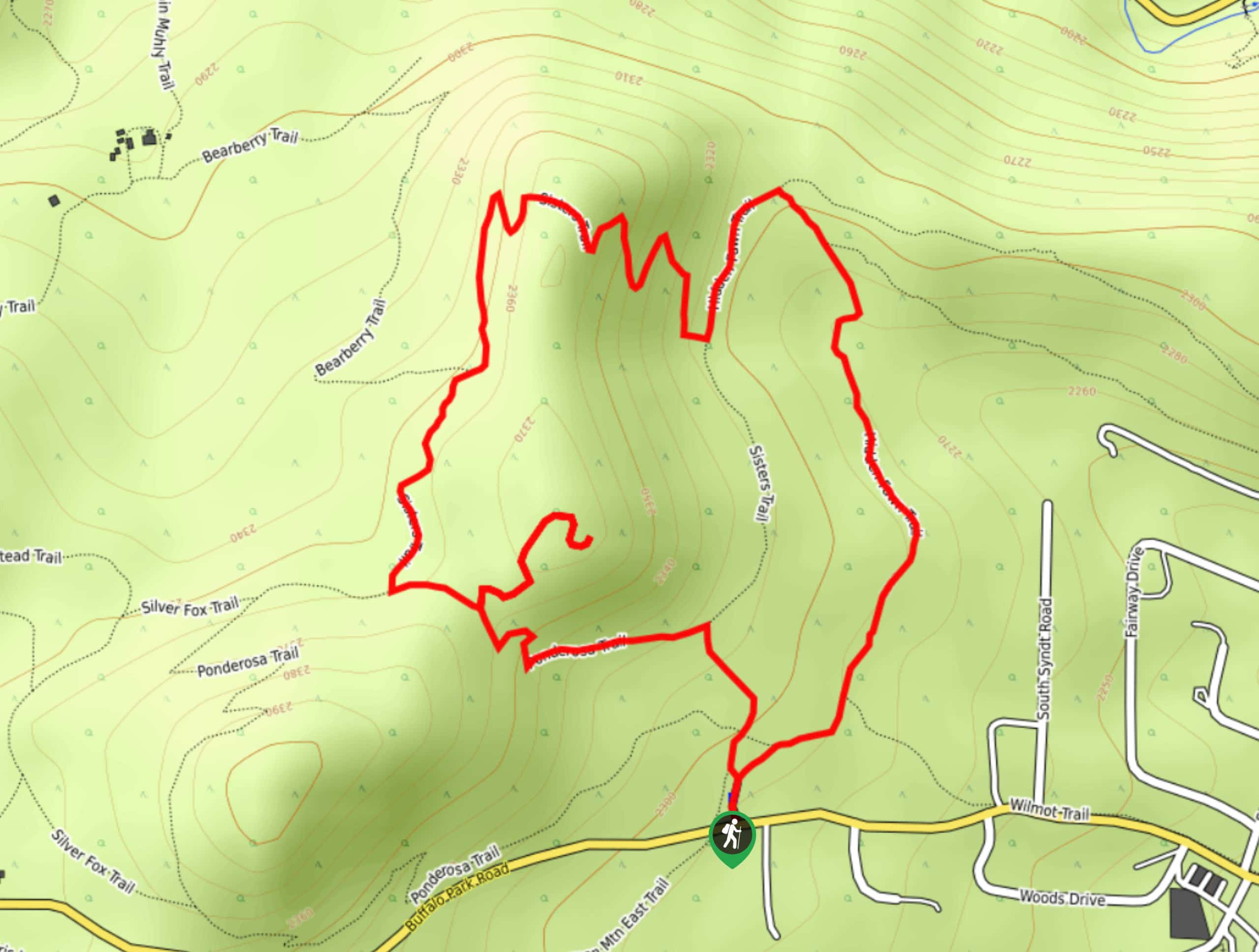
Hidden Fawn Loop Trail
The Hidden Fawn Loop Trail is a lovely meadowland adventure in the Alderfer/Three Sisters Open Space Park. Enjoy sights of…
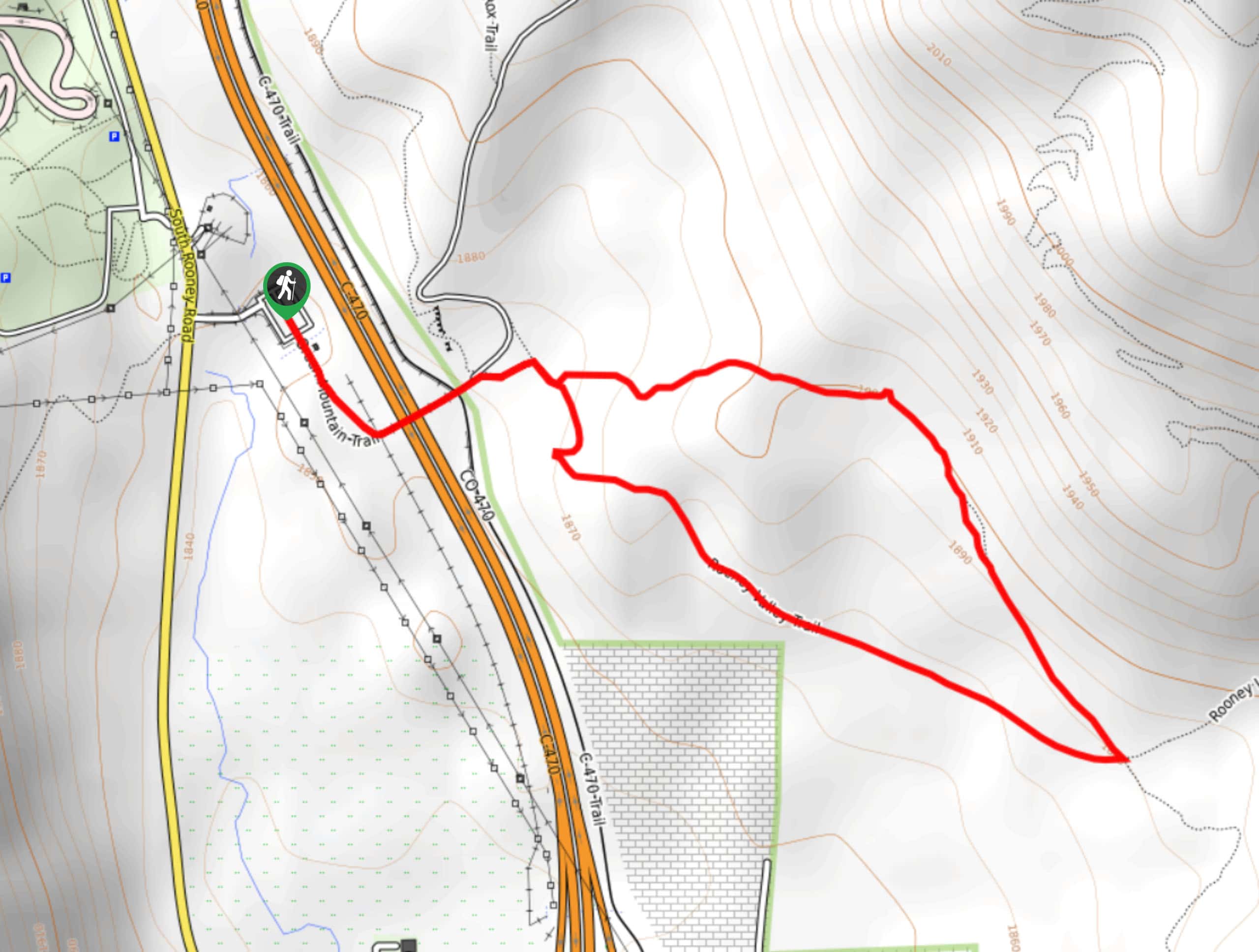
Green Mountain Loop Hike
The Green Mountain Loop Hike is a charming nature walk along the base of Green Mountain. Hike through the grassy…
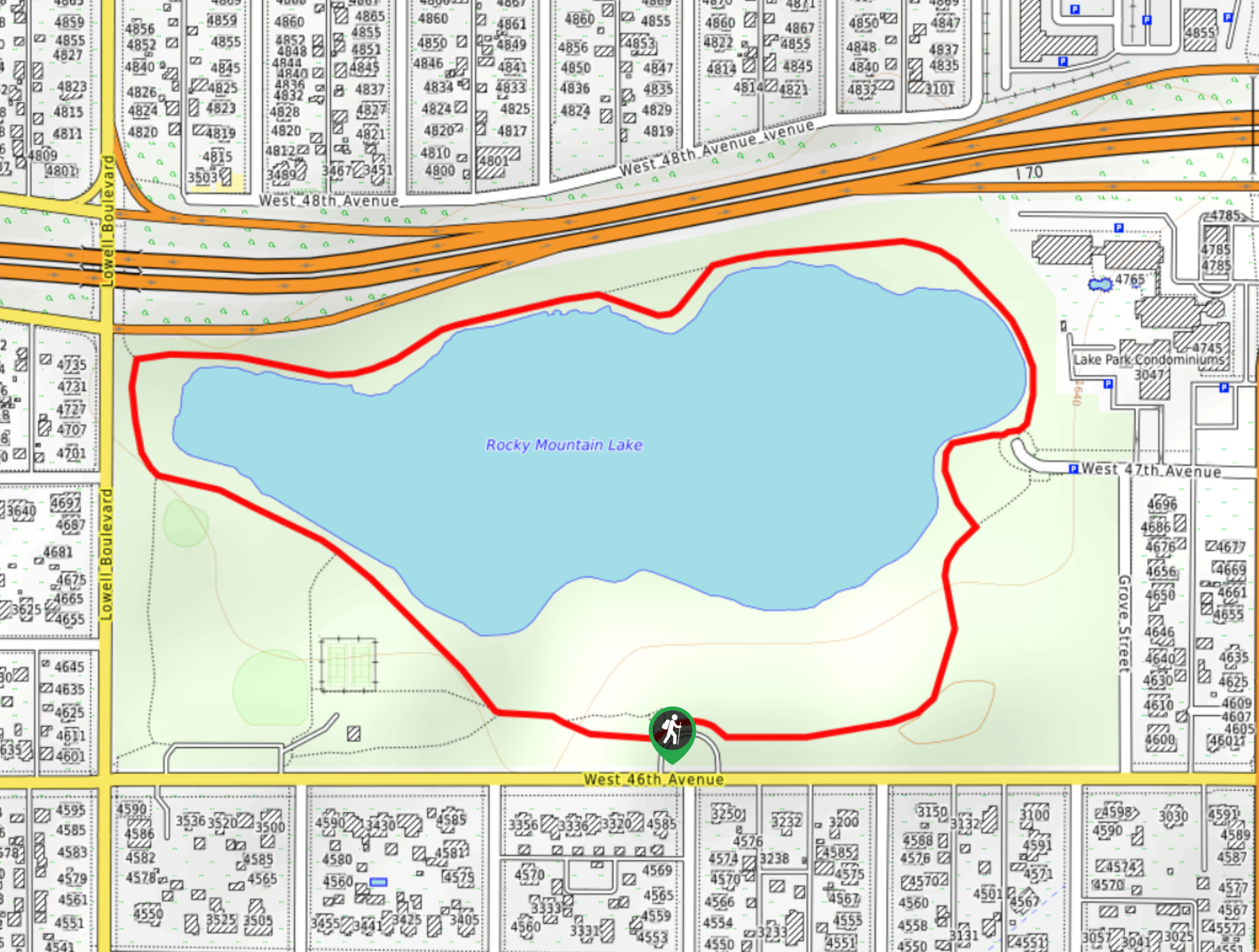
Rocky Mountain Lake Park Loop
The Rocky Mountain Lake Park Loop will transport you from the city’s center to a lakeside oasis. Hike around the…
Comments