
Coalton Road Hike
View Photos
Coalton Road Hike
Difficulty Rating:
The Coalton Road Hike is a wonderful day-hike near Denver. If you are seeking a long hike with limited elevation change, then you have met your match. This charming trail will guide adventurers through the plains which reveal grand views of the mountains that line the horizon.
Getting there
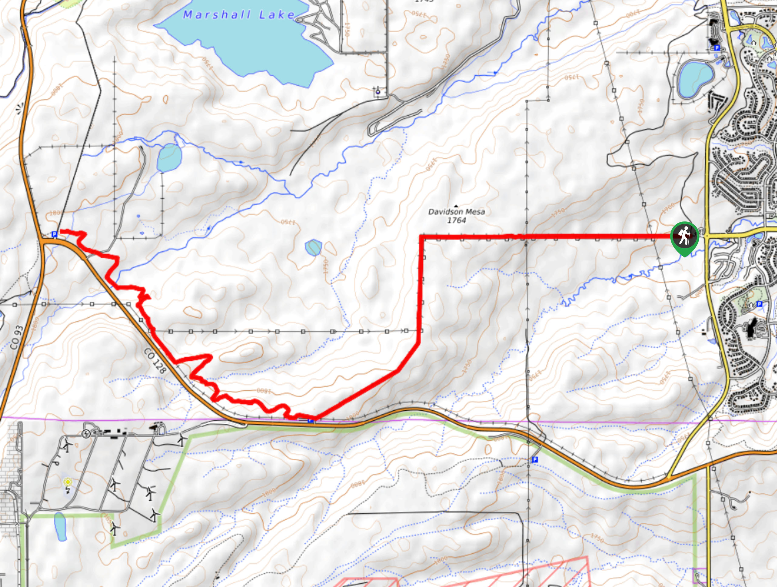
The Coalton Road Hike begins from the trailhead at the intersection of McCaslin Blvd and Coalton Road.

About
| Backcountry Campground | No |
| When to do | Year-round |
| Pets allowed | Yes - On Leash |
| Family friendly | Older Children only |
| Route Signage | Average |
| Crowd Levels | Moderate |
| Route Type | Out and back |
Coalton Road Hike
Elevation Graph
Weather
Coalton Road Hike Description
The Coalton Road Hike is a wonderful day hike choice for those seeking a lengthy, but moderately easy venture. The level terrain boasts expansive views of the Front Range and Denver’s skyline. This versatile trail attracts outdoor enthusiasts of all sorts, so don’t be surprised if you have to share the trail. Summer, winter, fall, or spring, this path is open to the public, but if you track this route in the summer months it is worth noting that rattlesnakes love sunbathing on the road, so keep an eye and ear out as you hike.
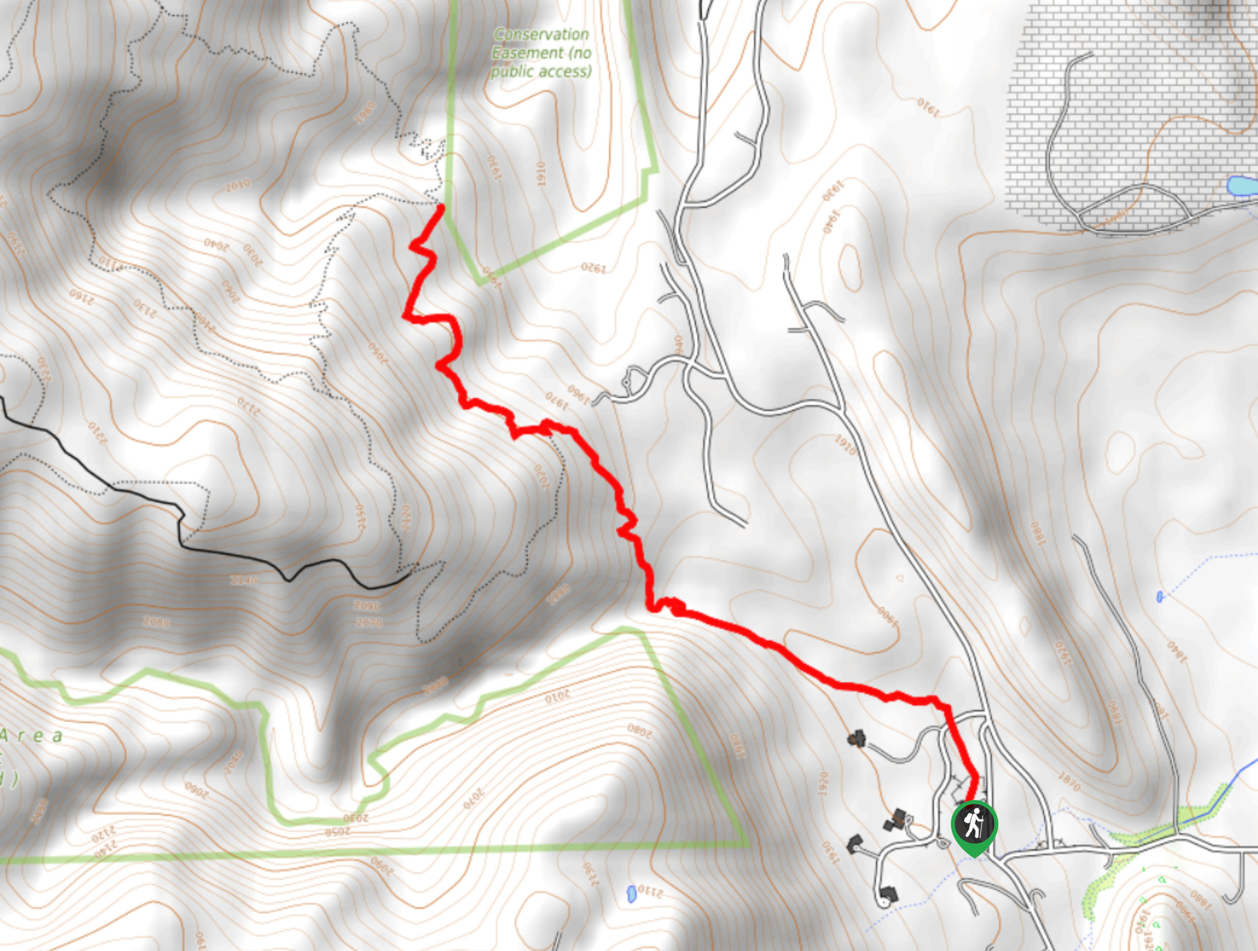
Departing from the Coalton Road Trailhead, track the service road west. The exposed path will guide you past the Davidson Mesa before abruptly curving south. As you hike make sure to take in the stunning views which include sights of the Flatirons. Follow the path which will eventually guide you back west where you will encounter a junction. Keep straight and you will be diverted onto the High Plains Trail. Ascend the mild grade up to the trail’s end at the Greenbelt Plateau Trailhead.
From here enjoy a better view of the cityscape, rest and recover before beginning your return. When you are ready, simply retrace your footing along the path all the way back to the trailhead.
Similar hikes to the Coalton Road Hike hike

Singletree and Mayhoffer Trail
The Singletree and Mayhoffer Trail is a scenic adventure that will guide adventurers through the lush meadowlands that reveal sights…

Mount Galbraith via Cedar Gulch Trail
The Mount Galbraith via Cedar Gulch Trail is a charming adventure near Golden, Colorado that reveals the beauty and diversity…
Belcher Hill and Whippletree Trail
The Belcher Hill and Whippletree Trail is an exciting adventure—how could it not be with a name like that? The…
Comments