
Cottonwood Canyon Trail
View Photos
Cottonwood Canyon Trail
Difficulty Rating:
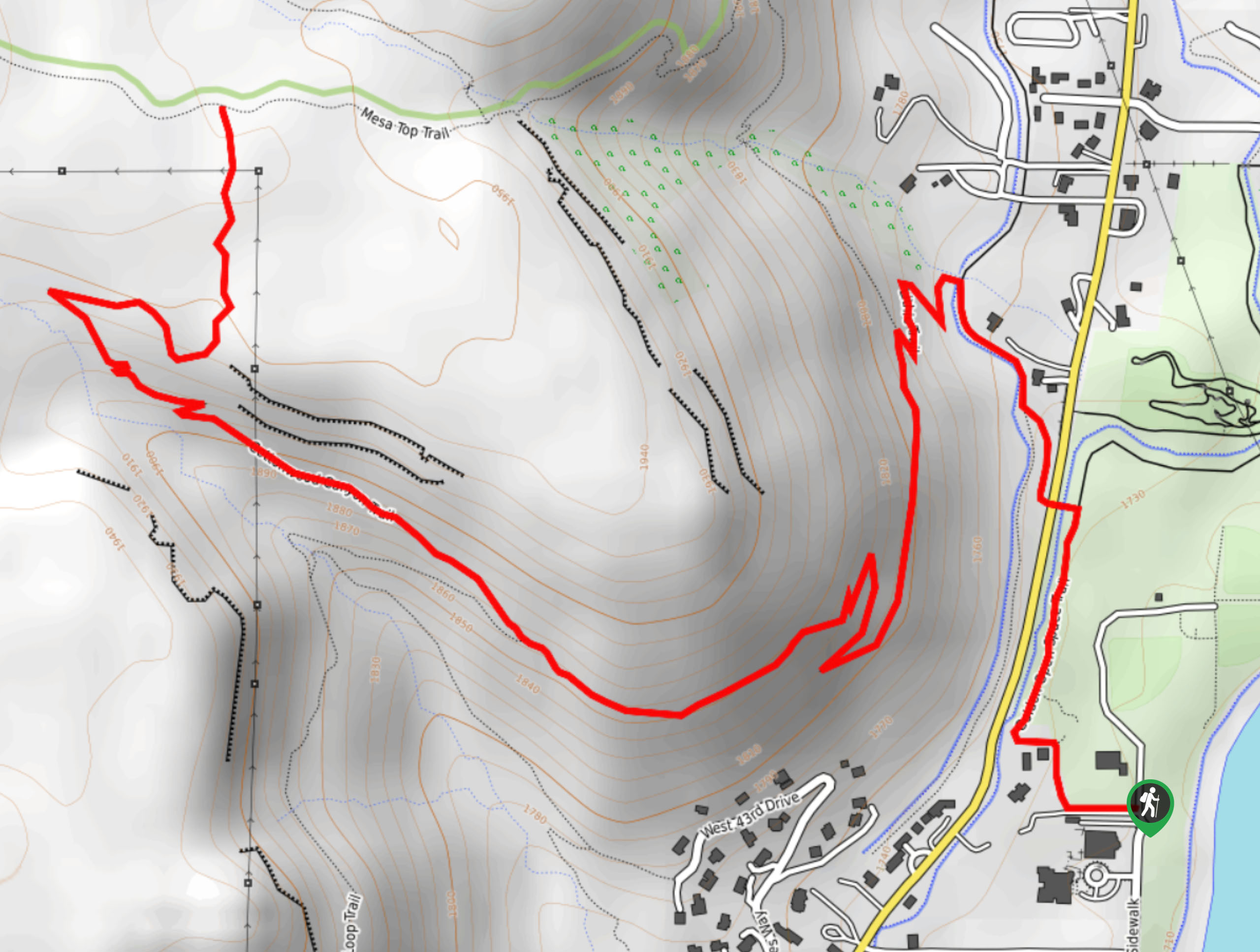
The Cottonwood Canyon Trail is an exciting adventure up a steep-walled canyon. Hike along a gurgling creek and enjoy the sights of rock climbers and boulderers as you ascend the rocky terrain. Ideal for intrepid adventurers who don’t mind a bit of a scramble up to the summit of the North Table Mesa.
Getting there
The Cottonwood Canyon Trail departs from the Golden Open Space Trail off Salvia Road.

About
| Backcountry Campground | No |
| When to do | April-September |
| Pets allowed | Yes - On Leash |
| Family friendly | Yes |
| Route Signage | Poor |
| Crowd Levels | High |
| Route Type | Out and back |
Cottonwood Canyon Trail
Elevation Graph
Weather
Cottonwood Canyon Trail Description
The Cottonwood Canyon Trail is a stimulating adventure near the city’s center. Ideal for a spontaneous day hike, this trek is an epic adventure to blow off some steam. This versatile trail is accessible year-round, and in the summer months, you will often be hiking amongst mountain bikers, so keep an ear out for them as they pass by. We highly suggest wearing sturdy footwear to avoid rolling an ankle on the rocky terrain! Note that rattlesnakes are abundant in this area, so be mindful of them as you travel through the arid terrain. The exposure of the terrain warrants epic vistas, but unbearably hot conditions in the warmer season, so wear plenty of sunscreen and consider wearing a sunhat.
Fill up your water bottle and lace up your hiking shoes because we are going on an adventure along the Cottonwood Canyon Trail. Departing from the trailhead, track the Golden Open Space Trail north along Church Ditch. Soon after your departure from the trailhead, turn left onto the Fairmont Canal Trail, crossing over the ditch and Easley Road. Now trekking along the canal, turn left at the next intersection onto the Lithic Trail. Ascend the switchbacks to the next junction. From here, veer left onto the North Table Loop Trail and hike southwestwardly.
At the next intersection, keep right onto the Cottonwood Canyon Trail. Ascend the valley, along a gurgling creek and admire the encompassing towering cliffs. Scramble up the rocky terrain to the summit of the North Table Mesa. Revel in the panoramic sights of the encompassing wilderness and the cityscape before beginning your descent. When you are ready, simply retrace your footing along the path back to the trailhead.
Similar hikes to the Cottonwood Canyon Trail hike

Singletree and Mayhoffer Trail
The Singletree and Mayhoffer Trail is a scenic adventure that will guide adventurers through the lush meadowlands that reveal sights…
Hidden Fawn Loop Trail
The Hidden Fawn Loop Trail is a lovely meadowland adventure in the Alderfer/Three Sisters Open Space Park. Enjoy sights of…

Mount Galbraith via Cedar Gulch Trail
The Mount Galbraith via Cedar Gulch Trail is a charming adventure near Golden, Colorado that reveals the beauty and diversity…
Comments