Chimney Gulch Trail
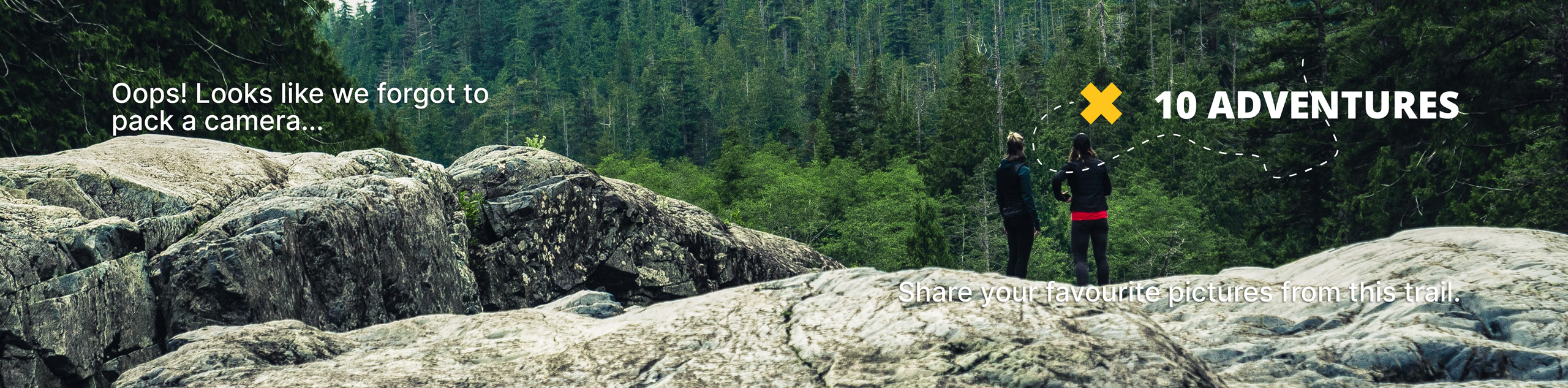
View Photos
Chimney Gulch Trail
Difficulty Rating:
The Chimney Gulch Trail is a great adventure that travels through several Colorado ecosystems. Hike through grassy plains, ponderosa pine forests, and up to the summit of Lookout Mountain, which delivers awe-inspiring views of the Clear Creek Canyon and mountainous Colorado landscape.
Getting there
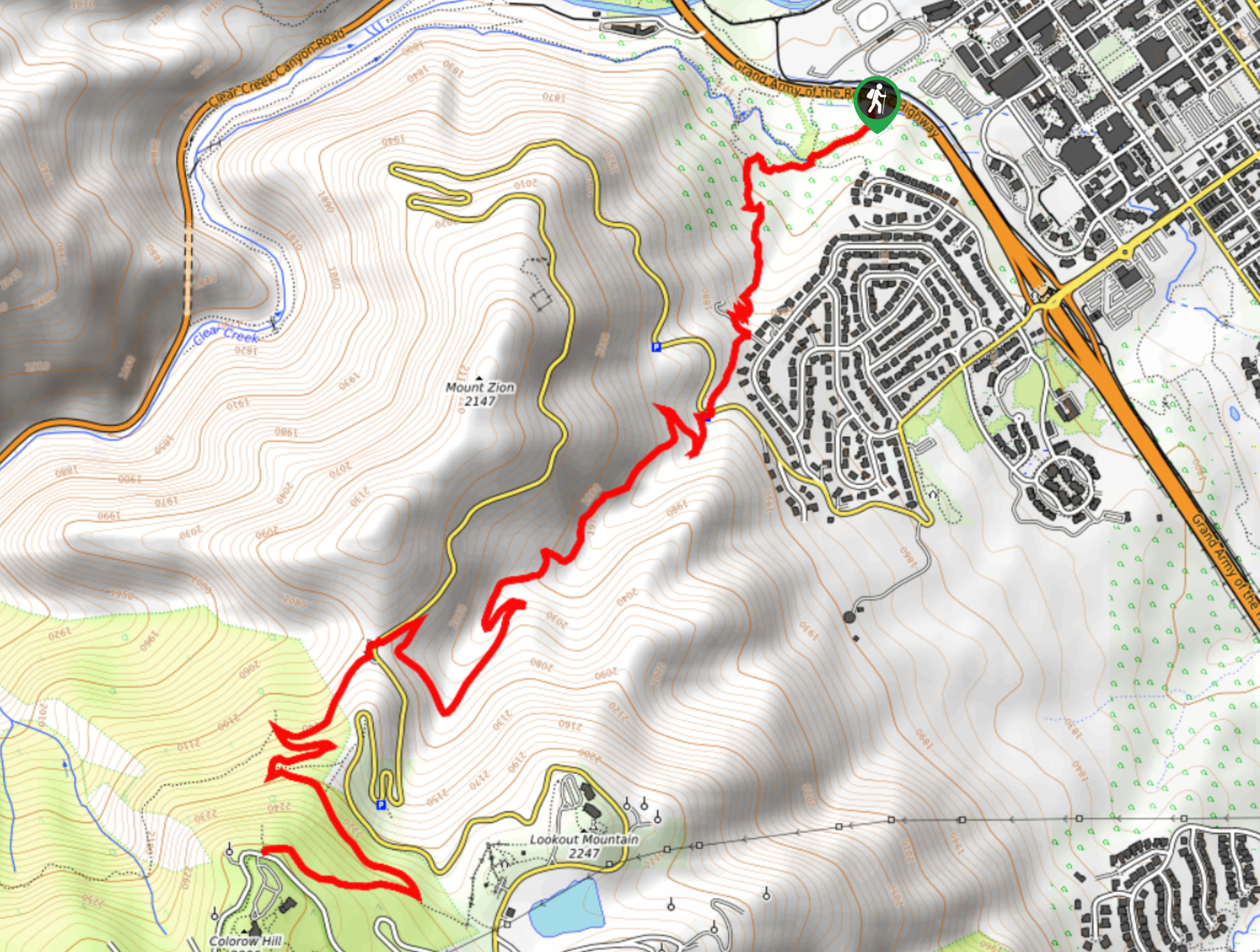
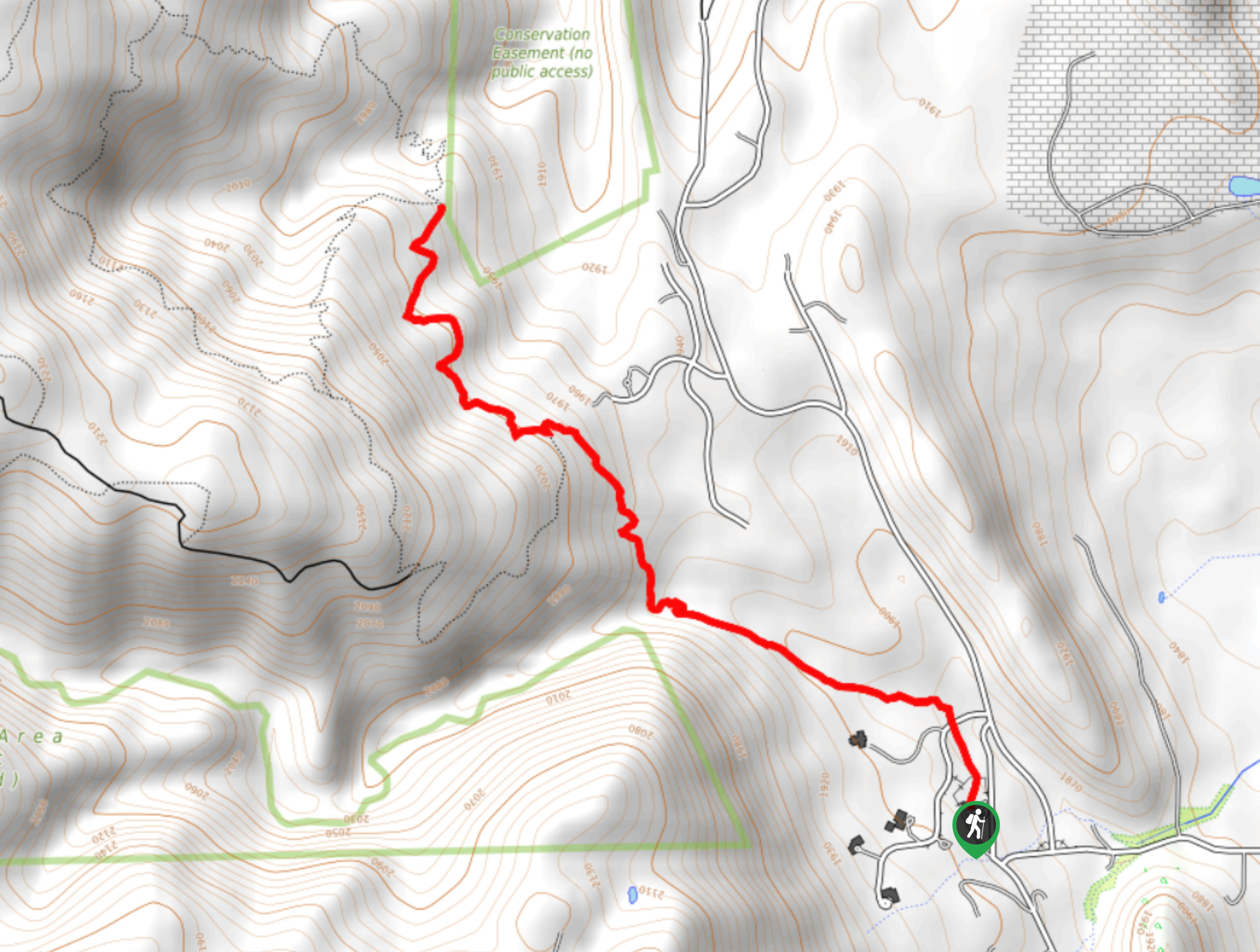
The Chimney Gulch Trail departs from the trailhead off Highway 6.

About
| Backcountry Campground | No |
| When to do | Year-round |
| Pets allowed | Yes - On Leash |
| Family friendly | Older Children only |
| Route Signage | Good |
| Crowd Levels | Extreme |
| Route Type | Out and back |
Chimney Gulch Trail
Elevation Graph
Weather
Chimney Gulch Trail Description
The Chimney Gulch Trail is a scenic adventure that sits on the city limits. If you are seeking an escape from the hustle and bustle, then we have the perfect excursion for you. Traveling through diverse terrains, the Chimney Gulch Hike exhibits all the best that Colorado has to offer, rolled all into one epic day hike. Make sure you wear layers, as the various ecosystems warrant differing temperatures. We would also recommend sturdy footwear as sections of the terrain are rocky and rugged! This versatile path is also shared with bikers, so be mindful of your fellow adventurers and step off the single-track trail to let them pass. It is also worth noting that rattlesnakes are abundant in this area, so keep an eye and ear out for them as you progress the route.
Hike through luxuriant meadows, ponderosa pine forests, and up to a Front Range summit that reveals breathtaking views of Colorado’s Clear Creek Canyon. This epic adventure gradually ascends through the various terrains all the way to the summit—we won’t kid you; it’s a butt burner. Get in your daily steps as you climb up the scenic path among other like-minded outdoor enthusiasts. As you trek, keep your eyes out for deer grazing in the meadowlands and birds soaring above. This is a perfect hike for those who enjoy summit hikes but don’t have the time to drive out into the Indian Peaks Wilderness. Conveniently located on the border of Golden, Colorado, this trail presents the perfect excuse to get out into nature.
Embark on your adventure along the Chimney Gulch Trail from the trailhead off Highway 6. From here, the climb up to the summit begins immediately. The initial section of the hike will guide you through meadowlands and exposed terrain. Enjoy sights of Mount Zion as you cross over Clear Creek and past the Colorado School of Mines tunnels. Soon after your departure from the trailhead, you will have to cross over Lookout Mountain Road. Be mindful of vehicles and cycling traffic as you cross the intersection before reconnecting with the Chimney Gulch Trail. Ascend the meadow-cloaked trail, noticing sights of Lookout Mountain looming in the south.
As you ascend, the path will guide you through a few switchbacks as it climbs through increasingly forested terrain. You will again have to cross over the Lookout Mountain Road which will lead you to a parking lot. From here, take the Lookout Mountain Trail through the coverage of ponderosa pines. At the next junction, keep left, navigating another set of switchbacks up the route. Soon, you will confront yet another intersection where you will want to keep right, guiding you to the panoramic overlook.
From the lookout point atop Lookout Mountain, enjoy expansive views of the Clear Creek Canyon, North and South Table Mountains, sights of the city, and distant vistas of the snow-capped Front Range peaks. Revel in the scenery and when you are ready to return, simply retrace your footing along the path all the way back to the trailhead, marking the end of your Chimney Gulch adventure.
Frequently Asked Questions
How long is the Chimney Gulch Trail?
The Chimney Gulch Trail can be customized to your liking, but from the trailhead on Highway 6, the path travels about 6.5mi to Lookout Mountain.
Are dogs permitted on the Chimney Gulch Trail?
Yes, dogs on-leash are allowed on the Chimney Gulch Trail.
Insider Hints
The Chimney Gulch Trail travels through exposed terrain, so wear layers and sunscreen on warm days
Bring plenty of water, this path and elevation gain will tire you
If you venture this trail in the winter or autumn, make sure to wear microspikes or snowshoes
Beware of rattlesnakes as you track through the arid terrain
Similar hikes to the Chimney Gulch Trail hike

Singletree and Mayhoffer Trail
The Singletree and Mayhoffer Trail is a scenic adventure that will guide adventurers through the lush meadowlands that reveal sights…

Mount Galbraith via Cedar Gulch Trail
The Mount Galbraith via Cedar Gulch Trail is a charming adventure near Golden, Colorado that reveals the beauty and diversity…
Belcher Hill and Whippletree Trail
The Belcher Hill and Whippletree Trail is an exciting adventure—how could it not be with a name like that? The…
Comments