Centennial Cone Trail
View Photos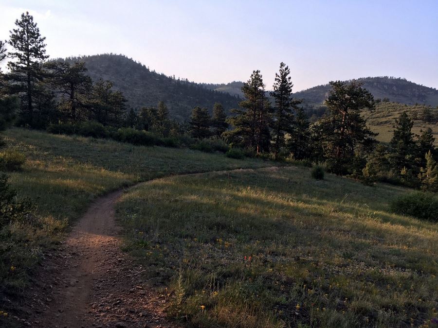
Centennial Cone Trail
Difficulty Rating:
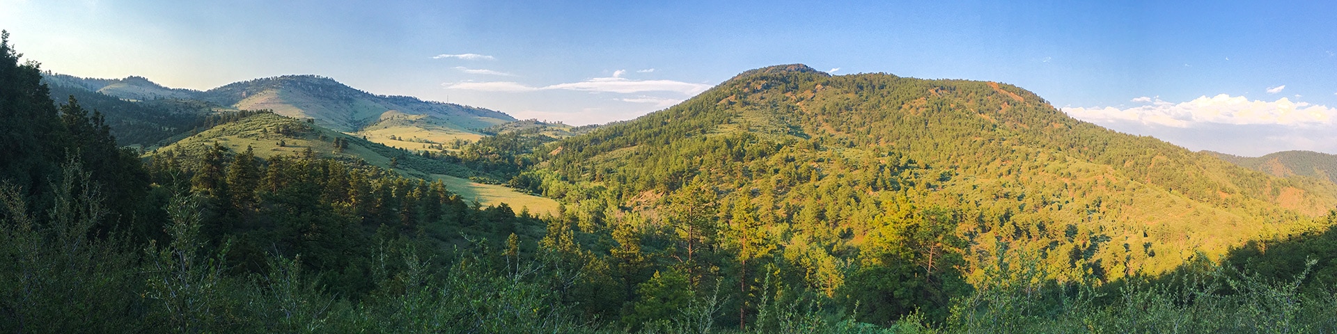
The Centennial Cone trail encompassing over 15.0mi of multi-use pathways, encompassingthe beauty of Clear Creek Canyon and far enough away from the crowds that you’ll feel as if you’ve escaped to the backcountry. It’s a popular trail with locals and once you experience the natural beauty for yourself, you’ll understand why!
Getting there
To get to Centennial Cone Trailhead, from Denver, head west on Highway 6. This curves around and heads north to become HW 93. Take a left, west, at the intersection of Highway 93 and Highway 58 (west on HW 58 becomes HW 6) to head up Clear Creek Canyon. About 11.0mi up the road you’ll see the parking lot for Mayhem Gulch on the right.

About
| When to do | Year round |
| Backcountry Campsites | No |
| Toilets | Pit toilets at Mayhem gulch trailhead |
| Pets allowed | Yes - On Leash |
| Family friendly | No |
| Route Signage | Average |
| Crowd Levels | High |
| Route Type | Lollipop |
Centennial Cone Trail
Elevation Graph
Weather
Centennial Cone Trail Report
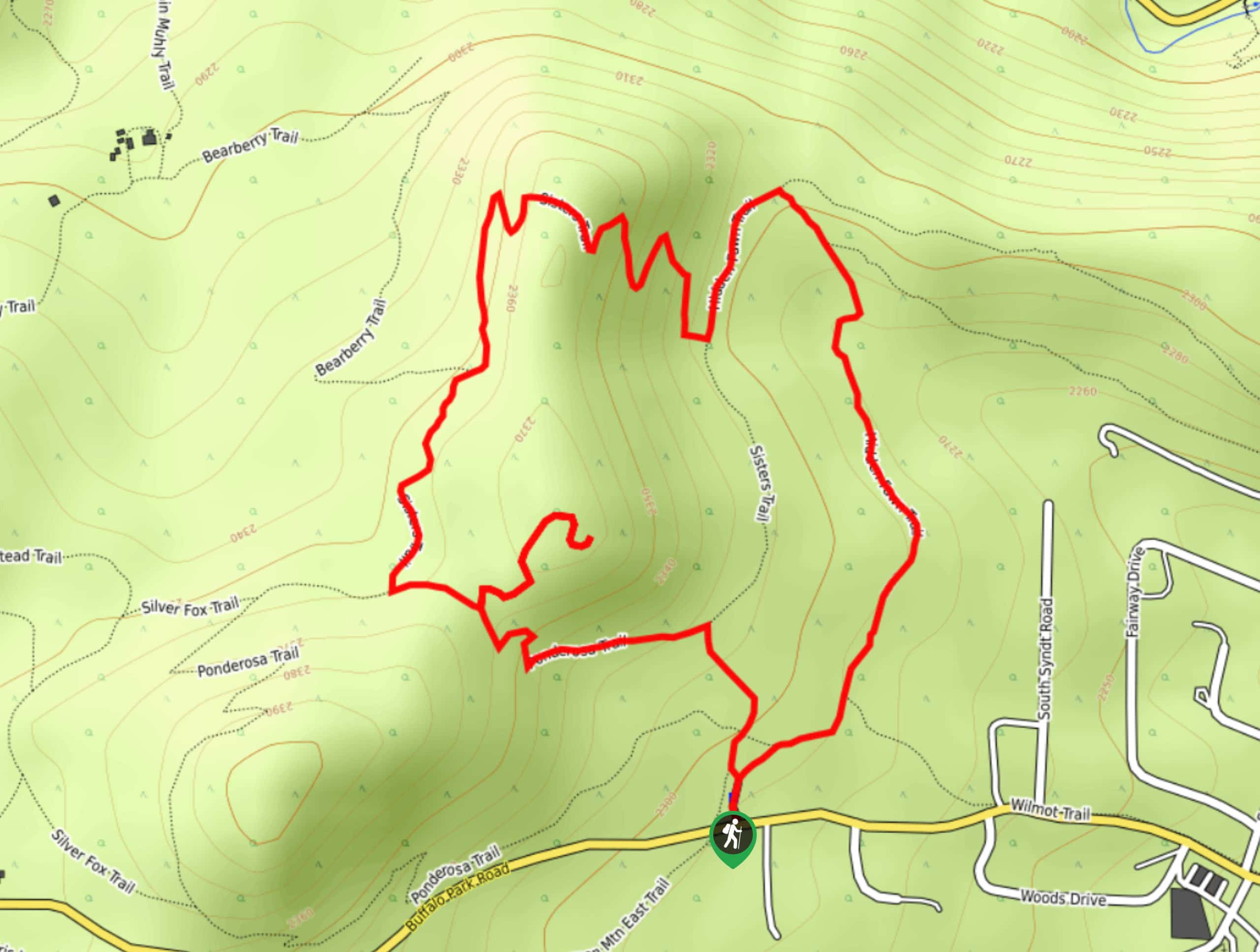
There are many ways to enjoy the Centennial Cone Park: on foot, horse or bike. During the week, all trail users share this beautiful space, but on the weekends, there is a strictly enforced alternate use schedule. Before heading out to the park, check the trail usage calendar. On even numbered weekends, hikers and horses are prohibited. On odd numbered days, hikers get to enjoy the hills without bikers. Visit this link for a calendar. From the Mayhem Gulch trailhead, there is a small loop that connects to the larger 12.0mi loop around Centennial Cone. You can hike the whole thing or just the smaller loop of the Mayhem Gulch trail system.
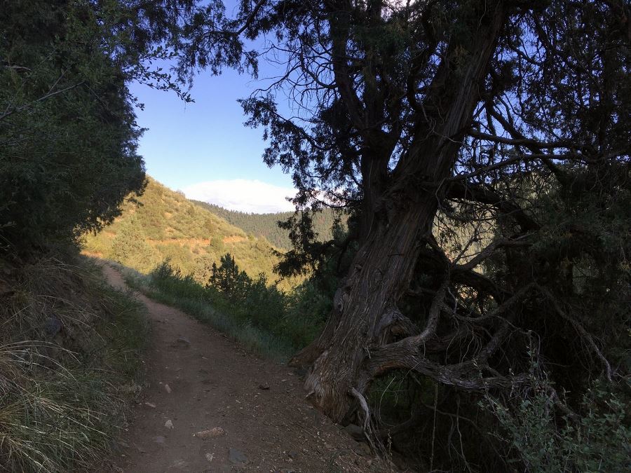
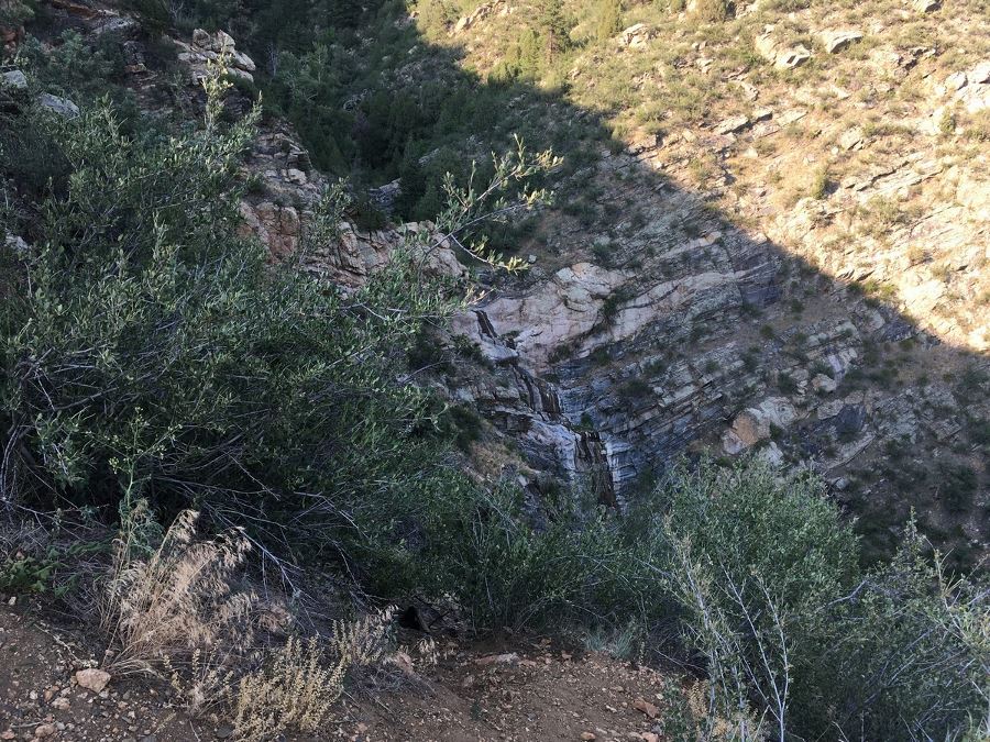
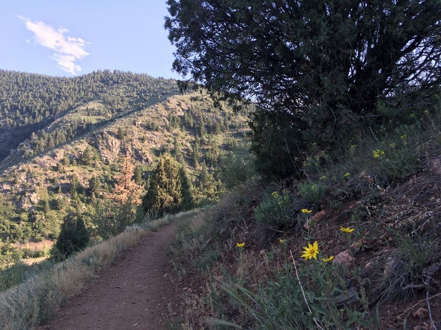
From the Mayhem Gulch Trailhead in Clear Creek Canyon, find the start of the trail at the west side of the parking lot. You’ll immediately start ascending into the park getting your heart pumping. Between breaths, you’ll have views down Clear Creek Canyon. Take a pause at about 0.8mi, right before a switch back on the east side of the trail. The gulch to the east is Mayhem Gulch and during early spring you can see a waterfall. During the winter, it freezes and sometimes you’ll find people ice climbing.
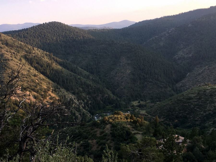
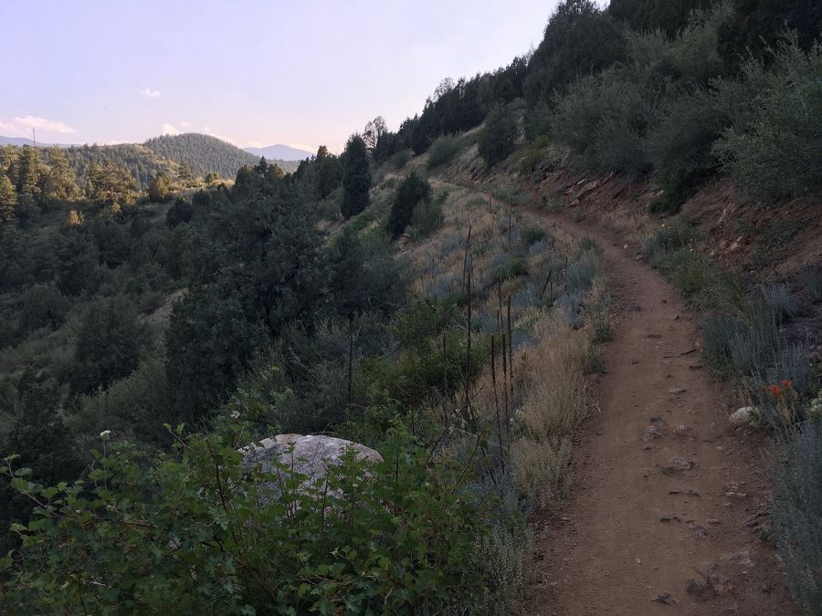
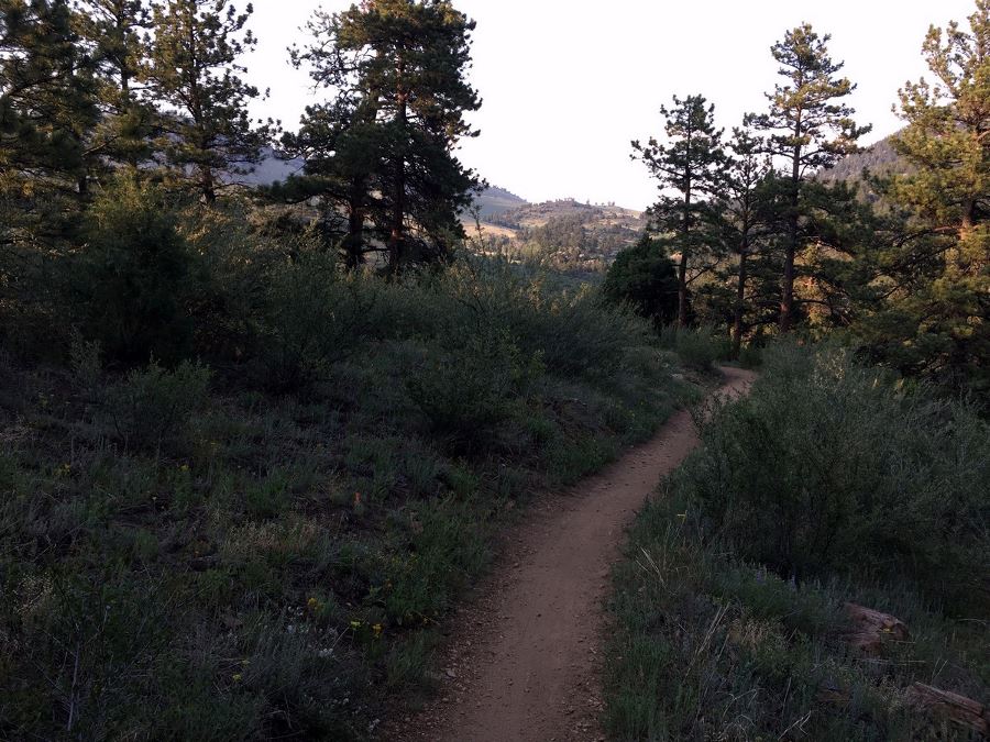
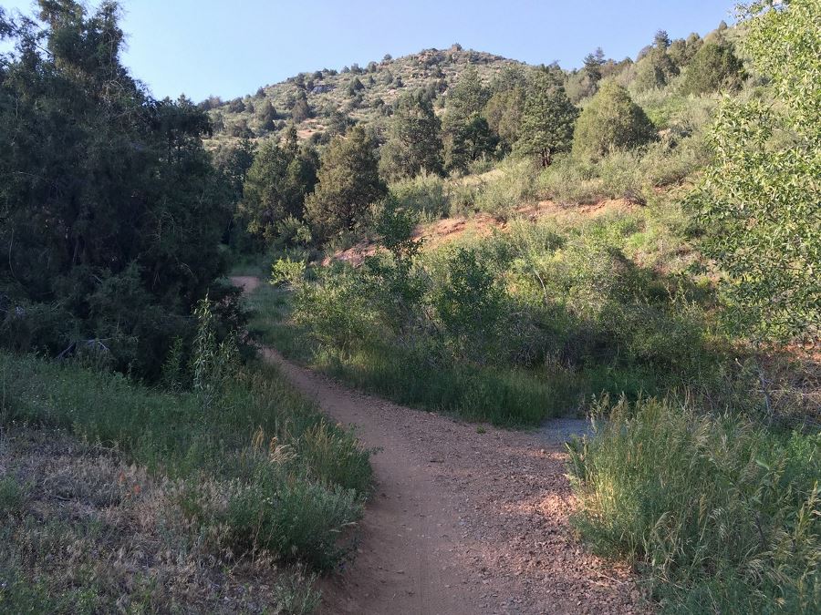
Continue on up the trail and at 1.5mi, the trail splits. Take a right to follow the map above, but either direction will end up in the same place. Following the path on our map above, the trail stops ascending the hillside and enters a wooded forest. Peak through the trees to see the whole of Centennial Cone, the additional 12.0mi of looped trail that winds around a valley, sometimes without a single sign that you’re close to thecity, feeling as if you’ve escaped to the backcountry.
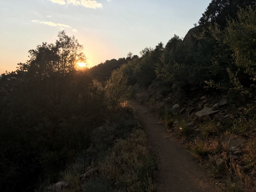
At 2.5mi, the trail opens up to the meadow and you’ll connect to the 12.0mi loop start. Keep left at each trail junction to head back to the Mayhem Gulch trailhead. The hike back gives you more stunning views of the canyon along the side of a steep hill. When you reach the junction, hang a right to arrive back at your car.
If hiking in late spring or early summer, take a look at all the wildflowers blooming from Indian paintbrush, sunflowers, prickly pears and more!
Trail Highlights
Centennial Cone Park
The Centennial Cone Park is an expansive greenspace not too far from the city, making it a perfect day hike escape. The park is on an incline, offering a fun challenge for anyone who visits. From the tip top of the park, you can enjoy sweeping views over Clear Creek. It’s also a well-known wildlife spotting area, especially for elk and deer.
Stroll alongside rolling highland meadows with viewpoints overlooking snowy mountain peaks off in the distance. Follow the rust-coloured dirt paths to enjoy peaceful cattle fields and endemic plant species, including plenty of cati!
Check out some other great hikes around Denver:
Insider Hints
To see more of the park without adding on more hiking miles, drive to the other two parking lots on the north side of the Centennial Cone Park from Golden Gate Canyon Road or Highway 119.
Clear Creek Canyon offers a beautiful and fun east to west drive alternate to I-70.
Pack your bike! Parts of the “Clear Creek Canyon Peaks to Plains Bike Trail” are open to bikers, starting at Mayhem Gulch heading west, with more and more parts of the trail opening every year.
Try your hand at rafting! Multiple companies can take you white water rafting through Clear Creek Canyon.

Similar hikes to the Centennial Cone Trail hike

Singletree and Mayhoffer Trail
The Singletree and Mayhoffer Trail is a scenic adventure that will guide adventurers through the lush meadowlands that reveal sights…
Hidden Fawn Loop Trail
The Hidden Fawn Loop Trail is a lovely meadowland adventure in the Alderfer/Three Sisters Open Space Park. Enjoy sights of…

Mount Galbraith via Cedar Gulch Trail
The Mount Galbraith via Cedar Gulch Trail is a charming adventure near Golden, Colorado that reveals the beauty and diversity…
Jane Lewitt 4 years ago
The trails were well-marked and there were free maps. Great hike!
onoyuki 4 years ago
No photos can give justice to its beauty. It's stunning!
Lisa B 5 years ago
Centennial Cone Park is a fun little hike!
tesssssaaa 5 years ago
Really nice quick one, great for when you want a nature hit without too much work!