
Beaver Brook Trail
View Photos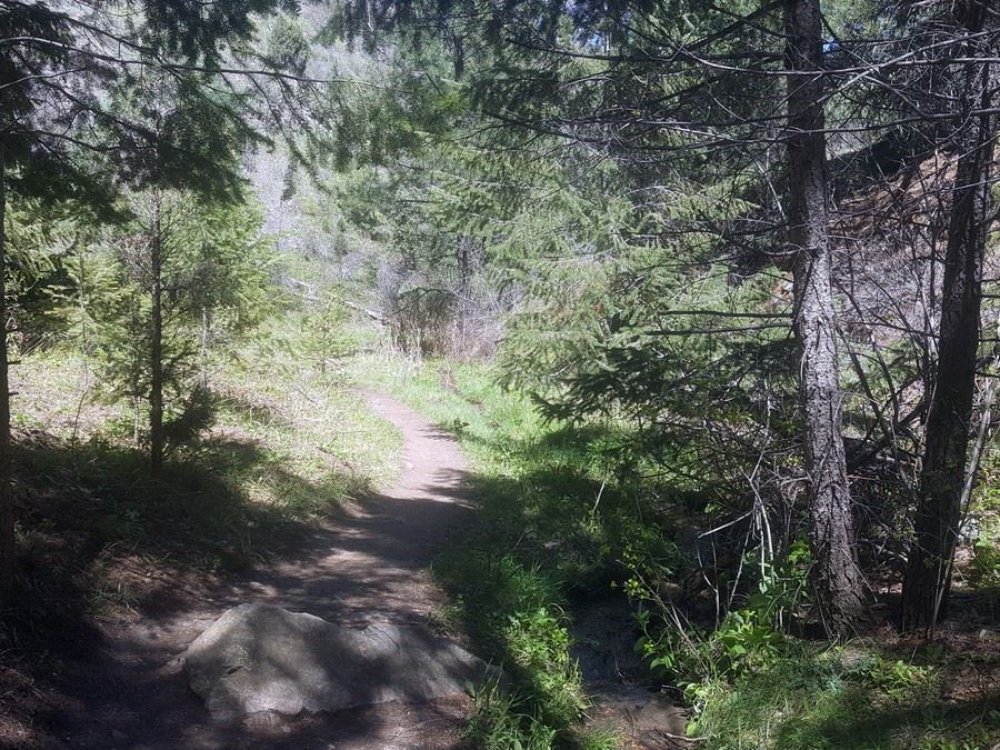
Beaver Brook Trail
Difficulty Rating:
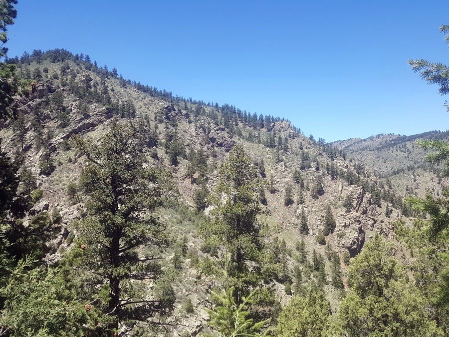
The Beaver Brook trail is one of Colorado's most adventurous hikes, where you’ll leave the city behind and find yourself immersed in nature. Experience the best of all of Colorado’s trails, rolled into one, as you stroll alongside hills, rocks, wildflowers, animals, river crossings and more!
Getting there
To get to the Beaver Brook Trailhead, from Denver, head west on I-70. Take exit 253/Genesee Park. Turn right, north, and then make an immediate right onto Stapleton Rd (a dirt road). Follow the road for about 0.8mi. You’ll pass by the Buffalo Herd Overlook on your right and shortly after you’ll see the Beaver Brook Parking lot on the left.

About
| When to do | April to October |
| Backcountry Campsites | No |
| Toilets | Pit toilets at trailhead |
| Pets allowed | Yes - On Leash |
| Family friendly | No |
| Route Signage | Average |
| Crowd Levels | High |
| Route Type | Circuit |
Beaver Brook Trail
Elevation Graph
Weather
Beaver Brook Trail Report
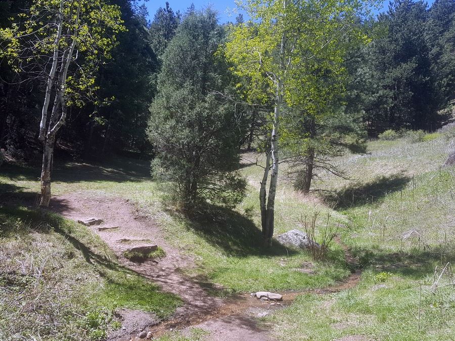
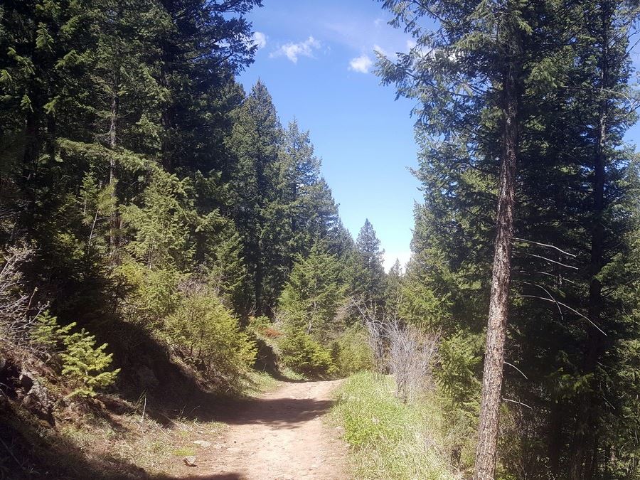
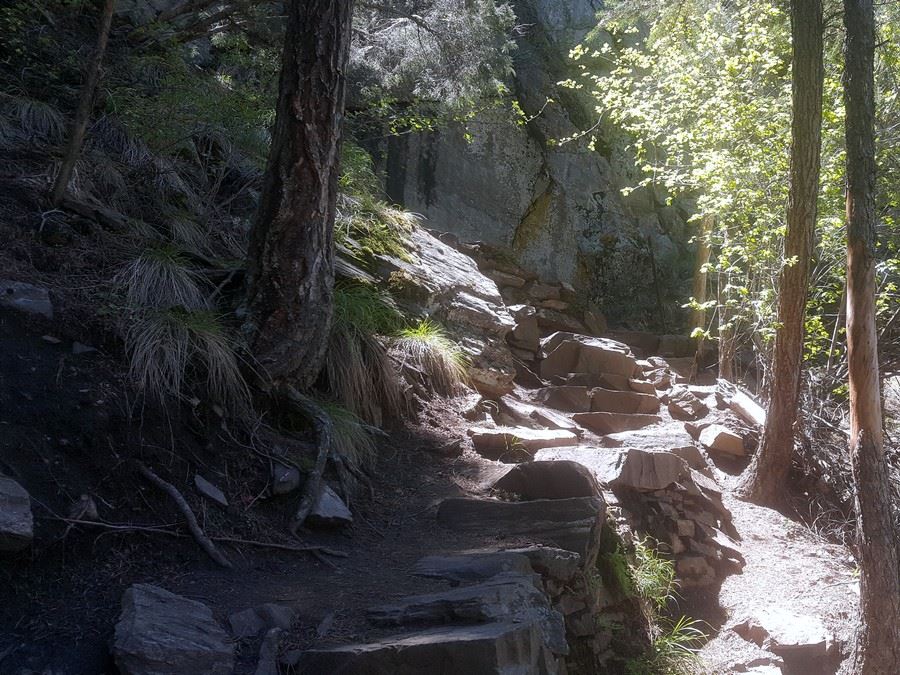
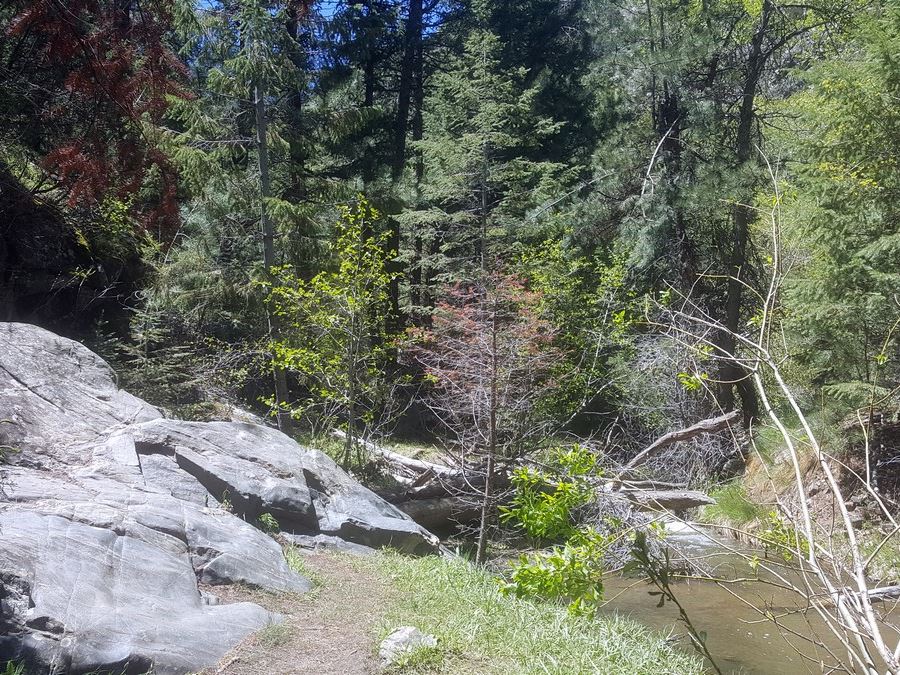
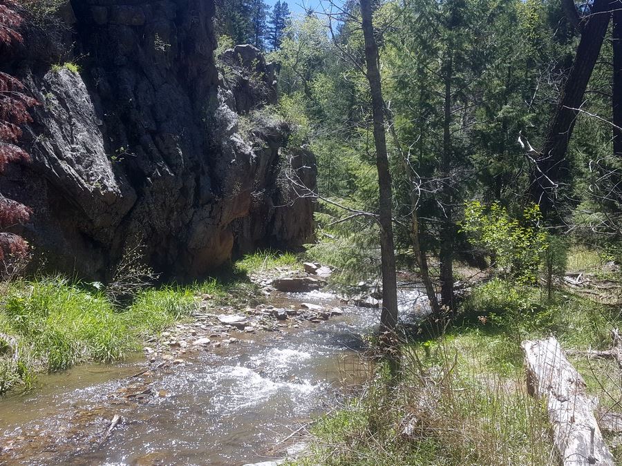
There is something to please every type of adventurer on the beautiful Beaver Brook trail that takes you all the way to Chavez Trail Loop. This trail allows you to enjoy nature, without being too far from Denver. The Beaver Brook trail is lined with pine trees that blow in the wind and provide much needed shade on a hot day. Birds chirp as you pass and butterflies flutter around you as you walk. While the trail itself is not too difficult in terms of elevation, there are quite a few obstacles: creek crossings (you might have to roll up your pants!), ledges, rocks that seem to have “grown” over the trail, and sometimes a downed tree or two to climb around.
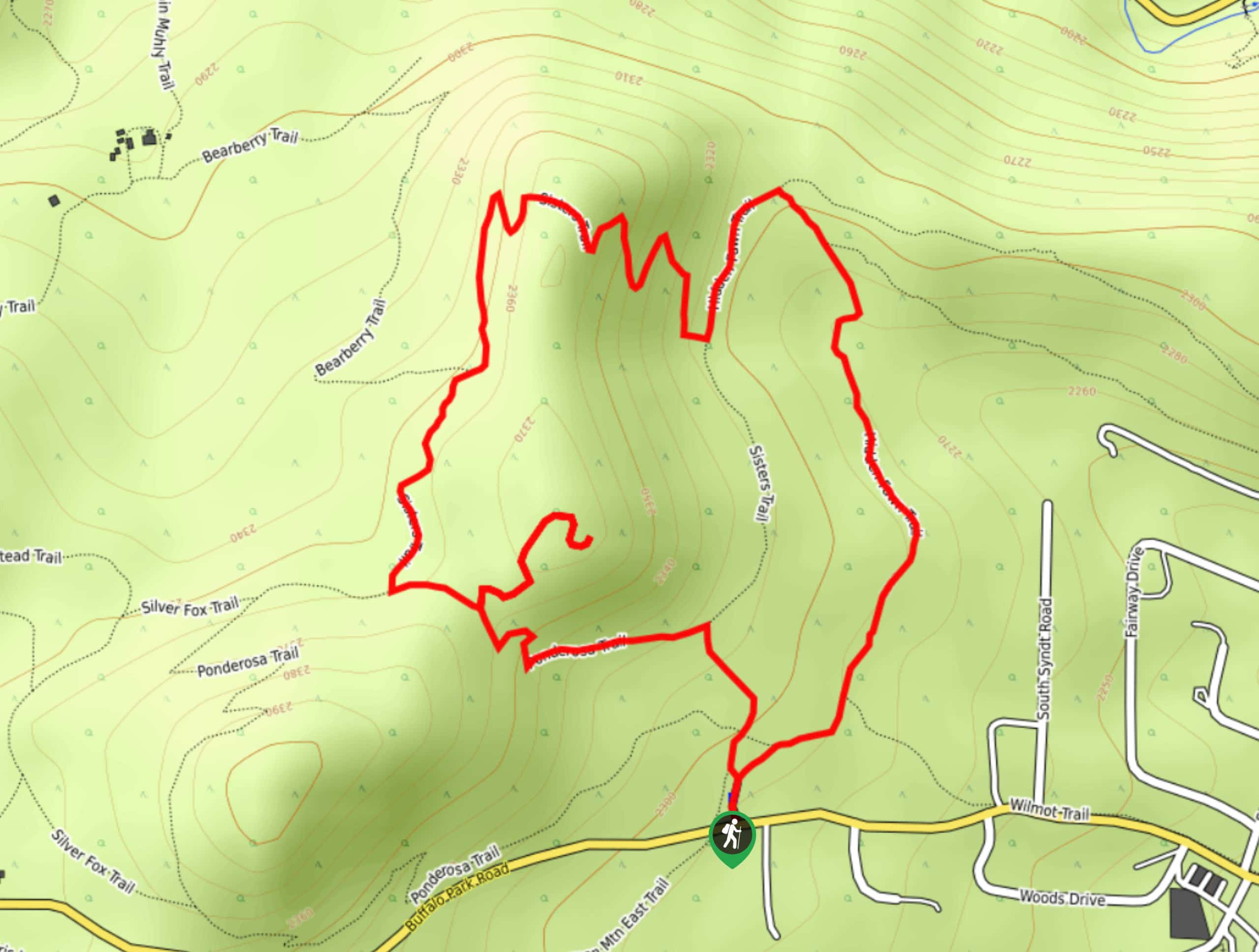
From the Beaver Brook parking lot, you’ll find the trail start just behind the toilets. You’ll head west from the trailhead starting off with a nice gradual decline. After a 0.3mi, you’ll reach the first intersection and it’s decision-making time!
If you go straight on Beaver Brook trail you’re in for a long, gradual decline with a short, steep incline on the way back. If you turn right onto Chavez trail, you’ll have a shorter, but more steep decline with a longer, but more gradual, incline back to the car.
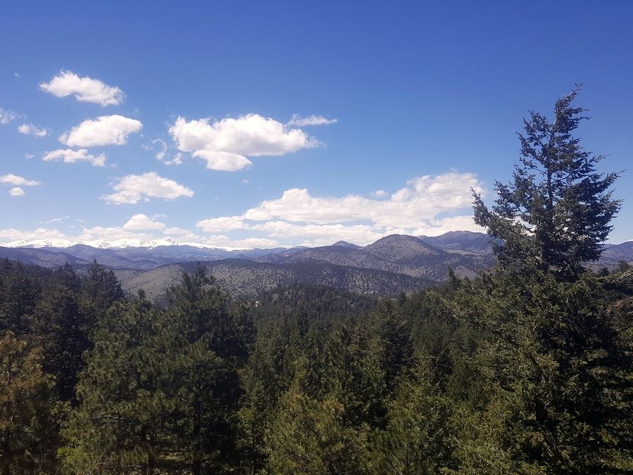
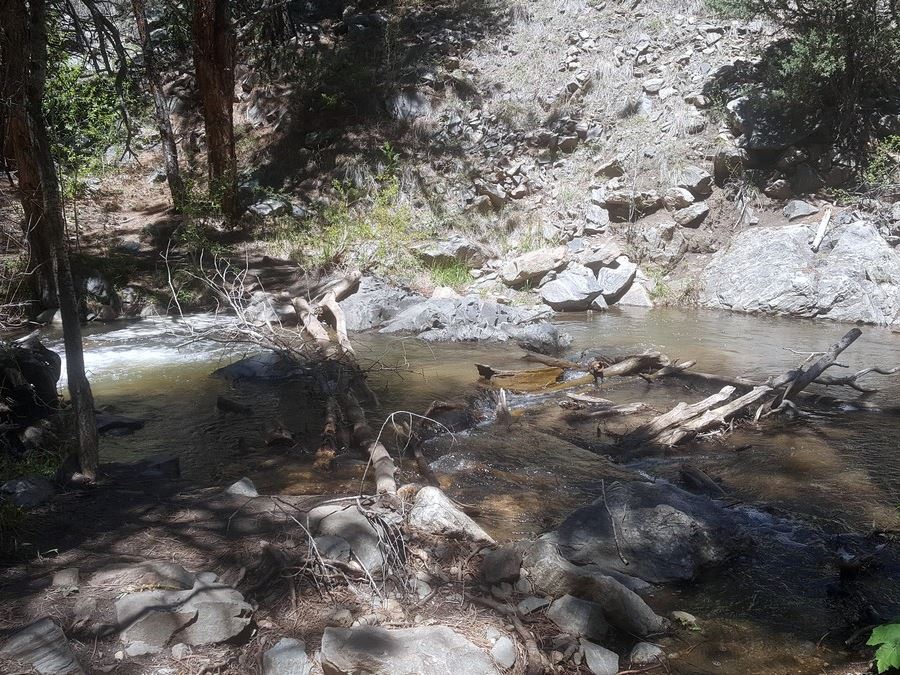
For the sake of this trail description, let’s go straight. Shortly after this intersection, at 0.5mi, you’ll be greeted with a beautiful view at the mountains between the trees. A 1.0mi into the hike, the trail starts hopping back and forth over the creek as you cross over bridges.
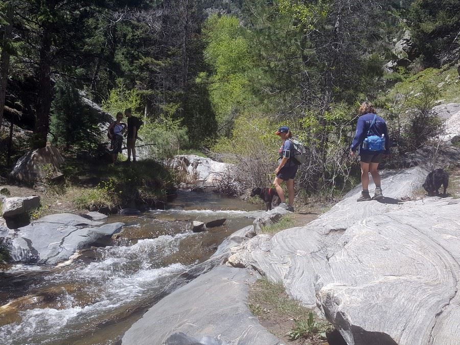
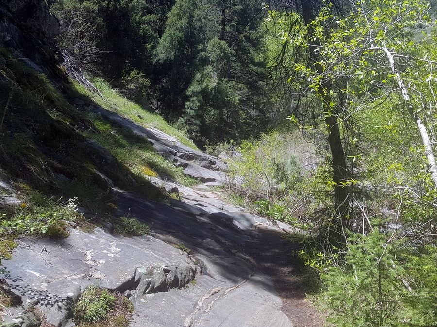
After 2.0mi, you’ll hike directly on a rock that looks as if it has melted right over the trail. Beware, this rock can be slippery if wet. Then, you’ll take off your shoes for the first of four larger creek crossings. Avoid walking on the logs, as they are not stable; it’s best to just hike right through the water.
Shortly after the fourth creek crossing, you’ll reach the turnoff for the Chavez trail, clearly marked. If you’ve been hiking the loop in a clockwise fashion, this will be a right turn off. This starts the ascent back.
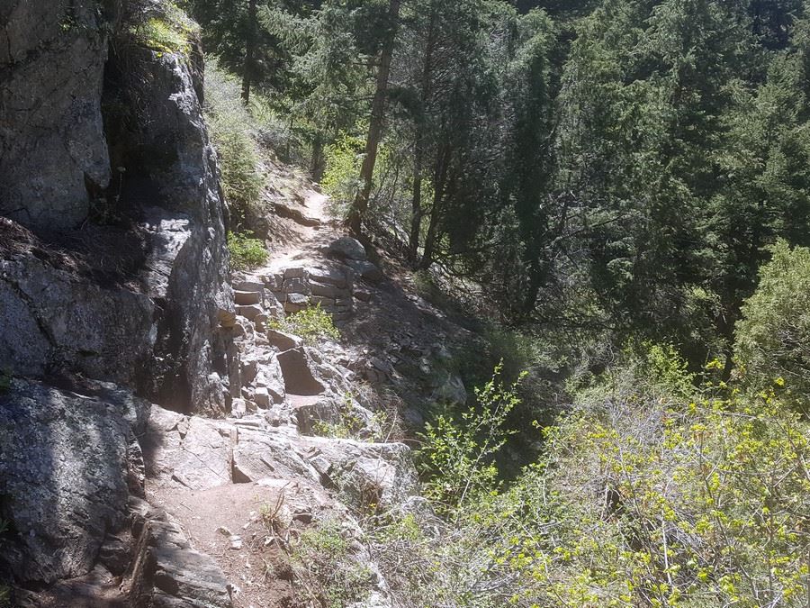
Just after you’ve entered the Chavez trail, you’ll get to a short, but challenging rock ledge. While you don’t have to scramble, you do need to hug tight to the wall as you make your way across the rocky ledge; the drop off on your right is steep. For the next mile, pay attention to your footsteps because the trail is narrow and has a steep drop off on one side.
The hike back to the parking lot brings a steep rocky stair climb, a waterfall view at 3.5mi and views of the canyon around you through the trees. You’ll pass the now unused Braille Trail, which used to be a nature trail for the blind. The trail splits, but you can take either side since it reconnects at the same spot. This is where you’ll cross a dirt road and pick the trail back up, coming up to the first intersection from the beginning. Turn left and head back to the parking lot.
Trail Highlights
Windy Saddle Park
Windy Saddle Park is an exceptional area for hiking of all skill levels. With three unique trails to explore (including Beaver Brook trail), it’s the kind of area you can come back to time and time again to explore something new. Located near Lookout Mountain in Golden, CO, you’ll be rewarded with stunning views from the moment you pull into the parking lot.
Besides Beaver Brook trail, there are two other options if you want to extend your day hike even longer. You’ll also find Chimney Gulch trail, which is a steep path that can be done either uphill or downhill first, as well as Lookout Mountain trail, offering amazing views over Lookout Mountain Nature Center.
Check out some other great hikes around Denver:
Insider Hints
You can make this a longer hike by adding on some miles toward Windy Saddle. To do so, instead of turning right onto the Chavez Trail, turn left toward Windy Saddle on Beaver Brook for an out and back addition.
Check out the buffalo herd along I-70. There is a lookout just across the street from the Beaver Brook Trailhead or head east on I-70 to the next exit for another overlook.
Take a scenic drive and check out Colorado via the Lariat Loop.

Similar hikes to the Beaver Brook Trail hike

Singletree and Mayhoffer Trail
The Singletree and Mayhoffer Trail is a scenic adventure that will guide adventurers through the lush meadowlands that reveal sights…
Hidden Fawn Loop Trail
The Hidden Fawn Loop Trail is a lovely meadowland adventure in the Alderfer/Three Sisters Open Space Park. Enjoy sights of…

Mount Galbraith via Cedar Gulch Trail
The Mount Galbraith via Cedar Gulch Trail is a charming adventure near Golden, Colorado that reveals the beauty and diversity…
rosevalley 4 years ago
Great views! But take extra care because the steps could be slippery.
Adamcox 4 years ago
This is a spectacular hike in the heart of the city!
Sammy L. 4 years ago
Gorgeous trails! beautiful views and nice hike along the river
tesssssaaa 4 years ago
Truly a bit of everything in one hike. We really enjoyed it. Easy enough for most people I'd say
Sofia L. 4 years ago
Exceptional area for leisure activities and bondings. Nice views with minimal effort.
BoulderBound 4 years ago
Perfect for scenery,climbing and plain hiking. You will enjoy this trail while being surprised with the beauty of nature.
Tiffany Swift 4 years ago
Perfect for just about everything; climbing, scenery, plain hiking. Great adventure along with spectacular views.
Mary Lou 4 years ago
It was an incredible place to immerse yourself with nature.
will-perry 4 years ago
The elevation was not that high but there are plenty of amazing wildflowers and animals along the trail.
Jethro P. 5 years ago
I was immensly satisfied with the gorgeous trail and beautiful views. Outstanding hike in Denver.