
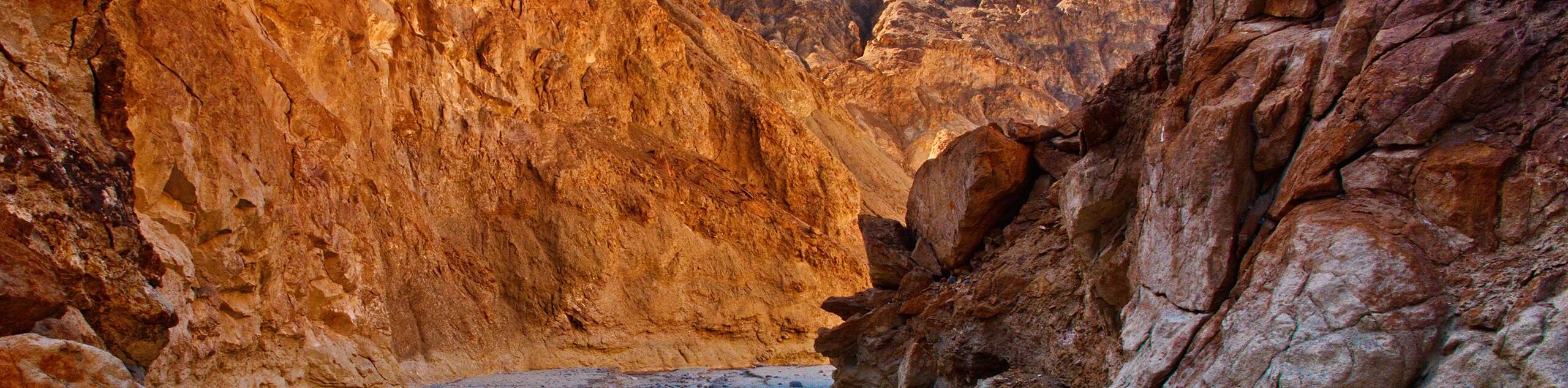
Inyo Mine Trail
View Photos
Inyo Mine Trail
Difficulty Rating:
Short and with little elevation fluctuation, the Inyo Mine Trail is a perfect route for families and those who are interested in history. Taking you through an abandoned mining complex, the Inyo Mine Trail is an incredible route that offers insight into the history of resource extraction within the Death Valley National Park region.
Getting there
The trailhead for Inyo Mine Trail is located off of Echo Canyon Road.

About
| Backcountry Campground | No |
| When to do | September-May |
| Pets allowed | No |
| Family friendly | Yes |
| Route Signage | Poor |
| Crowd Levels | Low |
| Route Type | Out and back |
Inyo Mine Trail
Elevation Graph
Weather
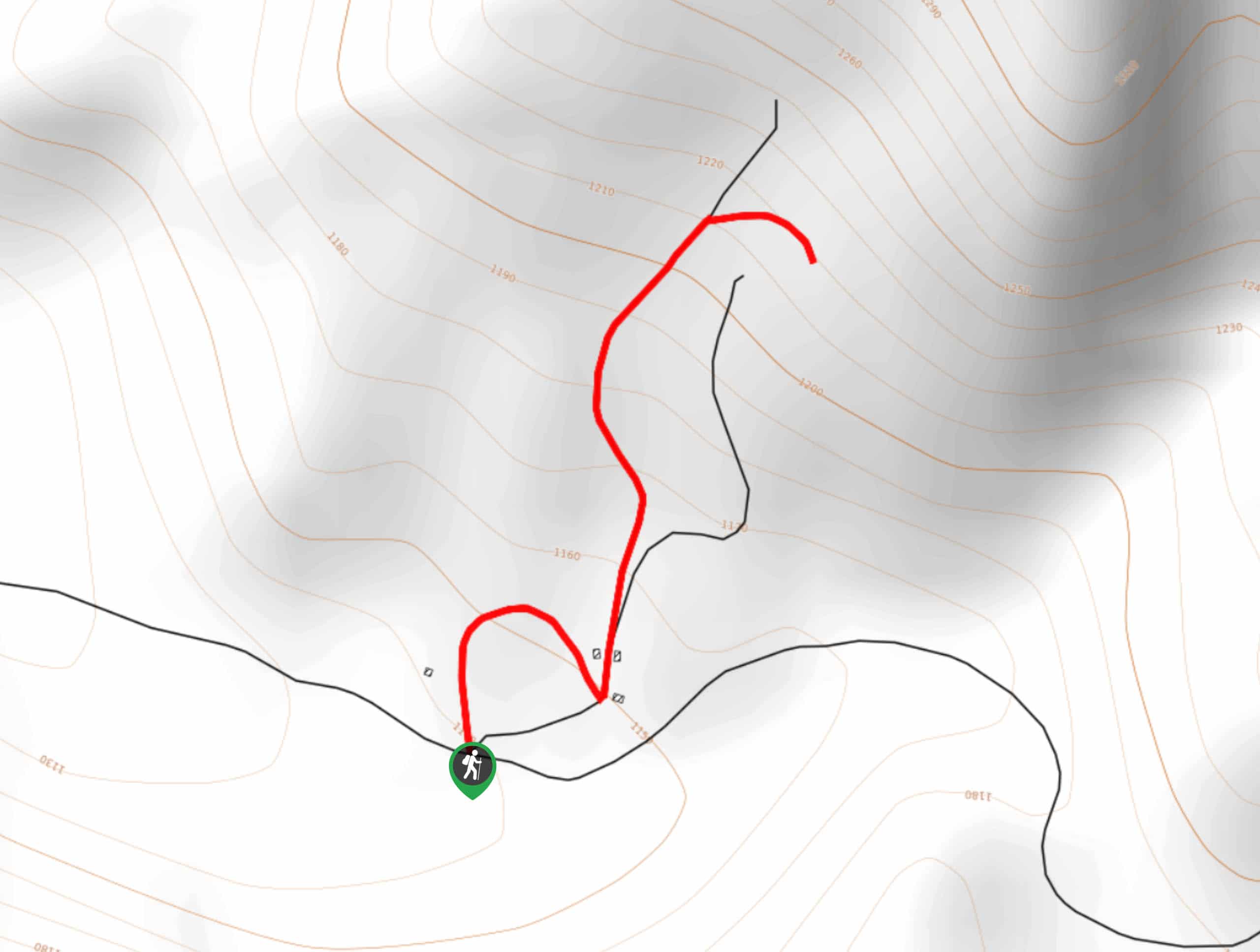
Inyo Mine Trail Description
The Inyo Mine Trail is incredibly interesting, as it leads you through an abandoned mining complex. That being said, it is important you are vigilant – especially when traveling with young children – around the abandoned mine shaft. We do not recommend entering the mine shaft itself, as it is old, and not guaranteed to be stable.
Having arrived at the trailhead, make your way along the Inyo Mine Trail to the north. Almost immediately, you will arrive at a junction within the trail, where you can choose to go in either direction, as both will take you through different parts of the complex. Whatever path you choose to take, they will end at roughly the same location. Take your time and enjoy the many historical buildings and artifacts before backtracking your steps towards the trailhead.
Similar hikes to the Inyo Mine Trail hike
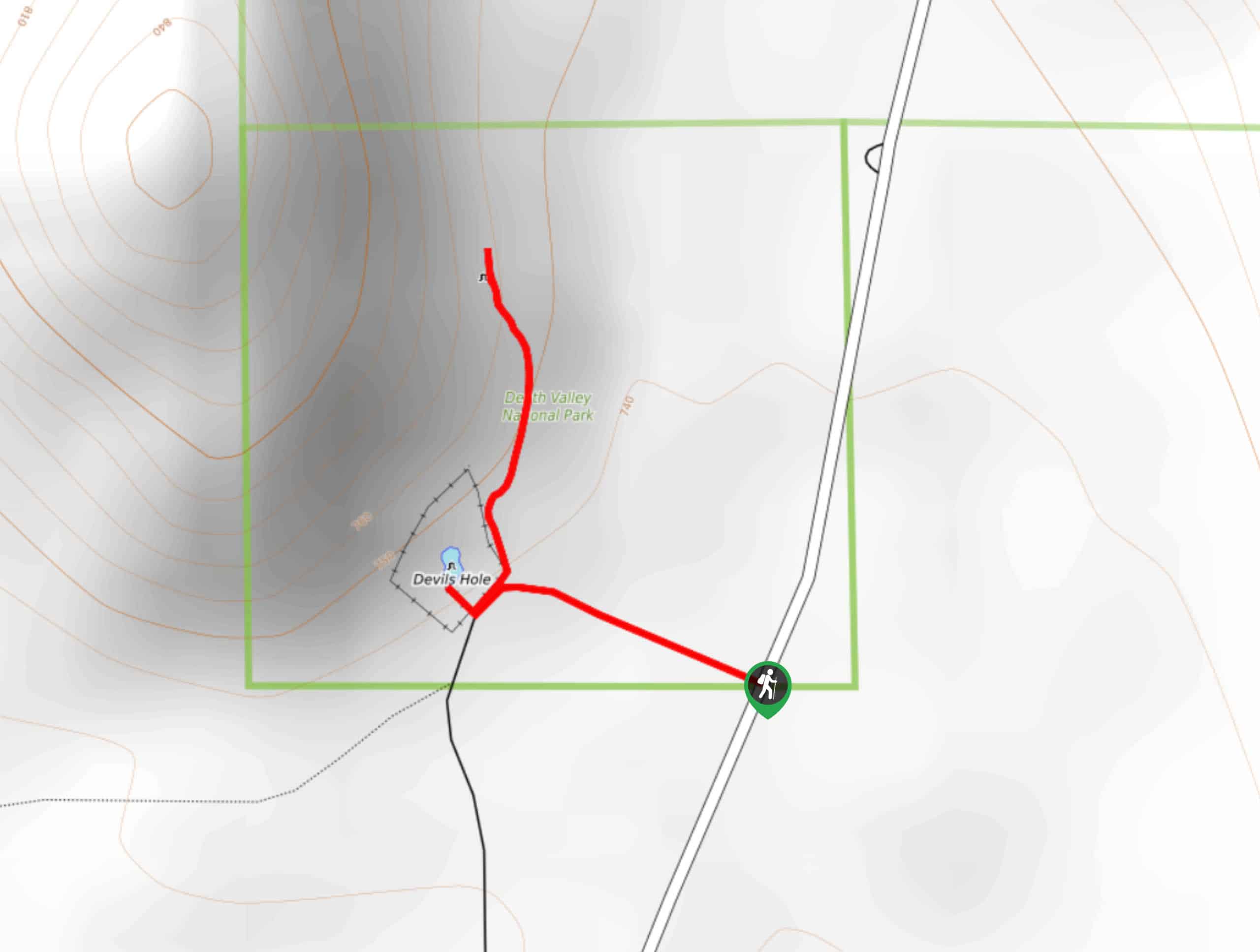
Devil’s Hole Overlook
An excellent route for families with young children and those looking for a more casual hiking experience, the Devil’s Hole…
Zabriskie Point and Gower Gulch Path Loop
Short in distance and with relatively little elevation incline, the Zabriskie Point and Gower Gulch Path Loop is ideal for…
The Grandstand via Racetrack Trail
A short trail that is not too physically demanding, The Grandstand via Racetrack Trail is an excellent route for beginner…
Comments