
River Walkham Circular Walk
View Photos
River Walkham Circular Walk
Difficulty Rating:
The River Walkham Circular Walk is a fairly relaxed adventure on the western edge of Dartmoor National Park that will expose you to some lovely views along a meandering river. While out on the trail, you will pass through a beautiful stretch of woodland terrain that is made all the more scenic by the winding river that cuts through its expanse. There is a small amount of elevation gain in the final half of the walk as you cut across the open countryside, but overall, this is an awesome walking route that is suitable for a wide range of skill levels.
Getting there
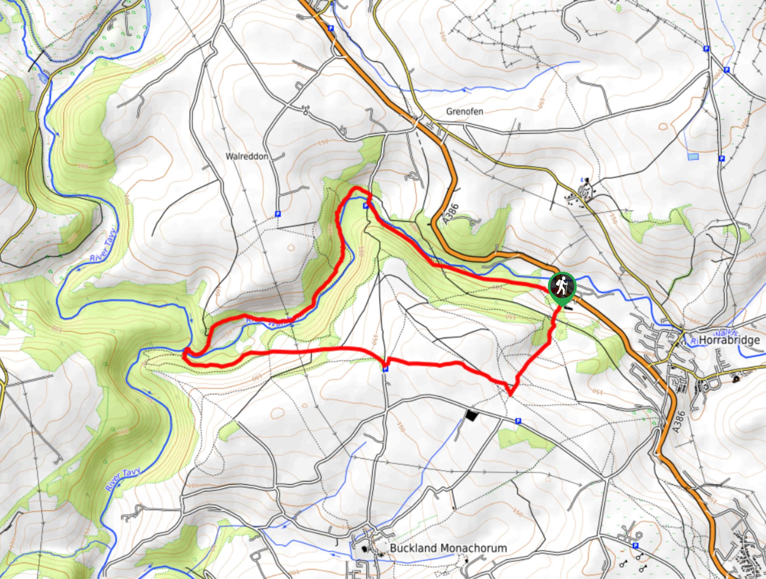
To reach the trailhead for the River Walkham Circular Walk from neighbouring Horrabridge, drive northwest on A386 for 0.7mi and turn left to enter the car park.

About
| When to do | Year-Round |
| Backcountry Campsites | No |
| Pets allowed | Yes |
| Family friendly | Yes |
| Route Signage | Poor |
| Crowd Levels | Moderate |
| Route Type | Circuit |
River Walkham Circular Walk
Elevation Graph
Weather
River Walkham Circular Walk Description
Walking the River Walkham Circular Route is a popular trail in the Tavistock area, as it features easy to traverse terrain and beautifully scenic views along the river. There are a number of intersecting trails along the route, so be sure to pay attention or bring a GPS in order to stay on the correct course. Setting out from the car park, you will head to the northwest and follow along the winding banks of the river as it cuts through the peaceful woodland landscape. After crossing a bridge to the opposite side of the river, you will turn left to continue along the water’s edge as it turns to the southwest, eventually reaching a scenic viewpoint where the waters of the River Tavy and River Walkham meet. From here, you will head to the east and climb uphill across the open countryside on the return leg of the walk back to the car park.
Similar hikes to the River Walkham Circular Walk hike

Shipley Bridge and Avon Dam Reservoir Walk
Located in the southern part of Dartmoor National Park, the Shipley Bridge and Avon Dam Reservoir Walk is a lovely…

The Sherlock Holmes Track
The Sherlock Holmes Track is a fun adventure in the southeast corner of Dartmoor National Park that will take you…

Ryder’s Hill via Sandy Way Trail
The Ryder’s Hill via Sandy Way Trail is a beautiful walking route in Dartmoor National Park that will lead you…
Comments