
Dunsford Daffodil Walk
View Photos
Dunsford Daffodil Walk
Difficulty Rating:
If you enjoy relaxing walks set in a wonderfully atmospheric riverside setting, then the Dunsford Daffodil Walk will be a great addition to your list of upcoming adventures. While out walking this route, you will meander along the winding banks of the River Teign and experience charming views of the wooded terrain of the Teign Gorge. This walk is made up of fairly level terrain and well-maintained pathways that feature no gates or stiles, making it wheelchair and stroller friendly.
Getting there
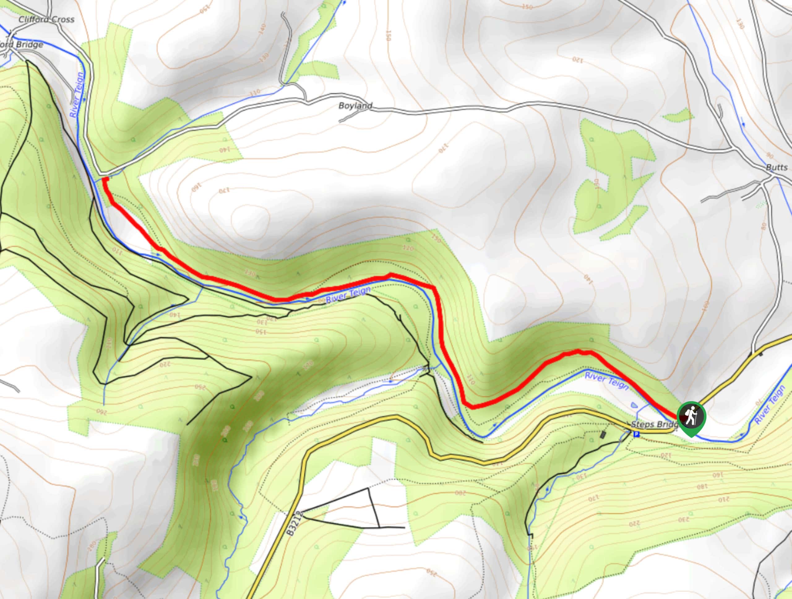
To reach the trailhead for the Dunsford Daffodil Walk from Moretonhampstead, drive east on Cross Street/B3212 for 4.8mi to arrive at the parking area.

About
| When to do | Year-Round |
| Backcountry Campsites | No |
| Pets allowed | Yes - On Leash |
| Family friendly | Yes |
| Route Signage | Average |
| Crowd Levels | Moderate |
| Route Type | Out and back |
Dunsford Daffodil Walk
Elevation Graph
Weather
Dunsford Daffodil Walk Description
Thanks to a wonderfully maintained trail and easy-to-navigate terrain, the Dunsford Daffodil Walk is an excellent trail that can be utilized by walkers of every age and skill level. The trail will take you from the car park to the northwest on a course that runs parallel to the winding banks of the river Teign. As the walk largely takes place within the peaceful setting of the forest, you will have nothing to do but relax as you stroll along the water’s edge and appreciate the beauty of nature. Reaching the terminus of the trail where it meets up with Boyland Road, simply turn back and retrace your footsteps to relive the tranquility of the Dunsford Daffodil Walk on the return leg back to the trailhead.
Similar hikes to the Dunsford Daffodil Walk hike

Shipley Bridge and Avon Dam Reservoir Walk
Located in the southern part of Dartmoor National Park, the Shipley Bridge and Avon Dam Reservoir Walk is a lovely…

The Sherlock Holmes Track
The Sherlock Holmes Track is a fun adventure in the southeast corner of Dartmoor National Park that will take you…

Ryder’s Hill via Sandy Way Trail
The Ryder’s Hill via Sandy Way Trail is a beautiful walking route in Dartmoor National Park that will lead you…
Comments