
Gutter Tor Walk
View Photos
Gutter Tor Walk
Difficulty Rating:
The Gutter Tor Walk is a lovely excursion in Dartmoor National Park that will produce exceptional views of the surrounding area. While out on the trail, you will climb uphill across the rugged landscape of the moor and walk past the remains of medieval structures. What an excellent way to experience the natural and historical beauty of Dartmoor.
Getting there
To reach the trailhead for the Gutter Tor Walk from the Burrator Reservoir, drive east for 0.9mi and turn right to continue on for another 0.5mi. Make a slight left here and you will arrive at the car park in 0.7mi.

About
| When to do | Year-Round |
| Backcountry Campsites | No |
| Pets allowed | Yes |
| Family friendly | Yes |
| Route Signage | Average |
| Crowd Levels | Moderate |
| Route Type | Circuit |
Gutter Tor Walk
Elevation Graph
Weather
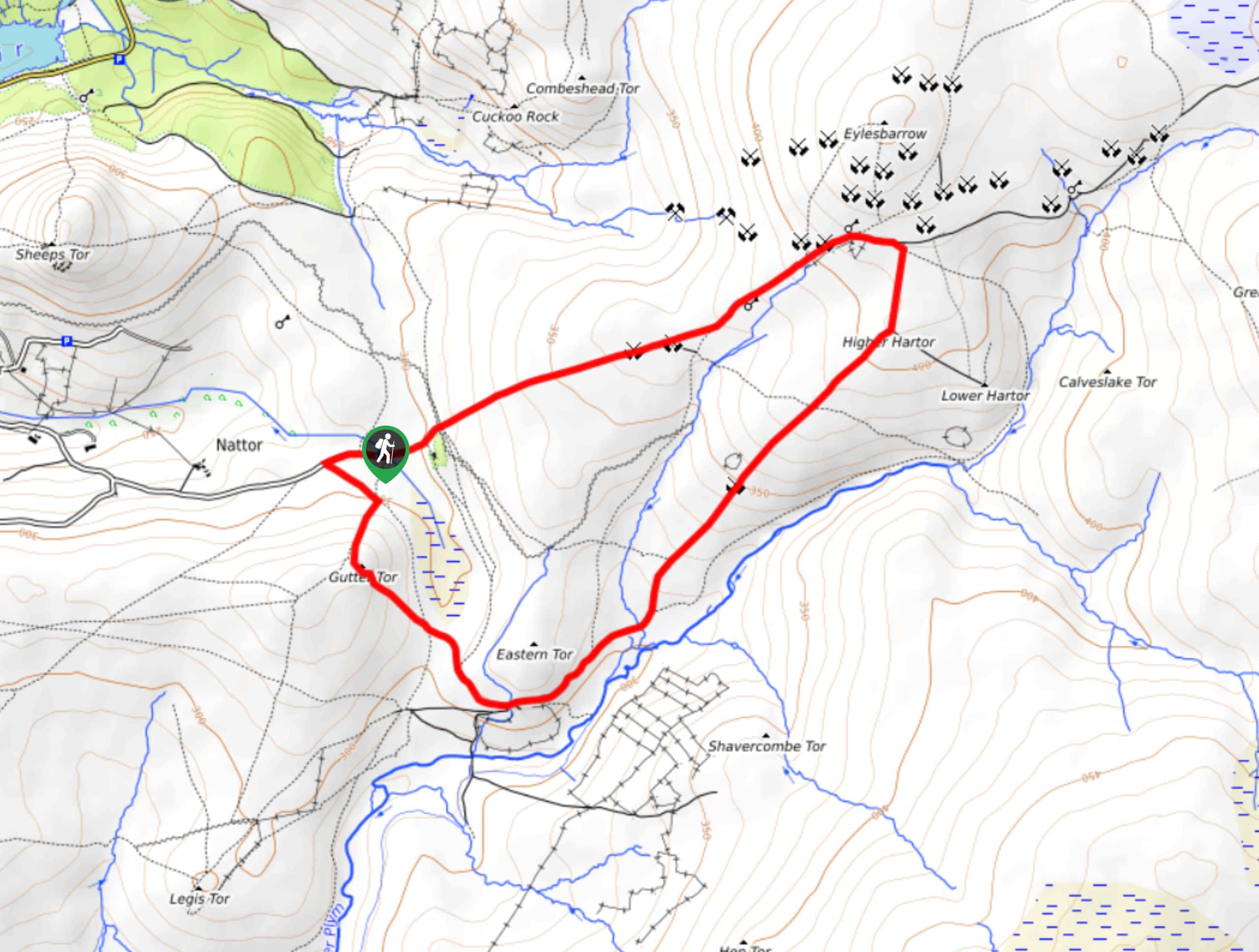
Gutter Tor Walk Description
Walking the Gutter Tor Trail is a fantastic adventure that can be experienced by walkers of all varieties and skill types, especially those with an interest in Medieval history. Setting out from the car park, you will make your way to the southwest to scale the slopes of Gutter Tor, overlooking the marshy terrain of Gutter Mire just below to the east. After taking in the views, follow the trail downhill to the southeast, where it will bend to the northeast to take you across the undulating terrain. After passing by the remains of several Medieval structures, you will arrive at the Eylesborrow Tin Mine that dates to the same period. From here, turn to the southwest and follow the trail back to the car park where you began your journey.
Similar hikes to the Gutter Tor Walk hike

Shipley Bridge and Avon Dam Reservoir Walk
Located in the southern part of Dartmoor National Park, the Shipley Bridge and Avon Dam Reservoir Walk is a lovely…

The Sherlock Holmes Track
The Sherlock Holmes Track is a fun adventure in the southeast corner of Dartmoor National Park that will take you…

Ryder’s Hill via Sandy Way Trail
The Ryder’s Hill via Sandy Way Trail is a beautiful walking route in Dartmoor National Park that will lead you…
Comments