Two Moors Way Section 6: Chagford to Drewsteignton
View Photos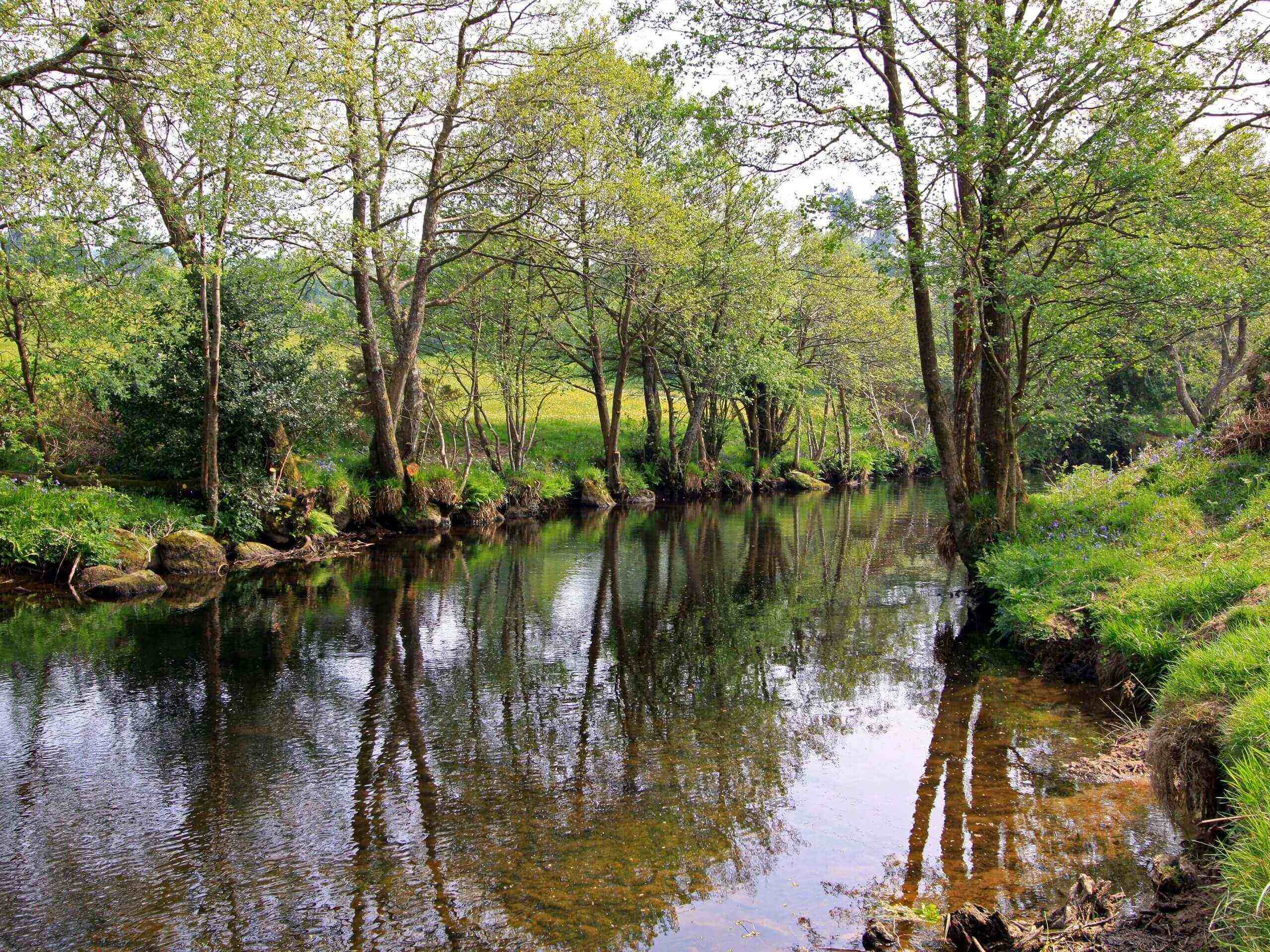
Two Moors Way Section 6: Chagford to Drewsteignton
Difficulty Rating:
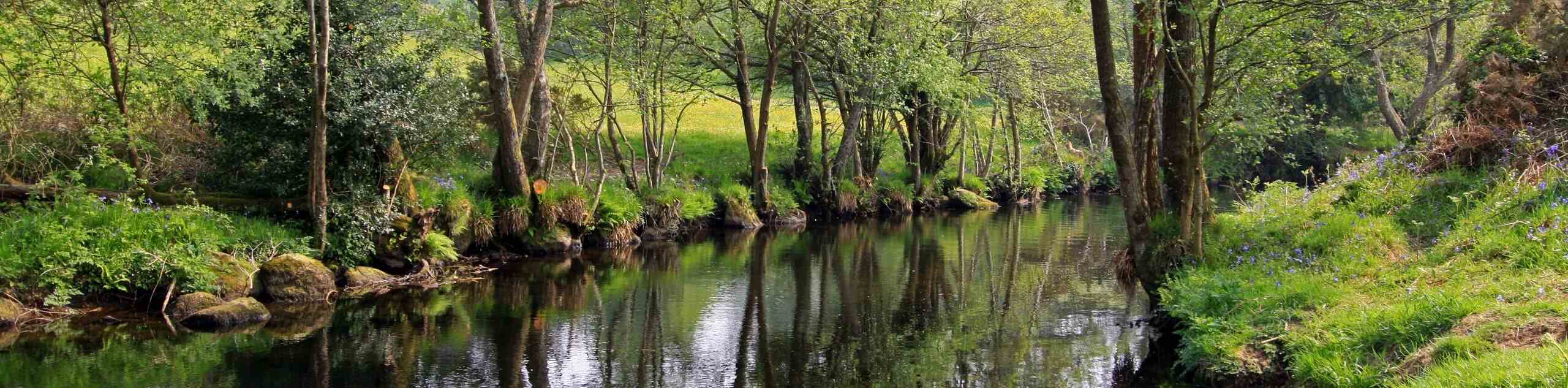
Walking along the Two Moors Way Section 6: Chagford to Drewsteignton is a lovely experience that will allow you to take in the natural beauty of the Devon countryside. Along the trail, you will enjoy a picturesque riverside setting, as you follow the meandering banks of the River Teign, before climbing uphill past the extravagant grounds of Castle Drogo. Keep in mind that this is a one-way route, so you will need to either backtrack along the trail or arrange a pick up at the end point.
Getting there
To reach the Two Moors Way Section 6: Chagford to Drewsteignton trailhead from Chagford, drive northwest on Mill Street for 0.4mi and turn right. Continue on for 0.1mi, where you will find the starting point of the walk on your right. Remember to arrange a pick up at the end of the trail, as this is a one-way walk.

About
| When to do | Year-Round |
| Backcountry Campsites | No |
| Pets allowed | Yes - On Leash |
| Family friendly | Older Children only |
| Route Signage | Average |
| Crowd Levels | Moderate |
| Route Type | One Way |
Two Moors Way Section 6: Chagford to Drewsteignton
Elevation Graph
Weather
Two Moors Way Section 6: Chagford to Drewsteignton Description
The Two Moors Way Section 6: Chagford to Drewsteignton isn’t an overly challenging walking route; however, there are a few steep climbs and stretches of rugged terrain that will need to be accounted for. Make sure to wear proper walking boots for the best footing on your walk. Additionally, this is a one-way trail, so remember to arrange a pick up with a friend, or else you might find yourself back tracking along the trail – which isn’t so bad considering the beauty of the terrain!
As mentioned above, this is a fantastic walking experience that will allow you to take in the natural beauty of the Devon countryside, as you meander along rivers, rolling hills, and serene stretches of woodland terrain. Not only for nature lovers, the route will also appeal to those interested in history, as it features the extravagant grounds of Castle Drogo, which has the distinction of being the most recently built castle in England. Whether you set out on this adventure for the natural views, historic architecture, or both, you can rest assured that your walk will be a special one.
Setting out from the trailhead just outside of Chagford, pass through the series of gates and follow the path as it runs alongside the River Teign for the next 0.9mi, enjoying the peaceful riverside setting and passing through a stretch of woodland terrain that features a gate and a kissing gate, before arriving at the edge of the road. Pass through the gate here and turn left along the road, following it to the northeast for 0.2mi to pick up a track on the right just after the swimming pool. Keep left along the trail here for 0.6mi, once again following along the winding banks of the River Teign until you arrive at a fork. Head to the right here and continue along the edge of the field, keeping the river on your right as you cross directly over the road.
Continue on to the east, following along the coursing water of the River Teign for another 0.6mi, where you will come to a junction with a bridge on your right and a track on your left. Turn left and follow the track uphill, keeping left to eventually meet up with a lane. After walking along the lane for 0.21mi, make a sharp right onto the trail known as the Hunter’s Path, following it through the forest and into a clearing just below the grand structure of Castle Drogo. Turn left at the next junction to continue along the Hunter’s Path, keeping right to make your way east along the hillside to eventually traverse the summit of Sharp Tor.
From here, continue east along the hillside for 0.2mi, making a left turn, followed by the next right to begin the final leg of the walk to Drewsteignton. After traversing a relatively flat stretch of terrain along the hilltop, you will begin to descend the north slope of the hill. Keep left here to reach the bottom of a gully, before climbing gently back uphill to meet up with the edge of the road. Turn right and follow the road for 400ft, turning left here to arrive at the end point of the walk. If you are planning on heading back to the trailhead by foot, turn back and simply retrace your steps along the trail. If you’ve arranged a pick up, feel free to pop into the Drewe Arms or The Old Inn while you wait and enjoy some post-adventure refreshments.
Trail Highlights
Castle Drogo
This beautiful country house was constructed between 1911 and 1930, making it the last castle to be built in England. The building sits atop a hill overlooking the Teign Gorge, on lands that the client, Julius Drewe, believed to at one time be in the possession of his supposed medieval ancestor, Drogo de Teigne. This is who the castle was named after.
Frequently Asked Questions
Is the Castle Drogo restoration finished?
Following 8 years of renovations to make Castle Drogo watertight, an issue that plagued the building since its completion, the castle and associated grounds have reopened.
Who built Castle Drogo?
The castle was commissioned by millionaire entrepreneur Juliud Drewe and was designed by the renowned architect Sir Edwin Lutyens.
Insider Hints
Wear proper walking footwear for the best traction along the trail.
The Old Inn and Drewe Arms are great spots for some post walk refreshments.
Remember to arrange a pick up at the end point of your walk.
Similar hikes to the Two Moors Way Section 6: Chagford to Drewsteignton hike

Shipley Bridge and Avon Dam Reservoir Walk
Located in the southern part of Dartmoor National Park, the Shipley Bridge and Avon Dam Reservoir Walk is a lovely…

The Sherlock Holmes Track
The Sherlock Holmes Track is a fun adventure in the southeast corner of Dartmoor National Park that will take you…

Ryder’s Hill via Sandy Way Trail
The Ryder’s Hill via Sandy Way Trail is a beautiful walking route in Dartmoor National Park that will lead you…
Comments