Cadover Bridge to Shaugh Bridge Circular Walk
View Photos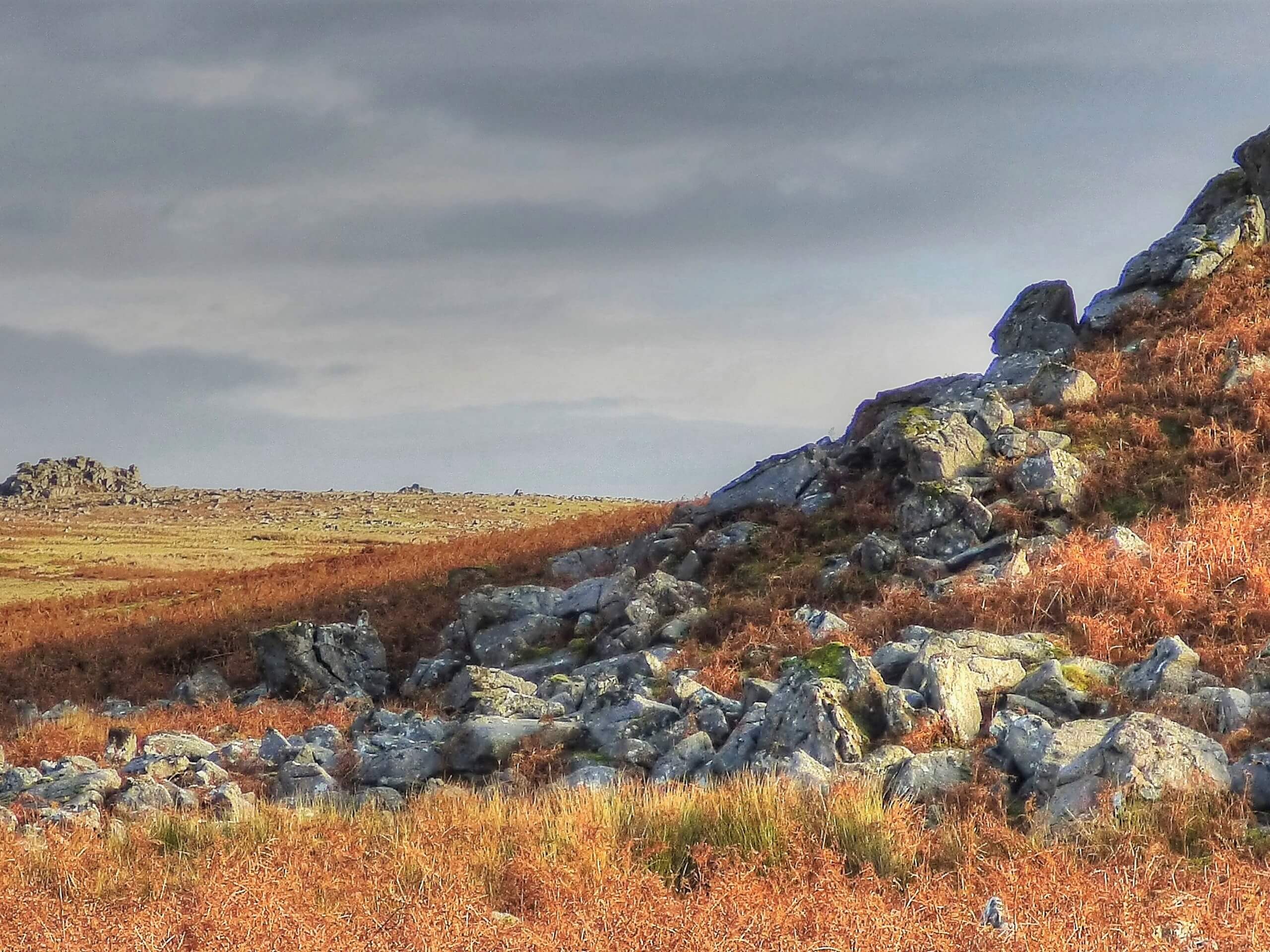
Cadover Bridge to Shaugh Bridge Circular Walk
Difficulty Rating:
The Cadover Bridge to Shaugh Bridge Circular Walk is a great family-friendly adventure in Dartmoor National Park that will see you traverse some rugged terrain and experience some breathtaking views. While out on the trail, you will climb uphill to reach the rugged viewpoint atop Dewerstone Rock before heading through the forest to meander along the banks of the River Plym. This is a wonderfully scenic journey that will truly allow you to get lost in the beauty of nature.
Getting there
To reach the trailhead for the Cadover Bridge to Shaugh Bridge Circular Walk from Yelverton, head southeast on Meavy Lane for 0.3mi and continue straight onto Gratton Lane. Follow this for 1.5mi and make a left, continuing on for 1.7mi to find the car park on the right.

About
| When to do | March-November |
| Backcountry Campsites | No |
| Pets allowed | Yes - On Leash |
| Family friendly | Yes |
| Route Signage | Average |
| Crowd Levels | Moderate |
| Route Type | Circuit |
Cadover Bridge to Shaugh Bridge Circular Walk
Elevation Graph
Weather
Cadover Bridge to Shaugh Bridge Circular Walk Description
While the Cadover Bridge to Shaugh Bridge Circular Walk can certainly be done as a fun family adventure, there are some sections of the trail that are steep, rocky, overgrown, and tricky to navigate. Be sure to bring a GPS along for your adventure if you are planning to explore the forest fully. Additionally, you will want to wear proper walking boots with good support in order to safely traverse the rugged terrain here.
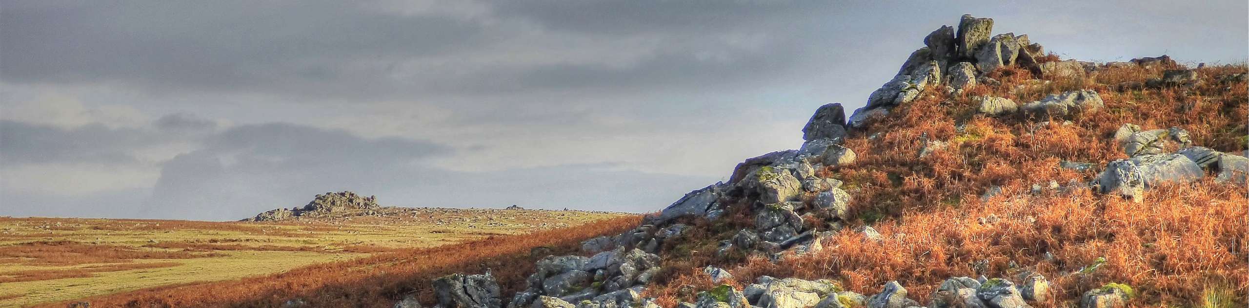
Even though it may be a bit rugged in certain areas – especially around Dewerstone Rock – this is a fantastic walking trail that will produce gorgeous views of the surrounding Dartmoor landscape, as well as a number of peaceful settings within the forest and along the edge of the river. The woodland terrain along this route, filled with large slabs of rock, moss-covered trees, and winding rivers, creates an almost magical feeling that is sure to make your time on the trails a special one. What better way to leave the chaos of the outside world behind to reconnect with nature!
Setting out from the car park, head to the northeast along the road for 0.2mi, crossing over the beautiful stone architecture of Cadover Bridge to pick up a track on the left. Follow it for 375ft and turn right on the footpath to make your way gradually up the hillside. Keep left along the trail for the next 1.3mi, working your way across the rugged terrain of the moor along the edge of Dewerstone Wood, until you arrive at the rocky summit of Dewerstone Rock itself. Take a few moments to appreciate the stunning views of the surrounding Dartmoor landscape that includes rolling green hills and serene forests, before heading back out on the trail.
Take the path leading towards the west to begin your descent of the rocky hillside, working your way downhill through the near-magical forest terrain and keeping left along the path for 0.5mi, as it sweeps between the trees. Reaching a junction, turn right and continue along the path until you reach the charming buildings of Dewerstone Cottage. Make a sharp left here along the trail and follow it to the southwest along the banks of the River Meavy, enjoying the lovely riverside setting over the next 0.4mi.
Here, you will cross over another beautifully constructed bridge, Shaugh Bridge, and keep left along the path to make your way through a car park next to the ruins of an old mine. Reaching the edge of the road, turn left and follow it for 285ft, picking up the trail on the left that leads through the cover of the forest. Follow this path for the next 1.6mi, climbing uphill through the lovely woodland terrain along the edge of the River Plym until you arrive back at the car park where you began your adventure along the Cadover Bridge to Shaugh Bridge Circular Walk.
Trail Highlights
Dewerstone Rock
Local folklore states that the devil rides across the Dartmoor landscape with a pack of black, phantom hounds, chasing people over the rugged terrain of Dewerstone Rock to fall to their deaths. In reality, the rock is the site of an historic Iron Age hillfort and the craggy outcrop features over 100 rock climbing routes, making it a popular spot for outdoor enthusiasts.
Insider Hints
Proper walking boots with good support are needed, as the terrain around Dewerstone is fairly rugged.
Free parking is available at Cadover Bridge. Arrive early to secure a space.
During the summer months, an ice cream truck can often be found near the car park.
Similar hikes to the Cadover Bridge to Shaugh Bridge Circular Walk hike

Shipley Bridge and Avon Dam Reservoir Walk
Located in the southern part of Dartmoor National Park, the Shipley Bridge and Avon Dam Reservoir Walk is a lovely…

The Sherlock Holmes Track
The Sherlock Holmes Track is a fun adventure in the southeast corner of Dartmoor National Park that will take you…

Ryder’s Hill via Sandy Way Trail
The Ryder’s Hill via Sandy Way Trail is a beautiful walking route in Dartmoor National Park that will lead you…
Comments