Burrator Reservoir and Princetown Walk
View Photos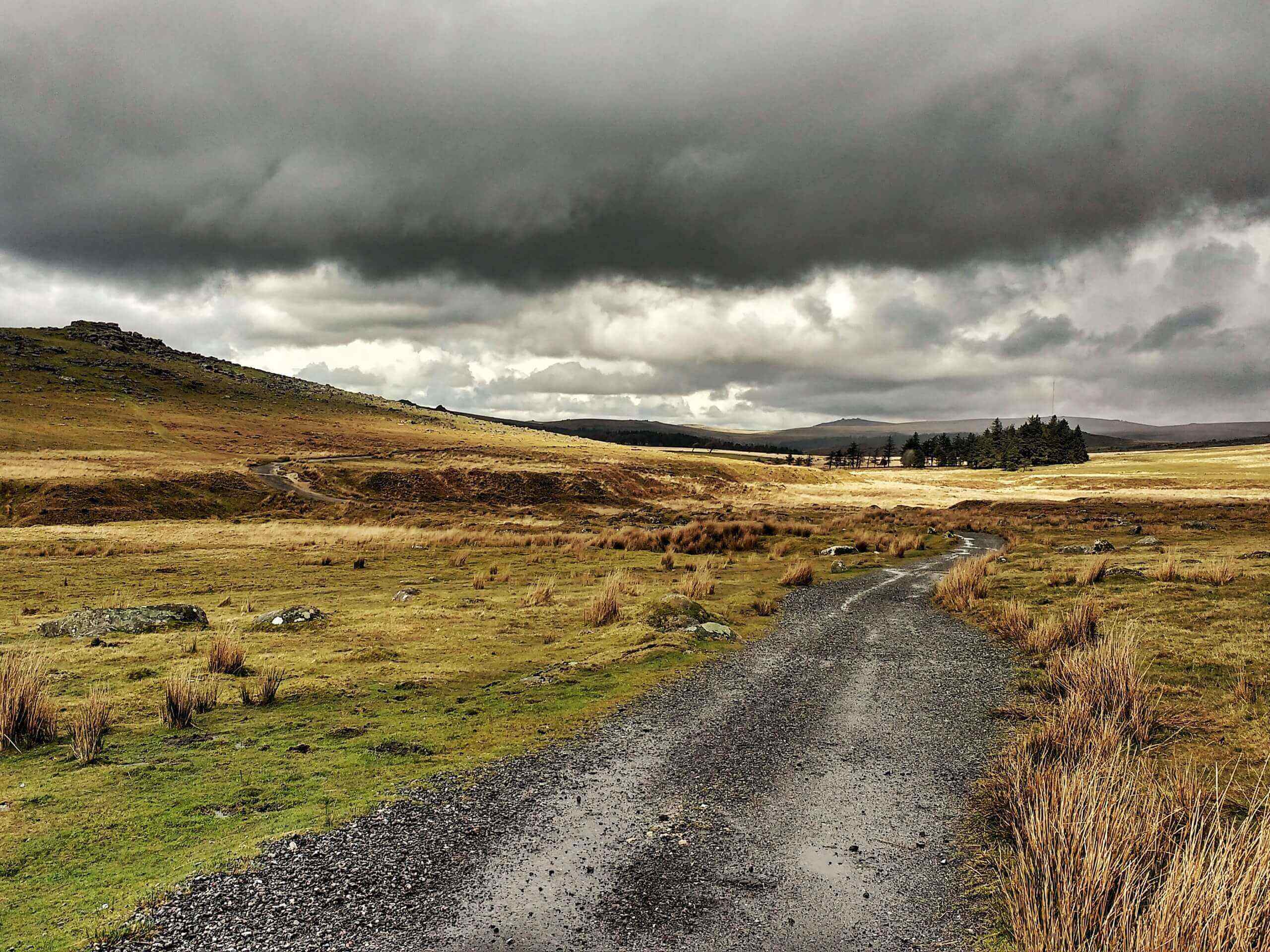
Burrator Reservoir and Princetown Walk
Difficulty Rating:
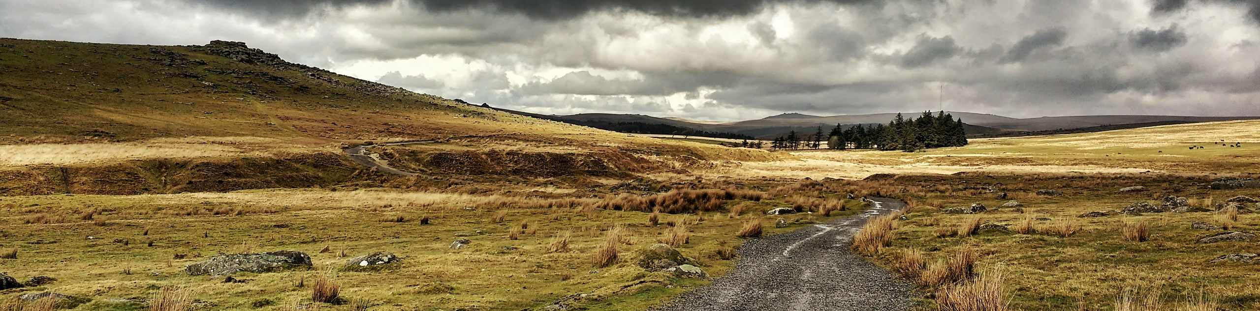
The Burrator Reservoir and Princetown Walk is a difficult adventure in Dartmoor National park that will see you traverse a lengthy stretch of trail across several rugged tors. Covering an area that stretches north from the Burrator Reservoir to King’s Tor and east across the moor to Princetown, you will have a fair amount of ground to cover on this beautifully scenic walk through the Devon countryside. Don’t forget to bring some pocket change, as there just might be an ice cream truck near the end of the walk at Norsworthy bridge to reward you for your hard efforts.
Getting there
To get to the trailhead for the Burrator Reservoir and Princetown Walk from Dousland, drive to the southeast for 0.7mi along Burrator Road and make a left. Keep on for 0.8mi to reach the car park.

About
| When to do | March-November |
| Backcountry Campsites | Plume of Feathers Campsite |
| Pets allowed | Yes - On Leash |
| Family friendly | No |
| Route Signage | Average |
| Crowd Levels | Moderate |
| Route Type | Circuit |
Burrator Reservoir and Princetown Walk
Elevation Graph
Weather
Burrator Reservoir and Princetown Walk Description
The Burrator Reservoir and Princetown Walk isn’t overly difficult in terms of terrain; however, the overall length of 14.4mi that makes it such a challenge. Pack plenty of water and snacks for this adventure, as you will need to keep your energy levels up while out on the trail. Additionally, make sure to wear sturdy walking boots with good ankle support, as there is a good variety of terrain along this lengthy walk.
Although this trail is a long one, you shouldn’t let it discourage you from getting out to explore the beautiful landscapes of Dartmoor National PArk. While out exploring this fantastic route, you will traverse the rugged terrain along several tors and experience breathtaking views across the countryside before wrapping up your day with a waterside walk along Burrator Reservoir. What an amazing way to spend an entire day experiencing the natural beauty that can be found in Devon and Dartmoor National Park.
Setting out from the car park at the Burrator Reservoir, you will make your way uphill through the forests to the northwest, following along the Devonport Leat to get out into the open countryside. Continuing along the trail to the north, you will pass by Peak Hill and Leeden Tor on your right before winding your way across the rugged landscape to loop around the summit of King’s Tor. After taking in the sweeping views of Dartmoor National Park, you will turn to the southeast to cut across the open moor, passing by Foggintor Quarry on your left to arrive in Princetown.
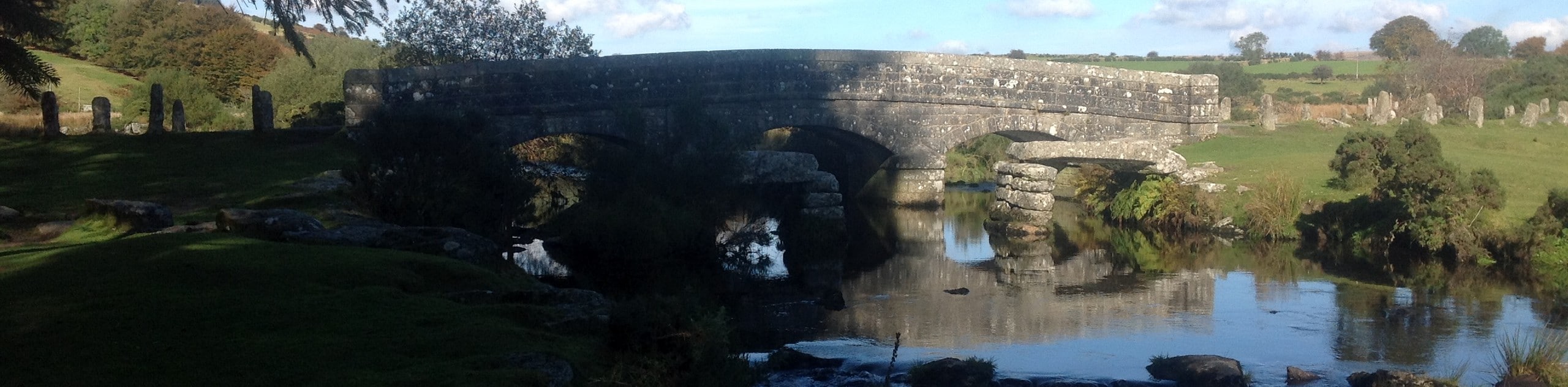
Once you have made your way through the charming village, continue on to the southeast to traverse the summit of South Hessary Tor, after which, you will turn to the southwest on the final leg of the walk towards Burrator Reservoir. A lengthy descent along the rugged terrain of the moor will bring you to the edge of a beautiful expanse of wood that will lead you to Norsworthy Bridge. Instead of crossing the arched stone bridge, turn left and follow the road as it bends further to the southwest, taking you along the edge of the reservoir. After walking along the edge of the water and crossing over the two dam walls, you will arrive back at the trailhead, having completed your lengthy adventure along the Burrator Reservoir and Princetown Walk.
Trail Highlights
Burrator Reservoir
Situated in the southern part of Dartmoor NP, the Burrator Reservoir is a beautiful body of water with the purpose of supplying fresh drinking water to the surrounding area, including the nearby city of Plymouth. Completed in 1898, the reservoir features two dam walls, one in each corner along the southern edge of the reservoir.
Foggintor Quarry
A quick detour from the main trail, just after passing King’s Tor; the Foggintor Quarry is a beautifully scenic location featuring a small lake and shear rock faces. The quarry was operational from the early 1800s until 1938, and provided granite for famous landmarks like the London Bridge and Nelson’s Column.
Frequently Asked Questions
How deep is Burrator Reservoir?
Although water levels in the reservoir fluctuate, its deepest point can be measured at 77ft.
Insider Hints
Toilets can be found near the trailhead.
Bring plenty of water and snacks to stay fueled on this long walk.
Proper walking boots with good support are highly recommended, as much of the terrain along the route is rugged.
Similar hikes to the Burrator Reservoir and Princetown Walk hike

Shipley Bridge and Avon Dam Reservoir Walk
Located in the southern part of Dartmoor National Park, the Shipley Bridge and Avon Dam Reservoir Walk is a lovely…

Ryder’s Hill via Sandy Way Trail
The Ryder’s Hill via Sandy Way Trail is a beautiful walking route in Dartmoor National Park that will lead you…
Two Bridges, Bellever, and Dartmeet Circular Walk
At 15.7mi in length, the Two Bridges, Bellever, and Dartmeet Circular walk is a long adventure; however, it…
Comments