Burrator Reservoir Circular Walk
View Photos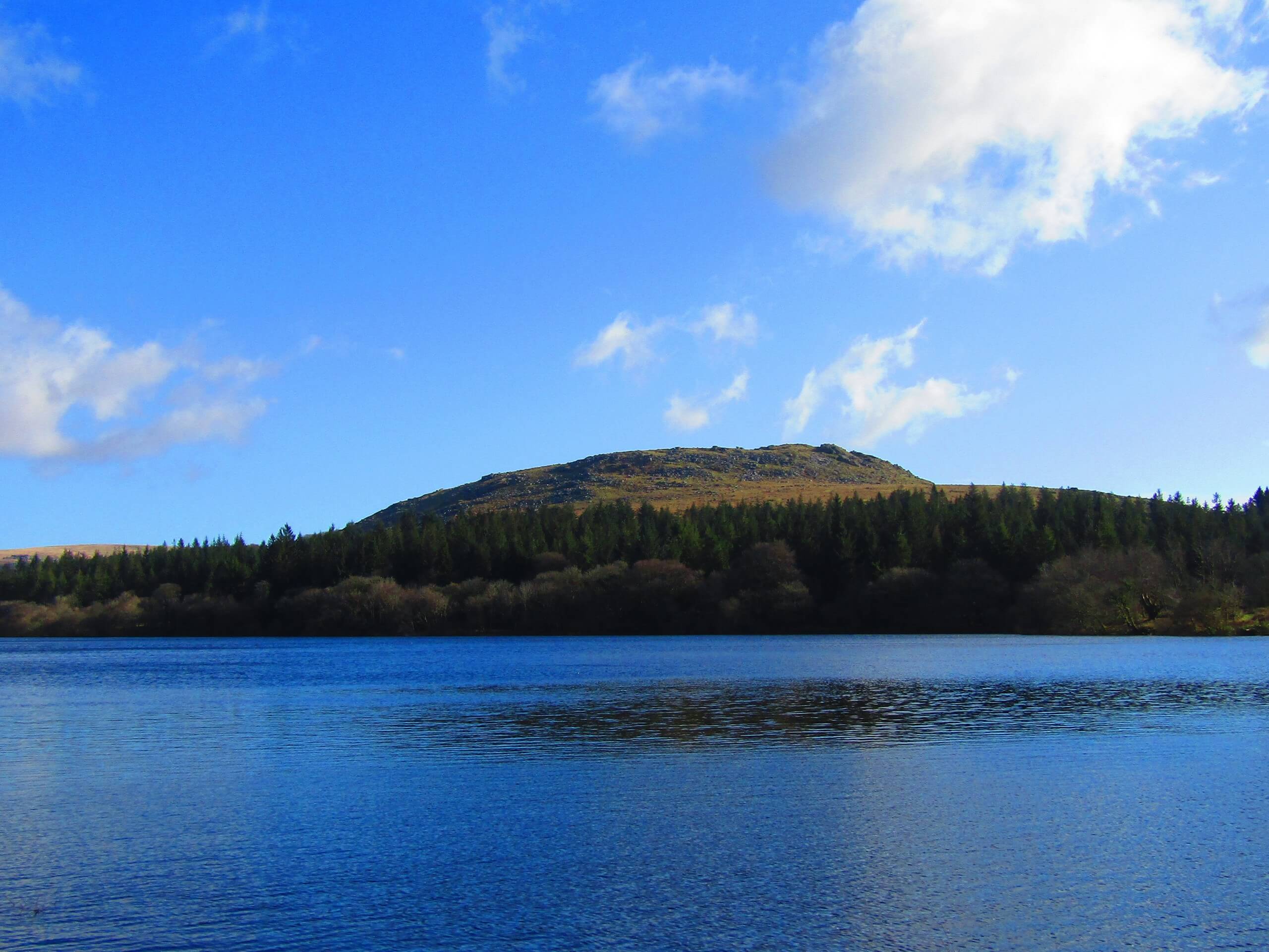
Burrator Reservoir Circular Walk
Difficulty Rating:
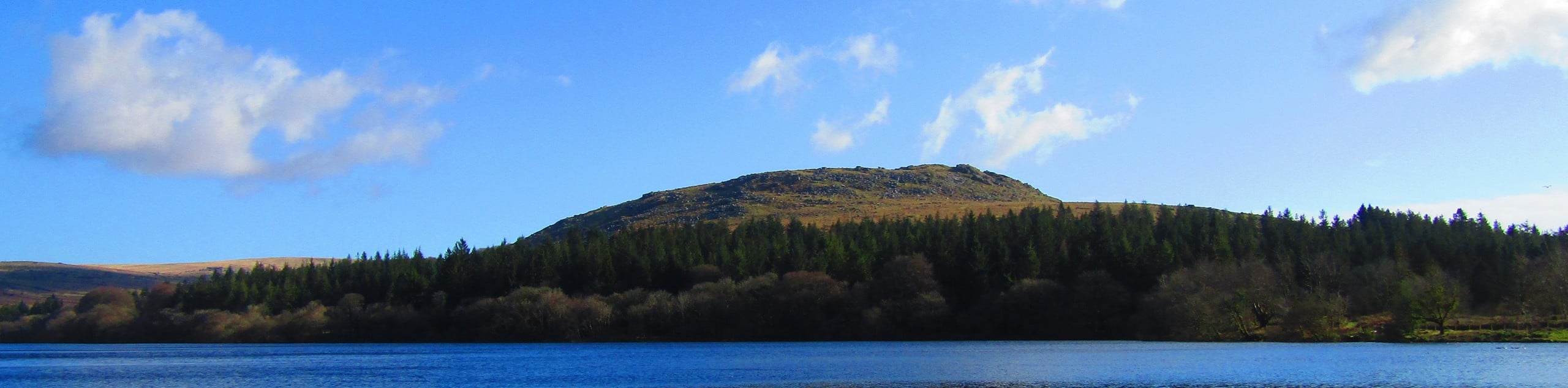
Walking the Burrator Reservoir Circular is a lovely adventure in the southwest corner of Dartmoor National Park that will take you on a laidback route for some wonderfully scenic views. While out on the trail, you will walk across two separate dams and traverse the edge of the reservoir, enjoying scenic views across the water and surrounding hills. The relatively flat and well-maintained pathways here make this a great adventure for the entire family.
Getting there
To reach the car park for the Burrator Reservoir Circular Walk from Dousland, head southeast on Burrator Road for 0.7mi and turn left, continuing on for another 0.8mi to arrive at the trailhead.

About
| When to do | Year-Round |
| Backcountry Campsites | No |
| Pets allowed | Yes - On Leash |
| Family friendly | Yes |
| Route Signage | Average |
| Crowd Levels | High |
| Route Type | Circuit |
Burrator Reservoir Circular Walk
Elevation Graph
Weather
Burrator Reservoir Circular Walk Description
The Burrator Reservoir Circular Walk is a fairly easy adventure that doesn’t feature much in the way of difficult terrain, with the exception of some forest pathways that can become quite muddy after a good rainfall. Be sure to wear decent walking shoes that are preferably water-resistant in these conditions. Make sure to keep your canine friends on a lead, as there is usually a decent amount of foot traffic on this route.
Offering beautifully scenic views overlooking the Burrator reservoir and surrounding hillside, as well as a wonderfully atmospheric woodland setting, it is easy to see why the Burrator Reservoir Circular Walk is such a popular route with families and beginner walkers. If you find yourself in the southwest of England and looking for a gentle afternoon walk, why not try exploring this lovely circular route within Dartmoor National Park.
Setting out from the roadside parking area, head east along the dam wall of the Burrator Reservoir and enjoy the views of the water before entering into the cover of the forest. After 0.4mi from the trailhead, you will exit the tree cover and pick up the path on the left, passing through a gate to follow it across the length of the Sheepstor dam wall. Reaching the opposite side, the path will enter a stretch of woodland terrain and turn to the north. Keep left along the trail for the next 1.4mi, walking through the variety of terrain along the edge of the reservoir and gazing out across the calm water, as you make your way past the ruins of Longstone Manor and around a point, eventually meeting up with a junction in the northeast corner of the reservoir.
With the reservoir on your left and the slopes of Sheeps Tor on your right, turn left and follow the path through the trees to cross over Narrator Brook and arrive at the banks of the River Meavy. From here, you will turn to the northeast and follow the path slightly uphill to cross the river and arrive at Norsworthy Bridge. There will likely be an ice cream truck parked nearby, where you can pause for a few minutes to enjoy some refreshments in a scenic locale. Once you are ready to get back on the trails, head west to make your way along the River Meavy towards the edge of the Burrator Reservoir. Once there, keep left along the trail for the next 1.1mi, enjoying the intermittent views across the water as you pop in and out of the tree cover while crossing over a number of streams that flow into the reservoir.
Reaching a junction with the road, turn left and follow it along the western edge of the reservoir. Enjoy the final views across the water, as well as a lovely highlight in the waterfall on your right side. After walking south for 0.4mi, you will arrive back at the roadside parking area where you began the Burrator Reservoir Circular Walk.
Trail Highlights
Burrator Reservoir
Located in the southern portion of Dartmoor National Park, the Burrator Reservoir is a unique body of water, in that it features two dams – one in its southeast corner and another to the southwest. Completed in 1898, the reservoir supplies drinking water for Plymouth and other nearby towns.
Norsworthy Bridge
Situated near the eastern side of the Burrator Reservoir, Norsworthy Bridge is a lovely stone bridge that spans the River Meavy. Many people use this as a beginning/end point for their walks through the area, as there is often an ice cream truck parked here, offering delicious snacks to enjoy in a picturesque setting.
Frequently Asked Questions
How deep is Burrator Reservoir?
At its deepest point, the reservoir is 77ft deep. This will fluctuate as the water levels within the reservoir rise and fall.
Can you paddle on the Burrator Reservoir?
Any form of water sports, including swimming, kayaking, canoeing, or paddleboarding are prohibited on the Burrator reservoir.
Insider Hints
After a good rainfall, certain parts of this trail can become very muddy. Don’t forget your wellies if you are thinking of exploring in these conditions.
An ice cream truck is often parked near Norsworthy Bridge at the roughly halfway point of this walk, making for some great mid-walk refreshments in a picturesque location.
Toilets can be found near the trailhead.
Similar hikes to the Burrator Reservoir Circular Walk hike

Shipley Bridge and Avon Dam Reservoir Walk
Located in the southern part of Dartmoor National Park, the Shipley Bridge and Avon Dam Reservoir Walk is a lovely…

The Sherlock Holmes Track
The Sherlock Holmes Track is a fun adventure in the southeast corner of Dartmoor National Park that will take you…

Ryder’s Hill via Sandy Way Trail
The Ryder’s Hill via Sandy Way Trail is a beautiful walking route in Dartmoor National Park that will lead you…
Comments