
Belstone and River Taw Circular Walk
View Photos
Belstone and River Taw Circular Walk
Difficulty Rating:
Walking the Belstone and River Taw Circular Trail is a laidback adventure that will take you through a quiet riverside setting along the northern edge of Dartmoor National Park. While out on the walk, you will meander along the scenic River Taw as it leads you through a wooded valley. Don’t forget to pop into The Tors Inn next to the trailhead for some post-walk drinks.
Getting there
To reach the trailhead for the Belstone and River Taw Circular Walk from the National Trust Finch Foundry in Sticklepath, drive west for 1.4mi and turn left to continue on for 0.8mi. At this point, keep straight for another 360ft to arrive at the car park.

About
| When to do | March-October |
| Backcountry Campsites | No |
| Pets allowed | Yes |
| Family friendly | Yes |
| Route Signage | Average |
| Crowd Levels | Moderate |
| Route Type | Lollipop |
Belstone and River Taw Circular Walk
Elevation Graph
Weather
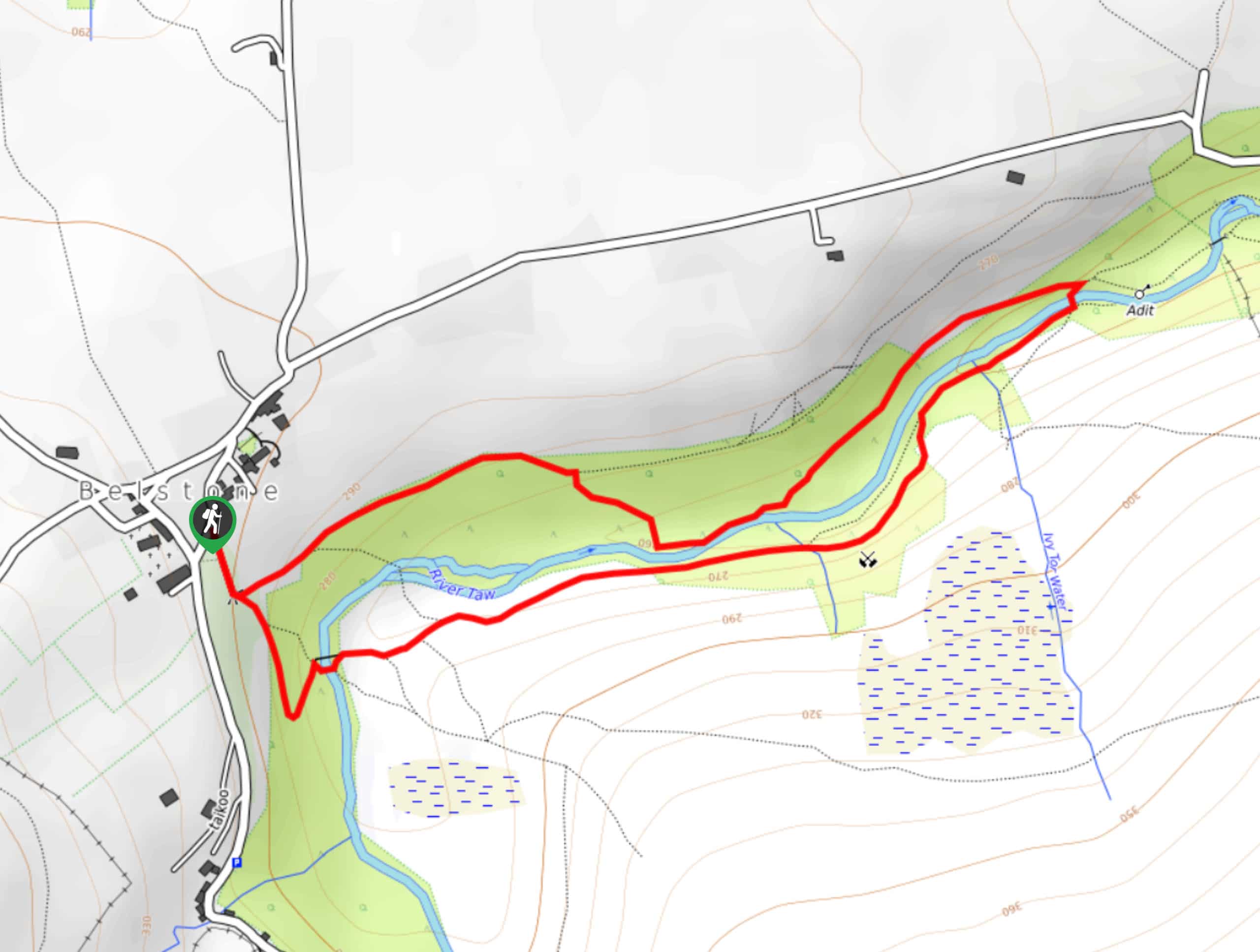
Belstone and River Taw Trail Description
While it is only a short trek, the Belstone and River Taw Circular Walk offers a nice mixture of easy to navigate pathways and scenic views that can be enjoyed by walkers of every age and skill level. The trail sets out from the village of Belstone and leads you to the southeast to enter the wooded valley along the River Taw. Continue along the winding riverbank to the east, where you will eventually cross over the water and make your return along the opposite side of the river.
Similar hikes to the Belstone and River Taw Circular Walk hike

Shipley Bridge and Avon Dam Reservoir Walk
Located in the southern part of Dartmoor National Park, the Shipley Bridge and Avon Dam Reservoir Walk is a lovely…

The Sherlock Holmes Track
The Sherlock Holmes Track is a fun adventure in the southeast corner of Dartmoor National Park that will take you…

Ryder’s Hill via Sandy Way Trail
The Ryder’s Hill via Sandy Way Trail is a beautiful walking route in Dartmoor National Park that will lead you…
Comments