
Heart Mountain Horseshoe hike
View Photos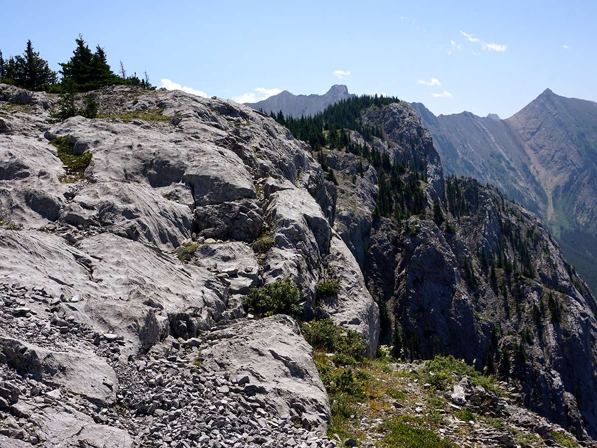
Heart Mountain Horseshoe hike
Difficulty Rating:
Hiking the Heart Mountain Horseshoe is a wonderful hike near Canmore. Hiking the full Horseshoe gets you away from the highway and into incredible, big-mountain views. Who knew hiking around Heart Mountain would be this great? We love this hike!
Getting there
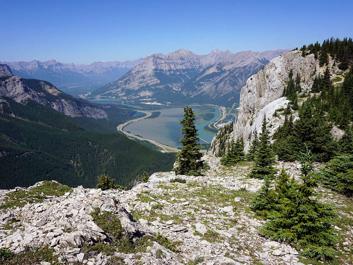
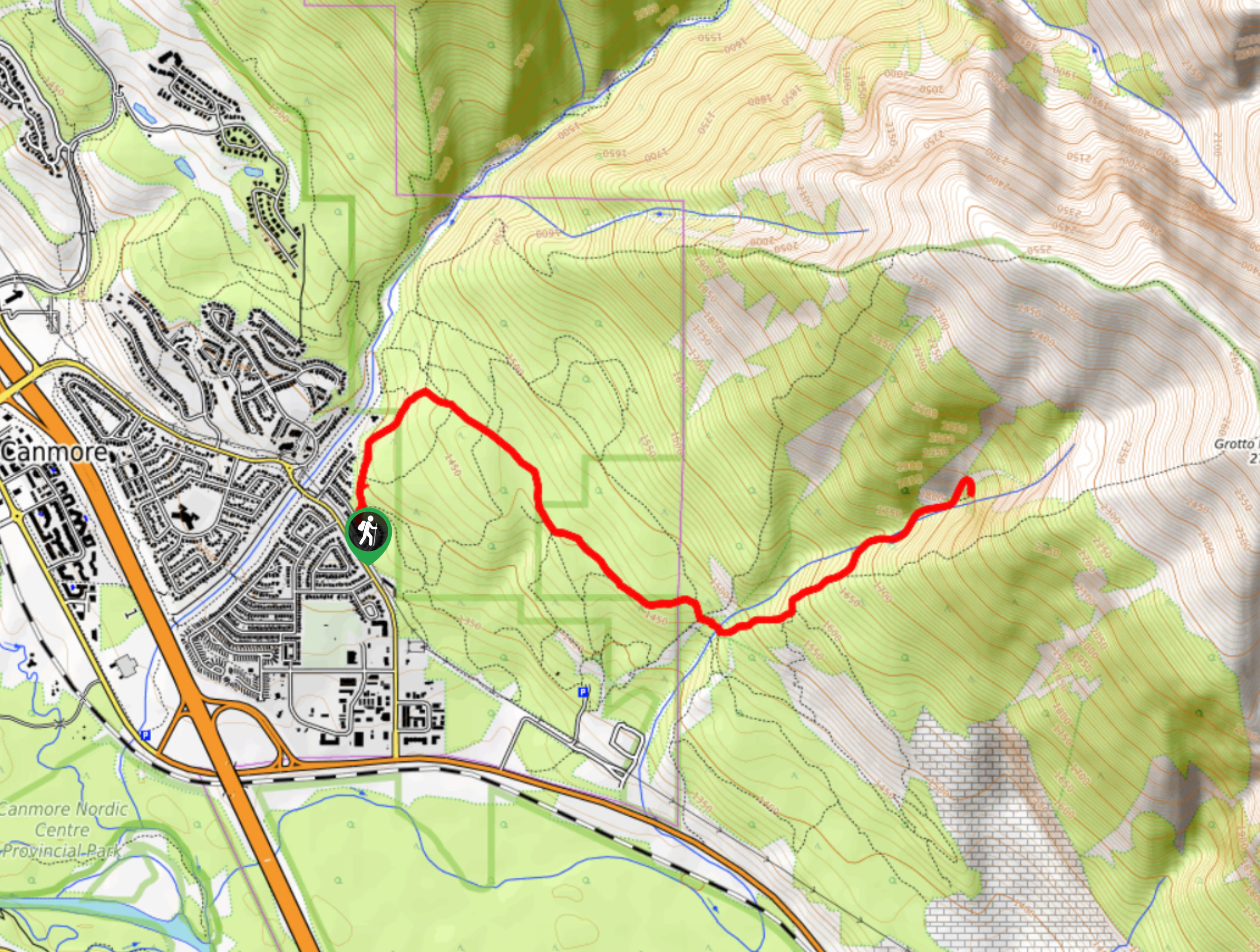
The Heart Mountain Parking Lot is roughly 10.7mi east of Canmore on the TransCanada highway. Whether you are coming from the east or west, take the turn-off at Lac des Arcs and go to the south side of the highway, where you will find a parking lot.

About
| When to do | May to early October |
| Backcountry Campsites | No |
| Toilets | At Trailhead |
| Family friendly | No |
| Route Signage | None |
| Crowd Levels | Moderate |
| Route Type | Circuit |
Heart Mountain Horseshoe
Elevation Graph
Weather
Route Description for Heart Mountain Horseshoe
Before you do this hike, please be aware that this hike does have a scramble as you ascend, which requires the use of hands for two moves to get through a rock-band. Some people find it easy, some people hate it. Check out the photos to understand what this looks like.
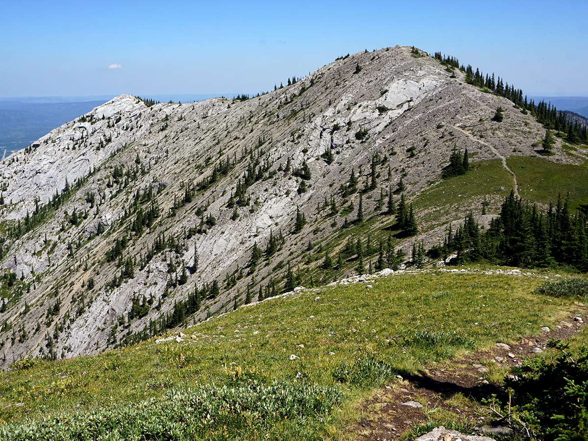
OK, now onto the Heart Mountain Horseshoe Hike. This is a great hike, but it doesn’t start out like one, as you climb steeply up to the summit of Heart Mountain. The great hiking comes after you’re over the first peak and on the horseshoe. Then it’s tranquility, great views and a fantastic day out.
To start this hike, head past the toilets near the parking lot and past a Heart Creek sign, and then head into the trees. You’ll walk on a trail through woods.
When you come to a creek (Heart Creek) you can either follow a faint path down and over the creek or follow the creek up for a short while. On our GPS we have taken a faint path past a trail-closed sign down to Heart Creek and crossed the creek. Once you come up other side you will see the scramblers route sign for Heart Mountain.
Start hiking up the ‘Scramblers Route’ for Heart Mountain. The trail up Heart Mountain is steep and rocky.
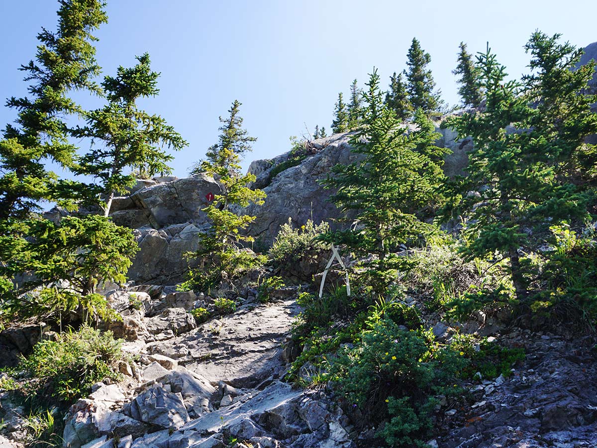
After about 45 minutes of climbing you will come to a rock band. You do not need to scramble up this rock band. Instead, go left and follow a dirt trail up through the forest for a few minutes and then pop back out onto the ridge top. Note: DO NOT GO RIGHT at this rock band, as it’s easy to get into exposed, very dangerous scrambling.
Soon you’ll come to another small rock band. At this rock band stay to the left going up. Quite soon after this rock band you come to another, smaller rock band to get over. At this smaller rock band there is a clear path going to the left—through the forest—to get around it.
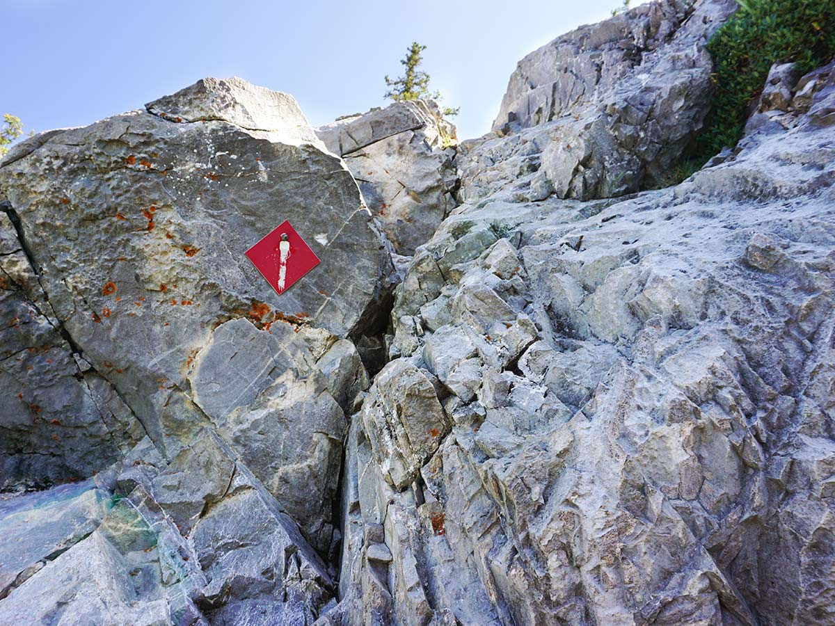
Soon you will see a ridge rising on your left. As you get close you’ll see a faded red triangle on a rock (roughly 1.5mi form the start). There are often some small orange plastic flags here as well. Take this path, this is the only scramble you can’t avoid. To get up the scramble requires some flexibility or a hand from a friend. Some people hate this scramble, others find it easy. If this is too tough, don’t hesitate to turn around here.
Once over this scramble you get up on the ridge. Stay left, away from edge, heading onto a path that snakes through the trees.
Coming out of the trees you are presented with a steep gully. On our GPS we explored a route to the left, however it’s easier to hike up this gully. The route going left is a lot rougher and has a bit of exposure.
Continue hiking uphill, making sure you stay well away from the edge on the right. There are many paths here, so take care and ensure the route you are on is safe and you are not trending out toward the edge and the dangerous cliffs below.
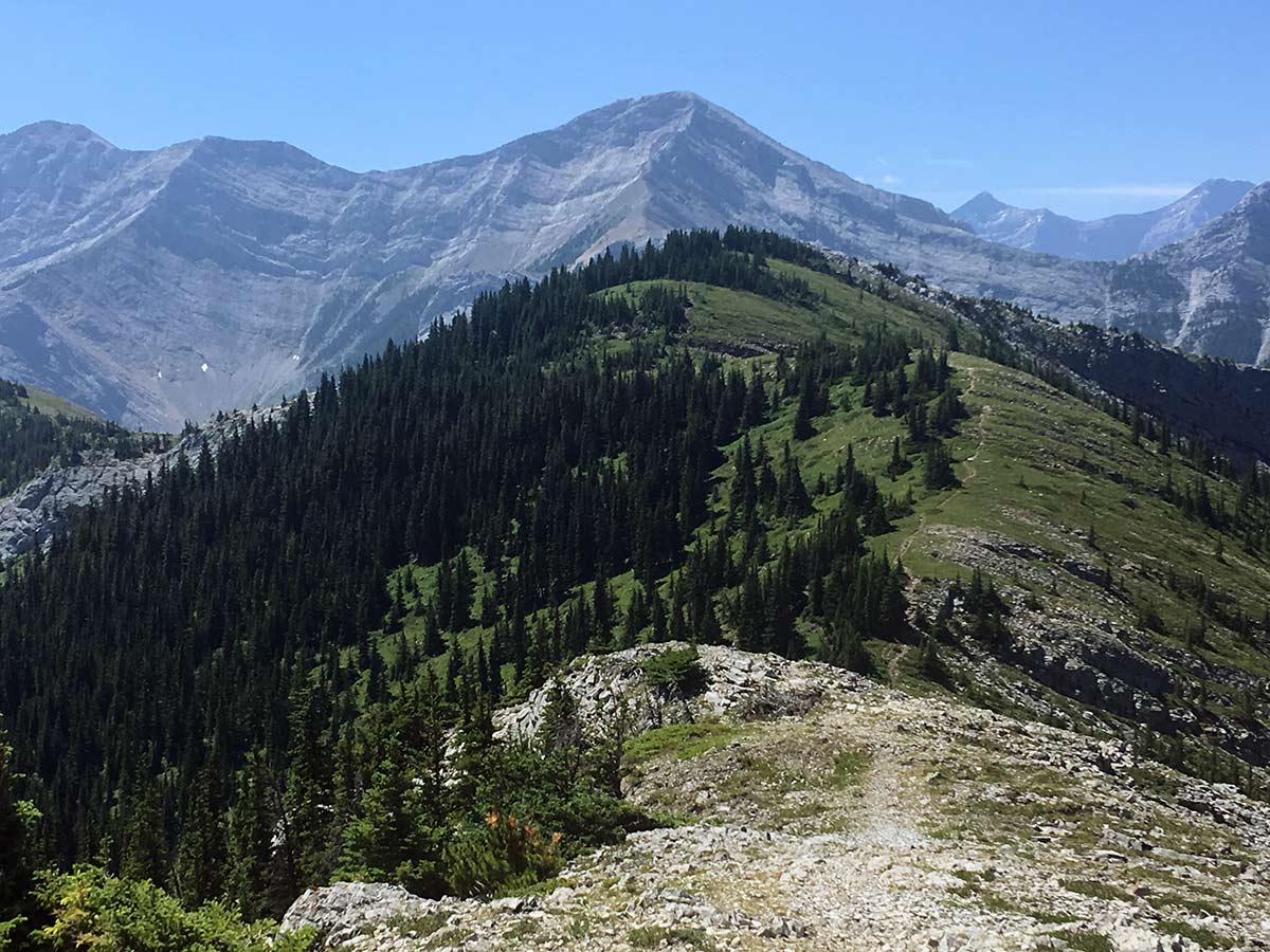
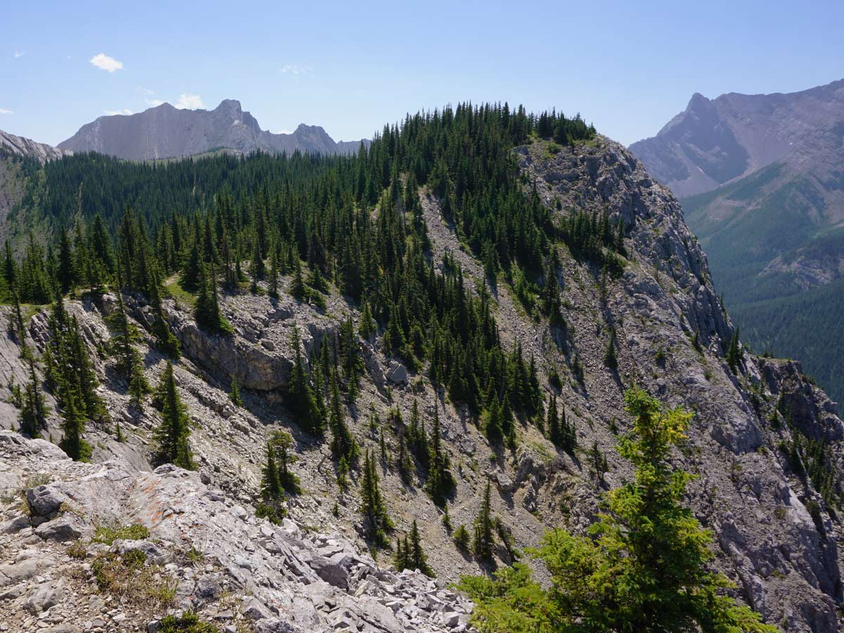
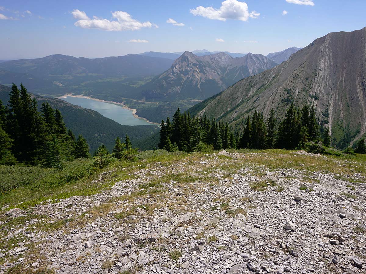
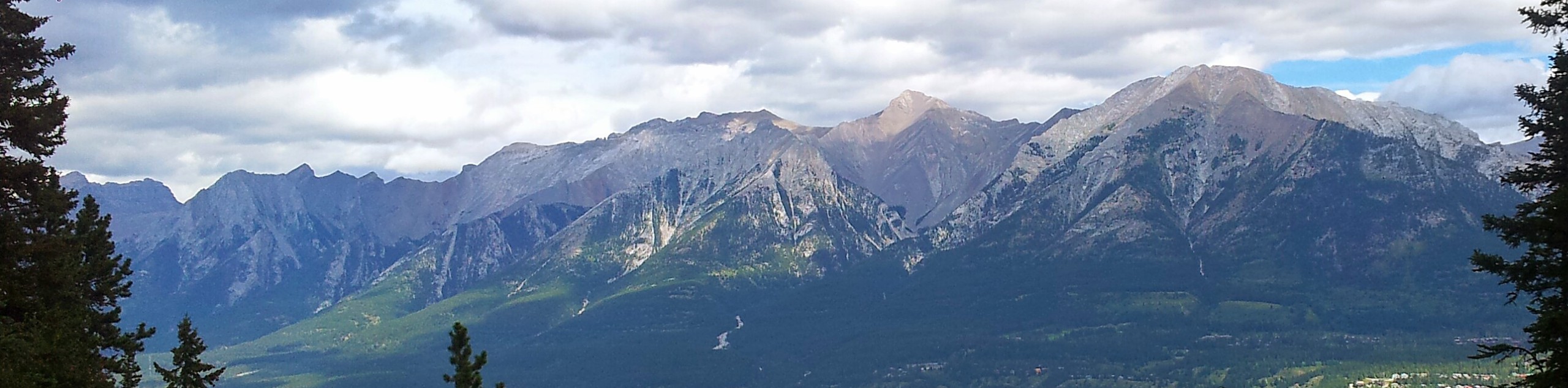
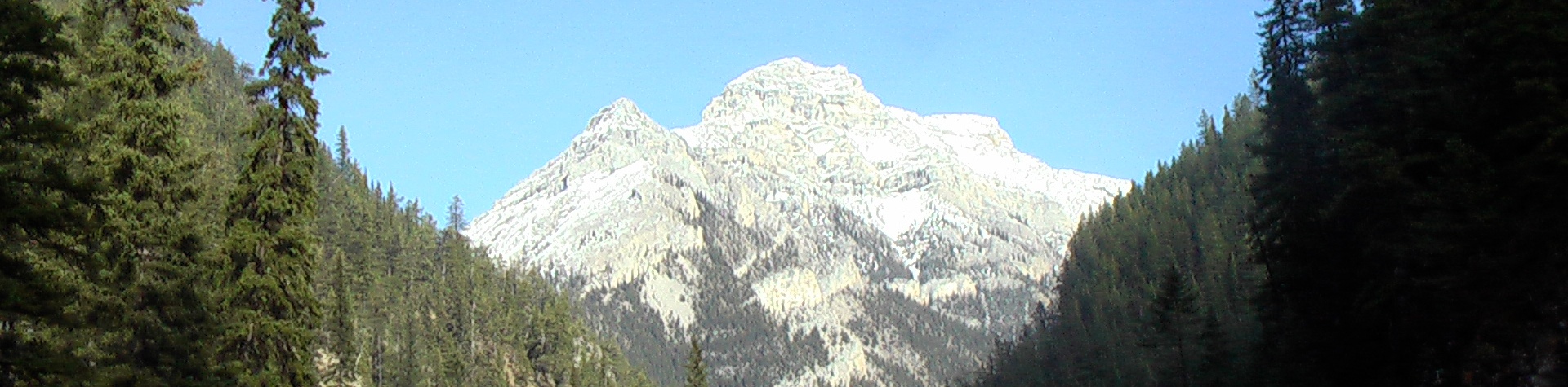
Finally, after 2-2.5h from the start you come out on the flat summit ridge of Heart Mountain and eventually reach the summit. The summit of Heart Mountain is 7005ft. The next few km’s are the best part of the hike, in our opinion! There is a whole other mountain environment back here. Best of all, the path past the summit sees a lot less traffic. The last two times we hiked it there was nobody else on the trail!
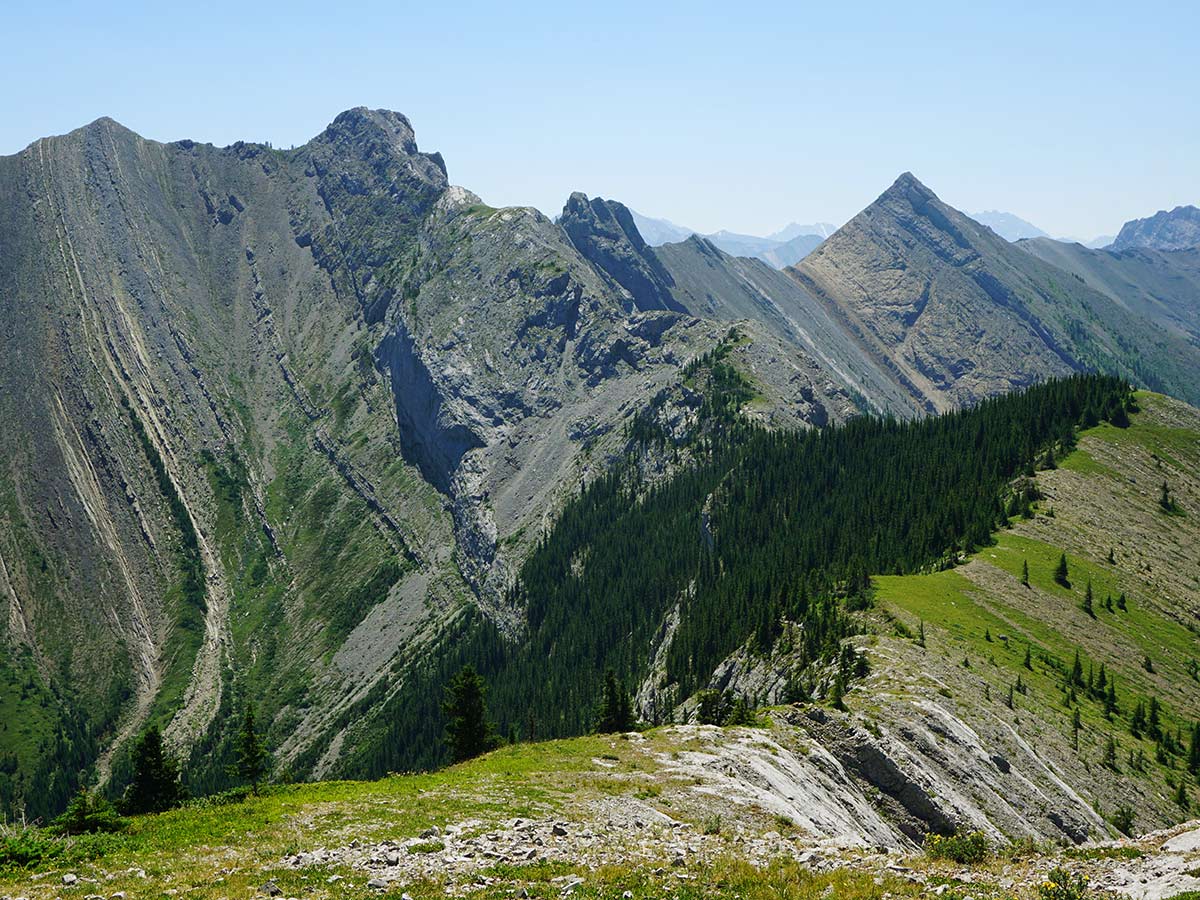
As you continue forward, the path will curve to the left as it goes down off the Heart Mountain summit. Eventually the path goes into forest as it curves left towards Grant MacEwan Peak, SE from the Heart Mountain summit.
The path is clear as it takes you to the summit of Grant MacEwan Peak (7047ft). Most people get here in 3–3.5 hrs from the car.
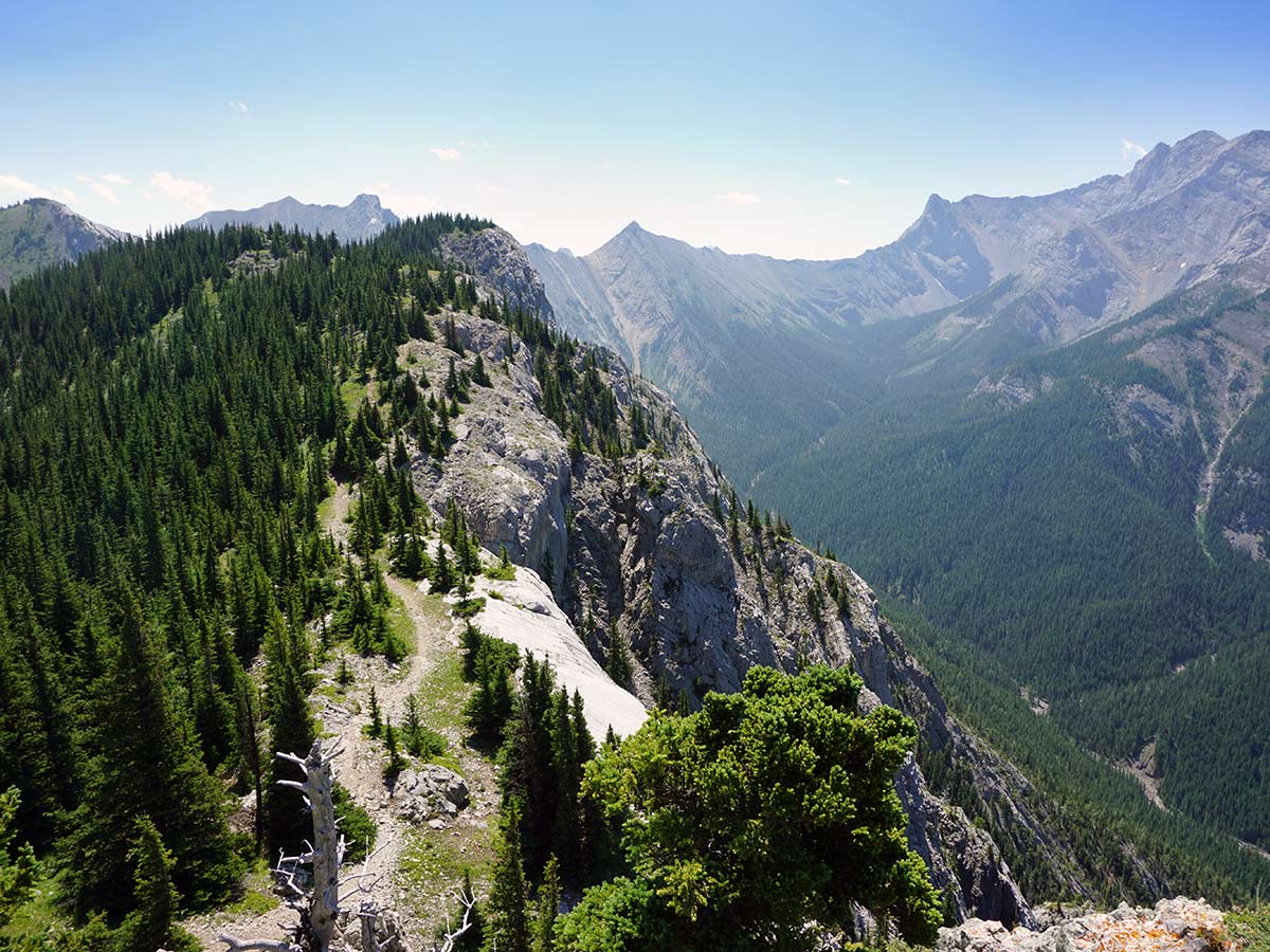
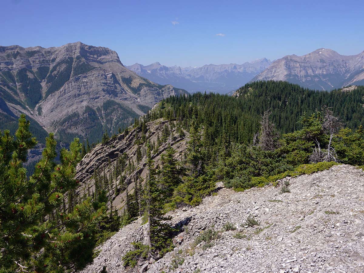
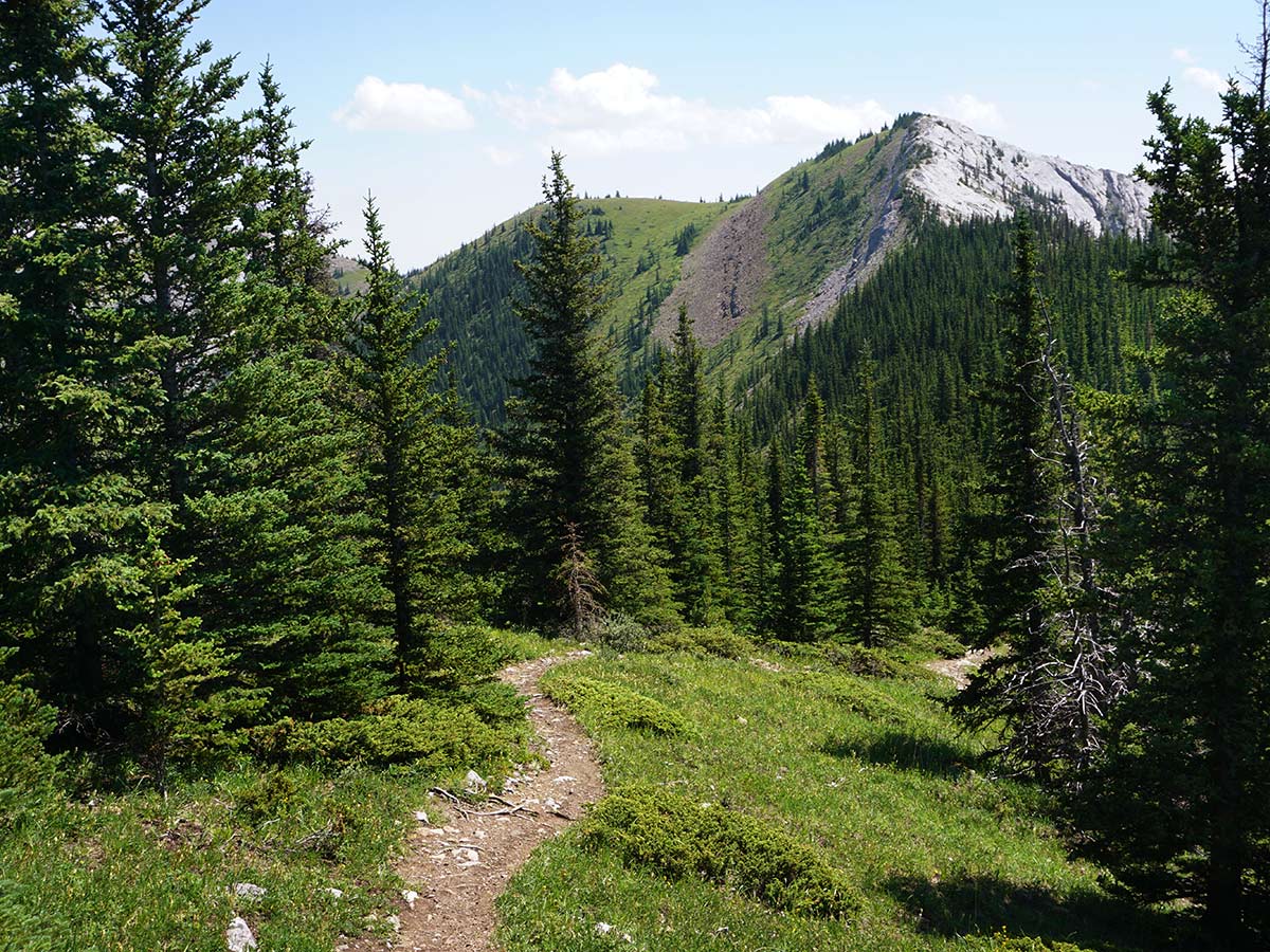
There is a summit register at Grant MacEwan Peak, so bring a pen and write your name for posterity! After leaving your mark on history in the mountain registry, continue down and to the left. You’ll pass a field of wildflowers where you can do your best “Julie Andrews in The Sound of Music” impression.
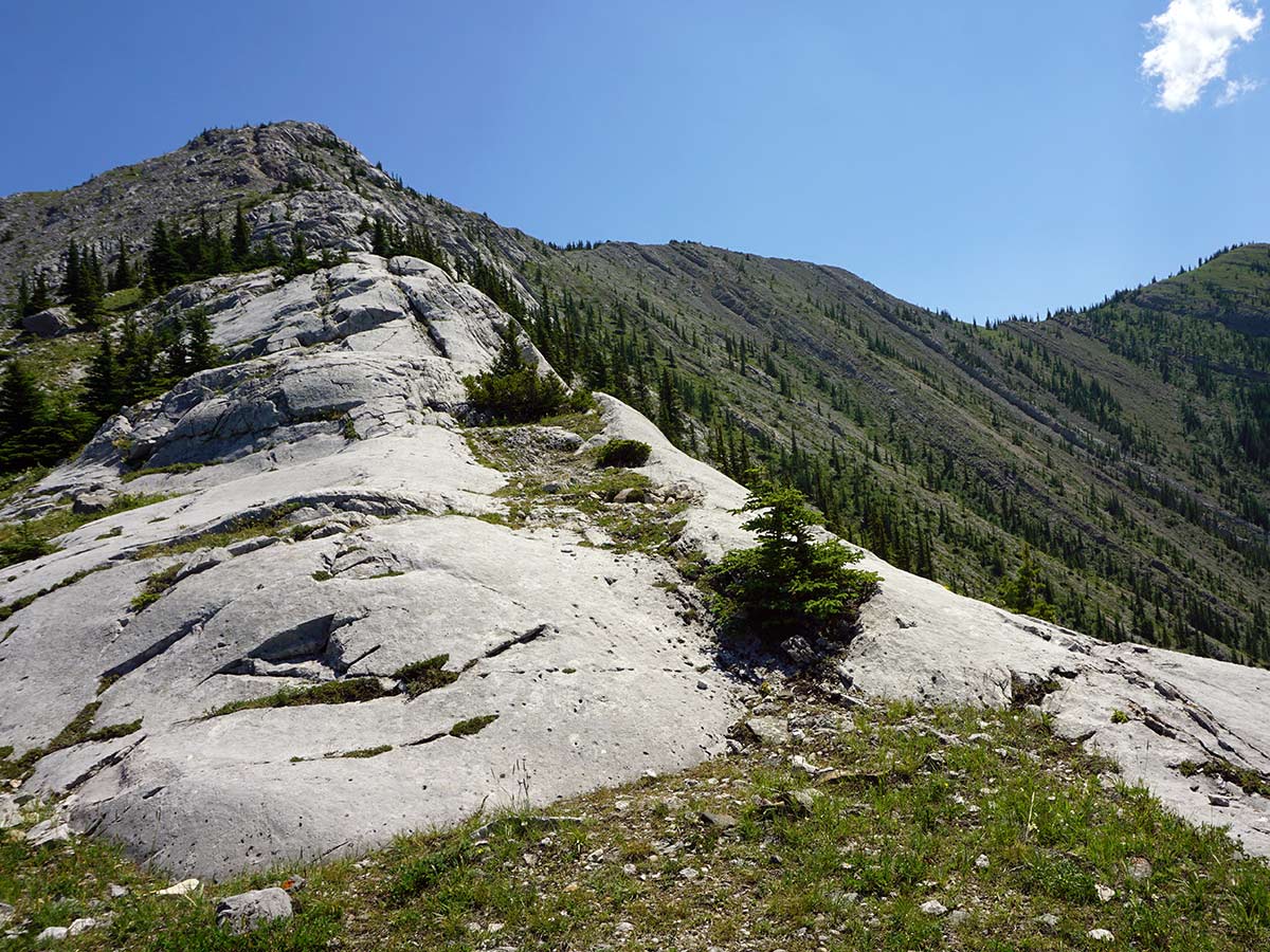
Once at the third summit the path drops sharply. With a rock wall on your left and a clear path going down over light scree. This scree is just the wrong size to go down easily, and poles definitely help.
After coming down from these rocky, steep bits (some light bum-scooching may be required if you didn’t bring your poles), you’ll enter a forest with a nice soft trail.
You know you are almost done when you come to a creek. Follow the path downhill, with the creek on your left. After the hard rock, the soft forest path is a nice change.
Now at the bottom of the descent you will come to some electrical poles and a clearing. Go left here, under the poles.
Soon you come out from under the poles and onto a path just before a small lake. Go to the left here, following the path all the way back to your car.
Looking for more amazing hikes near Canmore? Check out the Grassi Lakes hike, Grotto Canyon hike or the Ha Ling Peak hike.
Insider Hints
In recent years there seems to have been more bear activity here. Hike in a group and bring bear spray. Also, check the weekly bear report to see if there is a bear in the area.
We like to stock up with coffee and snacks at Beamers Coffee bar in Canmore before this hike. It’s great coffee and snacks!
Bow Valley campground is a nice campground nearby. The spots that back onto the Bow River are wonderful, and there is good biking for families in the area.

Similar hikes to the Heart Mountain Horseshoe hike
Echo Canyon Trail
The Echo Canyon trail in Canmore is accessible from the Cougar Creek area and is close to local amenities. It…
Highline Trail
The Highline Trail is a multi-use trail in Canmore that travels westbound to Quarry Lake and the Powerline Trail before…
Cougar Creek Trail
The Cougar Creek Trail in Canmore starts at a multi-sport adventure hub. The parking area is a starting place for…
KDarough 4 years ago
I loved hiking Heart Mountain! We did the full loop, tackling the steeper and more challenging portion of climbing to the Heart Mountain peak first. Hikers should be aware that there are some sections of scrambling and very steep terrain to climb along the initial climb to the Heart Mountain peak. Thee challenging climb was worth the amazing views!
MartiniC 4 years ago
I love the varied terrains and remarkable view. It captured my heart!
Greenlife 4 years ago
I like how we immerse ourselves in nature, we should preserve it as much as we could. The urban jungle has no match for this one!
lavenderheaven 4 years ago
First of all, check the weekly bear report to see if there is a bear in the area. Beamers Coffee bar offers great coffee and snacks. Bow Valley campground has a good biking trail. Perfect for family activities.
alexjensen 4 years ago
Pretty tiring but worth it. The scramble and scree aren't my fav but if you stay true to the trail it's great
LyleM 4 years ago
Really nice climb. We did the whole horseshoe today and it was lovely. Our legs were burning and the views were solid. Would definitely recommend, especially for an more early season hike.
Otis Webster 4 years ago
The mountain was brimming with so much beauty. A wonderful hike to be done during warmer seasons.
Clark Hermano 4 years ago
Stunning views everywhere and a fantastic day in the Rockies. Difficult but I can say this was one hell of an accomplishment.
Grant Ko. 4 years ago
Great trail for the adventurous who loves to take challenge. Make sure to be in shape for this trail. It is very steep both up and down the trail has good markings the 360 views are worth the climb.
Alex Lavinson 4 years ago
This is not the most challenging hike I have done this year. So it was easier compared to others.