Wind Ridge hike
View Photos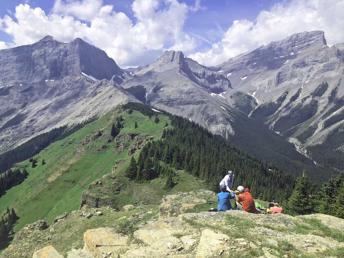
Wind Ridge hike
Difficulty Rating:
The hike up Wind Ridge, near Canmore, takes you away from the Bow Valley into the stunning West Wind Valley. Sometimes confused with West Wind Pass (which is accessed from the Smith-Dorrien Hwy), Wind Ridge is a great hike.
Getting there
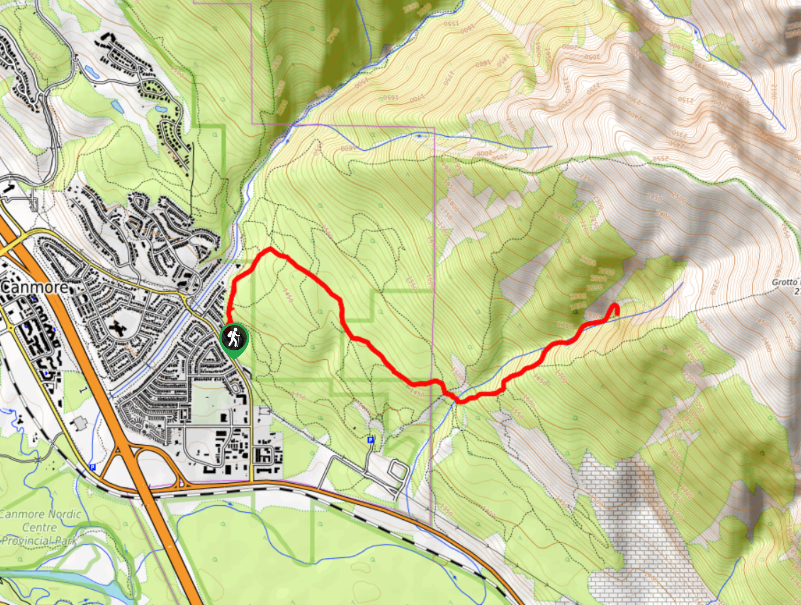
From Canmore, head East on the TransCanada highway for roughly 6.1mi. Take the turn-off at Dead Man’s Flats, however instead of crossing over to the town on the north side of the highway, head south for 0.9mi towards the Banff Gate Mountain Resort, eventually parking at the Mount Lougheed Viewpoint parking lot.

About
| When to do | June 15 - October |
| Backcountry Campsites | No |
| Toilets | At Trailhead |
| Family friendly | No |
| Route Signage | None |
| Crowd Levels | Moderate |
| Route Type | Out and back |
Wind Ridge
Elevation Graph
Weather
Route Description for Wind Ridge
Before starting out, note that parts of the Wind Ridge hike are closed from December 1 – June 15 each year. This closure is for Elk and Bighorn Sheep sustainability. While it is often said that You can still hike to Windy Ridge during this time, however not the entirety of Wind Ridge.
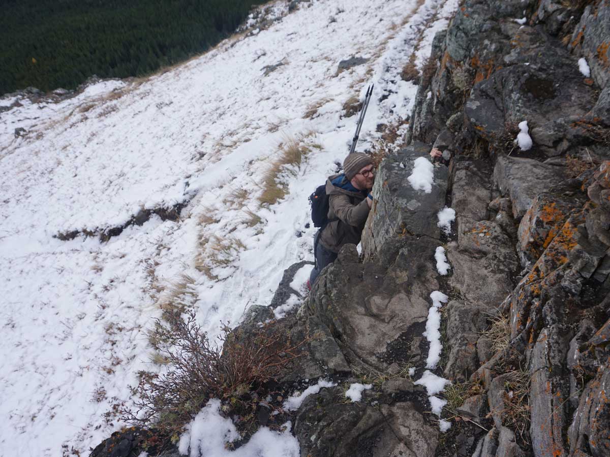
Finally, there is a small scramble required on this hike. There is a way around it, however the way around isn’t that great, and some feel it’s actually harder.
Now, for the route. From the parking lot, look up, there are incredible views from here already! Today is going to be a great day. Walk to the far end of the parking lot and go past a notice board and onto the trail. The trail starts in the trees.
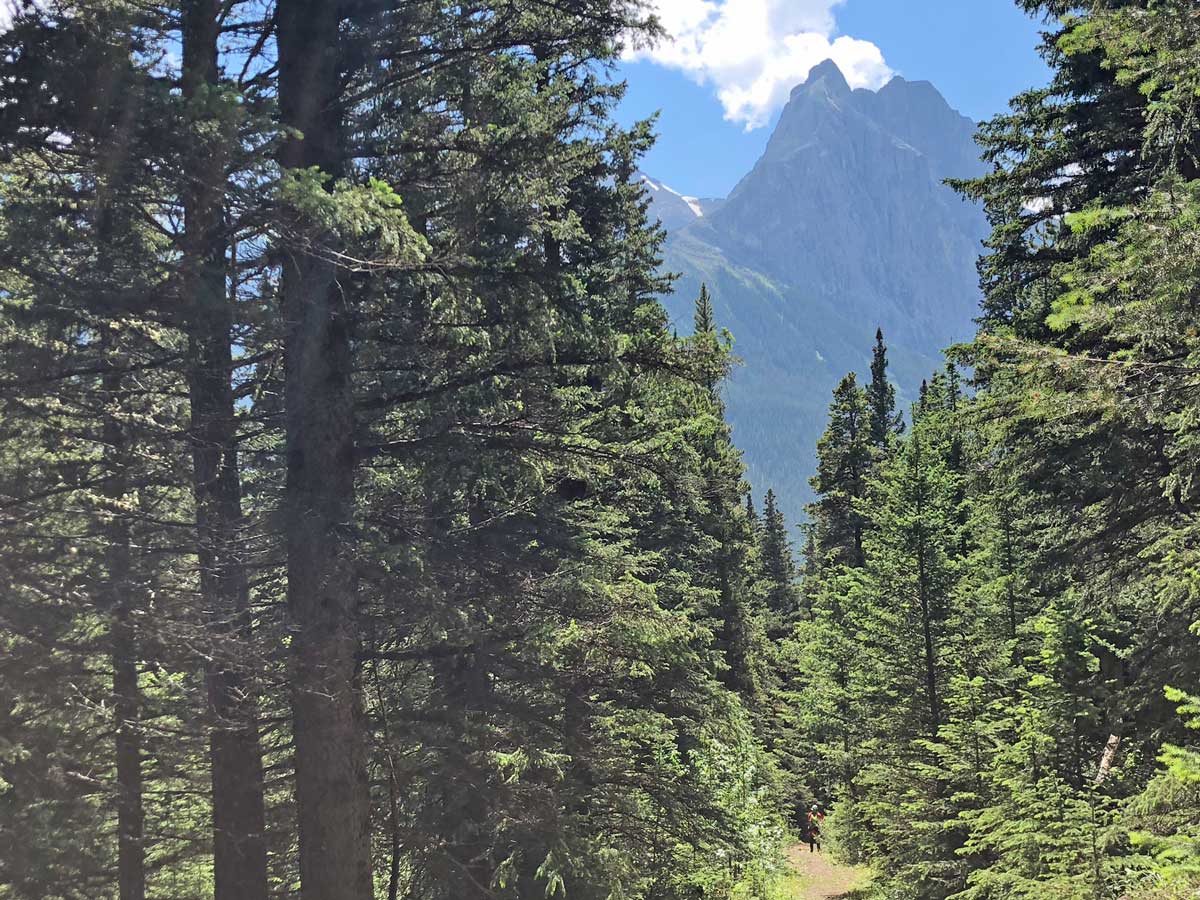
There is extensive re-routing and trail building as of June 2018. After about 15 minutes you’ll notice a path going down to your right. This is a path to rock-hop across Pigeon Creek – don’t take this. Continue on the main path and use the nice new bridge to cross Pigeon Creek.
Once over Pigeon Creek the path has been rebuilt, with new bridges and a new path in places. Hike along the trail, watching for signs that direct you to the Wind Valley or Wind Ridge. A path goes off to the left, which is the ascent to Centennial Pass. Along the way you will cross 3 new bridges and follow the path as it goes along a new routing.
Eventually you come out to a broad forest track, where you will go left, uphill. This is the old path, and you’ll notice some logs on your right, remember these and look out for them on your way back down.
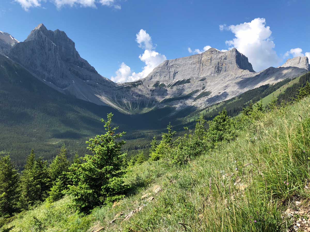
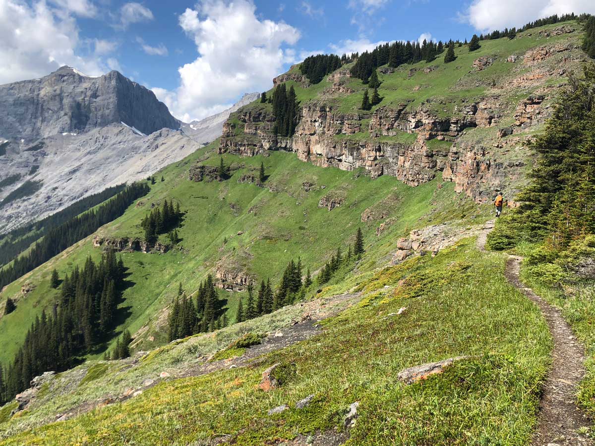
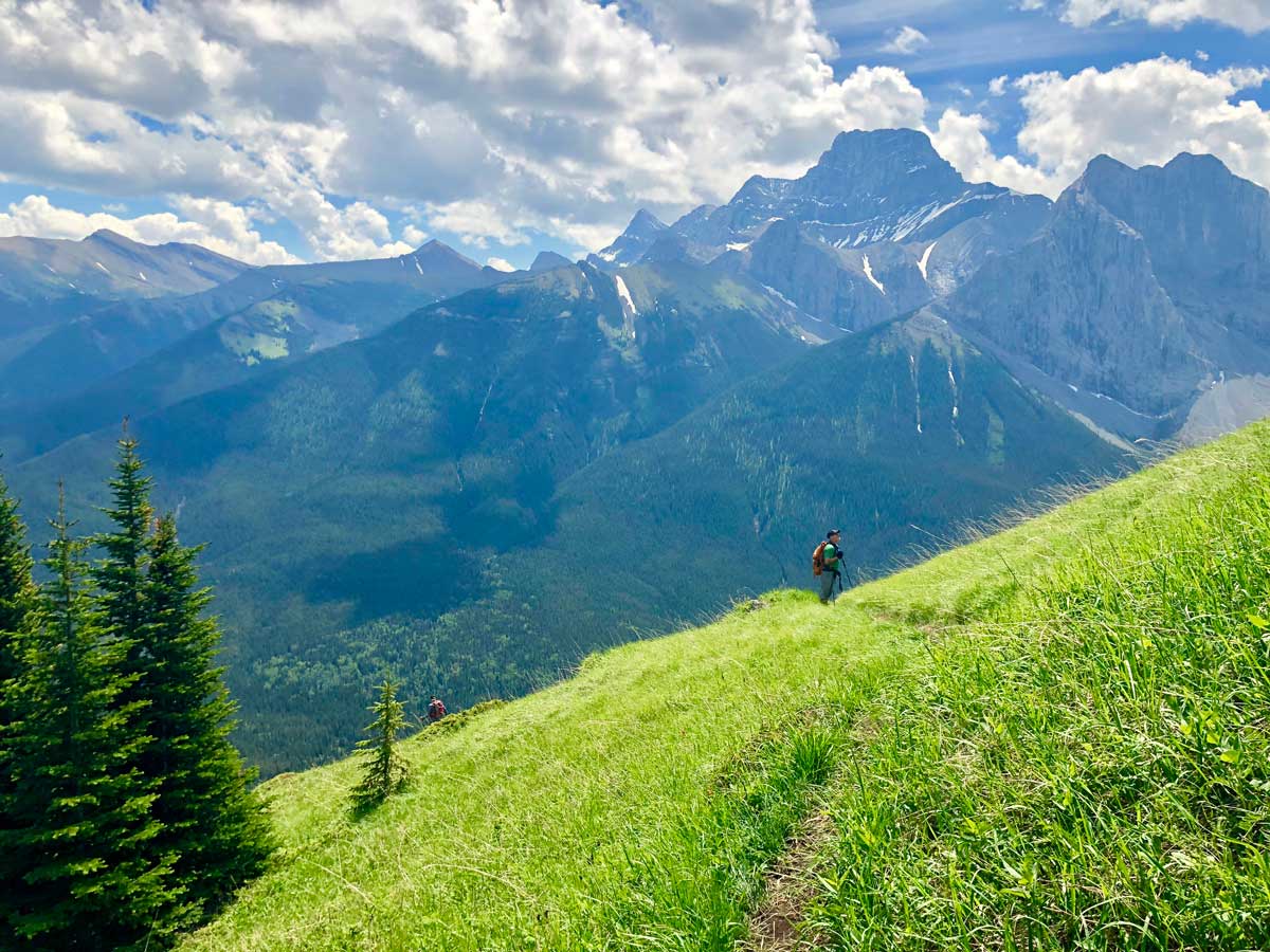
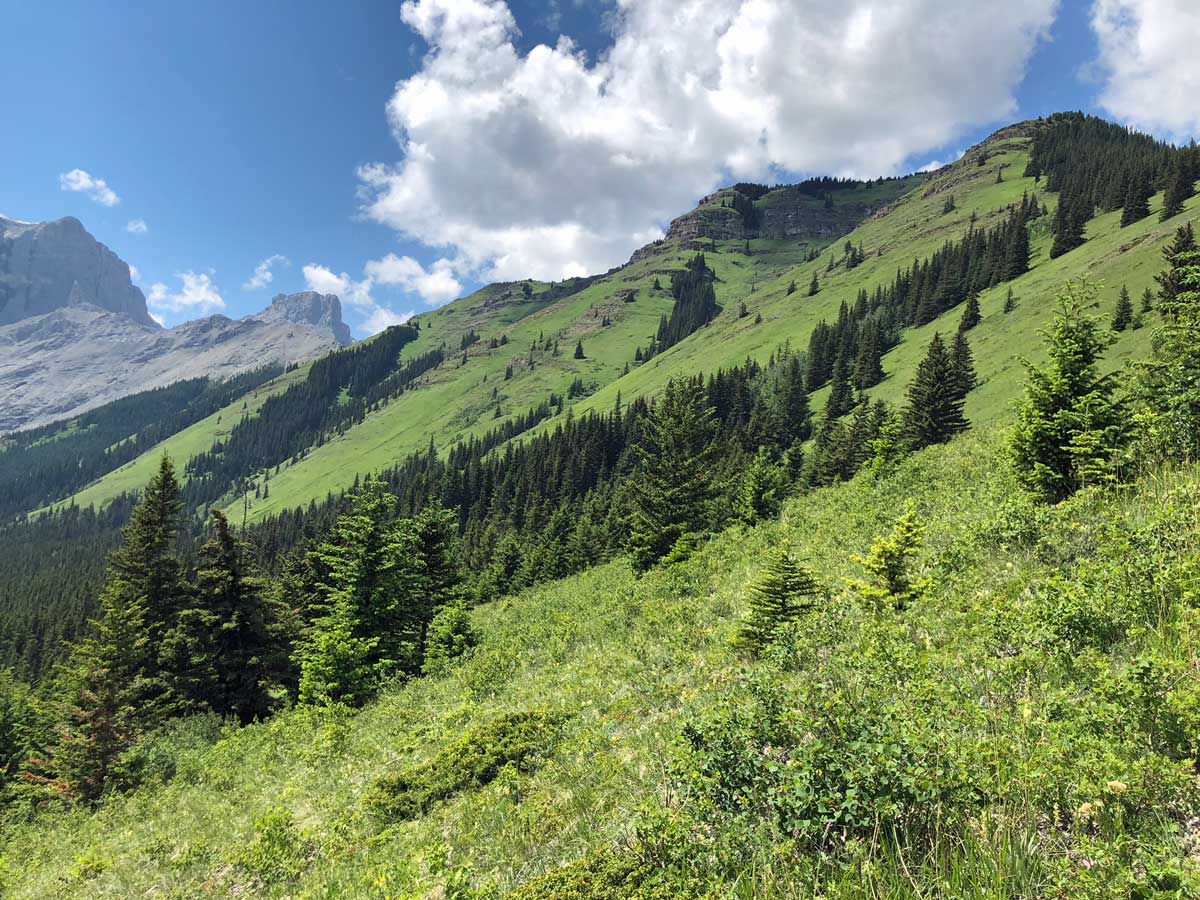
You are on a good path for approximately 0.7mi as it makes an enormous Z through the forest. You’ll get occasional views, but the true beauty of this hike is above the treeline. While walking through the forest, the path is broad and the path fairly flat as it meanders. Lookout for a right-hand turn, where you start to go uphill almost immediately.
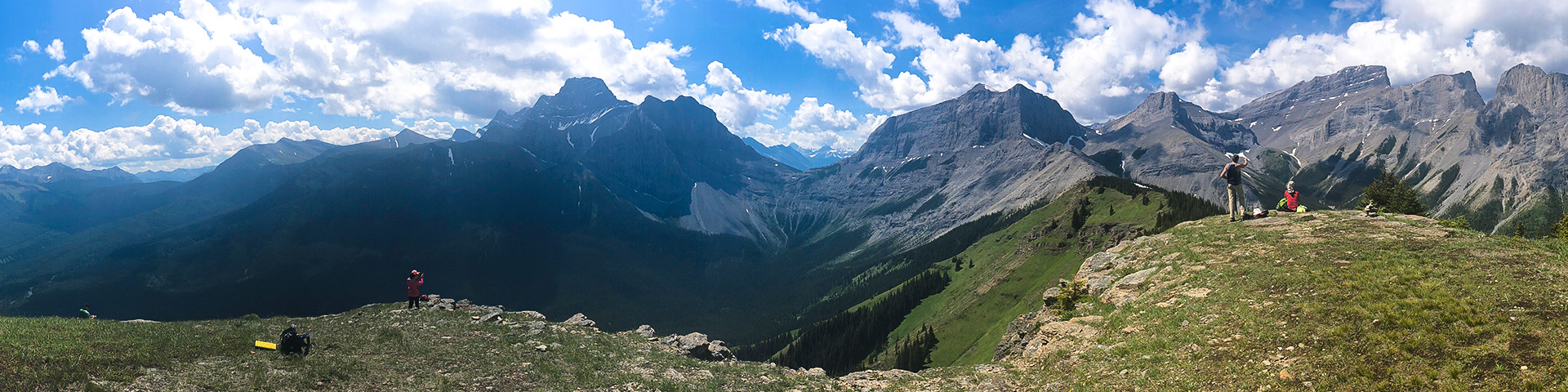
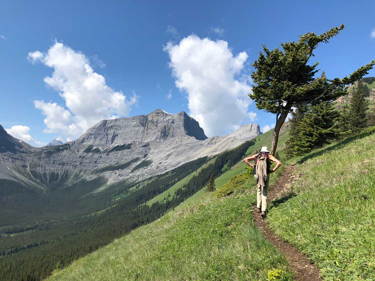
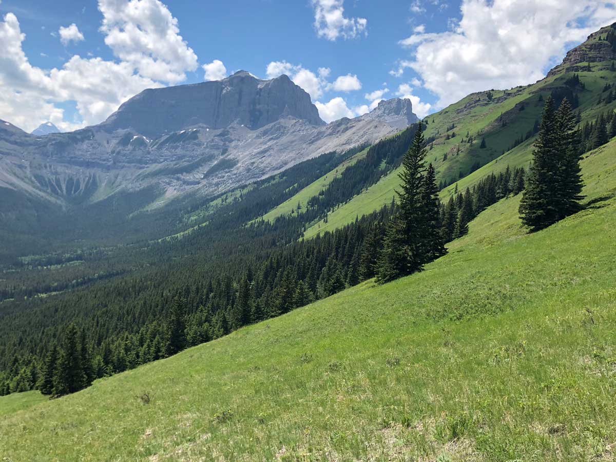
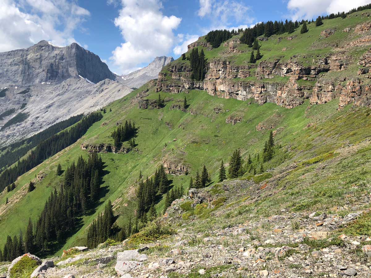
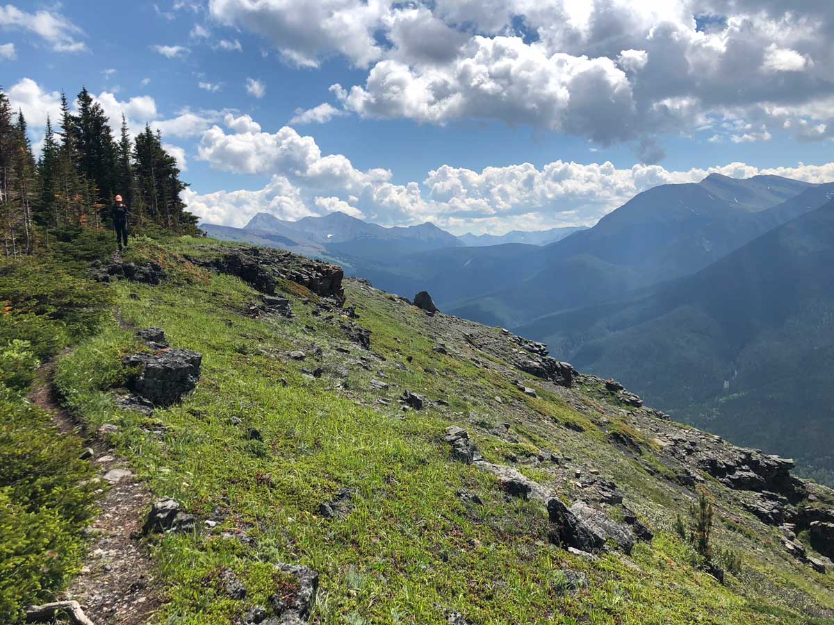
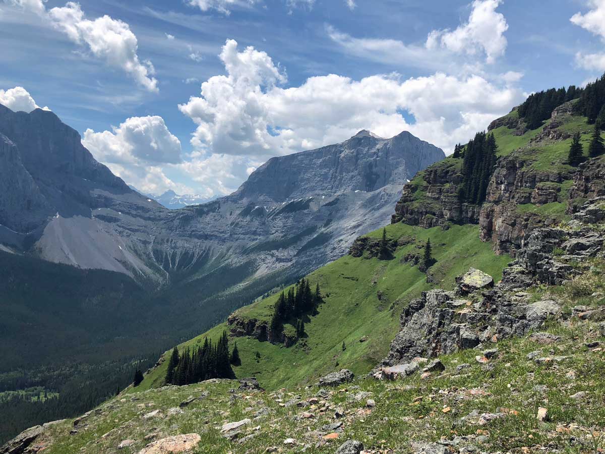
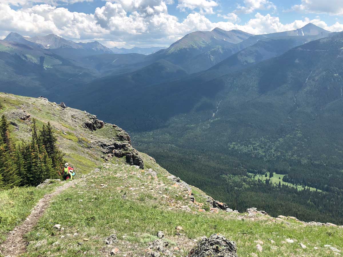
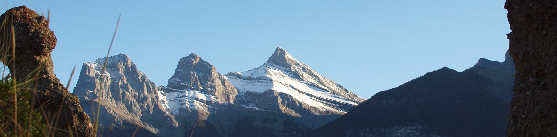
As you ascend you will come out of the trees and see Wind Ridge to your left. From here, the route up Wind Ridge is clear, though very, very steep at times. The views are spectacular here, as the trail passes through flowery meadows. The view of Windtower is especially stunning.
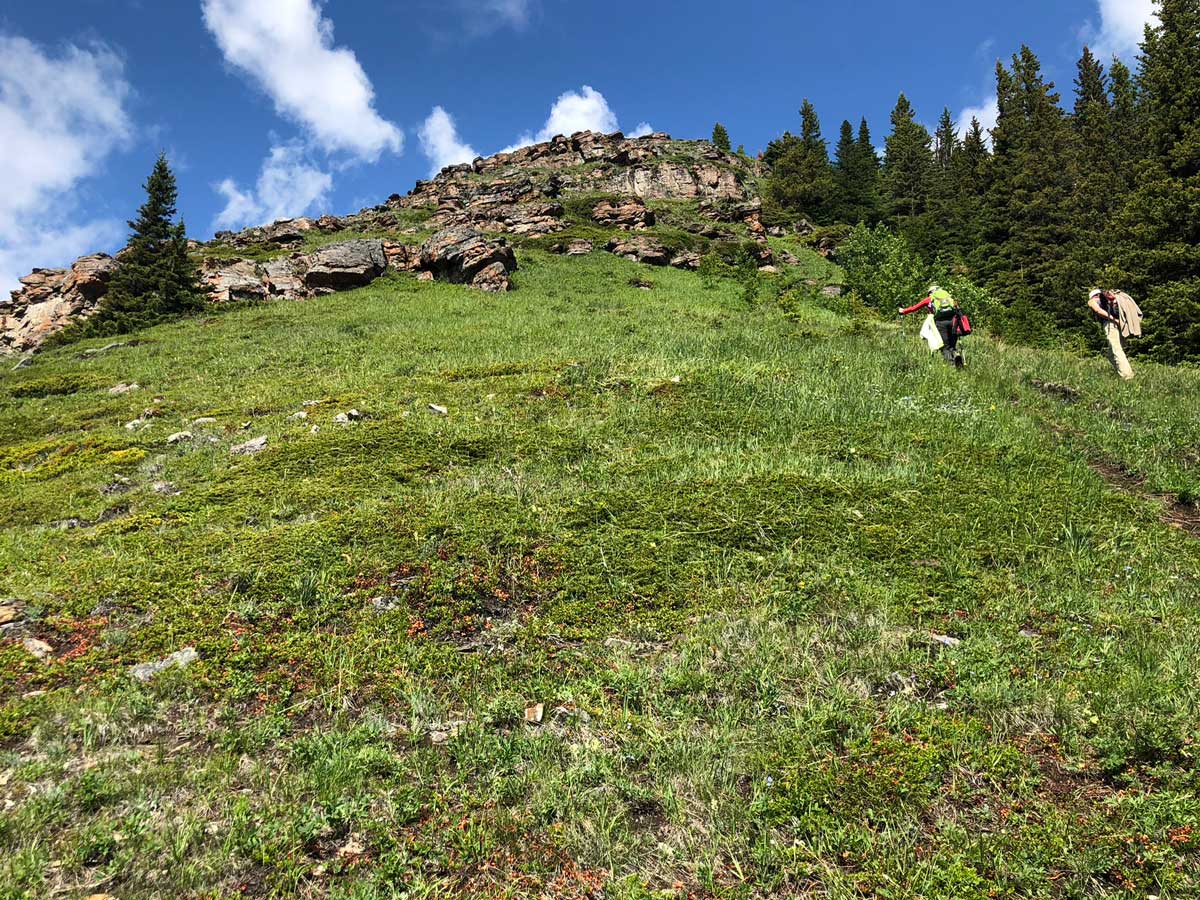
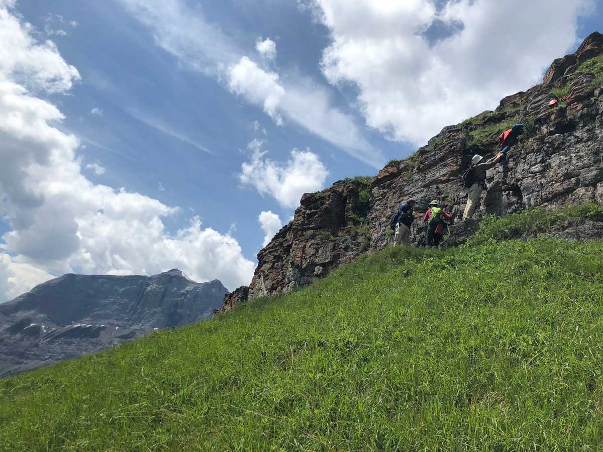
Soon the route comes to the base of a cliff. Don’t worry, you can go around the cliff to your right if you don’t want to go at it head-on. If you go on head-on, you will need to use your hands to get up. The way around on the right isn’t much easier. We typically scramble up and take the alternate route down, which is what is shown on the map.
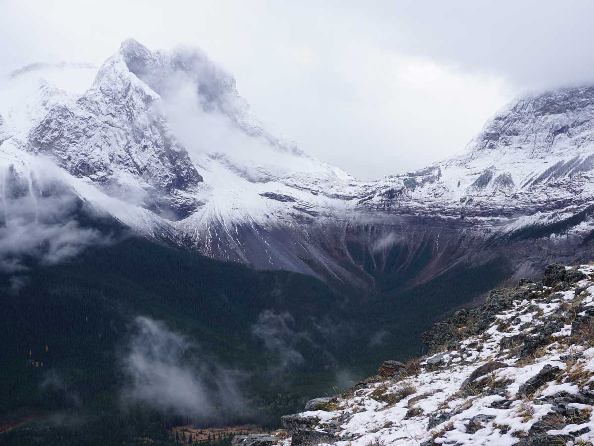
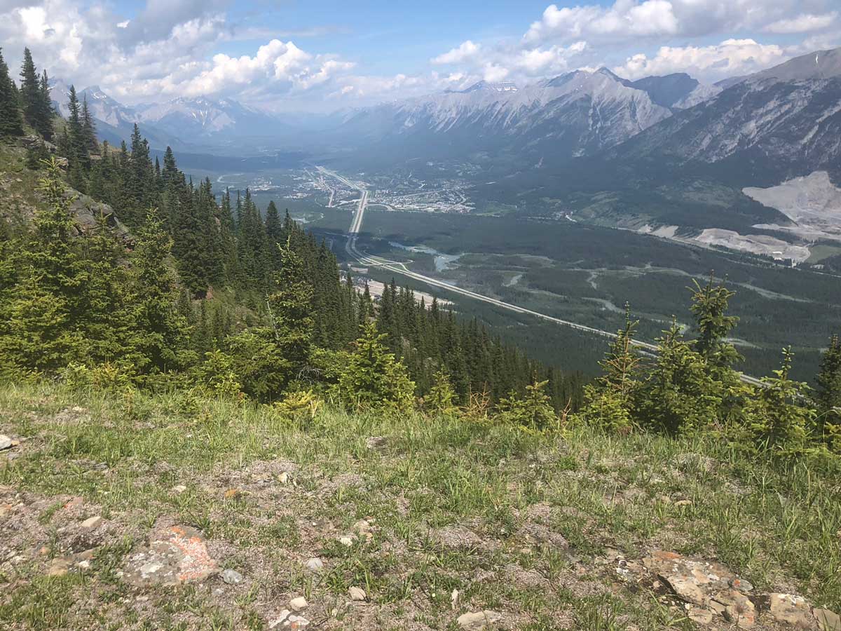
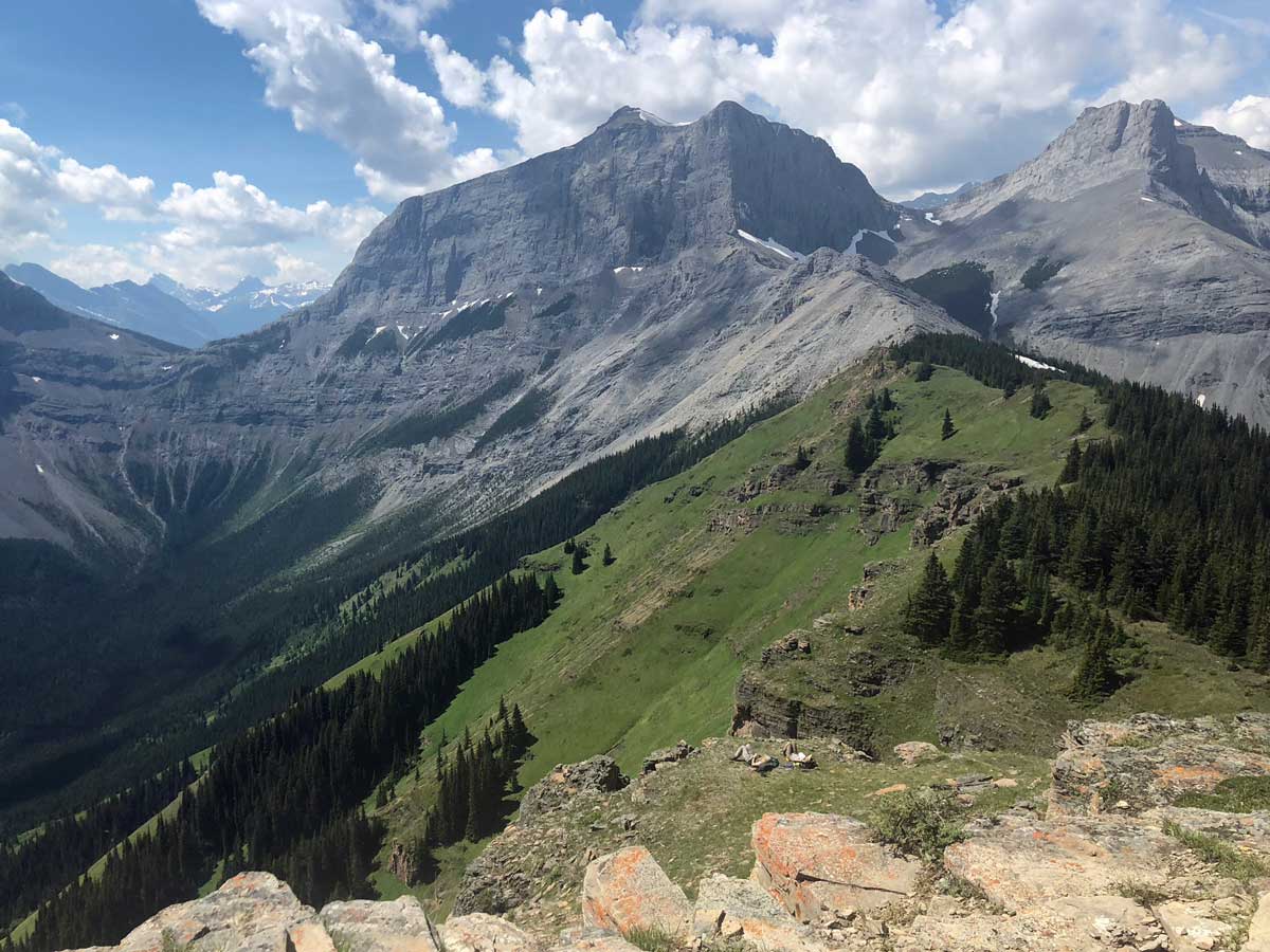
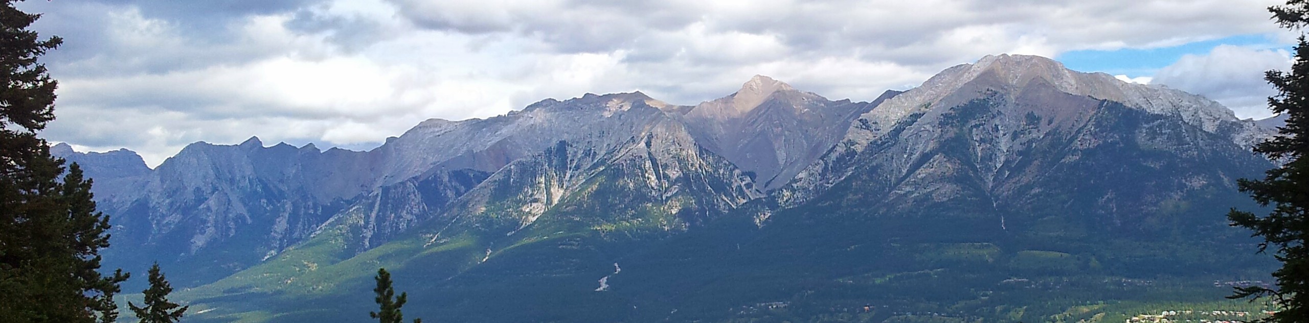
Continue going up along the ridge as it flattens. This is our favourite part of the hike. At the end you’ll come to a cairn, which marks the summit. From the summit of Wind Ridge, you have incredible views. While you can see down to Canmore and the Bow Valley corridor, we prefer the views of the backside of the Three Sisters as well as across the valley to Mount Lougheed, West Wind Pass and Windtower. Windtower is one of our favorite hikes in the Canadian Rockies and is a lot easier than it looks from here. You can find the info for this hike in our Kananaskis – Smith Dorrien Section.
Continue down the way you came.
Looking for more amazing hikes near Canmore? Check out the Grassi Lakes hike, Grotto Canyon hike or the Ha Ling Peak hike.
Insider Hints
The West Wind Valley and parts of this trail are closed from December 1 to June 15 every year. This region is critical for elk and Bighorn Sheep.
You may have noticed what looked like an overgrown ski-hill while you drove in. This is the famous Pigeon Mountain ski hill. This hill wasn’t successful, mainly due to the west-facing slopes. It was open for a few years in the 1960’s, closing in 1968. It reopened from 1979 to 1983, when it closed permanently.
You will have passed a sign for the Banff Gate Mountain Resort when you drove to the trailhead. This is the closest place to stay near the hike, however we recommend Copperstone Resort in Dead Man’s Flats. Copperstone is a great place to stay for families, with multi-room condos with kitchens. It’s usually a lot cheaper than staying in Banff and Canmore.

Similar hikes to the Wind Ridge hike
Echo Canyon Trail
The Echo Canyon trail in Canmore is accessible from the Cougar Creek area and is close to local amenities. It…
Canmore Hoodoos Trail
The Canmore Hoodoos Trail is a quick trip from downtown to explore the bench above the valley. It has outstanding…
Highline Trail
The Highline Trail is a multi-use trail in Canmore that travels westbound to Quarry Lake and the Powerline Trail before…
Allanhoward 4 years ago
Wind Ridge is magnificent!
Greenlife 4 years ago
This hike is for people who are hikers or fit. very lovely trail on your way up to the mountain!
kathkirz2 4 years ago
We took my oldest on this one, and she enjoyed it- not too hard but enough of a challenge. Would probably be too hard for younger kids. The views of Three Sisters were great! True to name, it was windy up there.
Atlanta R. 4 years ago
Spectacular view of the flowery meadows. The view of Windtower is really stunning. 10/10 would recommend.
Ewen P. 4 years ago
Incredible views at the summit. The hike is not hard but poses a challenge. The views at the peak are beautiful, it's also windy in there.
LyleM 4 years ago
This hike gets more challenging as you make your way to the top of the mountain. A gorgeous trail.
Michael M. 4 years ago
This hike requires some effort. Although it's a short hike, it's steep and mainly uphill, so depending on your physical fitness, it could be pretty challenging. I only recommend it to experienced hikers.
Grant Ko. 4 years ago
I would recommend this hike for experienced hikers. It was easier in parts but, definitely gets more challenging as you make your way to the top of the mountain. Absolutely beautiful! Very well marked.
Matt Ducker 4 years ago
Fun and exciting hike! I was very happy to see mountain goats. They were running from one side to the other. They were "kidding" the whole time.
Rocco Ellysia 4 years ago
Took us 5.40 hours to finish the trail. It was quite windy at the top but the view was amazing. Definitely recommend this hike.