Cougar Creek Trail
View Photos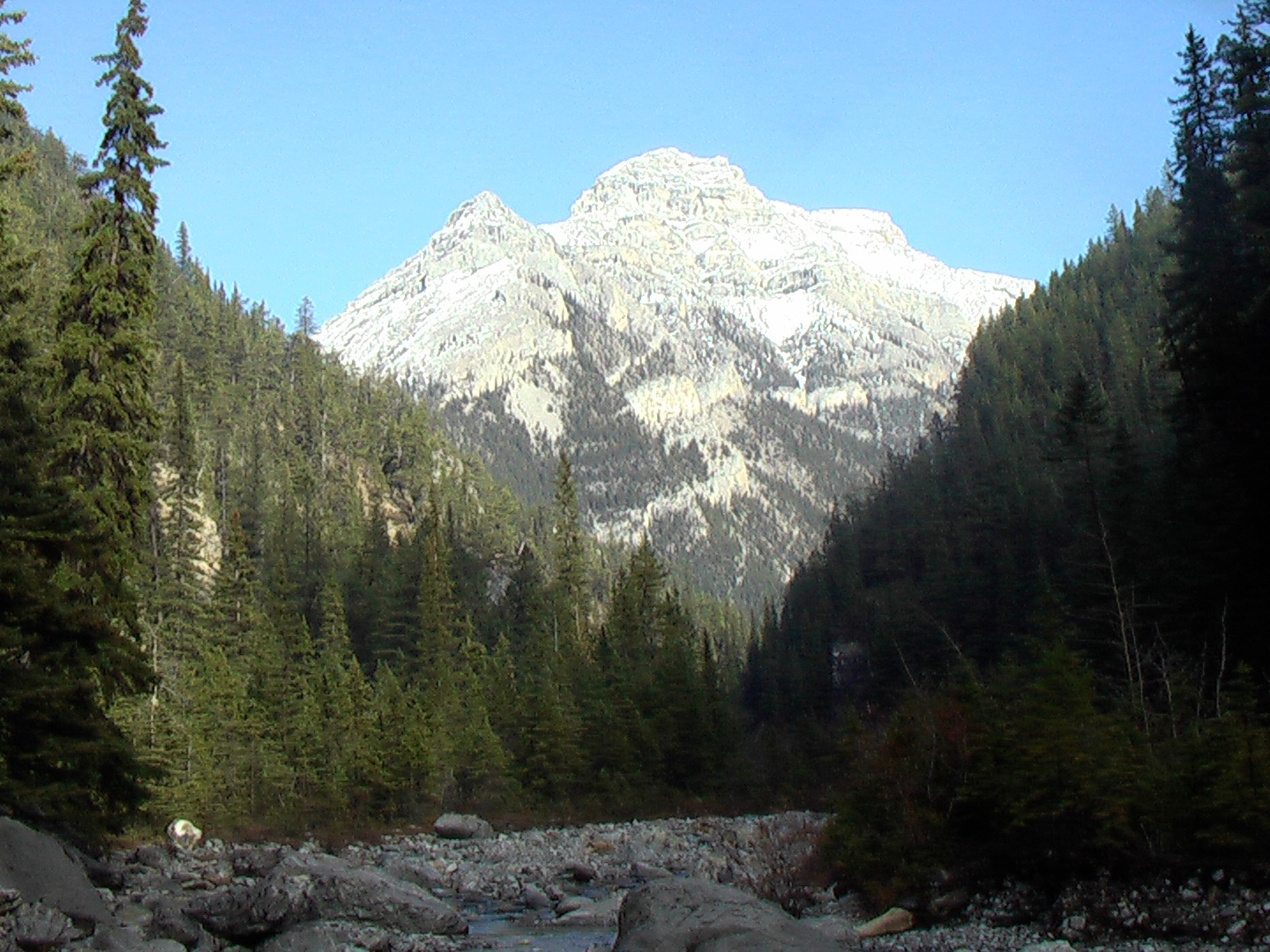
Cougar Creek Trail
Difficulty Rating:
The Cougar Creek Trail in Canmore starts at a multi-sport adventure hub. The parking area is a starting place for cyclists, climbers, scramblers, and hikers. Heading up the main creek area is simple. Hikers can choose their own route for the most part, following a defined trail beyond some flood mitigation structures.
Currently Closed for Construction (2021)
Getting there
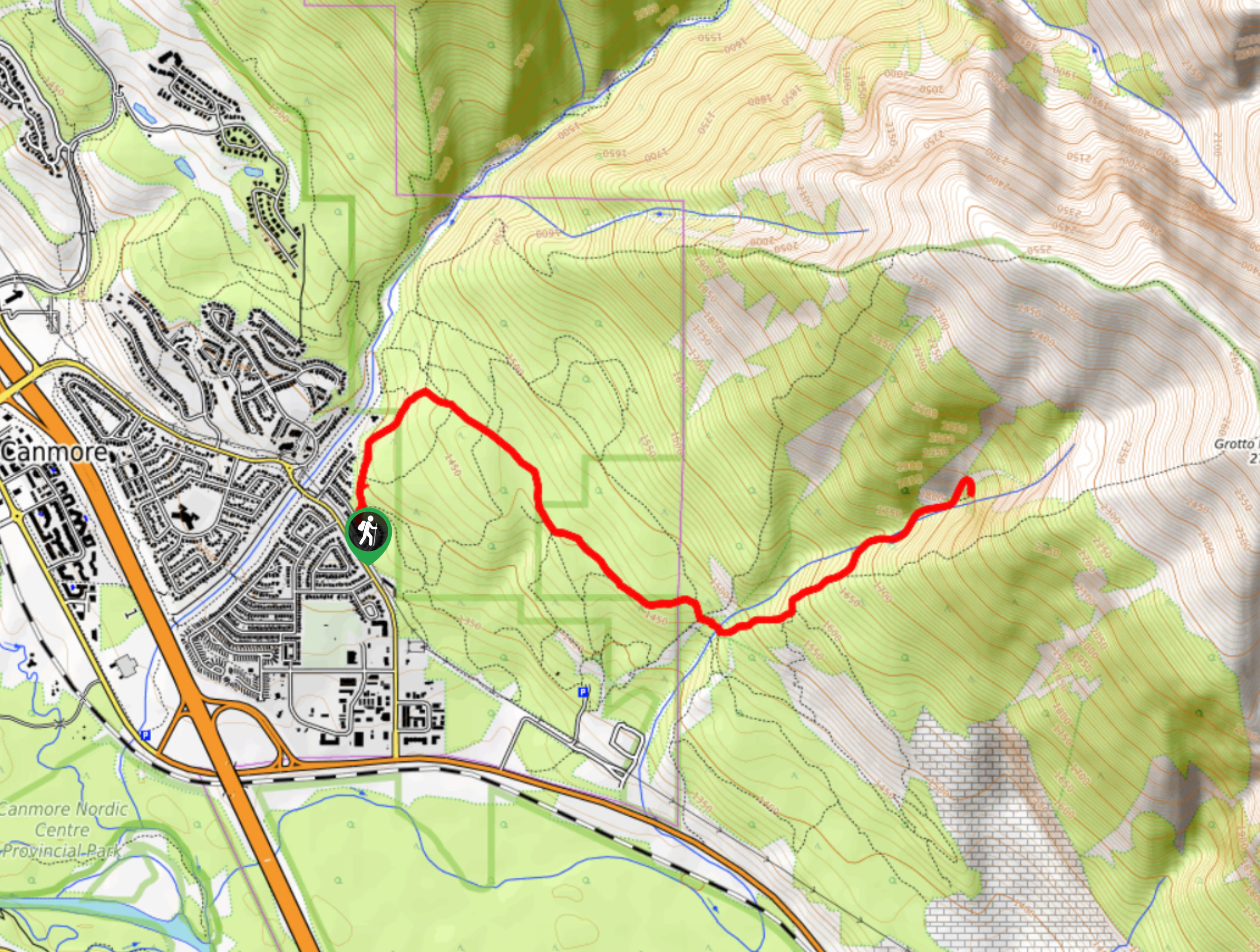
To get to the Cougar Creek Trail from the Town of Canmore, make your way onto Benchlands Trail from downtown by crossing over the Trans Canada Highway. Continue on this road until you reach the roundabout. Take the second exit off the roundabout and turn right immediately into the public parking area for Cougar Creek and the Lady MacDonald Trail.

About
| When to do | May-October |
| Backcountry Campsites | No |
| Pets allowed | Yes |
| Family friendly | Older Children only |
| Route Signage | Poor |
| Crowd Levels | High |
| Route Type | Out and back |
Cougar Creek Trail
Elevation Graph
Weather
Cougar Creek Trail Description
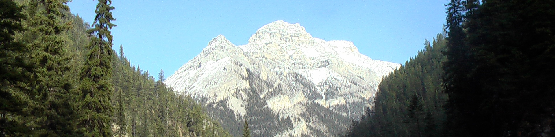
The Cougar Creek Trail begins at a very busy and popular trailhead. The parking area is the starting point for those heading to scramble to the summit of Mount Lady MacDonald, cycle on nearby mountain bike trails, explore the lower reaches of the creek, do some rock climbing in the canyon, and hike the canyon route. Be prepared for a busy start to your route.
The Cougar Creek Trail is a popular choice for hikers, but for good reason. Despite the crowds, this route is a fun and diverse experience that is great for families. If you choose to shorten the distance, you can do so at any time by simply turning around. This is an enjoyable route next to many town amenities that is perfect for a summer day.
From the parking area, begin hiking north on the paved path as it becomes a gravel path. After roughly one kilometer, the trail becomes rough and rocky, as the Lady MacDonald route forks off to the left. Stay within the main canyon, following whichever route feels best for you. The creek had expanded after the 2013 flood event in Canmore, making it a wide open space with many small trails.
Make your way over to the right to ensure you can pass through some fencing structures setup for flood mitigation. The trail’s elevation rolls up and down with some long flat sections in between. There are small trail markers and cairns throughout that will lead you to zigzag across the canyon over and over again. The trail can get quite muddy in the spring, so be watchful for slippery sections.
You’ll pass by the popular climbing walls within the canyon. Take some time to admire the climbers as they scale the walls around you. Continue up the straightforward canyon, following the creek until you reach the turnaround point at the end. The water levels can fluctuate throughout the season which can cause hikers to turn around early.
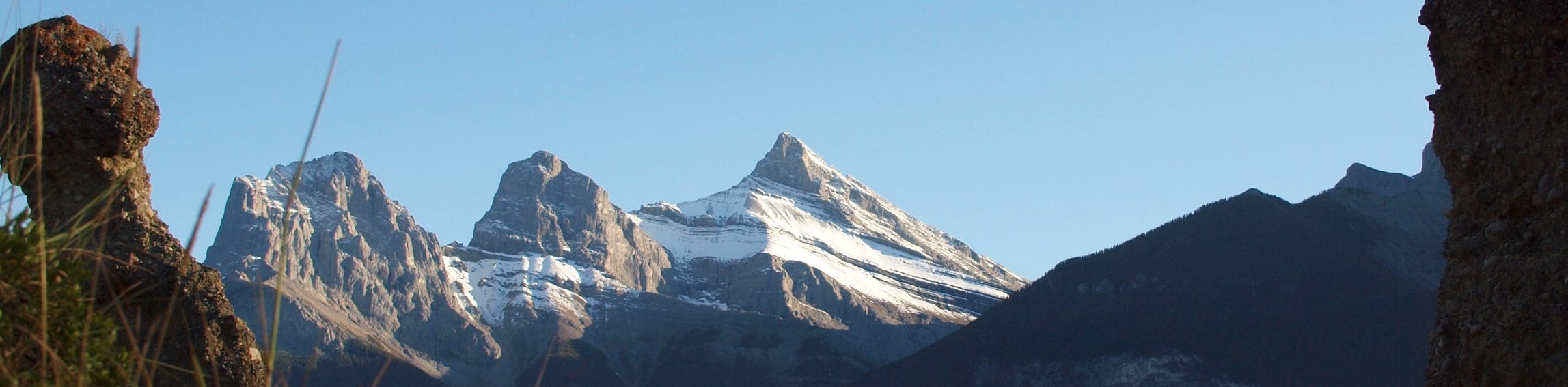
The trail is full of fun features and playful areas, which is great for families. There is plenty of shade, so if you are heading out on a hot day this is a good choice.
Insider Hints
Head to the trailhead early to avoid the busy crowds that fill the parking area.
Bring layers as weather can change, and despite summer heat, you might find yourself feeling chilled in the shade.
Similar hikes to the Cougar Creek Trail hike
Echo Canyon Trail
The Echo Canyon trail in Canmore is accessible from the Cougar Creek area and is close to local amenities. It…
Canmore Hoodoos Trail
The Canmore Hoodoos Trail is a quick trip from downtown to explore the bench above the valley. It has outstanding…
Highline Trail
The Highline Trail is a multi-use trail in Canmore that travels westbound to Quarry Lake and the Powerline Trail before…
Comments