The Cateran Trail: Spittal of Glenshee to Kirkton of Glenisla
View Photos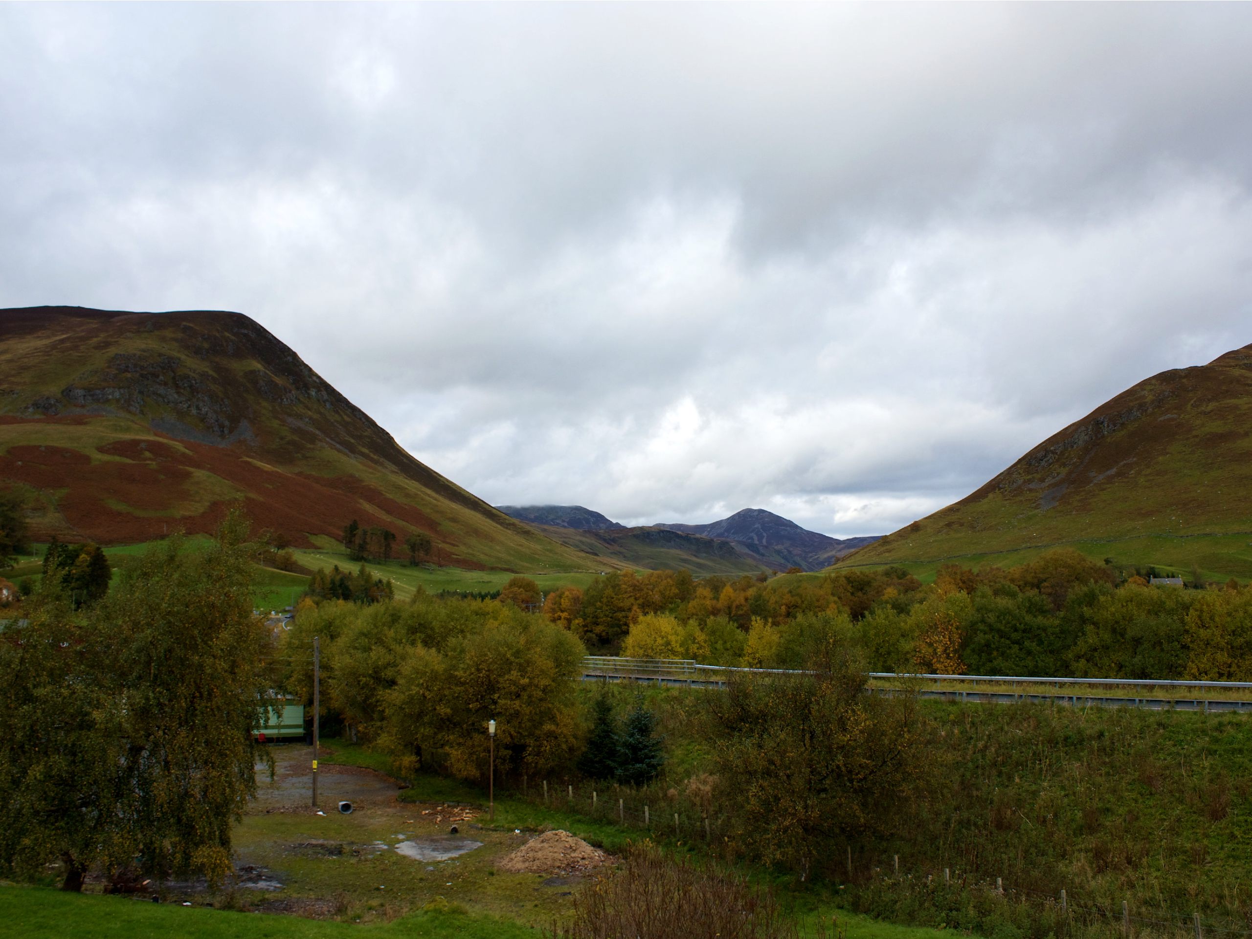
The Cateran Trail: Spittal of Glenshee to Kirkton of Glenisla
Difficulty Rating:
The Cateran Trail: Spittal of Glenshee to Kirkton of Glenisla is a 14.6mi section of the 64.0mi long Cateran Trail. This section is one of the easiest in terms of walking and the pleasant trail unfolds mostly on tracks and paths through farmland and moorland. The lovely village of Kirkton of Glenisla is a delightful place to end the route, where a quaint church and graveyard, a small hotel, and several tiny cottages await.
Getting there
To get to The Cateran Trail: Spittal of Glenshee to Kirkton of Glenisla walk from Glenshee, head southwest toward Old Military Rd/A93 and continue 0.2mi before turning right onto Old Military Rd/A93. Drive 1.6mi then turn left to locate the start of the walk (where the Cateran Trail reaches the road at the Spittal of Glenshee.)

About
| When to do | Year-Round |
| Backcountry Campsites | Wild Camping |
| Pets allowed | Yes |
| Family friendly | No |
| Route Signage | Average |
| Crowd Levels | Moderate |
| Route Type | One Way |
The Cateran Trail: Spittal of Glenshee to Kirkton of Glenisla
Elevation Graph
Weather
Spittal of Glenshee to Kirkton of Glenisla Description
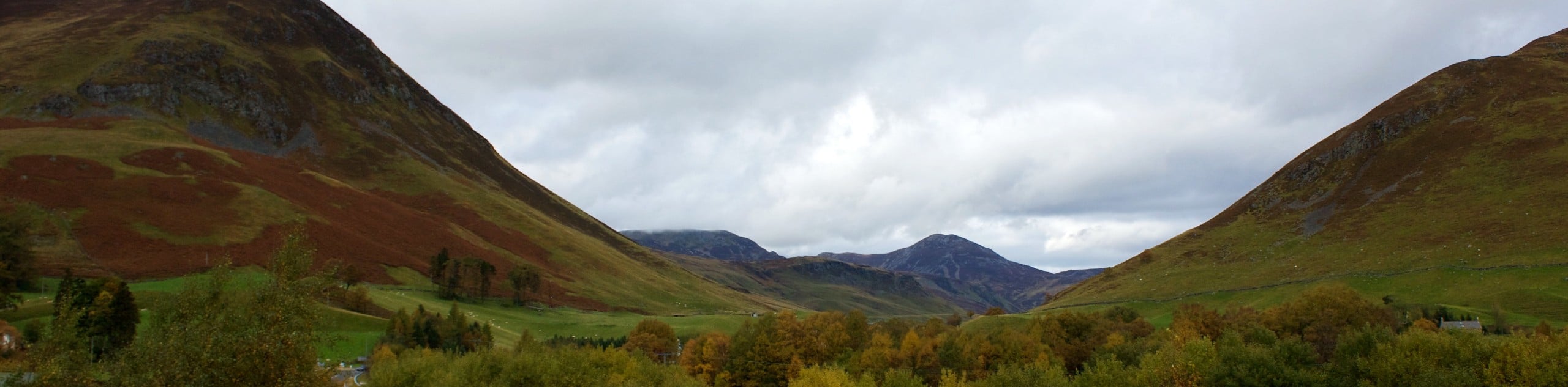
The Cateran Trail: Spittal of Glenshee to Kirkton of Glenisla is a superb section of the full-fledged Cateran Trail and is referred to by some as a gentler section. The trail is fairly straightforward and easy to follow and unfolds on a series of tracks and paths that lead through farmland. Once you reach the moorland stage, the going can be muddy at times and a steady climb ensues.
This walk is one of the best ways to experience the bold beauty of Glenshee, as the route features a section down the east side of the glen and stunning views in all directions. Glen Isla, where the route concludes, is a picture-perfect village perched on the River Isla and is a wonderful place to stop in for the night or to grab a pub meal following the walk. If you plan to continue to the next stage of the walk, why not book a room at the cozy Glenisla Hotel featuring a cozy bar and free breakfast.
Begin the walk at the confluence of the Cateran Trail and the Spittal of Glenshee. Take the road to pass Cairnwell Mountain Sport and head over the old stone bridge above the Shee Water. Meander past the church and a lodge and once you reach the main road, cross it and veer left for a brief while before heading over a stile. Following the stile, you’ll join a farm track that leads back down Glen Shee.
As the grassy route unfolds before you, look out for the barn up ahead and follow the track as it veers left before reaching it. Pass through a metal gate, then make a right turn to cross another bridge. Next, you’ll head right and back through another gate as you head down towards a field. Spot another rushing burn up ahead and cross it, then continue straight. Soon the buildings of Westerton of Runavey Farm will appear and before you reach them, climb the stile that leads uphill, then continue down towards the building and turn left along another track. Another stile will guide you to a track that runs between fences. Continue on the track as it leads you across a field and down to another stile and stream.
Spot the next field ahead and climb up it before veering right as you look out for the marker post which guides you to another stile to head through another field to reach a track. A marker further on indicates where you should turn right. Continue through several more fields and you’ll soon happen upon a footbridge which you’ll cross before embarking on a steep climb to reach a stone wall perched on a high stile. After crossing, turn right and join the faint path that leads behind Broughdearg towards yet another high stile. After climbing this, continue on the track that leads down to reach another clear track which you’ll head left on.
Take in the gorgeous old farm buildings at Dunmay and keep an eye out for a wooden gate which you’ll spot on the left. Follow the rough track that leads through the gate and head towards the forestry. Once you reach the edge of the trees, join the path that bears right and leads across a burn before continuing to hug the woods. When you reach the river, turn left uphill and maintain the main track, passing by the pint-sized Dalnagar Castle. At this point, you’ll enjoy a quiet minor road and will soon see signs for the Cateran Trail which beckons you to turn left. The road heads up over a low pass and ushers you into Glen Isla. At the next junction, turn left and walk towards Forter Castle.
Turn right and head towards Folda. You’ll soon cross the Bridge of Forter and then spot a high stile bearing a sign with a gate on the left. Take the forestry path that heads uphill while enjoying the lovely views of the castle now behind you. At a junction, head right to take the high pass and spot Auchintaple Loch sparkling on your right. Cross another stile and then turn right to descend towards the trees. Before you enter the trees, you’ll spot a wooden marker post, letting you know that you’re indeed on track.
Once out of the forest, cross a high stile on the far side of Auchintaple Loch. Cross another stile and turn left where the track bends to join a stony track that runs uphill. Reach the wooden gate and enjoy views down over Loch Shandra, which are nothing short of remarkable from here. Head through the heather turning right before the gate to maintain your course on the west side of the glen.
At the far end of Loch Shandra, you’ll spot a dam, join the track near here and stay right at the junction. An uphill stretch then leads you through a gate and further towards a collection of lofty pines. With the trees on your right, follow the track as it descends and the quaint buildings of Glen Isla come into view. Aim for the far ahead, walking past a war memorial that appears on your right. Turn right at a junction which is signed, and leads to the main road. Turn right onto the main road and follow it a short distance to reach the lovely village of Kirkton of Glenisla where the walk concludes.
See the full itinerary of The Cateran Trail:
- The Cateran Trail: Blairgowrie to Kirkmichael
- The Cateran Trail: Kirkmichael to Spittal of Glenshee
- The Cateran Trail: Spittal of Glenshee to Kirkton of Glenisla
- The Cateran Trail: Kirkton of Glenisla to Alyth
- The Cateran Trail: Alyth to Blairgowrie
Other Great Walks in Cairngorms National Park
Check out our trail guides to Ben Magdui, Loch Muick, Ben Vrackie, Loch an Eilein, and the Mount Keen Walk. Or see all of our Cairngorms walks.
Similar hikes to the The Cateran Trail: Spittal of Glenshee to Kirkton of Glenisla hike

Glen Banvie Trail and Blair Castle Walk
The Glen Banvie Trail and Blair Castle Walk is a great adventure in Cairngorms National Park that takes in the…

Beinn Udlamain Munro and Sgairneach Mhòr Walk
The Beinn Udlamain Munro and Sgairneach Mhòr Walk is a rugged and exciting journey in Cairngorms National Park that will…

Loch an Eilein, Loch Gamhna, Old Logging Way Loop
The Loch an Eilein, Loch Gamhna, Old Logging Way Loop is a wonderful walking trail in Cairngorms National Park that…
Comments