The Cateran Trail: Kirkton of Glenisla to Alyth
View Photos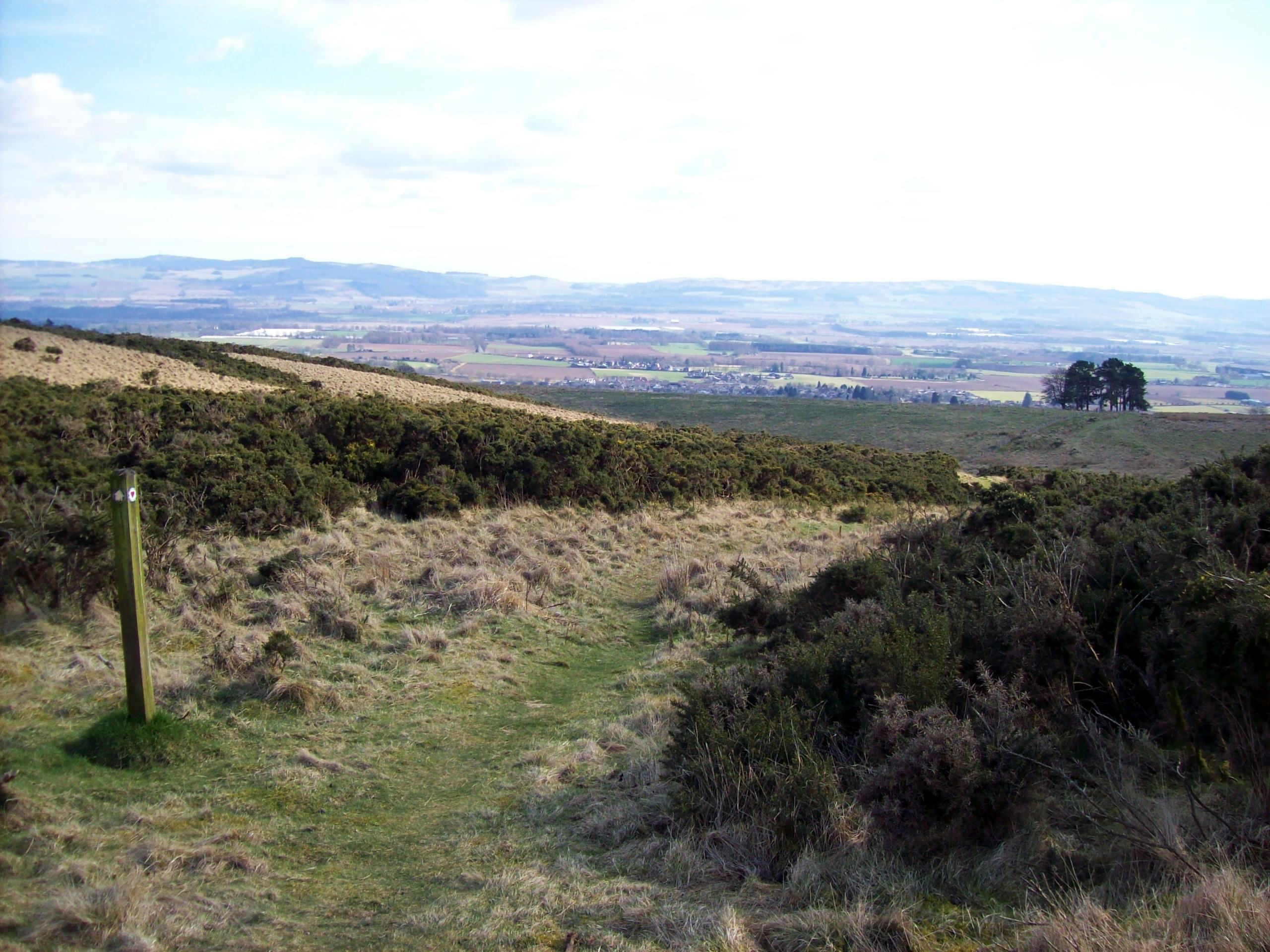
The Cateran Trail: Kirkton of Glenisla to Alyth
Difficulty Rating:
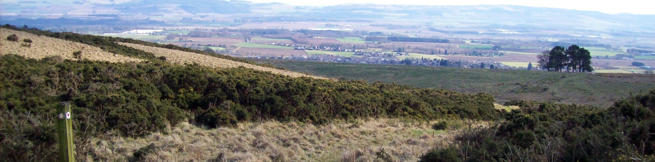
The Cateran Trail: Kirkton of Glenisla to Alyth takes walkers along a gorgeous 10.6mi section of the 64.0mi long Cateran Trail. This stage features superb views from atop the moorland found just south of Kirkton of Glenisla and later through the rolling Alyth hills. The lovely town of Alyth is the perfect ending to an already scenic walk and is an excellent place to spend the night before continuing on to the next stage or to just grab a pint and dinner following the walk.
Getting there
To get to The Cateran Trail: Kirkton of Glenisla to Alyth from Blairgowrie, take W George St to Dunkeld Rd/A923 for 0.1mi then follow A926 and B954 to B951 Angus Council for 16.0mi to reach the community hall and car park in Kirkton of Glenisla.

About
| When to do | Year-Round |
| Backcountry Campsites | Wild Camping |
| Pets allowed | Yes |
| Family friendly | No |
| Route Signage | Average |
| Crowd Levels | Moderate |
| Route Type | One Way |
The Cateran Trail: Kirkton of Glenisla to Alyth
Elevation Graph
Weather
The Cateran Trail: Kirkton of Glenisla to Alyth Description
The Cateran Trail: Kirkton of Glenisla to Alyth is a marvellous way to experience incredible scenery along the Cateran Trail. The walk unfolds on good waymarked paths and tracks, however, muddy sections are common, making waterproof footwear a good idea for this stage.
The 10.6mi walk kicks off with a steady climb to enter the heather moorland found south of Kirkton of Glenisla. This superbly scenic area grants spectacular views across Glen Isla and the surrounding rural lands. Later on in the walk, the hills of Alyth provide the perfect backdrop for a scenic finish to the route as you make your way into the charming town of Alyth, where the walk concludes.
Set out from the community hall car park in Kirkton of Glenisla to begin the walk, and head west along the B951. Spot the signs for “Alyth 10” up ahead, indicating where to turn left off the B951. Head down the steps to cross a footbridge above the River Isla, then continue to follow the markers that guide you up a well-trodden path that leads uphill onto the moorland. Enjoy the brilliant views of Glen Isla over your shoulder as you continue to climb, sticking to the waymarked path.
After sticking to the left of a cairn, you’ll soon reach a drystone wall accompanied by a stile, which you’ll cross before continuing straight ahead. A grassy track soon intersects the trail, where you’ll turn left to head along it into the woods. Enjoy this stretch among the age-old trees, and continue on the track as it guides you towards another gate and stile. Head across the stile and then turn left, heading down towards the field’s edge located beside a wall. Soon you’ll spot another gate and stile, which you’ll cross to join another track, turning right onto it.
Once you reach Whitehills Farm, keep straight for the Cateran Trail, heading along a grassy stretch before the track unfolds into another, more defined track. Continue towards Cammock Farm and head through another gate to join the track that heads to the left of the barn. Several tracks then lead above the belly of Glen Isla, headed towards a tarred drive which you turn right on.
Continue on the tarred track as it leads through a clearing lined by forest on either side. Soon Loanhead Farm appears, and you’ll ignore the “Coffin Route” signage to continue left past the farm. The route then swings left, heading past the Kilry Lodge and soon reaches a minor road. Head right along the road and turn left at a junction that soon follows.
Look for the green “Cateran Trail” sign up ahead, and turn off here to cross another stile found on the right. A lovely uphill stretch opens to stunning views of the surrounding farmland and the glen. After crossing another stile, another junction appears. Turn right to maintain the Cateran Trail and continue through a gate before crossing a tiny bridge that leads to a pedestrian gate on the right.
The route continues and is increasingly pathless at this point as it soon leads you uphill again beneath the shadows of mature trees. A fairly steep descent is up next, guiding you through another two stiles to join a grassy track that runs between them. Make your way straight across the field ahead to cross another stile, then maintain the route, keeping a ruined stone wall on your left.
Up ahead, a grassy strip leads towards the buildings at Ardormie. Before you make it to the houses, make a sharp left to join a surfaced track that leads towards them. The track then heads downhill and soon joins a minor road which you’ll turn right on to. A short distance on, you’ll turn right again onto B954, which is just beyond. Follow the main road and spot the signs for Cateran Trail Alyth, which leads to a grassy track. Continue through some pedestrian gates, maintaining a straight course. This undulating section can be very wet at times, so take care with your footing. Enjoy the views of the Alyth hills as you climb gradually, setting you up for your descent into Alyth. Continue downhill to head through a final gate which takes you to Loyal Road. From there, turn right once you meet Hill Street and then bear left on Toutie Street to make your way into Alyth town centre, where this stage concludes.
See the full itinerary of The Cateran Trail:
- The Cateran Trail: Blairgowrie to Kirkmichael
- The Cateran Trail: Kirkmichael to Spittal of Glenshee
- The Cateran Trail: Spittal of Glenshee to Kirkton of Glenisla
- The Cateran Trail: Kirkton of Glenisla to Alyth
- The Cateran Trail: Alyth to Blairgowrie
Other Great Walks in Cairngorms National Park
Check out our trail guides to Ben Magdui, Loch Muick, Ben Vrackie, Loch an Eilein, and the Mount Keen Walk. Or see all of our Cairngorms walks.
Similar hikes to the The Cateran Trail: Kirkton of Glenisla to Alyth hike

Glen Banvie Trail and Blair Castle Walk
The Glen Banvie Trail and Blair Castle Walk is a great adventure in Cairngorms National Park that takes in the…

Beinn Udlamain Munro and Sgairneach Mhòr Walk
The Beinn Udlamain Munro and Sgairneach Mhòr Walk is a rugged and exciting journey in Cairngorms National Park that will…

Loch an Eilein, Loch Gamhna, Old Logging Way Loop
The Loch an Eilein, Loch Gamhna, Old Logging Way Loop is a wonderful walking trail in Cairngorms National Park that…
Comments