The Cateran Trail: Kirkmichael to Spittal of Glenshee
View Photos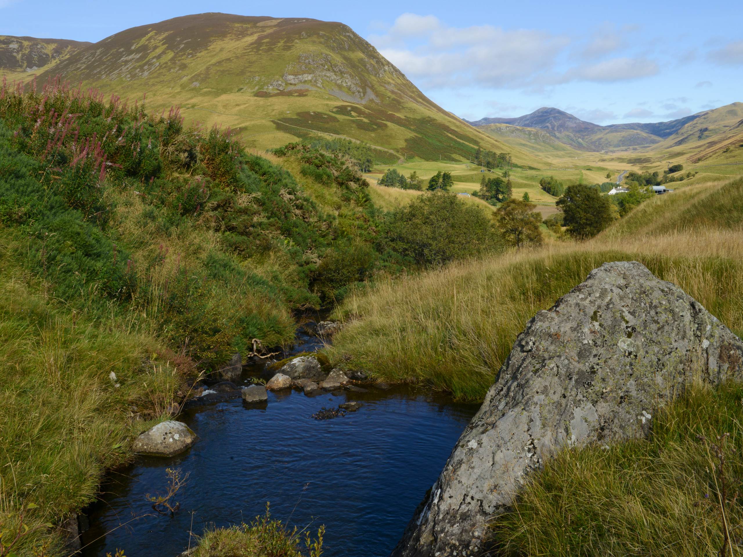
The Cateran Trail: Kirkmichael to Spittal of Glenshee
Difficulty Rating:
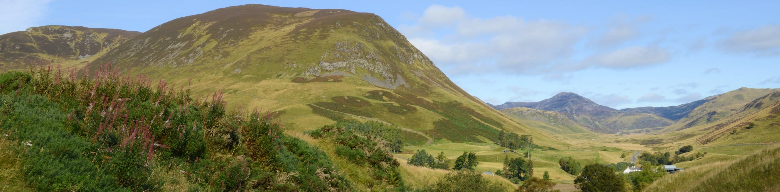
Kirkmichael to Spittal of Glenshee is a brilliant stage of the 64.0mi long-distance Cateran Trail that spans the gorgeous Perthshire and Angus glens. This 8.1mi stage can be enjoyed as an independent walk or completed as the second stage of the full Cateran Trail. Walkers are invited into the landscape of the glen before tackling a lofty moorland pass. A final downhill stretch to the Spittal of Glenshee grants incredible mountain views--the perfect note to end the walk on.
Getting there
To get to The Cateran Trail: Kirkmichael to Spittal of Glenshee from nearby Pitlochry, drive west on Well Brae toward Toberargan Place then turn right onto Toberargan Place. Continue less than 0.5mi and turn right onto Bonnethill Road. After 0.2mi, turn right onto W Moulin Rd/A924 and drive for 12.0mi to reach Kirkmichael, where the walk begins.

About
| When to do | Year-Round |
| Backcountry Campsites | Wild Camping |
| Pets allowed | Yes |
| Family friendly | No |
| Route Signage | Average |
| Crowd Levels | Moderate |
| Route Type | One Way |
The Cateran Trail: Kirkmichael to Spittal of Glenshee
Elevation Graph
Weather
Kirkmichael to Spittal of Glenshee Description
The Cateran Trail: Kirkmichael to Spittal of Glenshee a pleasant and immensely scenic stage of the long-distance Cateran Trail. Tracks and paths pave the way through sprawling moorland as meandering streams weave across the landscape. Due to the nature of the moorland terrain, waterproof shoes are a must on this walk, as the trail will be muddy in places.
On top of the scenery afforded by making your way over a high moorland pass during this walk, you’ll also encounter stunning mountain views on the descent to the Spittal of Glenshee, with Ben Earb, Meall Uaine, Creag, an Dubh Shluic and more painting the skyline. If combining this walk with the subsequent stages, you can opt to sleep beneath the stars and wild camp near the trail or book a room at a nearby cozy B&B.
The Kirkmichael to Spittal of Glenshee route commences on the west side of the river in Kirkmichael, leading you beside a collection of cottages where you should then spot signs for “Cateran – Spittal of Glenshee 9.” Overlook the riverside path that heads down to the right and instead continue on the lane that’s signed with “Enochdu.” The track soon splits in three, and you’ll want to take the middle path here and keep right at the next two forks. A white house soon appears, and you’ll note a fork that heads left on a grassy trail, take this and head towards the woods, passing through a gate up ahead.
The scenery becomes more and more enchanting beyond this point, with a pint-sized loch on your right and dense woods up ahead. Upon passing through another gate, the woods begin to disappear as you set out to cross the grass-covered field ahead. Veer right to join the track that heads towards then passes the stately white house of Dalreoch. Stick to the track and when you note it veering right, join the larger track that appears and continue across an old stone bridge. After crossing, you’ll rejoin a lane and press on towards the buildings of Enochdu.
Now in the tiny settlement of Enochdu, turn left and walk past several cottages. You’ll soon reach an info area with a car park and recycling bins. From here, bear right and make your way across the main road. At this point, follow signs for Spittal of Glenshee and join the track. A gentle climb then leads you towards Dirnanean Highland Garden, where you’ll want to keep left. Once you reach Home Farm, you’ll continue on the track as it leads behind the dwelling before guiding you left to make your way through farmland. Cross a stile and maintain the uphill track, sticking with the main track until you reach a defined junction. At the junction, turn left, following signs for Glenshee and climb another stile to enter the forest. Keep your eyes peeled for deer on this section, as several call this particular area home.
Further on, you’ll cross the Allt Dubhagan via a bridge before heading through the forest that soon makes way for another stile at the entrance to wide open moorland. Stick to the clear path and enjoy the spectacular views that unfold before you, with several peaks encircling the trail as you fix your eyes on the An Lairig pass up ahead. When a faint track veers, ignore it to keep right, and you’ll soon cross a burn as you climb to reach the top of the pass, found between Creag an Dubh and Meall Uaine. The going to the top can be muddy at times, but the views across the sprawling farmland and the Spittal of Glenshee make it well worth the effort.
The final leg of the walk has you descending Coire Lairige to join a path that runs alongside a rushing burn. You’ll spot a stone wall on your left as various buildings at the Spittal start to come into view. The path soon reaches the main road, which you’ll join at the Spittal of Glenshee, where the walk concludes.
See the full itinerary of The Cateran Trail:
- The Cateran Trail: Blairgowrie to Kirkmichael
- The Cateran Trail: Kirkmichael to Spittal of Glenshee
- The Cateran Trail: Spittal of Glenshee to Kirkton of Glenisla
- The Cateran Trail: Kirkton of Glenisla to Alyth
- The Cateran Trail: Alyth to Blairgowrie
Other Great Walks in Cairngorms National Park
Check out our trail guides to Ben Magdui, Loch Muick, Ben Vrackie, Loch an Eilein, and the Mount Keen Walk. Or see all of our Cairngorms walks.
Similar hikes to the The Cateran Trail: Kirkmichael to Spittal of Glenshee hike

Glen Banvie Trail and Blair Castle Walk
The Glen Banvie Trail and Blair Castle Walk is a great adventure in Cairngorms National Park that takes in the…

Beinn Udlamain Munro and Sgairneach Mhòr Walk
The Beinn Udlamain Munro and Sgairneach Mhòr Walk is a rugged and exciting journey in Cairngorms National Park that will…

Loch an Eilein, Loch Gamhna, Old Logging Way Loop
The Loch an Eilein, Loch Gamhna, Old Logging Way Loop is a wonderful walking trail in Cairngorms National Park that…
Comments