The Cateran Trail: Blairgowrie to Kirkmichael
View Photos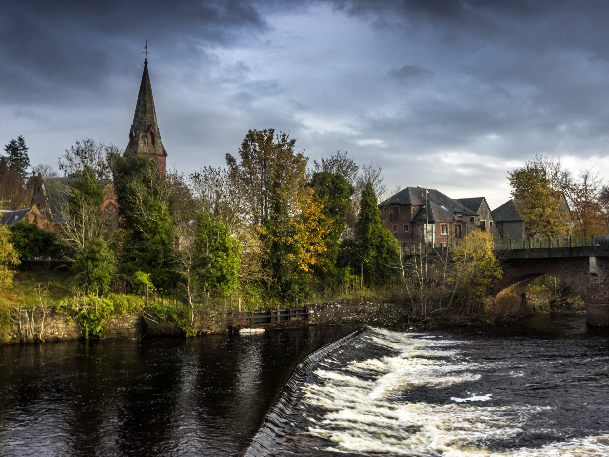
The Cateran Trail: Blairgowrie to Kirkmichael
Difficulty Rating:
lthough you can join The Cateran Trail at any section, the 15.1mi stretch from Blairgowrie to Kirkmichael is often taken on as the initial stage. Waymarked paths and tracks make for a pleasant walk, setting out from nearby the Ericht and continuing through moorlands with some rough sections to reach Bridge of Cally. The trail continues up lovely Strathardle’s west side before coming to an end in the former civil parish of Kirkmichael, which today is an attractive little town!
Getting there
To get to The Cateran Trail: Blairgowrie to Kirkmichael from Dundee, take Meadowside to Victoria Rd and follow A923 to Lower Mill St in Blairgowrie and Rattray. After 19.0mi, continue onto Lower Mill St for 0.1mi to reach the Wellmeadow carp park in Blairgowrie.

About
| When to do | Year-Round |
| Backcountry Campsites | Wild Camping |
| Pets allowed | Yes |
| Family friendly | No |
| Route Signage | Average |
| Crowd Levels | Moderate |
| Route Type | One Way |
The Cateran Trail: Blairgowrie to Kirkmichael
Elevation Graph
Weather
Blairgowrie to Kirkmichael Description
Scotland’s Cateran Trail is a spectacular long-distance circular trail that takes walkers on a multi-stage journey through the Perthshire and Angus glens in Central Scotland, covering a total distance of 64 miles. The full trail features enchanting castles, several pre-historic buildings, and a plethora of spellbinding natural landscapes. The 15.1mi stage from Blairgowrie to Kirkmichael is the traditional start point and features a stretch through low moorland and several charming villages. The route is waymarked and follows good paths and tracks, however, waterproof footwear is recommended due to several muddy sections.
There are several options for varied accommodations along the route for those wishing to complete the entire trail or subsequent sections. If pitching a tent in the wild is your cup of tea, find a nice spot along the trail outside Blairgowrie and enjoy a night beneath the stars. If you prefer to wake up in a bed and enjoy a full breakfast before you set out, perhaps book a room at the Kirkmichael House B&B.
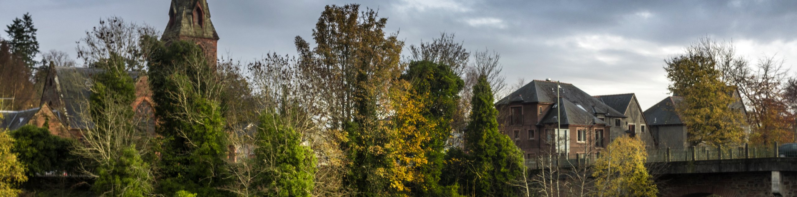
To begin the walk, set out from the riverside Wellmeadow car park, located on the northside of Blairgowrie’s village centre. Set out on the path that leads upstream alongside the Ericht. Enjoy the wooden viewpoints along this stage as the river rushes through the gorge below. The path soon forks to the right and leads you past a collection of old mills and cottages.
Once the track joins a minor road, you’ll turn left to continue uphill past the Lornty Farm. Another junction soon appears, which you’ll turn right at to join another track, following signs for the Cateran Trail. Enjoy this stretch through sprawling farmland as you continue to climb steadily. Views to Mount Blair on this stretch are particularly eye-catching.
The track soon leads you to pass through a pedestrian gate, and further signs indicate the route to continue on the Cateran Trail as the track leads downhill. Before you reach the next gate, turn right to curve around the farm buildings up ahead and maintain a straight course to follow the path that leads between a hedge and a fence. When you emerge from the fields onto a minor road, turn right and continue past another farm headed down towards a bridge.
Stick to the main track and follow the waymarked signs for the Cateran Trail. You’ll cross a cattle grid on the next section and will soon join a more minor track that tends to be muddy in sections. Continue straight on the path, ignoring other paths that veer off as you set out into the moorland. With Mounth hills rolling in the distance, you’ll soon enter a woodsy area, marking your descent into Strathardle.
Up next, you’ll pass through a gate to enter Blackcraig and continue through a forested area. The track continues to climb, bringing you to another junction where you’ll bear right, setting you up for another descent. Pass Blackcraig croft and continue to the next junction, where you follow a walled lane while soaking up the mountain views that paint the horizon before you. Stick to the waymarked track that continues on a straight course as you head through another section of pretty woodland.
After climbing a stile and passing a small bridge, continue the grassy path and pass through several more gates before turning left just above Dalnabreck to begin a steep climb. Once you reach a high fence, pass through another stile, then make a right turn to follow the fence through a section of rugged pastures. Continue as the route hugs the lower edge of the moorland and soon leads above a wooded area before crossing above the Pitcalmich Burn on a footbridge.
Further on, you’ll cross the Allt Cul na Coille burn before continuing through the woods and passing Dalvey Loch as well as another cattle grid.
A series of gates marks your approach to the River Ardle, and the route soon makes way for a lane that leads right into the village centre of charming Kirkmichael. You’ll pass a gorgeous, ruined church and turn right on the road here as the road leads to the shop in the centre of town.
See the full itinerary of The Cateran Trail:
- The Cateran Trail: Blairgowrie to Kirkmichael
- The Cateran Trail: Kirkmichael to Spittal of Glenshee
- The Cateran Trail: Spittal of Glenshee to Kirkton of Glenisla
- The Cateran Trail: Kirkton of Glenisla to Alyth
- The Cateran Trail: Alyth to Blairgowrie
Other Great Walks in Cairngorms National Park
Check out our trail guides to Ben Magdui, Loch Muick, Ben Vrackie, Loch an Eilein, and the Mount Keen Walk. Or see all of our Cairngorms walks.
Similar hikes to the The Cateran Trail: Blairgowrie to Kirkmichael hike

Glen Banvie Trail and Blair Castle Walk
The Glen Banvie Trail and Blair Castle Walk is a great adventure in Cairngorms National Park that takes in the…

Beinn Udlamain Munro and Sgairneach Mhòr Walk
The Beinn Udlamain Munro and Sgairneach Mhòr Walk is a rugged and exciting journey in Cairngorms National Park that will…

Loch an Eilein, Loch Gamhna, Old Logging Way Loop
The Loch an Eilein, Loch Gamhna, Old Logging Way Loop is a wonderful walking trail in Cairngorms National Park that…
Comments