Mayar and Driesh Walk
View Photos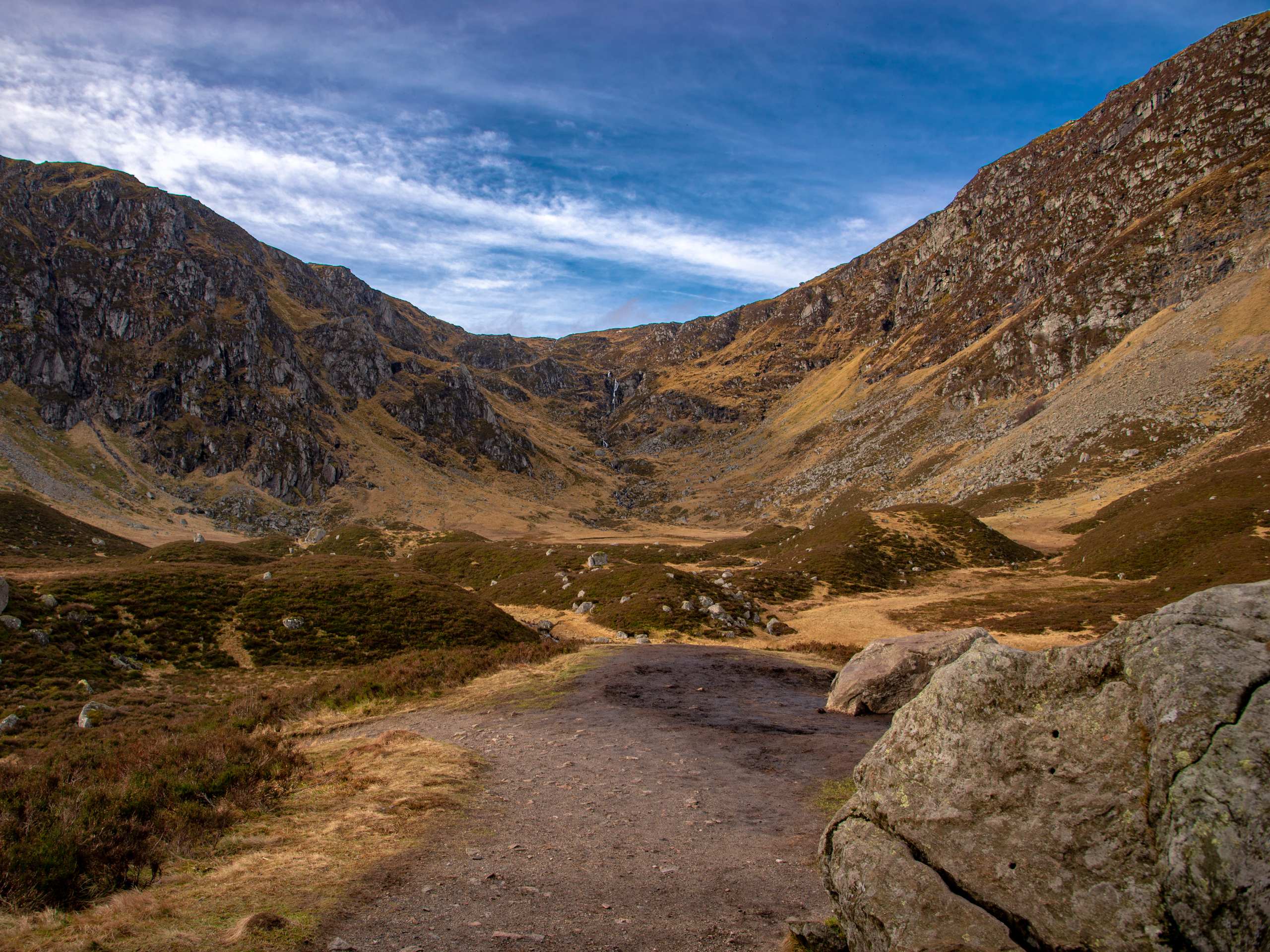
Mayar and Driesh Walk
Difficulty Rating:
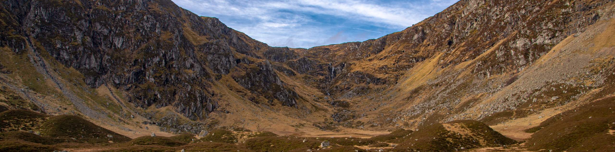
The 9.0mi Mayar and Driesh Walk unfolds near Folda, in Angus, Scotland and presents the perfect opportunity to check off two Scottish Munros in one go. The circular trail can typically be completed in under 5 hours, making for a superb half-day trip. The scenery during the ascent through Corrie Fee is noteworthy in addition to the spectacular views from atop Mayar and Driesh summits.
Getting there
To get to the Mayar and Driesh Walk from Dundee, take Meadowside for 0.2mi to Victoria Rd/A929, then drive 32.0mi from A90, A929 and B955 to Angus Council. Once in Angus Council, head to the Glen Doll car park found at the head of Glen Cova, where the walk begins.

About
| When to do | Year round access |
| Backcountry Campsites | Wild Camping |
| Pets allowed | Yes |
| Family friendly | No |
| Route Signage | Average |
| Crowd Levels | Moderate |
| Route Type | Lollipop |
Mayar and Driesh Walk
Elevation Graph
Weather
Mayar and Driesh Walk Description
From the head of Glen Cova, where the Mayar and Driesh Walk begins, you’re bound to be confronted with the imposing presents of both the Mayar and Driesh peaks. Begin the walk from the Glen Doll car park and enjoy the views of Driesh’s steep shoulder as it lords over the glen before you.
Following signs for “Forest Walks,” depart the car park to join the track that leads past the Acharn farm. Continue to follow signs for Forest Walks, keeping left at a fork and then following signs for Corrie Fee up ahead. Maintain the main track and follow the track as it leads into the woods.
As you make your way up the winding path leading uphill, you’ll soon arrive at the entrance of the Corrie Fee National Nature Reserve. From here, the views are majestic, looking out over the bowl-shaped corrie and its cascading waterfall etched into its back. Continue through the corrie until reaching its far end, where you’ll emerge on a path that leads to a plateau, marking the beginning of your ascent to Mayar’s summit.
From Mayar’s summit, soak in the sublime views before continuing northeast to soon join the Kilbo Path. Soon the bealach between Black Skellies and Corrie Kilbo is reached. Continue beyond the bealach and press on along the path that climbs steeply up to the Driesh Summit.
After drinking your fill of views, follow the path of descent that heads downhill across the slope towards a forest. Continue the path as it passes through a gate and continues across the Burn of Kilbo. Finally, at the final junction, make a left for Acharn Farm, then turn right on the track that leads back to the car park where the walk concludes.
Similar hikes to the Mayar and Driesh Walk hike

Glen Banvie Trail and Blair Castle Walk
The Glen Banvie Trail and Blair Castle Walk is a great adventure in Cairngorms National Park that takes in the…

Beinn Udlamain Munro and Sgairneach Mhòr Walk
The Beinn Udlamain Munro and Sgairneach Mhòr Walk is a rugged and exciting journey in Cairngorms National Park that will…

Loch an Eilein, Loch Gamhna, Old Logging Way Loop
The Loch an Eilein, Loch Gamhna, Old Logging Way Loop is a wonderful walking trail in Cairngorms National Park that…
Comments