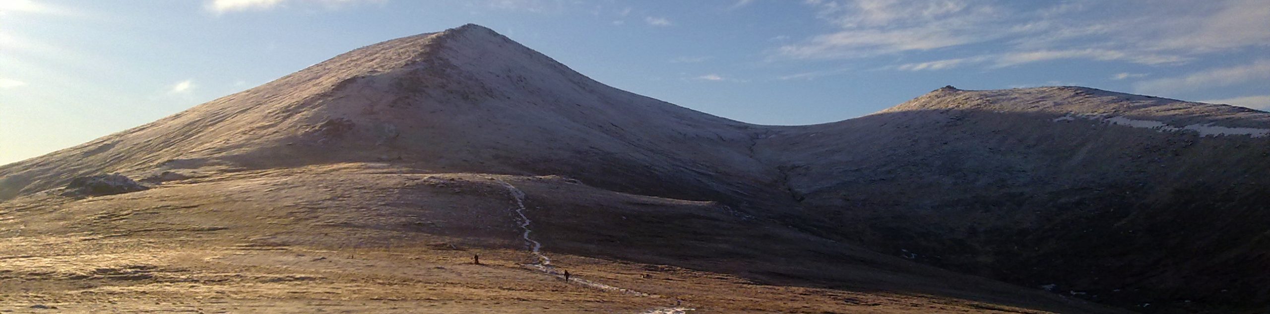
Bynack More from Glenmore Walk
View Photos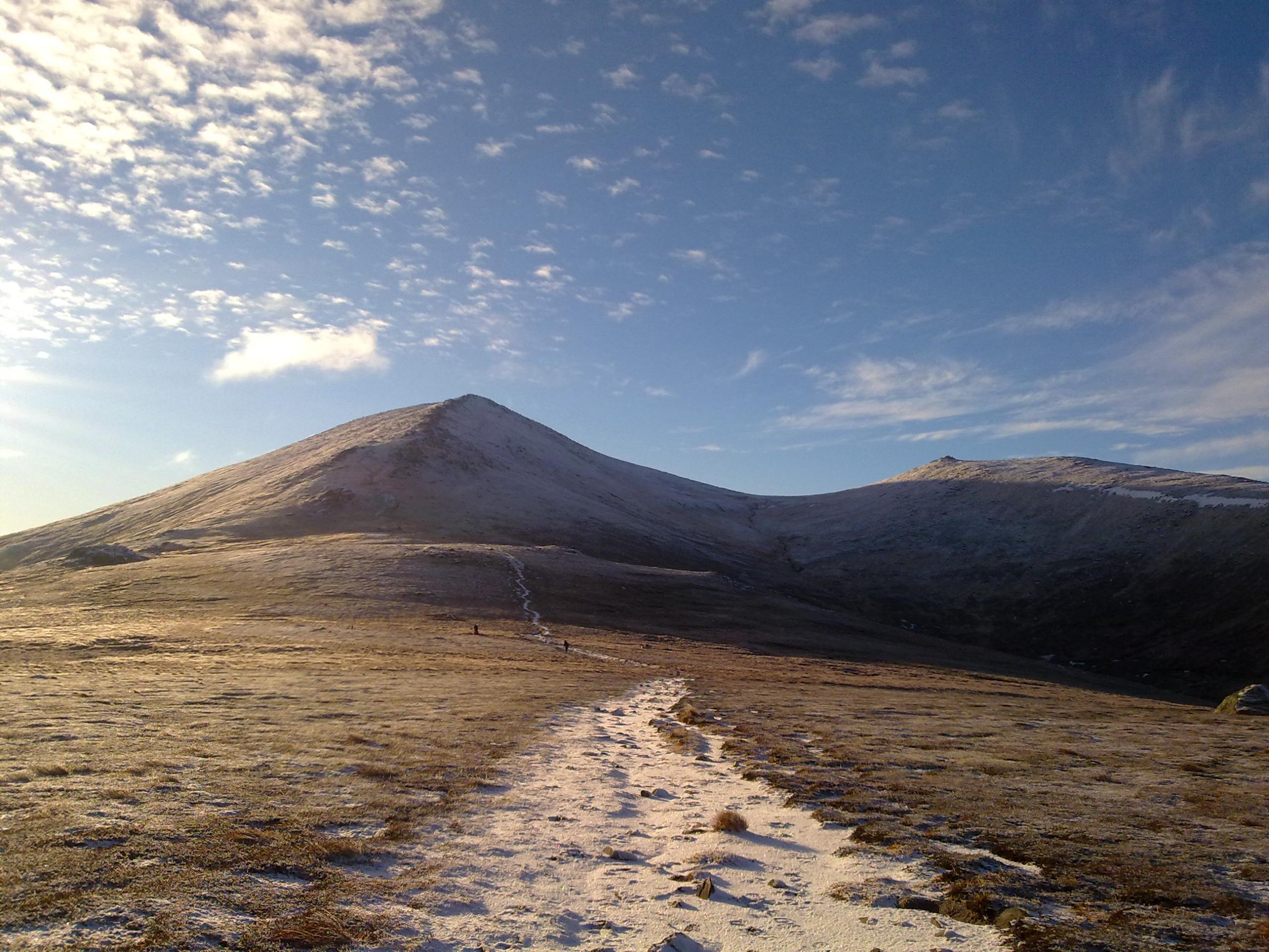
Bynack More from Glenmore Walk
Difficulty Rating:
The Bynack More from Glenmore Walk is a challenging 14.0mi walk that is considerably straightforward despite its length. The trail features spectacular scenery, including picturesque Scots pine forest, the dazzling blue-green waters of Lochan Uaine, and some thrilling river crossings. This prominent Scottish Munro’s summit stands at 3576ft high, making it a challenge well worth tackling.
Getting there
To get to the Bynack More from Glenmore Walk, head to the Allt Mòr car park, where the walk begins by taking Craggan More Rd and Dalfaber Dr in Aviemore to Grampian Rd/B9152. Continue 0.1mi, then follow Grampian Rd/B9152 and B970 for 3.0mi. Continue another 5.0mi to reach the Allt Mòr car park, where the walk begins.

About
| When to do | Year round access |
| Backcountry Campsites | Wild Camping |
| Pets allowed | Yes |
| Family friendly | No |
| Route Signage | Average |
| Crowd Levels | Moderate |
| Route Type | Out and back |
Bynack More from Glenmore Walk
Elevation Graph
Weather
Bynack More from Glenmore Walk Description
Set out from the Allt Mòr car park to begin the Bynack More from Glenmore Walk, and be sure to savour a deep inhale, as the fragrance of the Scots Pines that populate the area are guaranteed to delight. Head to the far end of the car park to join a well-defined path that is flanked by two boulders. Walk over the rushing Allt Mòr via the footbridge and continue ahead towards a ford. If needed, take the footbridge found a short distance upstream and continue on the main path.
Further on, you’ll be greeted by the turquoise waters of Lochan Uaine, a picture-perfect scene against the backdrop of the towering Scots Pines that hug the shores. Continue the track as it gradually begins to climb, following signs for Braemar up ahead at a fork. Ascending the moor, you’ll soon cross the Allt a’Garbh-choire, leading to Bynack Stable.
The path continues to climb the moors and soon reaches another river crossing at Fords of Avon. The expansive plateau found to the north of Bynack More is then reached, and so begins the ascent of Bynack More. Tackling the peak’s north ridge, navigate the steep path of ascent to reach 3576ft. Revel in the sensational views afforded by this vantage point at the Cairngorms northeastern edge, then proceed to descend following the same route that led to the summit.
Retrace your steps and enjoy the splendid views for the second time around, heading back to the car park where the walk began.
Similar hikes to the Bynack More from Glenmore Walk hike

Glen Banvie Trail and Blair Castle Walk
The Glen Banvie Trail and Blair Castle Walk is a great adventure in Cairngorms National Park that takes in the…

Beinn Udlamain Munro and Sgairneach Mhòr Walk
The Beinn Udlamain Munro and Sgairneach Mhòr Walk is a rugged and exciting journey in Cairngorms National Park that will…

Loch an Eilein, Loch Gamhna, Old Logging Way Loop
The Loch an Eilein, Loch Gamhna, Old Logging Way Loop is a wonderful walking trail in Cairngorms National Park that…
Comments