Sugarloaf Mountain Trail
View Photos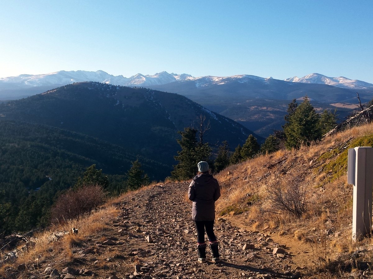
Sugarloaf Mountain Trail
Difficulty Rating:
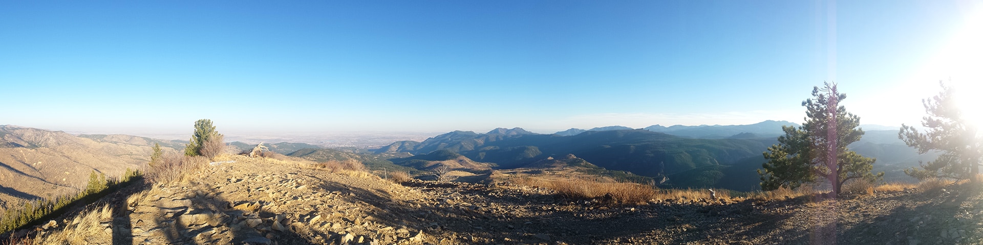
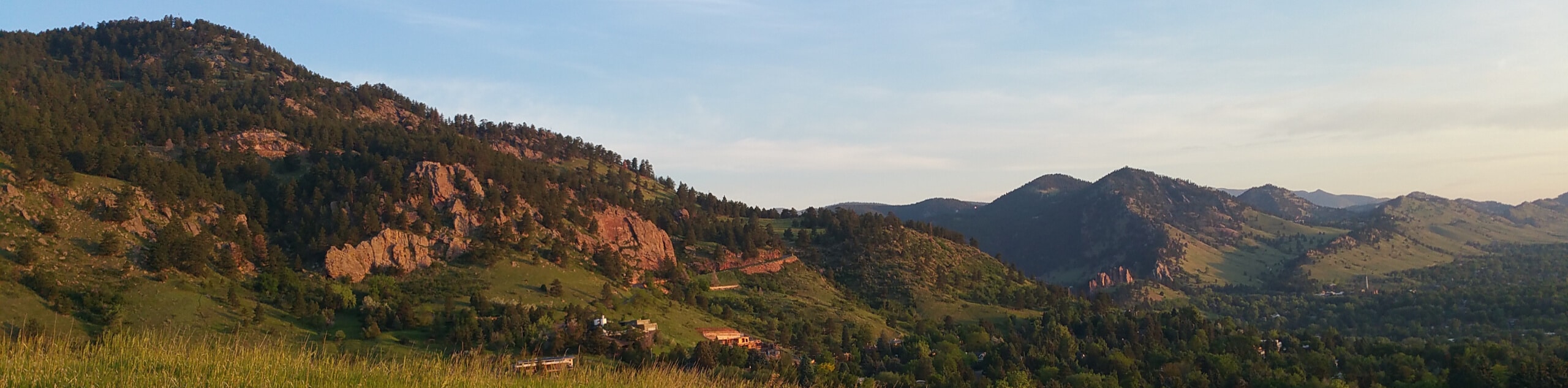
The Sugarloaf Mountain hike takes you up a prominent bald mountain with expansive views. Hiking up Sugarloaf Mountain rewards you with one the best panoramic views of Rocky Mountain National Park and Indian Peaks Wilderness. This short, family-friendly hike has low crowds and is a must do when visiting the Boulder area.
Getting there
From Boulder, take Canyon Dr. (119) into Boulder Canyon. Take a right onto Sugarloaf Road (122) up to Sugarloaf Mountain Road (on the right). The steep road, ends at a dirt trailhead parking lot (Sugarloaf Mountain Trailhead).

About
| When to do | Early June to late September |
| Backcountry Campsites | No |
| Toilets | No |
| Family friendly | Yes |
| Route Signage | None |
| Crowd Levels | Low |
| Route Type | Out and back |
Sugarloaf Mountain Trail
Elevation Graph
Weather
Route Description for Sugarloaf Mountain Trail
The hike to the top of Sugarloaf Mountain offers one of the best panoramic views in the area. This is a short hike and is really family-friendly. Youngsters love to hike to the top of the prominent bald mountain.
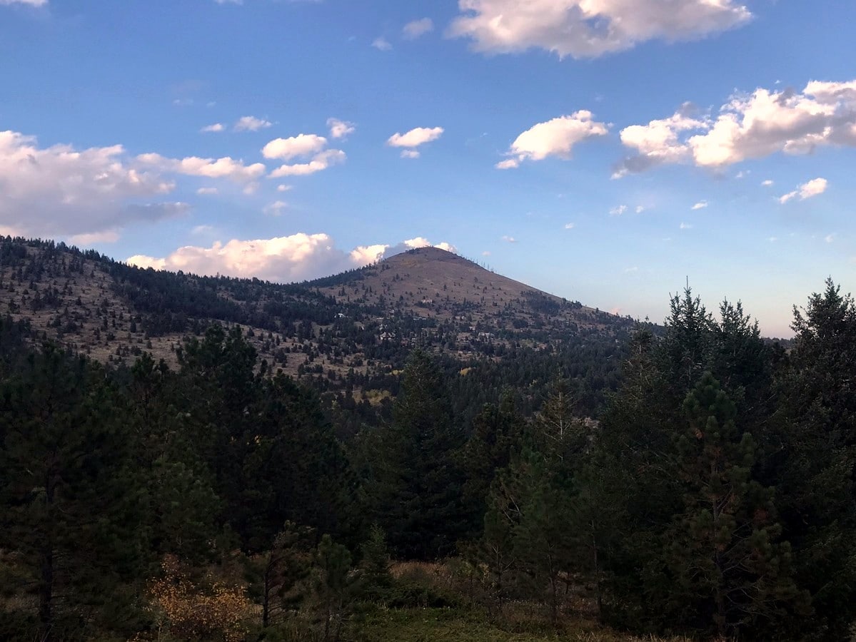
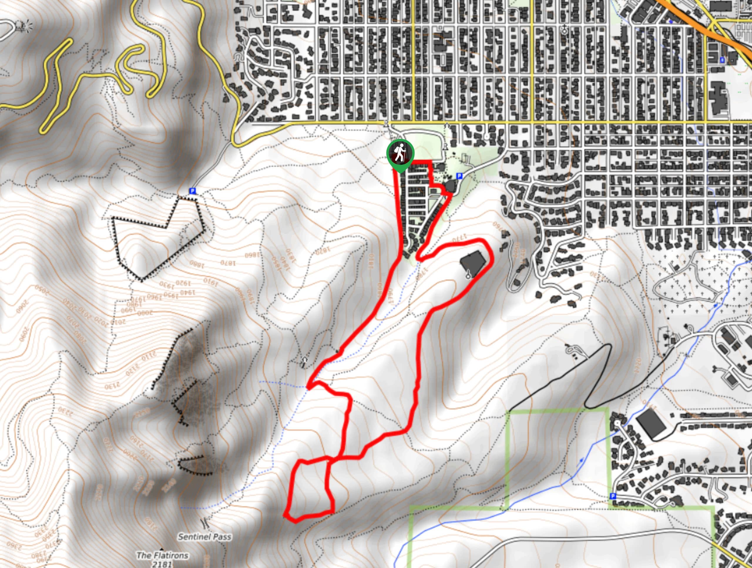
Begin the hike from the Sugarloaf Mountain Trailhead dirt parking lot. Hike up hill, through a couple of steep switchbacks, eventually climbing above tree line.
Traverse across the south slope of Sugarloaf Mountain, past a well-placed sitting bench until finally wrapping around the east side of the mountain, gaining the summit after a couple of final switchbacks.
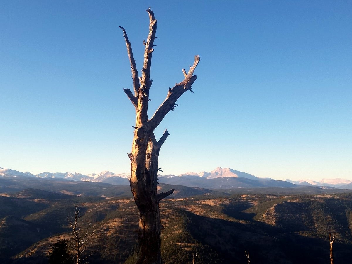
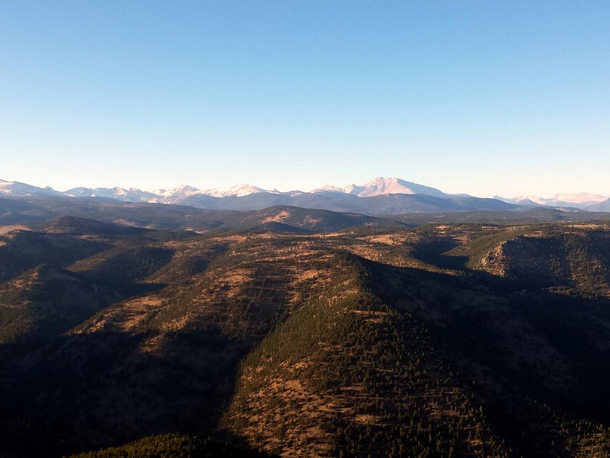
At 8917ft, the top of Sugarloaf Mountain is blessed with stunning, unobstructed views. Scanning around, you can orient yourself by locating Longs Peak (14259ft) located in Rocky Mountain National Park. South from Longs Peak, and West from your vantage point is Indian Peaks Wilderness and Arapaho Glacier. Further south from that is Eldora Mountain Ski Resort and James Peak (13301ft). To the south is Golden Gate Canyon State Park, which is recognizable by large granite domes high on the mountains.
After spinning around and around, soaking in the views, you’ll need to head back to your car. To descend, hike back the way you came.
Find more amazing hikes around Boulder:
Insider Hints
The beginning of the Switzerland Trail starts from Sugarloaf Mountain Trailhead parking lot. This is a railroad grade trail that traverses along Fourmile Canyon eventually ending close to Gold Hill. The Switzerland trail can be hiked, biked or even driven with a high-clearance vehicle.

Similar hikes to the Sugarloaf Mountain Trail hike

Crown Rock Trail
The Crown Rock Trail is a short but sweet nature walk that presents the perfect excuse to get the family…
Chautauqua, Bluebell and Baird Trail
Immerse yourself into nature and get some fresh air along the Chautauqua, Bluebell and Baird Trail. Conveniently located just outside…
Bluebell, Woods Quarry, and Enchanted Mesa Loop
The Bluebell, Woods Quarry and Enchanted Mesa Loop is a charming nature walk in the Boulder Open Space. Conveniently located…
Rocco Ellysia 4 years ago
Gorgeous trail and very unique core. The summit views were incredible, and I can say that Loaf Mountain was very awe-inspiring. I highly recommend bringing some poles and wearing appropriate shoes. The path was uneven, and it puts too much pressure on my foot. Train beforehand if you could.
BoulderBound 4 years ago
A short, steep, rocky hike with incredible 360 views from the top.
Anabelle Clyde 4 years ago
Nice and leisurely hike. Stunning views!
will-perry 4 years ago
Another great hike around the Boulder. It was fantastic!
Mary Lou 4 years ago
Amazing hike. I felt like a real adventurer.
mendel 4 years ago
The views were too sweet! We just can't get enough of it.
Jordan A. 5 years ago
Nice hike with low traffic. Gorgeous views. A nice walk with friends.
Ashley Ting 5 years ago
It was a short hike, but we never run short of good scenery. The environment is perfect if you want to relax.
Jasper Herrera 5 years ago
Awesome scenery. Hiking here is a great way to experience nature and see the outstanding views of the nearby peaks. Really impressive.
Em L. 5 years ago
Amazing environment! Make sure to take your camera. It's also perfect for some picnic.