Range View and Boy Scout Loop Trail
View Photos
Range View and Boy Scout Loop Trail
Difficulty Rating:
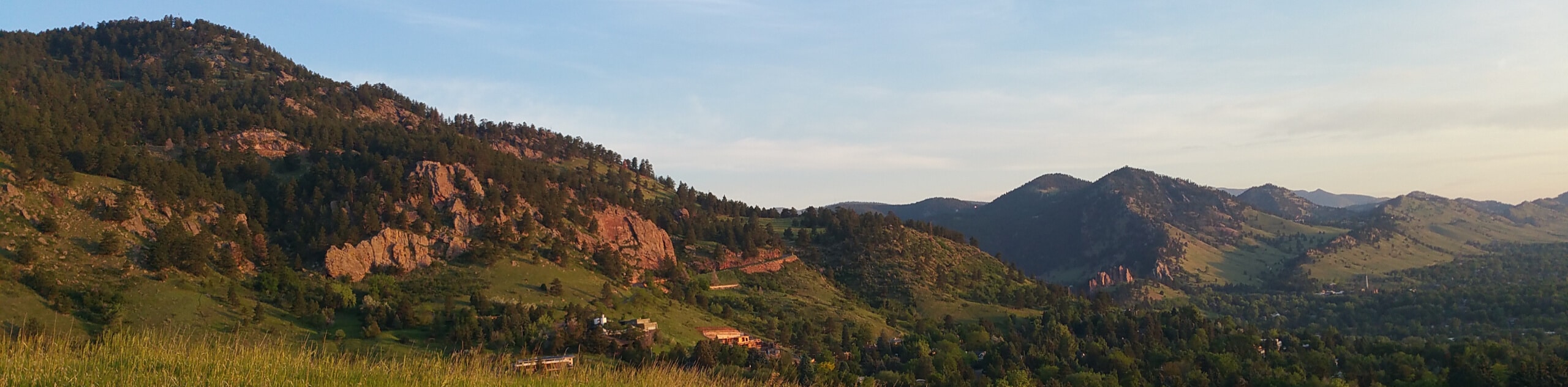
The Range View and Boy Scout Loop Trail is a wonderful adventure suitable for the whole family. Explore the summit of Flagstaff Mountain and revel in the sights of the Front Range foothills and the Boulder cityscape below. This trek is a must-add to your adventure itinerary.
Getting there
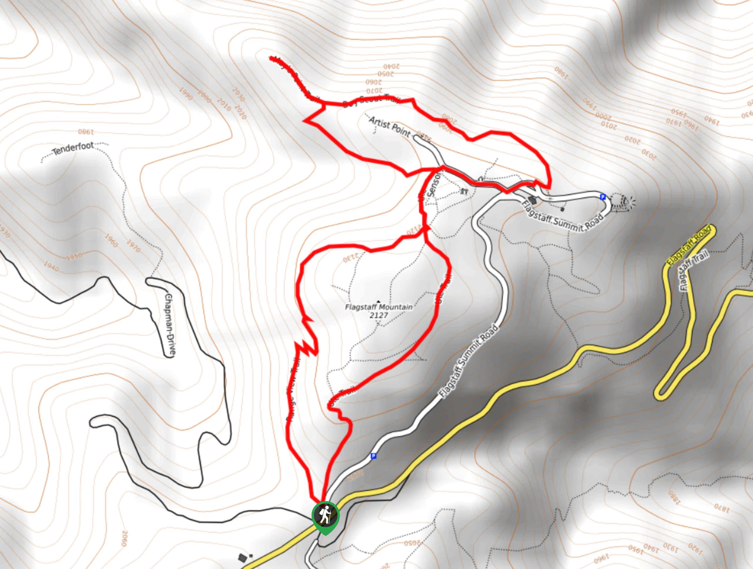
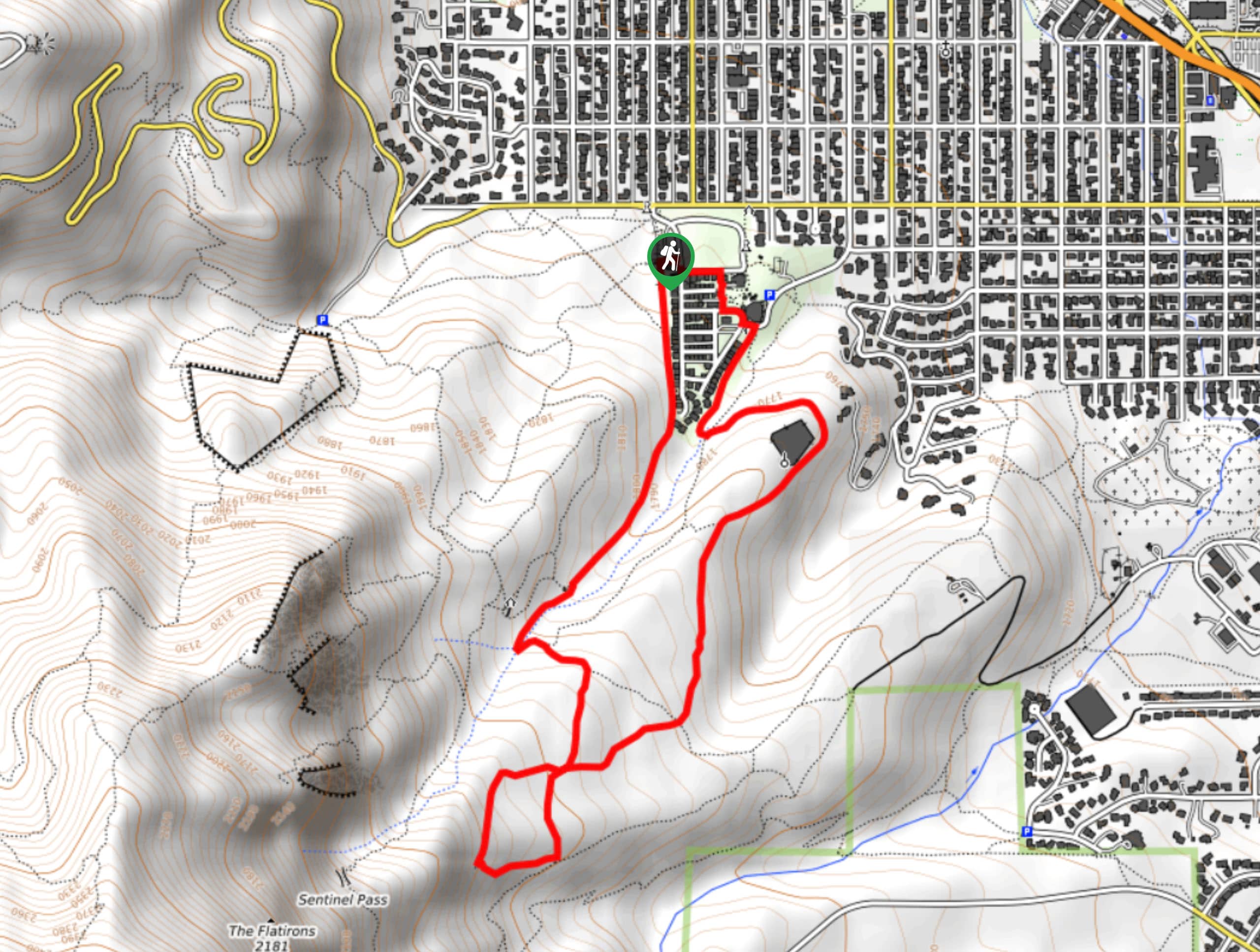
The Range View and Boy Scout Loop Trail departs from the Ute Trailhead off the Flagstaff Summit Road.

About
| Backcountry Campground | No |
| When to do | Year-round |
| Pets allowed | No |
| Family friendly | Yes |
| Route Signage | Average |
| Crowd Levels | High |
| Route Type | Circuit |
Range View and Boy Scout Loop Trail
Elevation Graph
Weather
Range View and Boy Scout Loop Trail Description
Appreciate the hustle and bustle of the city from a distant perspective. Ideal for a family-friendly adventure, this path presents the perfect excuse to get out into the fresh air. The crowds that this trail draws validate the beauty and awesomeness of the hike. Trek through ponderosa pines and luxuriant grasslands, which reveal stunning sights of the Front Range snow-capped peaks that line the horizon and flank the verdant foothills below. Appreciate Colorado’s mountainous landscape and get your steps in as you wander the Range View and Boy Scout Loop Trail.
Departing from the trailhead, track north along the Range View Trail which delivers wonderful views of you guessed it, the mountain range. Hike this path to the trail’s end, merging onto the Ute Trail and heading North. At the next intersection, turn left onto the Boy Scout Trail, wandering all the way to May’s Point Trail. Revel in the scenery and when you return to Boy Scout Trail, keep left.
Trek this route to the trail’s end, where you will hike along the road back to the Ute intersection. Here, keep left and hike along the Ute Trail southwest, all the way back to the trailhead, marking the end of your adventure.
Similar hikes to the Range View and Boy Scout Loop Trail hike

Crown Rock Trail
The Crown Rock Trail is a short but sweet nature walk that presents the perfect excuse to get the family…
Chautauqua, Bluebell and Baird Trail
Immerse yourself into nature and get some fresh air along the Chautauqua, Bluebell and Baird Trail. Conveniently located just outside…
Bluebell, Woods Quarry, and Enchanted Mesa Loop
The Bluebell, Woods Quarry and Enchanted Mesa Loop is a charming nature walk in the Boulder Open Space. Conveniently located…
Comments