Gross Reservoir Hike
View Photos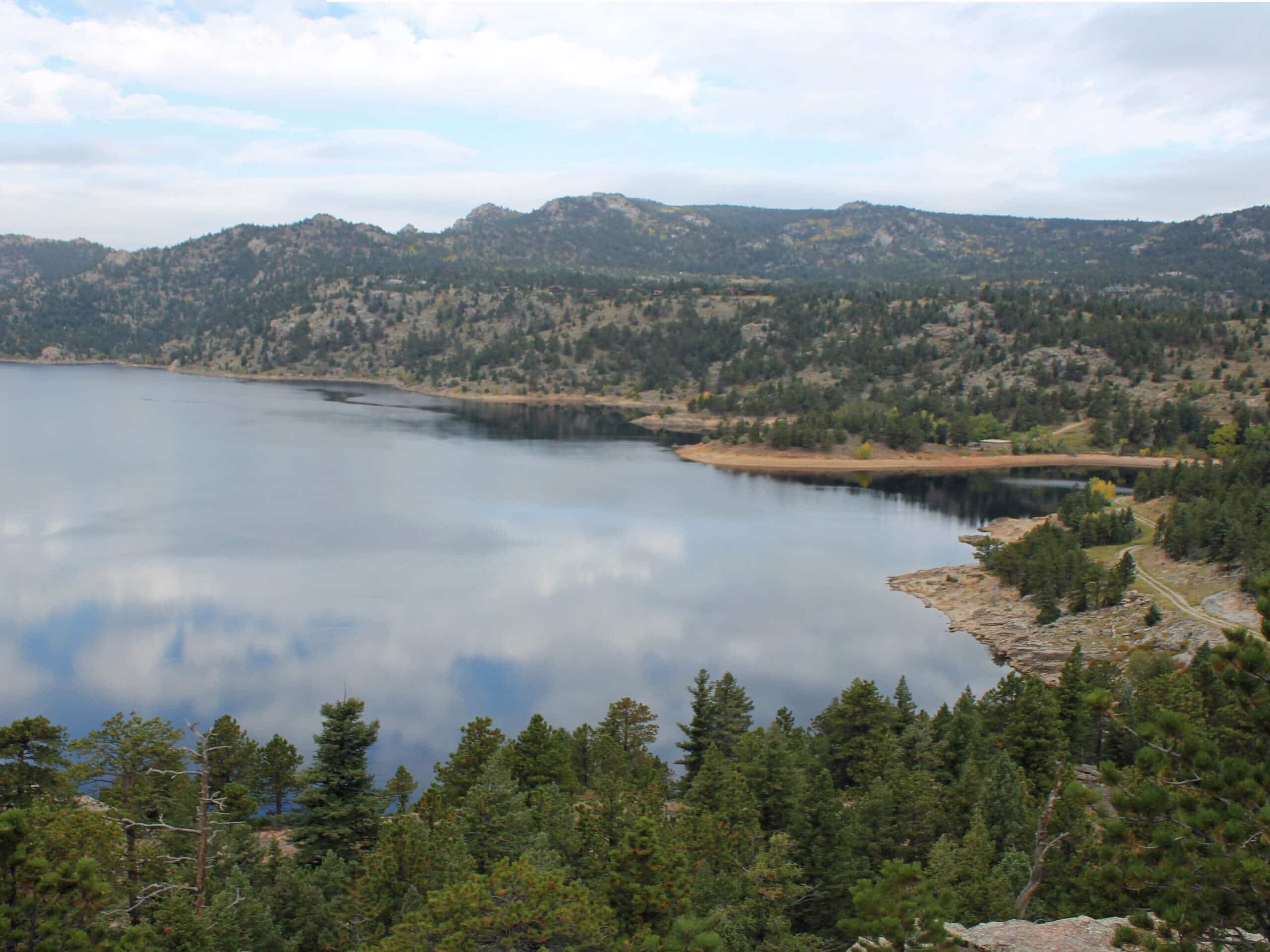
Gross Reservoir Hike
Difficulty Rating:
The Gross Reservoir Hike is a lovely nature walk through the Roosevelt National Forest. This charming adventure will guide hikers along a shared route with OHV/Off roading vehicles; thus, the path is super easy to follow. Enjoy the sights of the surrounding Front Range mountains that flank the verdant woodlands as you trek to the glittering reservoir.
Getting there
The Gross Reservoir Hike departs from the Winegar Ridge Trailhead off Route 86J.

About
| Backcountry Campground | Designated Backcountry Dispersed Campsites |
| When to do | Year-round |
| Pets allowed | Yes - On Leash |
| Family friendly | Older Children only |
| Route Signage | Average |
| Crowd Levels | Moderate |
| Route Type | Out and back |
Gross Reservoir Hike
Elevation Graph
Weather
Gross Reservoir Hike Description
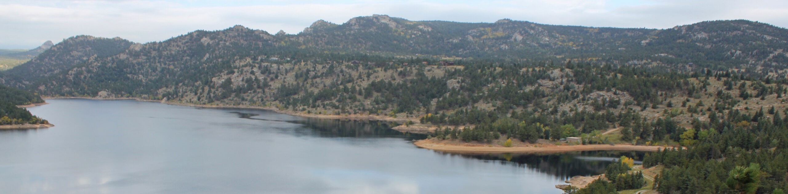
The Gross Reservoir Hike is a charming nature walk through the Roosevelt National Forest. Enjoy epic sights of the Front Range snow-capped peaks that line the horizon as you trek along the meadow-cloaked route. Shared with off-roading vehicles, the trail is easy to follow, but often noisy. If you don’t mind the odd vehicle passing by then we can almost guarantee you will love this scenic adventure. Don’t worry though, there will be plenty of other hikers along the trail to socialize with! As you travel deeper into the wilderness, it is important to be mindful of wildlife—beware of mountain lions and bears in the area! There are plenty of warning posts along the trails to remind hikers, and we suggest wearing a bear bell to deter unwelcome visitors. Note: this route is only welcome to vehicles before the snow falls, so if you venture this route in the winter months you will be trekking in solitude—bonus!
Don’t let the trail’s name deter you, the Gross Reservoir Hike is an awesome adventure through the arid terrain of the Colorado wilderness. Offering activities for outdoor enthusiasts of all sorts, this versatile route can be driven, biked, hiked, snowshoed, or cross country skied. What more could you ask for? The lovely grassland trail dotted with pines will reward hikers with stunning views of the Front Range peaks and the Continental Divide all before delivering them to the glittering reservoir often littered with kayakers and canoers enjoying the waters.
Lace up your hiking shoes and embark on your adventure along the Gross Reservoir Trail from the Winegar Ridge Trailhead. From here, track southeast along the WInegar Ridge Trail. If you are hiking, try to stay along the shoulder of the road. If you are driving the trail, we highly suggest a vehicle with 4×4 and high ground clearance. As you hike along the shared route, you will notice merging paths, ignore these routes, and continue along the Winegar Ridge Trail. Shortly after you depart from the trailhead, you will notice several designated dispersed campsites along the road. These are great places to set up shop for the night on your way back from the reservoir. Enjoy the sights of the towering pine trees and the vibrant wildflowers that dot the grasslands in the warmer months.
Eventually, you will pass Dispersed Campsites 8 and 9, where you will be granted epic views of the Front Range foothills, like Twin Sisters Peak in the north. Revel in the scenery, and from this point forward, the path will begin to gradually descend towards the reservoir. As you hike down the path, sights of the shimmering waters of the Gross Reservoir will come into view. Remember to keep an eye out for wildlife as you trek! Soon you will encounter the trail’s end, from here, track FDR 359 down to the shores of the Gross Reservoir. Revel in the grandeur of the vegetation laden cliffs that hem the waters of the reservoir and notice canoers and paddleboarders enjoying the waters. If you venture this trail in the winter months, you will likely see ice fishing huts littering the ice surface.
If you remembered to bring your fishing rod with you and you have a permit, then why not try your hand at some bass or trout? On lovely, summer days, we recommend having lunch along the shoreline of the Gross Reservoir. As you rest along the waters, appreciate the beauty of Colorado’s mountainous landscape. When you are done exploring the reservoir and you are rehydrated and recharged, simply retrace your footing along the path back to the trailhead.
Trail Highlights
Gross Reservoir
Gross Reservoir is a large body of water that supplies much of the Denver area with drinking water. Completed in 1954, the reservoir serves as a storage and regulation facility for the waters that flow under the Continental Divide through the Moffat Tunnel. Often perceived as uninviting due to the name, the reservoir is actually beautiful. Named after Dwight D. Gross, former Denver Water Chief Engineer, the stunning reservoir not only serves an infrastructural purpose, but it’s a wonderful recreational area. Hike, bike, camp, kayak, fish or ice fish, the outdoor activities in this area are limitless!
Frequently Asked Questions
Can you swim in Gross Reservoir?
No, swimming is prohibited in Gross Reservoir.
Is kayaking permitted on Gross Reservoir?
Yes, kayaking, paddle boarding, canoeing and other non-motorized boating is permitted on Gross Reservoir.
Is fishing permitted in Gross Reservoir?
Yes, assuming you have a valid Colorado fishing licence, fishing is permitted in Gross Reservoir.
Similar hikes to the Gross Reservoir Hike hike

NCAR to Fern Canyon Hike
The NCAR to Fern Canyon Hike is an awesome but challenging adventure up to the summit of Nebel Horn. Put…
Bear and South Boulder Peaks Loop
Looking for a demanding but rewarding hike near Boulder? We’ve got you covered. The Bear and South Boulder Peaks Hike…

Rattlesnake Gulch Trail
The Rattlesnake Gulch Trail is an epic adventure through the Eldorado Canyon State Park. Ascend the steep cliffs of Eldorado…
Comments