Boulder Reservoir Loop Trail
View Photos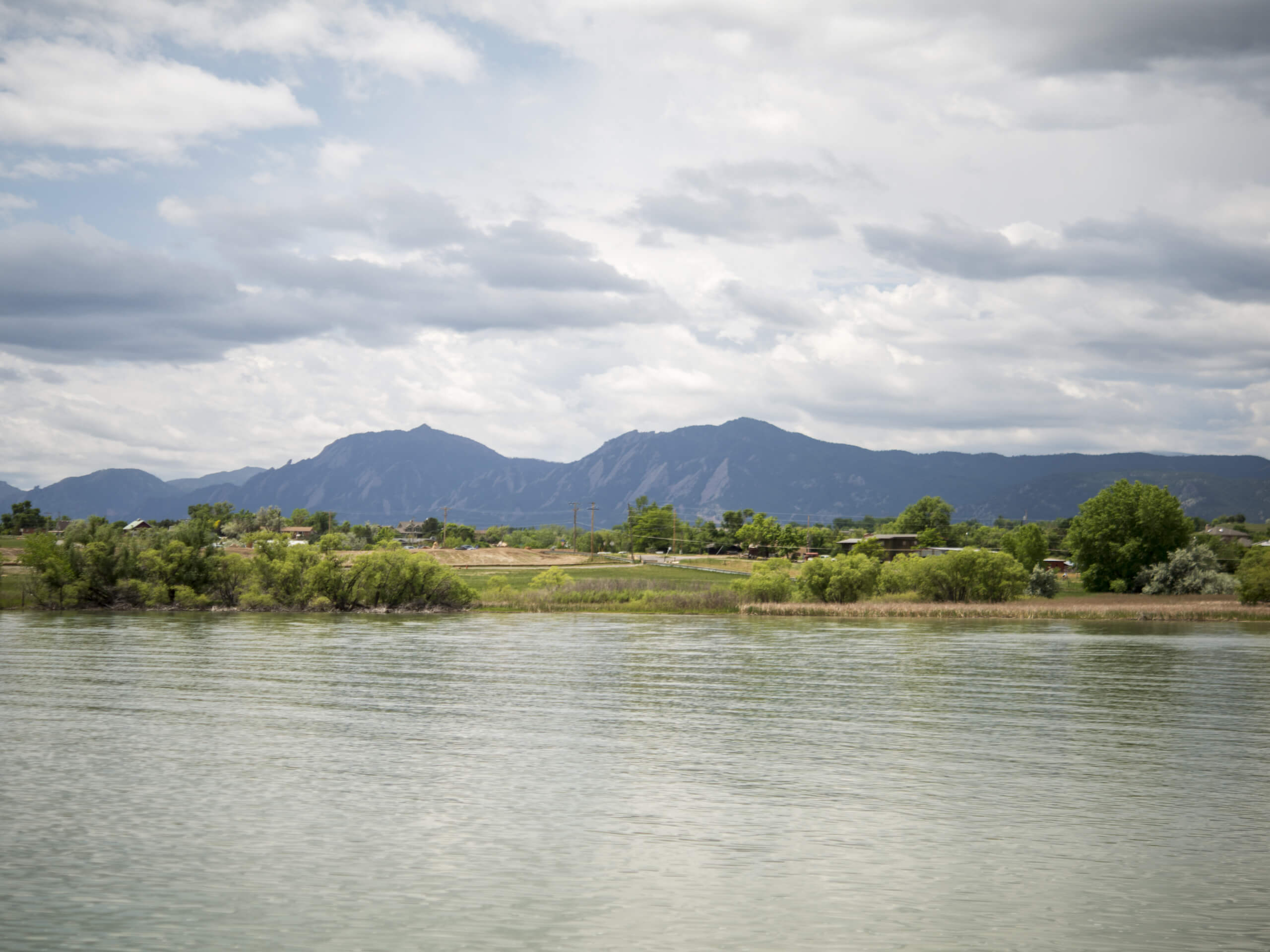
Boulder Reservoir Loop Trail
Difficulty Rating:
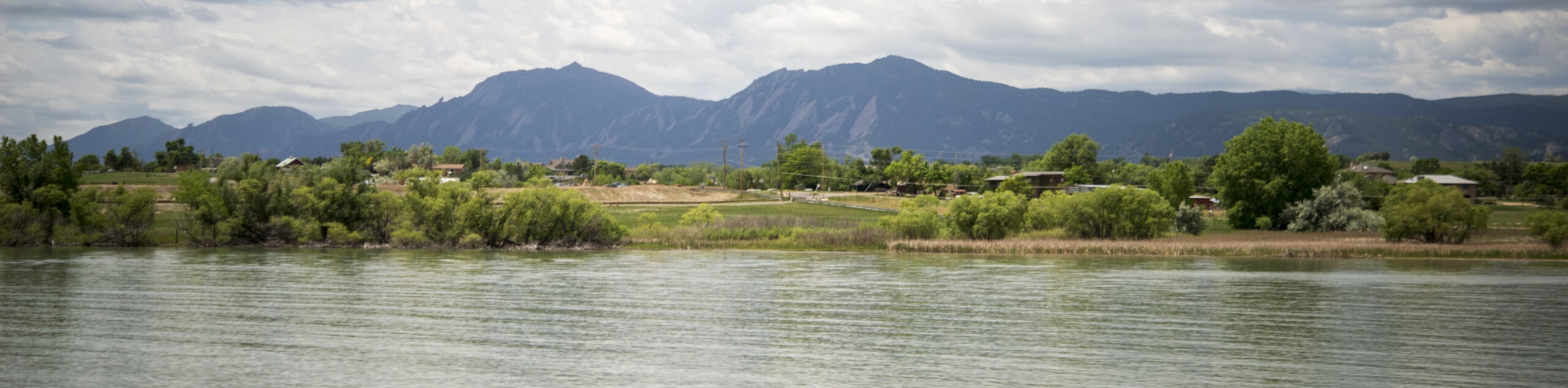
The Boulder Reservoir Loop Trail is a stunning nature walk around Boulder’s most popular fishing, boating, and swimming destination. Explore the shoreline of the glittering reservoir which exposes epic views of the Flatirons, the Front Range, and the cityscape. A beautiful oasis situated just outside the hustle and bustle of the city; the Boulder Reservoir Loop Trail is an awesome fresh air escape.
Getting there
The Boulder Reservoir Loop Hike departs from the North Trailhead off N 55th Street in Boulder.

About
| Backcountry Campground | No |
| When to do | Year-round |
| Pets allowed | Yes - On Leash |
| Family friendly | Yes |
| Route Signage | Good |
| Crowd Levels | Moderate |
| Route Type | Circuit |
Boulder Reservoir Loop Trail
Elevation Graph
Weather
Boulder Reservoir Loop Trail Description
The Boulder Reservoir Loop Trail is an amazing nature walk alongside the busy waters of the reservoir. Perfect for families and city escapes, this recreational area is a beloved destination for locals and tourists alike. If you were hoping to hike in solitude, then we urge you to consider another trek. The summer months and weekends are undoubtedly the busiest, so arrive nice and early to beat the crowds and secure a parking spot. The first few kilometers of the trek travels along the shoulder of a road, but don’t let that discourage you, the scenery is unparalleled.
*Note that the Boulder Reservoir has strict rules regarding pups: dogs are prohibited through the gates or anywhere along the south shoreline of the reservoir between May 15 and Labor Day, but in the off-season, they are permitted if they remain on-leash. The area charges an entrance fee to use the recreational area. Depending on when you visit, the day passes can cost anywhere between $5-13USD.
Ideal for a spontaneous adventure near the city, the Boulder Reservoir Loop Hike is a great, natural escape. Great for families and novice hikers alike, this hike presents the perfect opportunity to get out into the fresh air. The exposed terrain warrants epic vistas of the quintessential Colorado mountains, but also means it will be quite hot in the summer, so lather on the sunscreen! Open year-round and offering various outdoor activity possibilities, this area is an outdoor enthusiast’s dream. In the summer adventurers hike, bike, swim, fish, paddleboard, or canoe, and the winter months present the opportunity to snowshoe, cross country ski, or ice fish! What more could you ask for? Incredibly scenic and adventure-filled, the Boulder Reservoir Loop Trail is a must-add to your Boulder itinerary!
Embark on your exciting excursion along the Boulder Reservoir Loop Trail from the North Trailhead off N 55thStreet. From here, the loop can be completed from either direction, but we prefer trekking counterclockwise along this route. The initial segment of your hike will be along the roadside of N55th Street. Departing from the trailhead, keep right along the road and over a small stream. As you hike west you will be granted expansive views of the Front Range peaks and foothills that flank the cityscape, including the famous flatirons. Enjoy the stunning mountain views as you trek, and the path will begin to curve you south. Now near the shoreline, you will be granted an up close and personal view of the shimmering waters.
Crossing yet another stream, divert off the road and trek the access route through the southwestern entrance to the recreational area. Track east along the shoreline, passing the designated swimming area and boat rental shop. Eventually, you will merge onto the Boulder Reservoir Dam Trail South. Now closely hugging the shoreline you will notice all the paddlers and kayakers enjoying the waters. Follow this path, passing the water treatment plant. Soon after passing the plant, you will encounter an intersection, keep left and you will be diverted onto the Boulder Reservoir Dam Trail North.
Follow this route along the eastern shore of the reservoir up to Coot Lake. This area of the hike passes through wetlands so keep an eye out for osprey, herons, and raptors. Continue along this trail which will guide you west over another stream. Soon the path will deliver you back to the trailhead, marking the end of your Boulder Reservoir Loop Trail experience. If you have some spare time, consider renting a paddleboard and enjoy the reservoir from a different perspective.
Frequently Asked Questions
How long is the permitter trail around Boulder Reservoir?
The Boulder Reservoir Loop Trail is 5.3mi long.
Can you swim in the Boulder Reservoir?
Swimming is permitted in the designated swimming area of the Boulder Reservoir only. Additionally, it is prohibited to swim when there is no lifeguard on duty.
Can you fish in the Boulder Reservoir?
Yes, fishing is permitted in the Boulder Reservoir if you have a valid Colorado fishing license.
How much does it cost to enter the Boulder Reservoir?
Depending on the time of year and how you enter the park, entrance fees at Boulder Reservoir generally cost between $5-13USD.
Are dogs allowed in the Boulder Reservoir area?
Dogs are prohibited through the gates or anywhere along the south shoreline of the Boulder Reservoir between May 15 and Labor Day, but in the off-season, they are permitted if they remain on-leash.
Insider Hints
Pack provisions and have a picnic along the reservoir's shore.
Don’t forget there is an entrance fee to utilize the Boulder Reservoir Loop Trail, so pack some cash!
If you have a fishing license and fishing rod, why not try your hand at some trout?
Trade your hiking boots for snowshoes to enjoy this awesome adventure year-round!
Similar hikes to the Boulder Reservoir Loop Trail hike

NCAR to Fern Canyon Hike
The NCAR to Fern Canyon Hike is an awesome but challenging adventure up to the summit of Nebel Horn. Put…

Crown Rock Trail
The Crown Rock Trail is a short but sweet nature walk that presents the perfect excuse to get the family…

Rattlesnake Gulch Trail
The Rattlesnake Gulch Trail is an epic adventure through the Eldorado Canyon State Park. Ascend the steep cliffs of Eldorado…
Comments