East Boulder Creek to Walden Ponds Hike
View Photos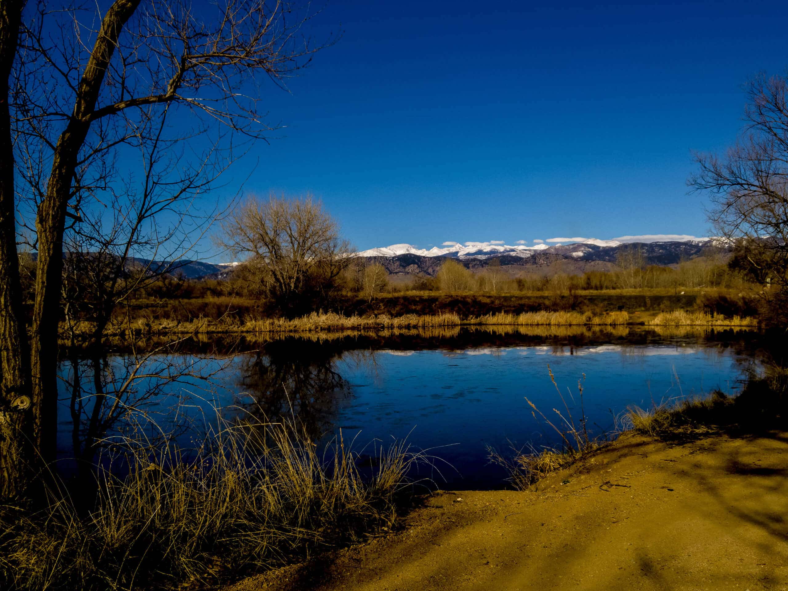
East Boulder Creek to Walden Ponds Hike
Difficulty Rating:
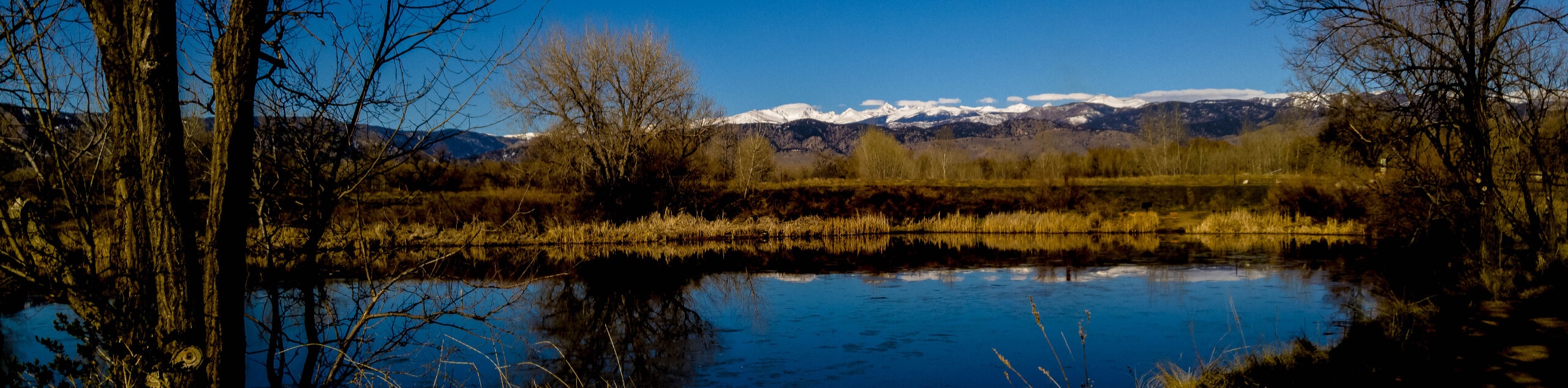
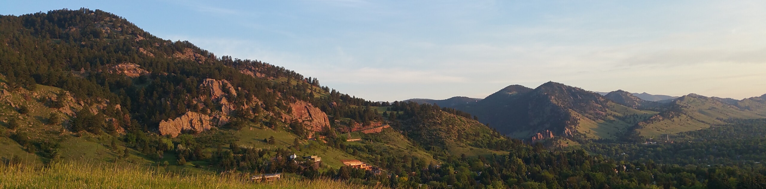
The East Boulder Creek to Walden Ponds Hike is a must-do when in the Boulder area. Adventure along a gurgling creek to the shimmering waters of the Walden Ponds. Revealing views of the cityscape that sits in the foreground of the foothills, this scenic hike is a must-add to your adventure itinerary.
Getting there
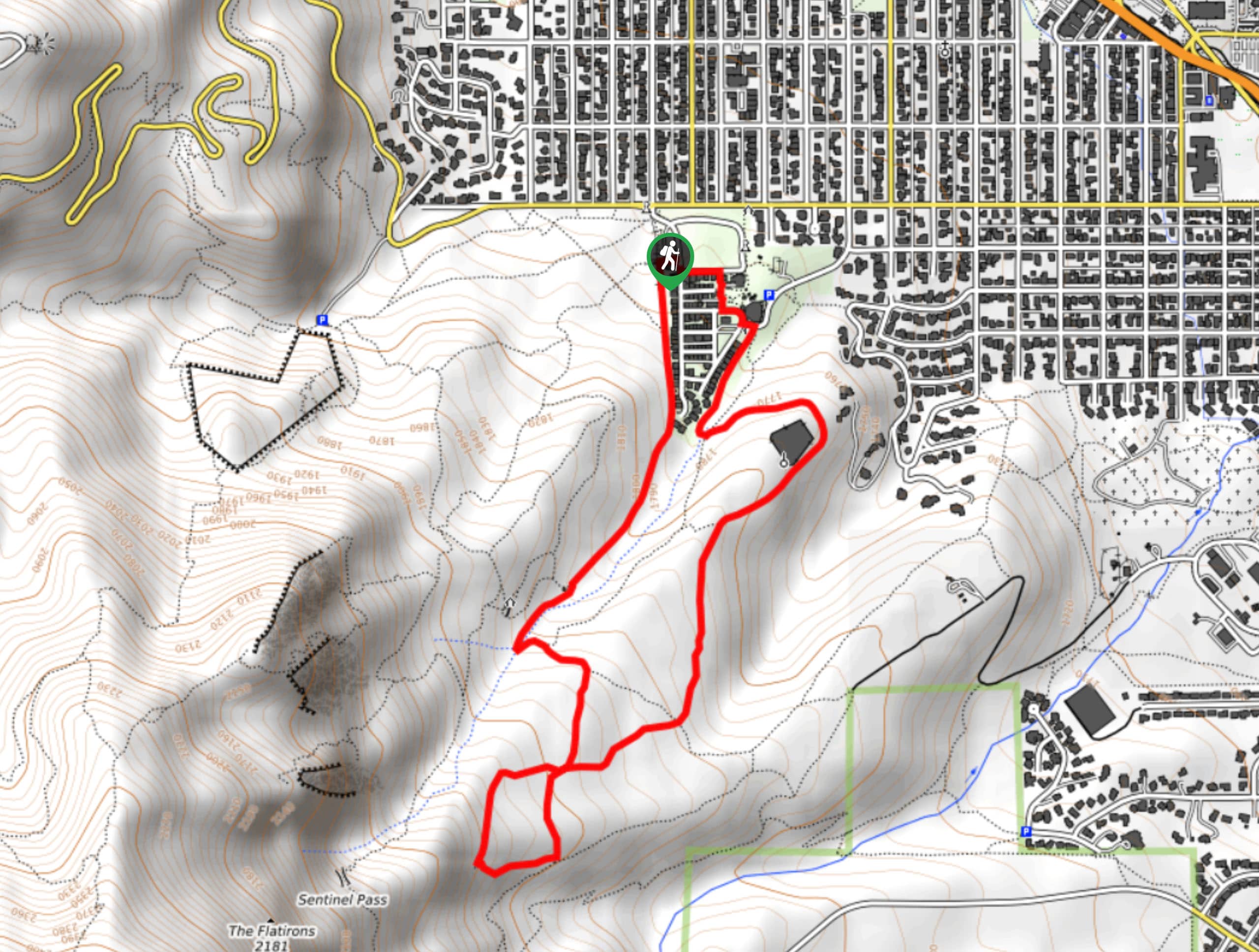
The East Boulder Creek to Walden Ponds Hike departs from the trailhead off N 75th Street.

About
| Backcountry Campground | No |
| When to do | Year-round |
| Pets allowed | Yes - On Leash |
| Family friendly | Yes |
| Route Signage | Average |
| Crowd Levels | Moderate |
| Route Type | Lollipop |
East Boulder Creek to Walden Ponds Hike
Elevation Graph
Weather
East Boulder Creek to Walden Ponds Hike Description
The East Boulder Creek to Walden Ponds Hike is a charming nature walk near Boulder’s city centre. Trek along Boulder Creek to the water treatment centre that scatters the landscape with glittering ponds. A perfect escape from the busyness of the city, the East Boulder Creek to Walden Ponds Trail is a great way to blow off some steam on your lunch break or to simply get out into the fresh air. Let the sights of the foothills motivate you as you hike along the exposed route. Note that this path has proven to be unbearably hot in the summer months, so wear sunscreen and a hat on hot afternoons!
Departing from the trailhead off N 75th Street, track west along the path that hugs the curves of Boulder Creek. Following the route east, the path will eventually curve south, merging onto the Walden Ponds Trail. Hike this path south along the shimmering waters of Walden Creek and at the next intersection, keep right. Now trekking along the south side of the pond, you will shortly be guided north.
Track north along the banks of the ponds, eventually reconnecting with the initial intersection. From here, retrace your footing along the route that follows Boulder Creek all the way back to the trailhead, marking the end of your adventure.
Similar hikes to the East Boulder Creek to Walden Ponds Hike hike

Crown Rock Trail
The Crown Rock Trail is a short but sweet nature walk that presents the perfect excuse to get the family…
Chautauqua, Bluebell and Baird Trail
Immerse yourself into nature and get some fresh air along the Chautauqua, Bluebell and Baird Trail. Conveniently located just outside…
Bluebell, Woods Quarry, and Enchanted Mesa Loop
The Bluebell, Woods Quarry and Enchanted Mesa Loop is a charming nature walk in the Boulder Open Space. Conveniently located…
Comments