Boulder Mesa Loop Trail
View Photos
Boulder Mesa Loop Trail
Difficulty Rating:
The Boulder Mesa Loop Trail is an exciting adventure that follows along the eastern flank of the foothills. Travel this undulating path through diverse topographies and revel in the impressive wilderness scenery that sits just outside of Boulder’s city center. Lengthy, but stunning, this trail is a must add to your adventure bucket list.
Getting there
The Boulder Mesa Loop Trail departs from the Bluebell Hiking Trailhead off Kinnikinnick Road.

About
| Backcountry Campground | No |
| When to do | April-October |
| Pets allowed | Yes - On Leash |
| Family friendly | Older Children only |
| Route Signage | Average |
| Crowd Levels | Moderate |
| Route Type | Lollipop |
Boulder Mesa Loop Trail
Elevation Graph
Weather
Boulder Mesa Loop Trail Description
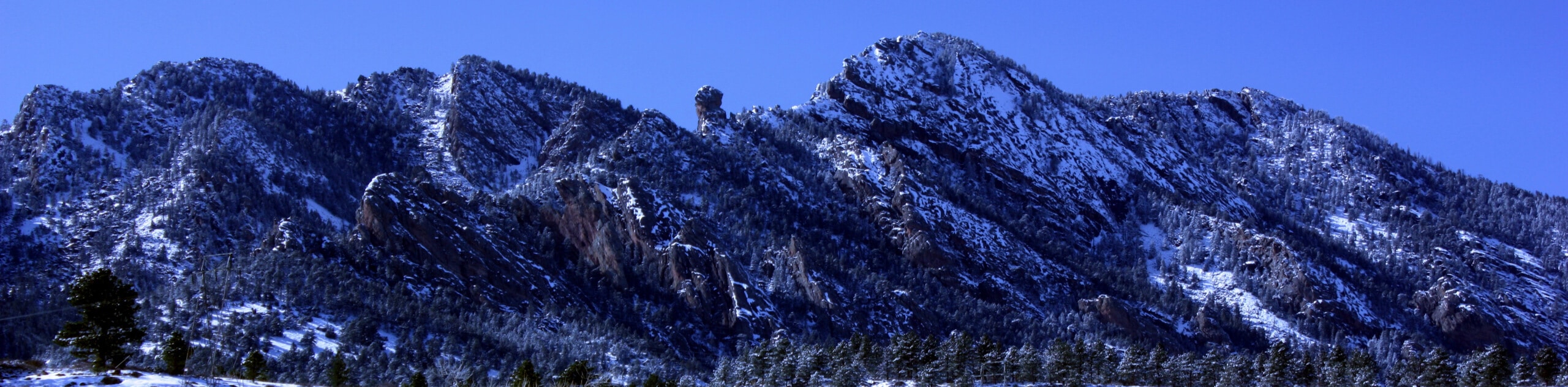
The Boulder Mesa Loop Trail is a wonderful adventure for eager hikers seeking to explore the diversity of the flora and fauna in the area. Revel in the sights of the luxuriant meadows, the ponderosa pine forests, the Boulder cityscape, and the mountains looming above. When hiking this trail, we recommend wearing layers as the ever-changing terrain warrants ever-changing weather conditions. Additionally, when hiking in the late fall or winter months, it is recommended to wear microspikes or snowshoes.
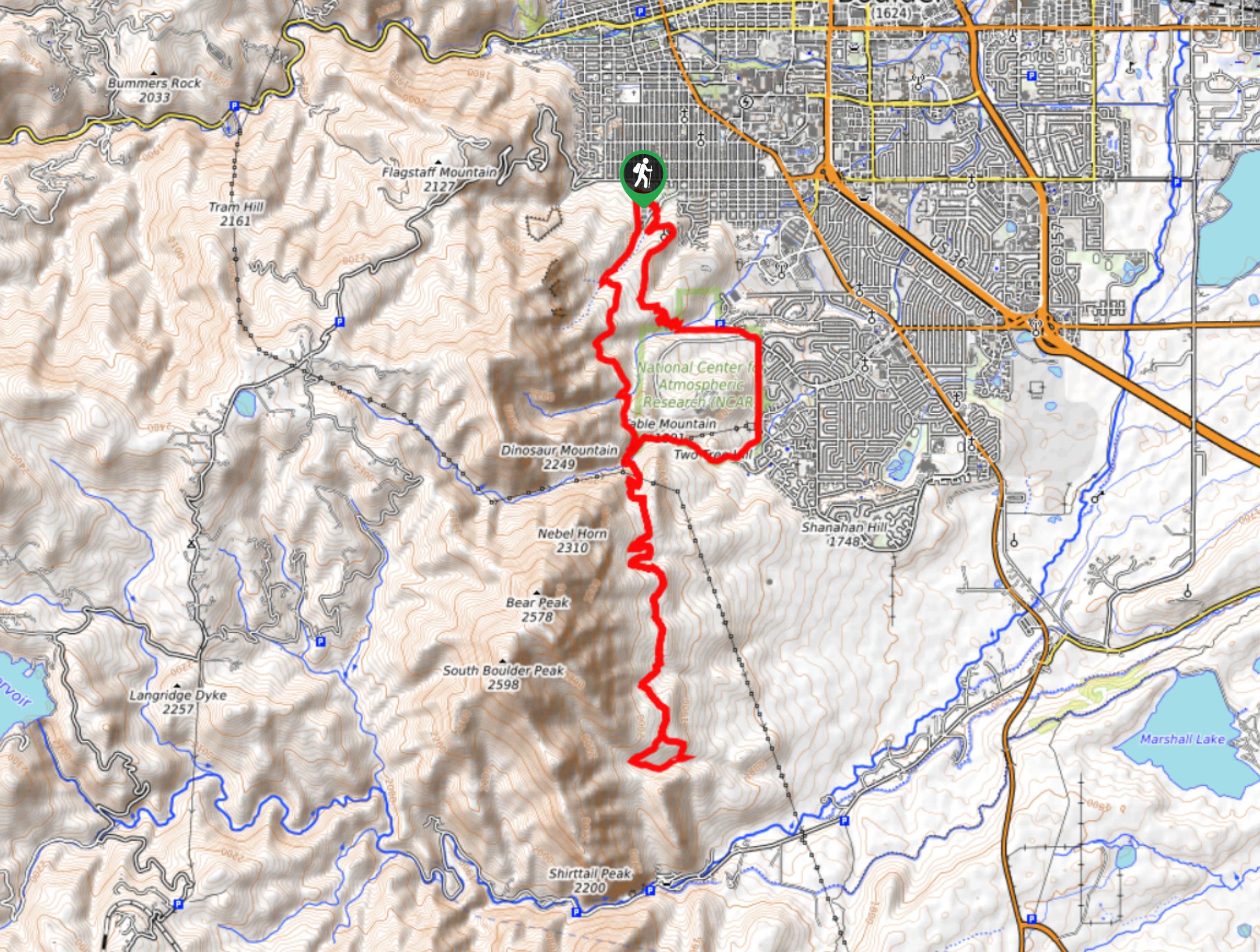
Embark on your adventure along the Boulder Mesa Loop Trail from the Bluebell Hiking Trailhead. From here, track south along the Bluebell Hiking Trail through the meadowlands. Eventually, you will encounter an intersection, keep left here and you will be diverted onto the Mesa Trail. Adventure along the Mesa Trail through the coverage of towering evergreens. Crossing over two creeks, you will merge onto the Shadow Canyon South Trail, which will loop around delivering you back to the Mesa Trail. Here, keep left and begin retracing your steps north along the Mesa Trail. Follow this path until you confront the junction with the Bear Canyon-NCAR Trail.
At this point, you will want to keep right onto the Bear Canyon-NCAR Trail, hiking east. Continue along this route to the trail’s end where you will converge with the NCAR-Table Mesa-Bear Trail. Track north, eventually connecting with the Skunk Canyon Service Road. At the next junction, hook onto the Skunk Canyon Spur Trail then onto the Enchanted Kohler Spur Trail. Now, take the Enchanted Mesa Trail all the way back to the Chautauqua Park, where you will hike north past the amphitheater and dining hall before turning left and tracking Clematis Drive back to the trailhead.
Similar hikes to the Boulder Mesa Loop Trail hike

NCAR to Fern Canyon Hike
The NCAR to Fern Canyon Hike is an awesome but challenging adventure up to the summit of Nebel Horn. Put…
Bear and South Boulder Peaks Loop
Looking for a demanding but rewarding hike near Boulder? We’ve got you covered. The Bear and South Boulder Peaks Hike…

Rattlesnake Gulch Trail
The Rattlesnake Gulch Trail is an epic adventure through the Eldorado Canyon State Park. Ascend the steep cliffs of Eldorado…
Comments