Shingle Creek and Dry Creek Loop Hike
View Photos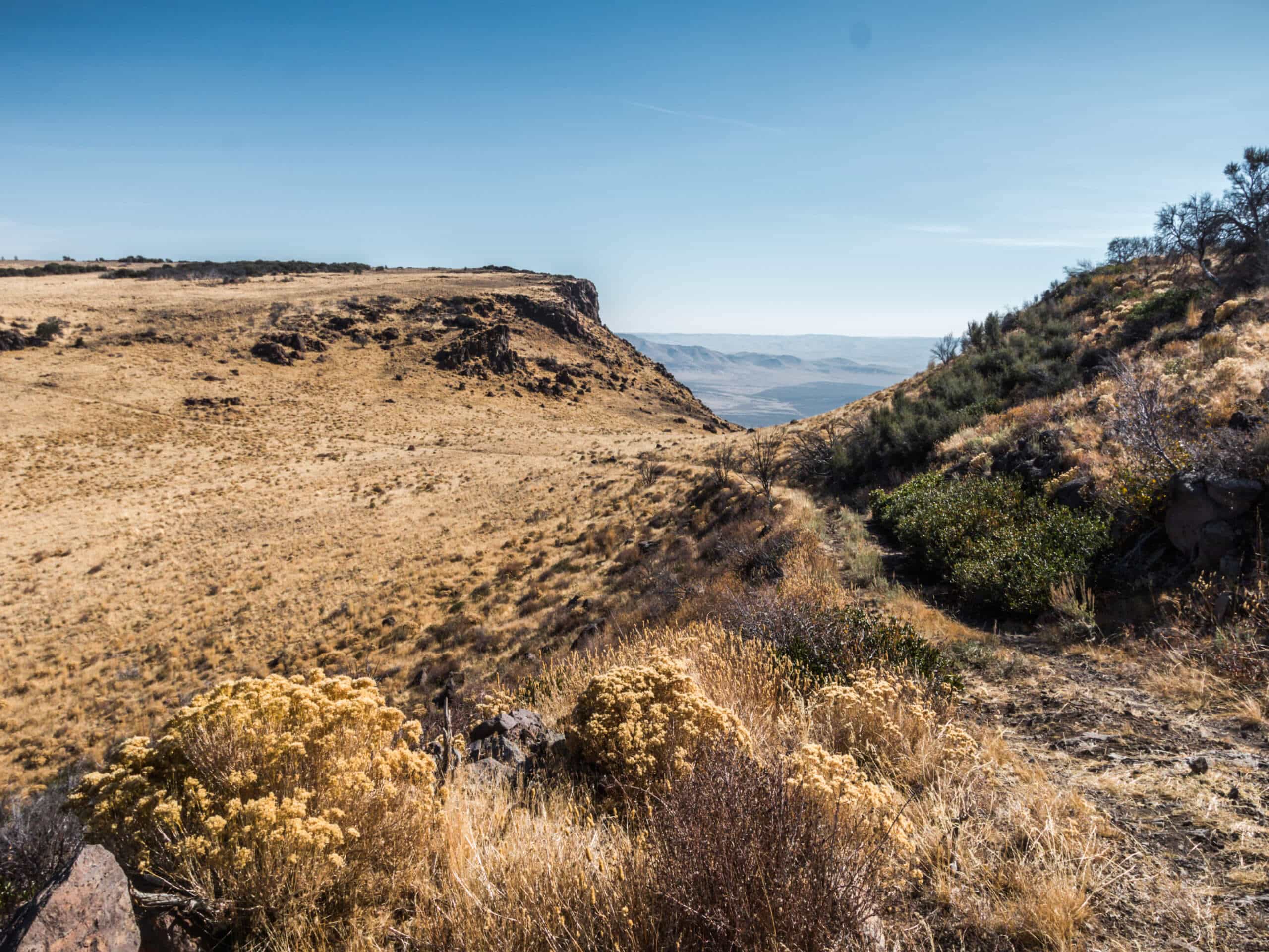
Shingle Creek and Dry Creek Loop Hike
Difficulty Rating:
The Single Creek and Dry Creek Loop Hike is a pleasant trail that explores Boise’s forested foothills. Contrary to its name, this adventure is anything but dry, instead, it demands several creek crossings—few of which are equipped with bridges. Exhibiting a variety of flora and fauna in addition to wonderful views of the forested mountains, this is one of, if not the best hike that the Boise National Forest has to offer.
Getting there
The Shingle Creek and Dry Creek Loop starts from the Dry Creek Trailhead off N Bogus Basin Road.

About
| Backcountry Campground | Backcountry Camping |
| When to do | Year-round |
| Pets allowed | Yes - On Leash |
| Family friendly | No |
| Route Signage | Good |
| Crowd Levels | Moderate |
| Route Type | Lollipop |
Shingle Creek and Dry Creek Loop Hike
Elevation Graph
Weather
Shingle Creek and Dry Creek Loop Hike Description
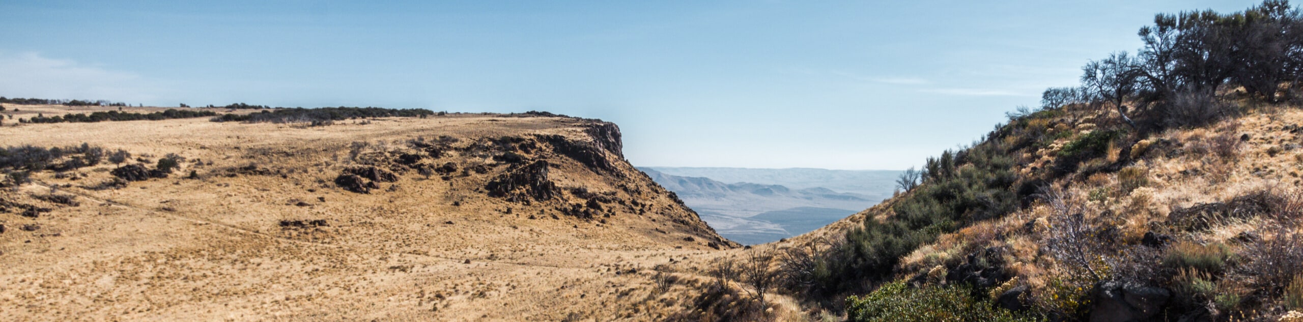
Explore Boise’s unspoiled wilderness along the Shingle Creek and Dry Creek Loop Hike. This epic expedition explores perennial streams in the Boise Foothills. While the trail is well maintained and well-signposted, the natural environmental shifts cause some inherent challenges. During peak run-off season, many of the flat-top log bridges are inundated, requiring hikers to ford the fast-moving creek. When doing so, take your time and use your judgment—if it’s too fast, turn around! Even in the summer and fall, you can expect to get your feet wet! Additionally, the terrain becomes quite muddy and precarious in spring and after rainfall, demanding careful footing. Note: those exploring in the winter months will likely need a pair of microspikes to safely navigate the slippery path.
Enjoy a peaceful adventure along the Shingle Creek and Dry Creek Loop. Boasting a pleasant experience, you will relish the opportunity to relax and unwind as you explore a diversity of landscapes, including sagebrush grasslands, stands of Douglas firs, ponderosa pines, and blossoming meadows that frame the streams. These lovely creeks are fed by the mountain springs near Bogus Basin. Oh, don’t miss out on the incredible hike by the name of Bogus Basin Loop Trail that is worthy of your exploration assuming time permits. Anyway, this topographical variation attracts plenty of wildlife, including deer, foxes, coyotes, and waterfowl. This beautiful but challenging day hike is an incredible expedition, and we cannot recommend it enough.
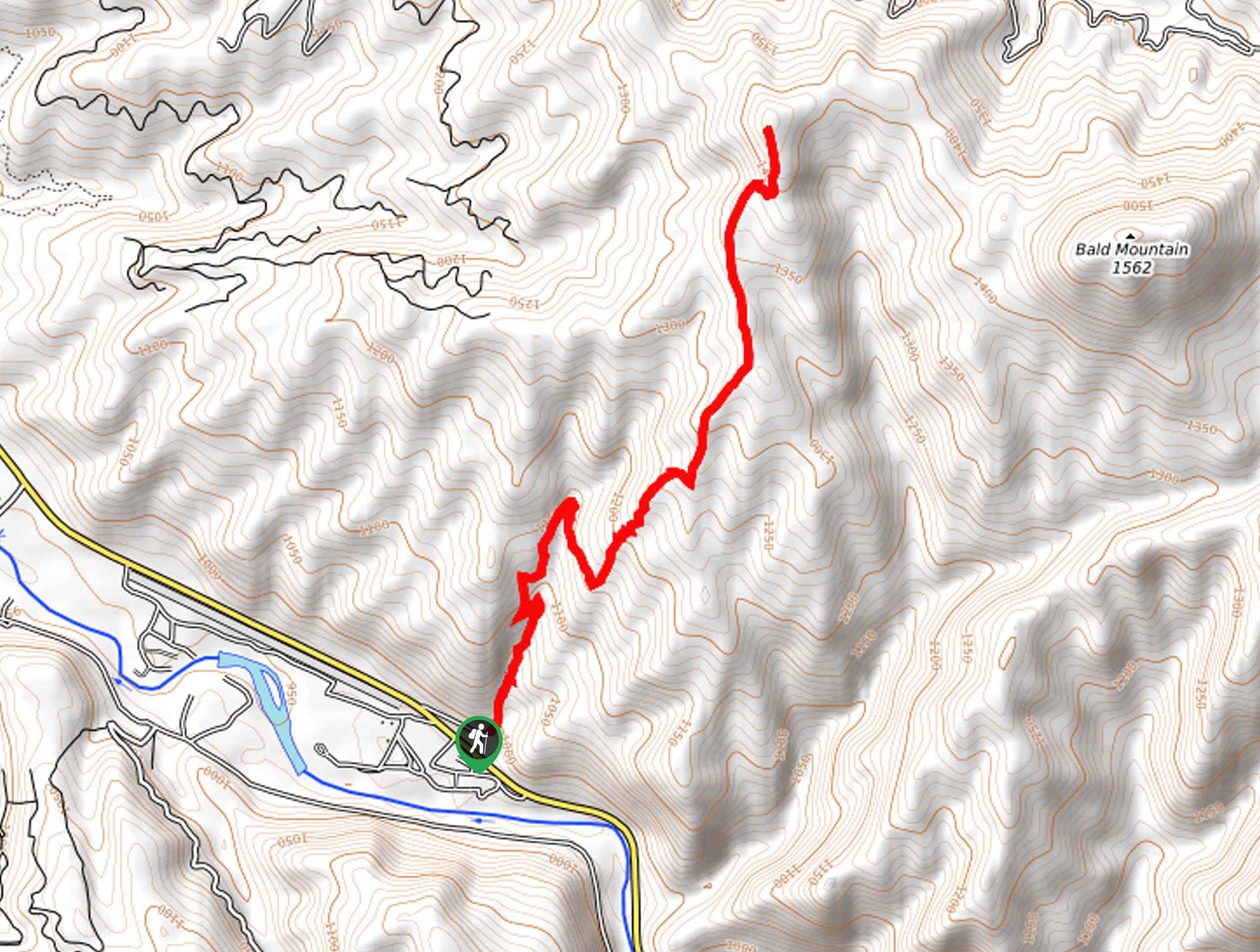
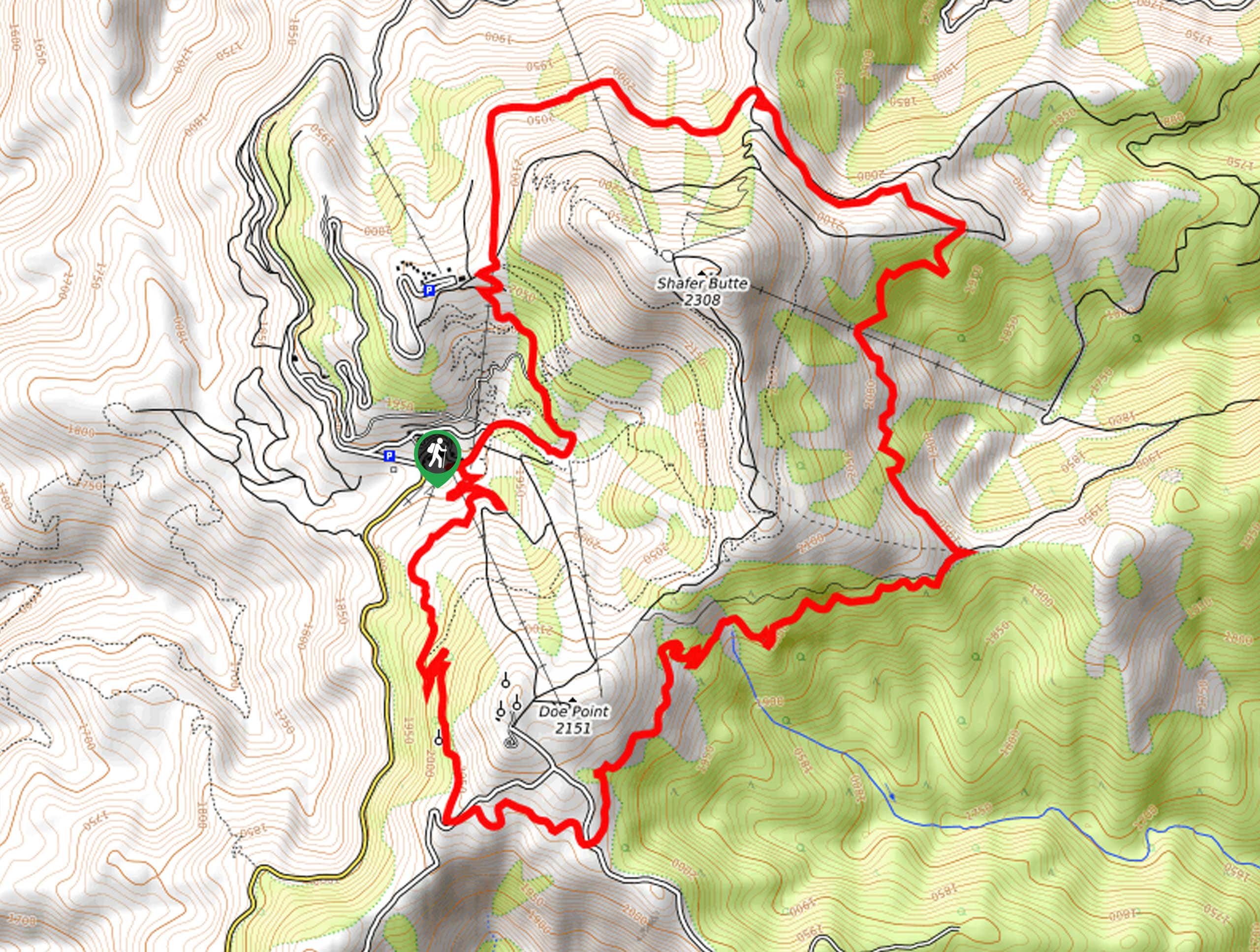
Embark on your journey along the Shingle Creek and Dry Creek Loop from the trailhead off N Bogus Basin Road. Setting out from here, the Dry Creek Trail tracks eastward into the preserved creek canyon. Not long after your departure from the trailhead will the path cross the footbridge over the southern side of the stream. Traveling through exposed grasslands and tree stands, the route will ultimately reach a fork in the road at the convergence of Dry Creek and Shingle Creek. Here veer right, and you will be diverted onto the Shingle Creek Trail.
This route tracks eastwardly up the drainage, alternating through green groves and meadows blossoming with arrowleaf balsamroot and lupines. Intersecting with the stream on several occasions, you will contour the ridges that are loose and uneven in section—so we advise you to take your time and mind your footing. Eventually, the path will divert away from the creek and up the wooded ridge. Using the trail GPS or your judgment, you will be directed up and over the ridge and down the sunny hillsides that offer great views of the surrounding foothills.
After some hiking, you will be delivered into the Dry Creek Canyon. Here, the westbound trail crosses the log bridge over to the north side of the creek, progressing through dense communities of sagebrush interspersed with vibrant wildflowers and numerous backcountry campsites. Enjoy the sounds of the babbling water flowing over incredible beaver dams. The further you travel west, the more barren the landscape will become. Ultimately, you will reach the bridge at the convergence of the perennial creeks. Beyond this point, you will retrace your footing along the Dry Creek Trail back to the trailhead, marking the end of your awesome adventure.
Frequently Asked Questions
How long is the Shingle Creek and Dry Creek Loop?
The Shingle Creek and Dry Creek Loop is a 13.8mi lollipop hike.
Is the Shingle Creek and Dry Creek Loop muddy?
The Shingle Creek and Dry Creek Loop is muddy at times, notably in the spring after rainfall during peak run-off season.
Insider Hints
Bring bug repellent, the mosquitos are relentless
Come prepared to balance on logs and get your feet wet
Sheep migrate down the Dry Creek Trail twice a year
Pack water or a water filter to stay hydrated
If you take your dog off leash make sure they are under strict voice command
Be mindful of your footing when fording the creeks or crossing the flat-top log bridges
Hike in the spring for a wildflower display
If you are hoping to hike in the winter months
Similar hikes to the Shingle Creek and Dry Creek Loop Hike hike
Station Creek Trail
The Station Creek Trail is a hidden treasure in the Boise National Forest. This lovely path explores shaded pine forests…
Around the Mountain Hike
Enjoy a different perspective of Bogus Basin along the Around the Mountain Hike. What is a bustling ski resort in…

Kepros Mountain Trail
The Kepros Mountain Trail ascends one of Boise’s famed ‘Grand Slam Peaks’. Tempting experienced hikers and ambitious beginners, this demanding…
Comments