
Freddy’s Stack Rock Trail
View Photos
Freddy’s Stack Rock Trail
Difficulty Rating:
Hiking the Freddy’s Stack Rock Trail explores the forested flanks of Boise Ridge. Leading through corridors of ponderosa pines and communities of sagebrush, this pleasant path opens to the incredible Stack Rocks that rise from the landscape, offering expansive views of Treasure Valley.
Getting there
The Freddy’s Stack Rock Hike departs from the Stack Rock Trailhead off N Bogus Basin Road.

About
| Backcountry Campground | No |
| When to do | Year-round |
| Pets allowed | Yes - On Leash |
| Family friendly | Older Children only |
| Route Signage | Good |
| Crowd Levels | High |
| Route Type | Lollipop |
Freddy’s Stack Rock Trail
Elevation Graph
Weather
Freddy’s Stack Rock Trail Description
The Freddy’s Rock Stack Rock Trail is a lovely adventure in the Boise National Forest that accommodates mountain bikers and hikers alike. There is no shortage of scenery and stimulation to explore a diversity of environments and exhibit a diversity of flora and fauna. There is no doubt that the beautiful setting attracts an abundance of outdoor enthusiasts, no matter the season, so expect company. Those seeking a more tranquil experience are encouraged to explore in the mornings or evenings to avoid the rush or in the off-season. Note that climbing the rocks is at your own risk, and those daring enough to ascend must exercise caution—and make sure you can just as easily get back down!
This enjoyable trail is a staple when visiting the Boise area. Full of wonderment, wonderful views, and wildflowers, the Freddy’s Stack Rock Hike is hard to beat. Ideal for intermediate hikers and families with older children, you will get your heart rate up but won’t be left exhausted. One of the few routes that offer year-round adventure opportunities, the fall is certainly our choice season. The autumn presents cool, crisp air, less traffic, and mesmerizing views of the changing foliage that blankets the Boise Mountain foothills. Contrarily, spring and summer exploration warrants blossoming meadows, lush vegetation, and warm conditions. Note those who explore in the winter will need microspikes or, better yet, snowshoes to navigate the snow-packed path. No matter the season, Freddy’s Stack Rock Trail will not disappoint.
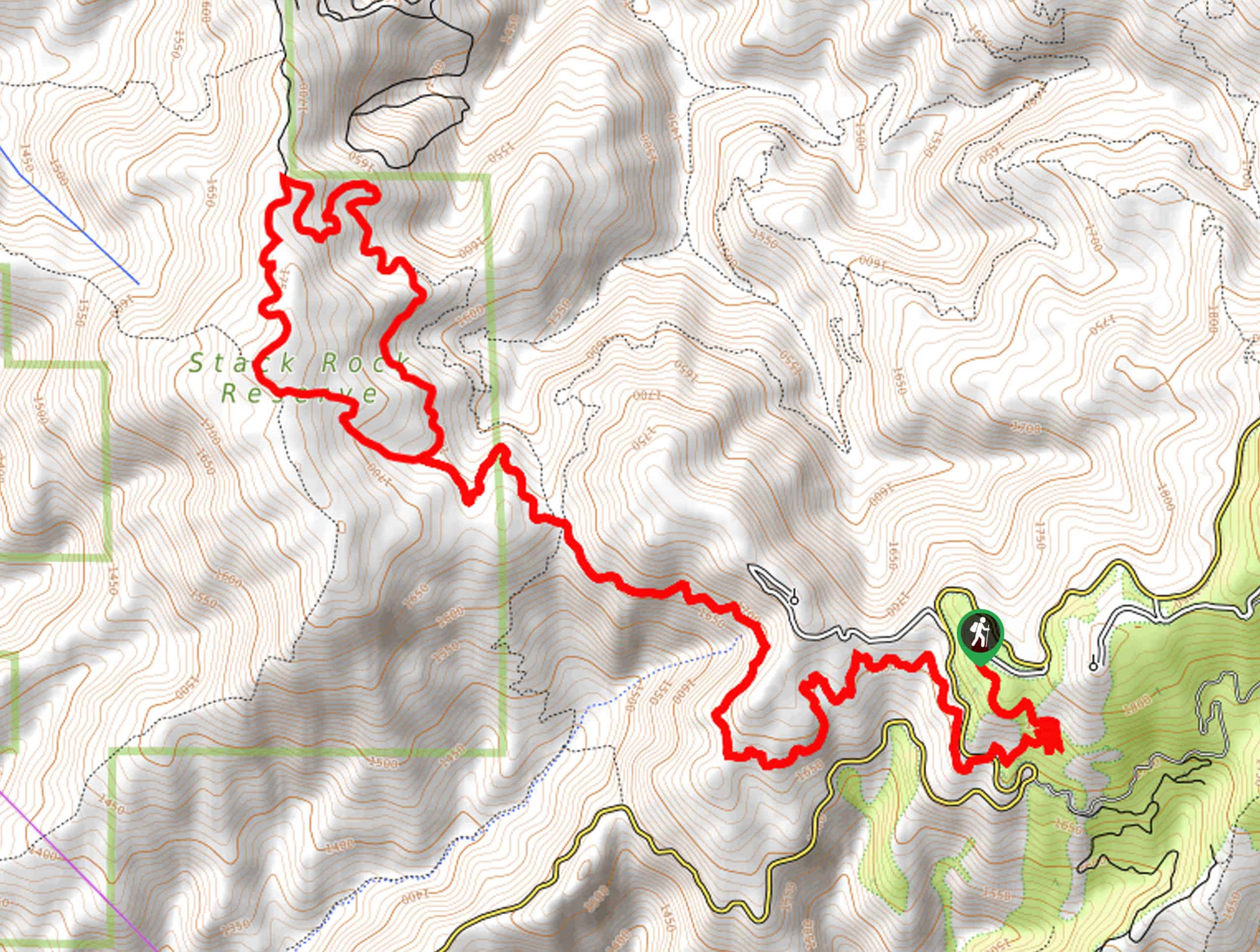
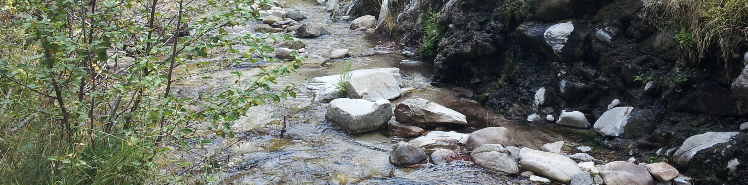
Embark on your adventure along the Freddy’s Stack Rock Hike from the parking lot and trailhead off N Bogus Basin Road. Setting out from here, the Stack Rock Connector Trail drops steeply from the parking lot before crossing over to the west side of the road. From here, the path gently descends, contouring a ridge, winding through the shade of ponderosa pines and exposed meadows of wild brush. From here, the view in the west includes sights of the famed rocks rising above the treeline, and the surrounding mountains are quite scenic. Traveling above Daniels Creek, you will likely notice hikers and bikers venturing the Sweet Connie Trail below.
After some hiking, you will reach an intersection with the Sweet Connie Trail, Mr. Big Trail, and the Upper Stack Rock Trail. Here, take the leftmost Upper Stack Rock Trail beneath the pine tree canopy. Wandering west, you will be granted views of charming wildflowers and lush undergrowth carpeting the forest floor. Soon you will confront a fork in the road; while you can head in either direction, we kept right, saving the best for last. This segment of the hike will gently undulate behind the rocks before gently climbing up to another junction.
Veer left, and the forested will open to the impressive granite outcrop that looms above the treeline. Climb up the ridges of the spire, ascending higher to take in even better views. The vistas from atop the Stack Rock are truly breathtaking, offering astounding views of Horseshoe Bend, the Boise Mountain foothills, Treasure Valley, and beyond. Snap a few photos, then continue your adventure, completing the circuit. Back at the intersection with the Sweet Connie Trail and Mr. Big, you will reconnect with Freddy’s Stack Rock Connector Trail, which will guide you all the way back to the trailhead and parking lot.
Don’t think this trail is your cup of tea? Check out some of Boise National Forest’s greatest hikes.
Frequently Asked Questions
How long is Freddy’s Stack Rock Hike in Boise?
The Freddy’s Stack Rock Trail is an 11.7mi lollipop hike above Boise.
How tall is Freddy’s Stack Rock?
Freddy’s Stack Rock stands at an elevation of 5895ft.
Insider Hints
Bring your camera, the scenery is quite photogenic
If you hope to climb Stack Rock, make sure you can safely get back down
Wear a sturdy pair of footwear to safely navigate the rocky segments of the track
Be mindful of mountain bikers passing by
Keep half an eye out for snakes as you wander
Wear microspikes when exploring in the winter months
Note the terrain becomes unstable with mud in the spring and after rainfall
Similar hikes to the Freddy’s Stack Rock Trail hike
Moondipper Hot Spring and Pine Burl Hot Spring Hike
The Moondipper Hot Spring and Pine Burl Hot Spring Hike is a family-friendly adventure beckoning your exploration. Wander along the…
Station Creek Trail
The Station Creek Trail is a hidden treasure in the Boise National Forest. This lovely path explores shaded pine forests…
Around the Mountain Hike
Enjoy a different perspective of Bogus Basin along the Around the Mountain Hike. What is a bustling ski resort in…
Comments