
Smith Rock's Misery Ridge Loop hike
View Photos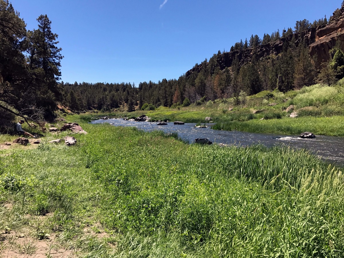
Smith Rock's Misery Ridge Loop hike
Difficulty Rating:
The most popular hike in Smith Rock State Park, the Misery Ridge Trail takes hikers and sightseers to one of the highest points in the park with incredible views. It’s easy to see why this walk is so popular.
Getting there
Head north from Bend along US-97 for 24.0mi. At Terrebonne, turn right onto Smith Rock Way, following signs for Smith Rock State Park. Turn left onto Lambert Road and follow this for 2.0mi, before turning left onto Crooked River Drive. Park near the visitor center.

About
| When to do | Year Round |
| Backcountry Campsites | None |
| Toilets | At trailhead |
| Family friendly | No |
| Route Signage | Average |
| Crowd Levels | High |
| Route Type | Circuit |
Smith Rock's Misery Ridge Loop
Elevation Graph
Weather
Route Description for Smith Rock's Misery Ridge Loop
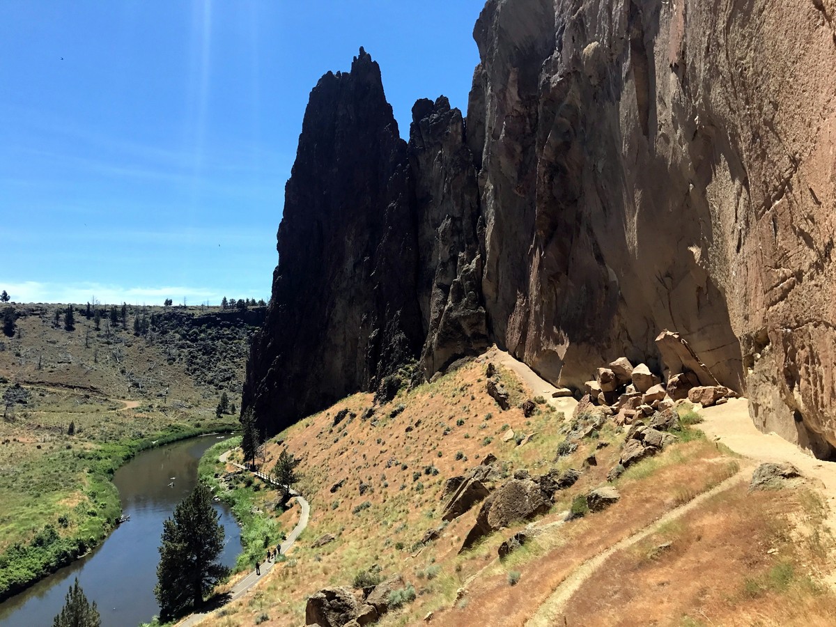
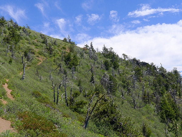
From the Visitor Center, descend to and then cross over the Crooked River. Directly across the bridge will be the Misery Ridge Trail. Start on this trail and begin the challenging, switch-backing climb up to Misery Ridge.
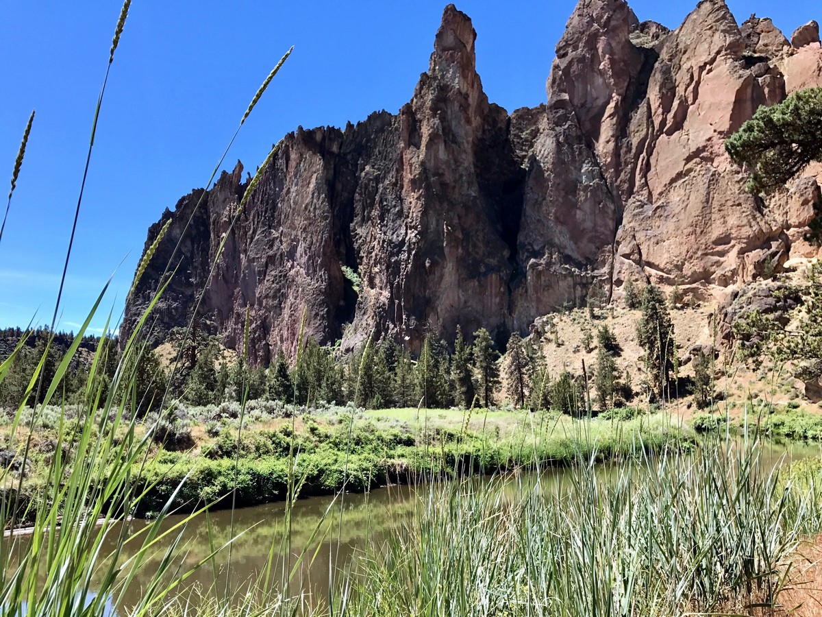
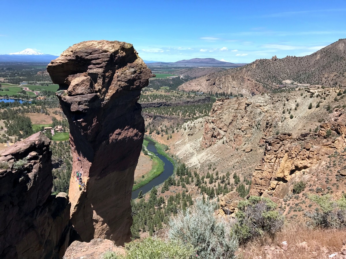
As you switchback you will soon arrive at Red Wall, a popular place for avid climbers. Peer upwards and see them ascending the incredibly steep face, holding onto the tiniest of holds as they struggle upwards.
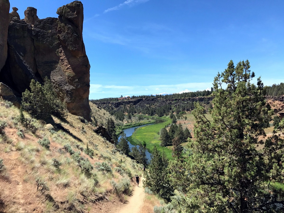
As you continue switch backing you will veer right, then proceed up a narrow gulch. After a few more switchbacks, you will soon begin to veer left again and crest the ridge. Looking west from the summit you will be able to see the Three Sisters, and north along the skyline Mount Jefferson.
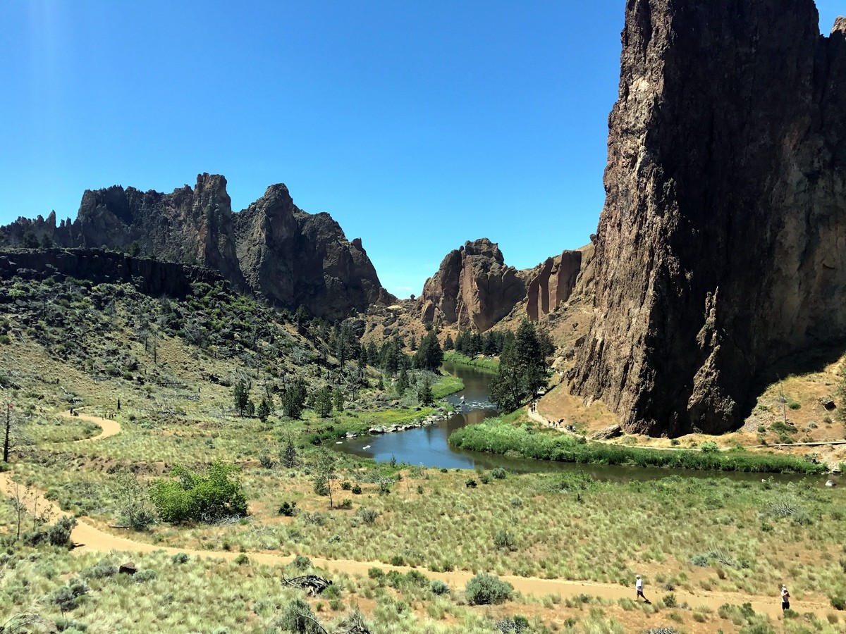
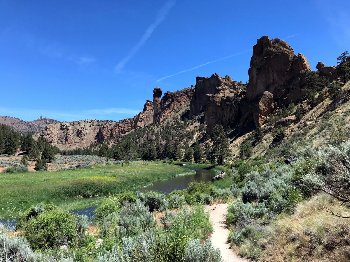
Take a moment to soak in the incredible views before you continue along the trail, descending the northwest side of the ridge. The trail will pass just underneath Monkey Face, an incredibly popular and scenic climbing rock. Soon you will reach a junction, where you will turn left to continue descending down the Mesa Verde Trail.
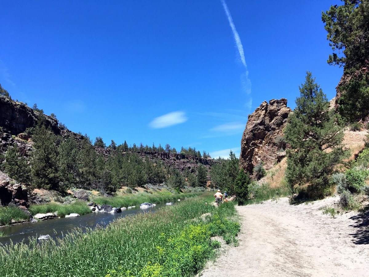
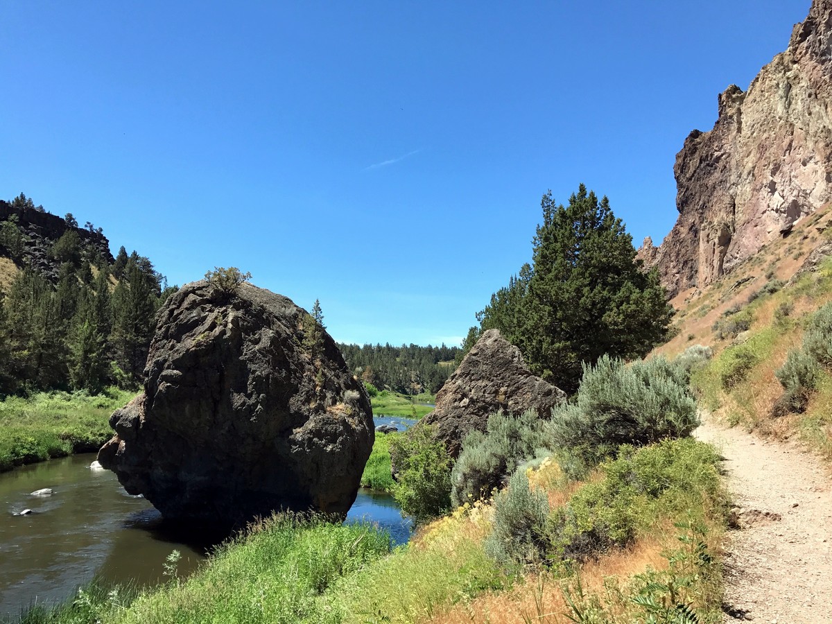
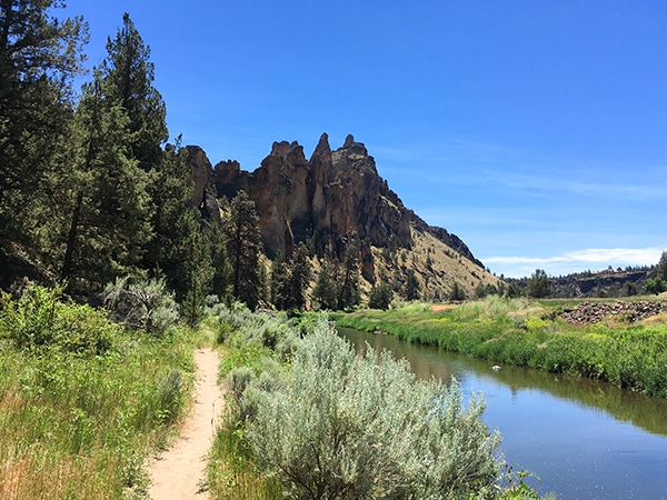
After travelling beside the cliffs, the trail will continue all the way down to the river. From here you will follow the River Trail as it winds along beside the impressive Crooked River. This path winds all the way around the southern tip of Smith Rock before turning north and returning to the bridge. Turn right here and return to the visitor center.
Would you like to try a similar level hike around Bend? Check out the Tumalo Falls.
Insider Hints
Smith Rock can get unbearably hot in the summer and this hike offers little shade. Come in the early morning if you complete this hike anytime from June to September.
Don't forget to get a parking pass, as day visitors are required to get a permit.

Similar hikes to the Smith Rock's Misery Ridge Loop hike
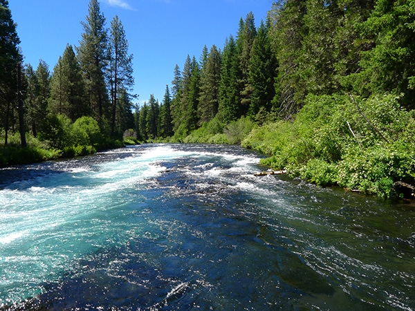
West Metolius River
It’s a postcard-perfect river walk: simple as that. The Metolius River is unbelievably beautiful and the easy hike along its…
Smith Rock’s Summit Trail Loop
Hiking around the stunning Smith Rock State Park is popular for a reason! This wonderful trek near Bend circumnavigates the…
Black Butte
The trek up to Black Butte is a classic hike near Bend. The views from the top are nothing short…
Sally S. Norbert 4 years ago
This place was unbelievable. What a great place!
HIllaryPNW 4 years ago
Incredible views. No wonder why it's popular.
VictoriaMD. 4 years ago
An amazing place to see and visit. Bring lots of water on this hike. The trails were well-maintained, and there were places to stop along the way.
sweethomealana 5 years ago
Awesome place with lots of trails to explore. Spent lots of time exploring and taking in the beauty.
southoftheborder 5 years ago
There were several trails of varying difficulty. The one along the river was quite scenic and not too difficult.
Eliza Bustamante 5 years ago
Awesome hike. It was pretty crowded. Bring a camera, proper hiking shoes, lots of water and snacks.
Emma Paxton 5 years ago
The area was surrounded by the crowd. Still a wonderful place, but some things can be improved.
Stewart M. 5 years ago
I was particularly astonished by the unique terrain. There were some challenges along the way, but it was truly a great experience.
Cisco K. 5 years ago
The uphill ascent was a bit tough but doable. The scenic views were marvelous. Glad I had my go pro with me.
Tom Tom 5 years ago
Amazing views from the top!