
Black Butte hike
View Photos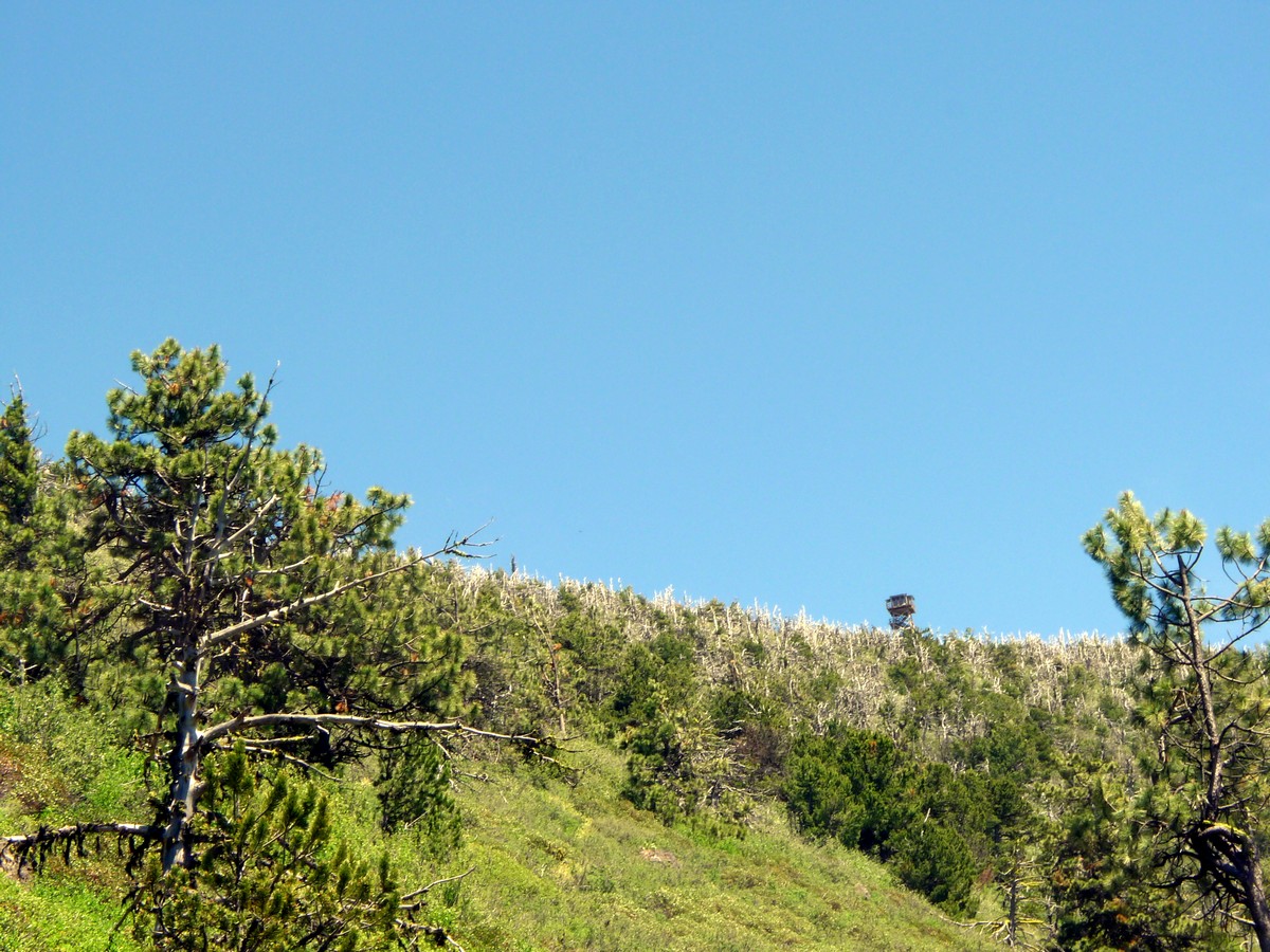
Black Butte hike
Difficulty Rating:
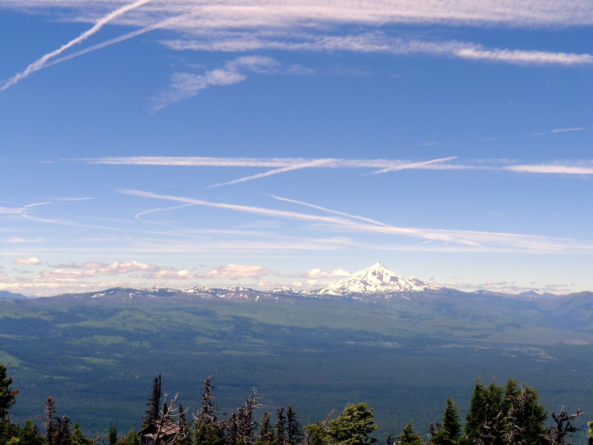
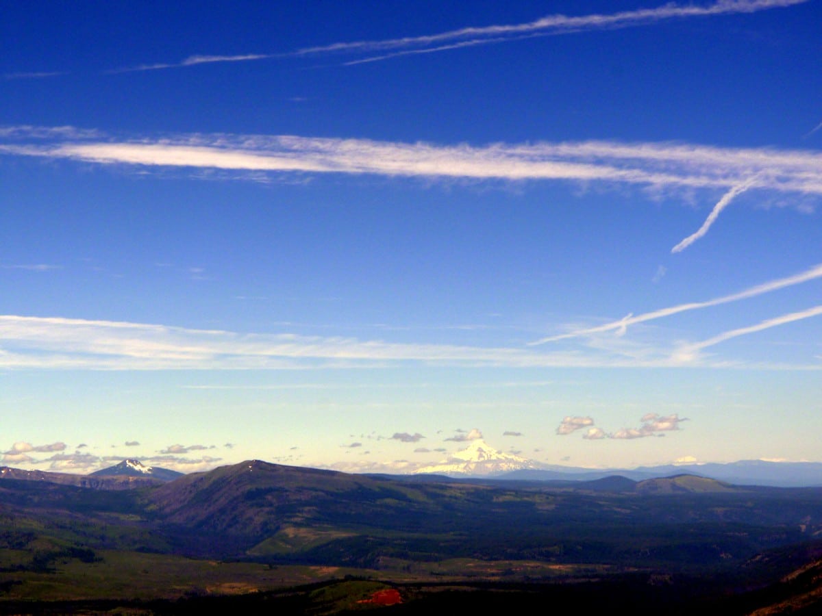
The trek up to Black Butte is a classic hike near Bend. The views from the top are nothing short of spectacular, well worth the walk. On a clear day you can see all the way to Mt. Hood.
Getting there
From Bend head north along US-97 for a short ways before turning onto US-20 west toward Sisters. Drive past Sisters, turning right onto the road signed Green Ridge Road. If you pass Black Butte Ranch, you’ve gone too far. Continue along this road (Sundown Rd) for just under 4.0mi, then turn left onto Black Butte Road and follow the signs to the Black Butte Trailhead.

About
| When to do | Not in winter |
| Backcountry Campsites | No |
| Toilets | At trailhead |
| Family friendly | No |
| Route Signage | Average |
| Crowd Levels | Moderate |
| Route Type | Out and back |
Black Butte
Elevation Graph
Weather
Route Description for Black Butte
Getting to this hike can be challenging as the road turns to dirt and slowly deteriorates as you get closer to the parking area at the Trailhead. It is still passable by most sedans however.
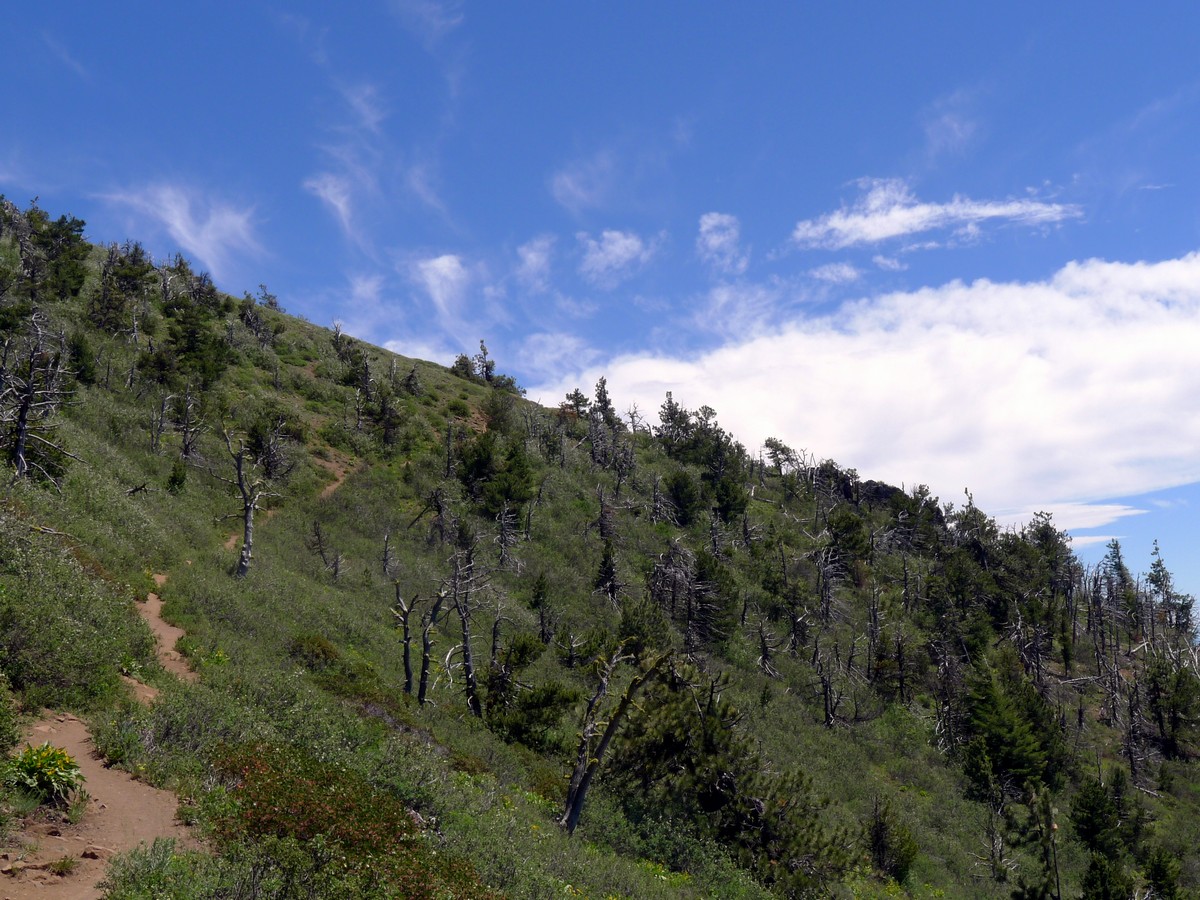
This hike consists of two massive switchbacks leading to Black Butte. First you will head to your left and start ascending the moderately graded trail through the dense forest. This trail is wide and in extremely good condition. After approximately one-third of the hike, you will switch back and start heading to the right.
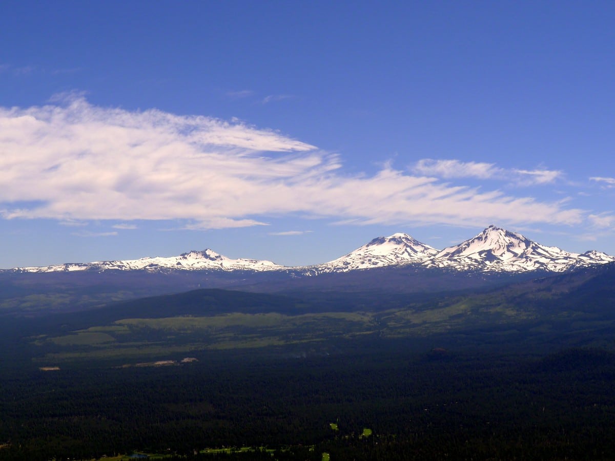
Soon you will exit the forest and have your first view of the Three Sisters and the smaller Broken Top. These mountains are truly stunning, coming out of nowhere, jutting into the sky. The views get better as you continue climbing!
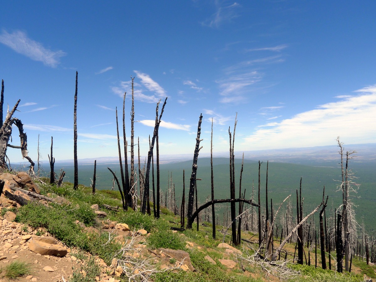
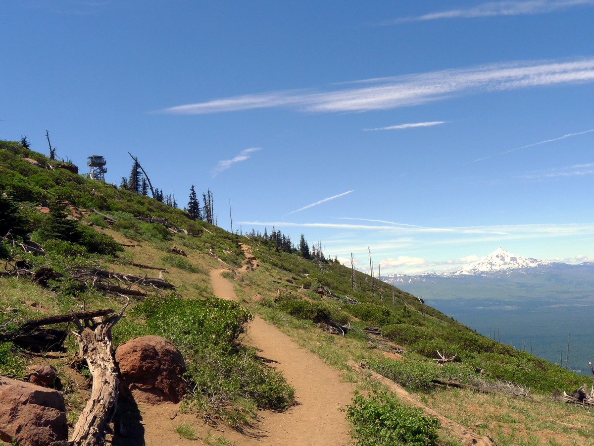
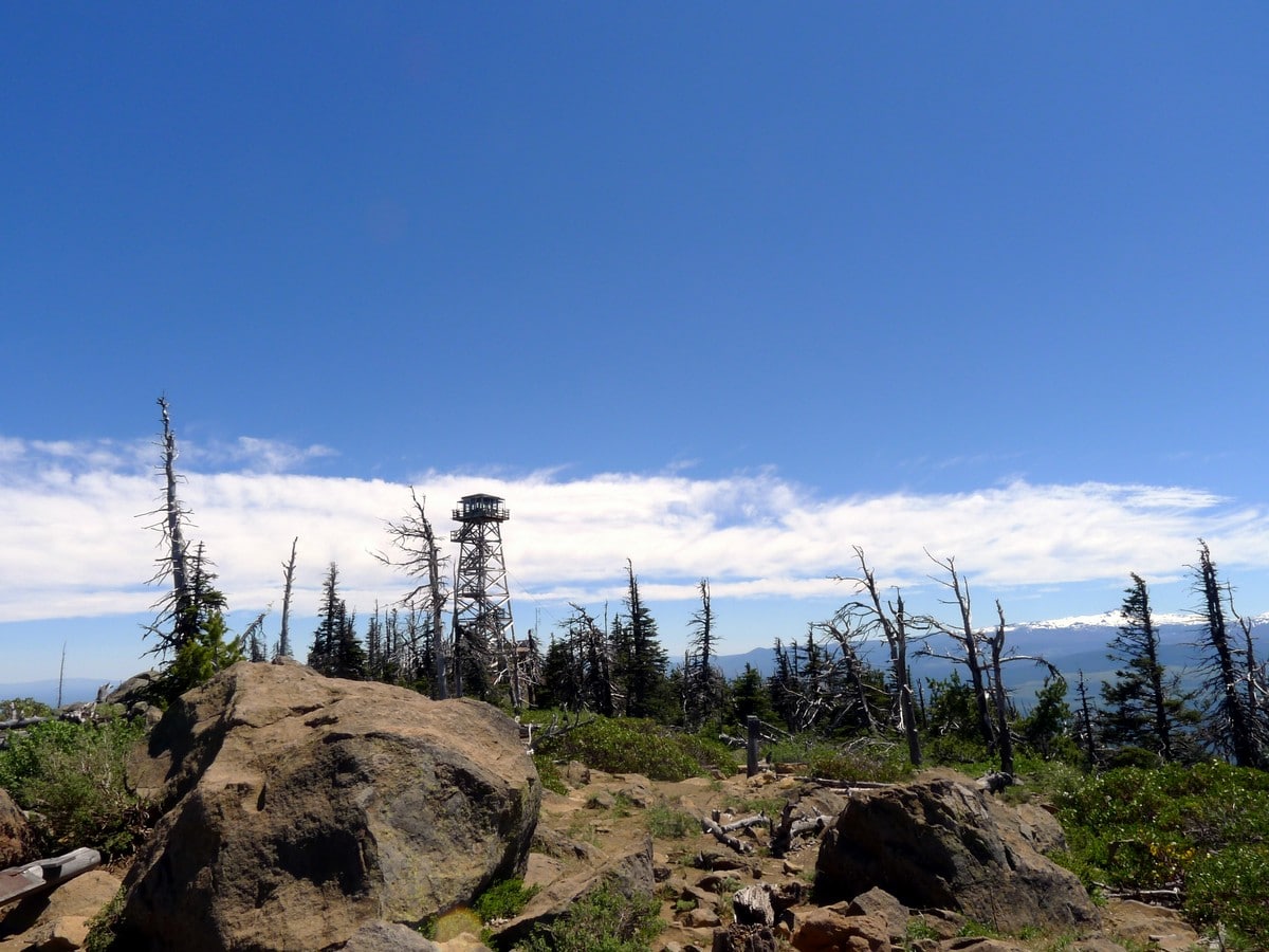
The trail will start to wind around the east side of Black Butte, going all the way around to the north aspect. After traversing a burnt-out section of forest you will crest the summit of this knoll. There is a forest fire lookout at the very top, which is regularly occupied by Forest Service employees.
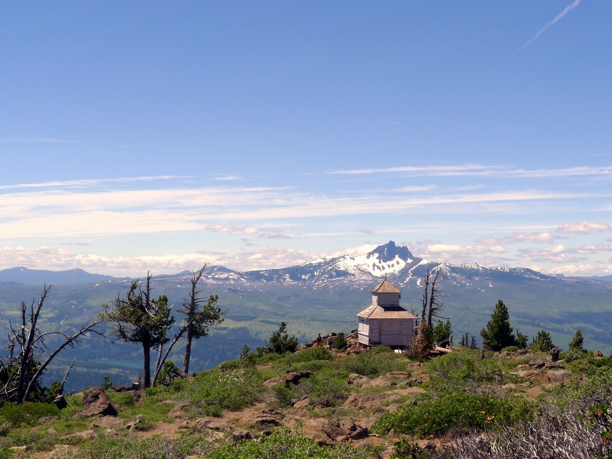
There was once a one-room log cabin near the top, for fire lookouts to sleep in, however the Forest Service burned it because it was getting old and decrepit. There remains a cupola-style building at the summit, though it is boarded up. Also, there are many signs that have information about the history of the lookout, and the mountains nearby.
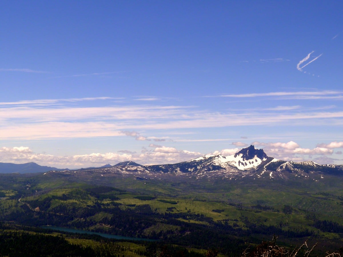
From left to right you’ll be able to see Broken Top, the Three Sisters, Mt Washington, the Three Fingered Jack and Mt Jefferson. On a clear day you will also be able to see Mt. Hood in the distance!
Return to your car the way you came.
Would you like to try an easier hike around Bend? Check out the Tumalo Falls.
Insider Hints
If you’re hiking with school-age kids, this hike will feel like an awesome challenge. They will love the feeling of summiting something!
A day fee is required to park at the trailhead, which can be paid at the trailhead. If you have a National Parks pass, however, display that on your dash and you can park for free.

Similar hikes to the Black Butte hike
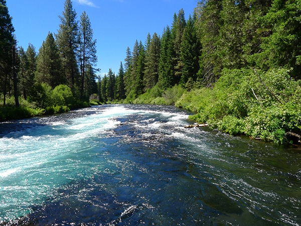
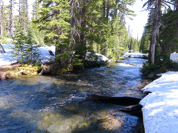
West Metolius River
It’s a postcard-perfect river walk: simple as that. The Metolius River is unbelievably beautiful and the easy hike along its…
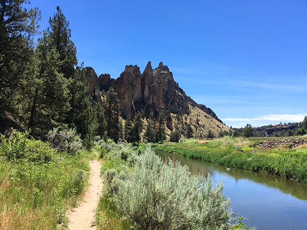
Smith Rock’s Summit Trail Loop
Hiking around the stunning Smith Rock State Park is popular for a reason! This wonderful trek near Bend circumnavigates the…
Green Lakes
Arguably the most popular hike near Bend, the Green Lakes Trail walks you up Fall Creek to the namesake lakes…
Sally S. Norbert 4 years ago
This is definitely a beautiful trail with spectacular 360 views at the top the mountain.
Suzy TQ 4 years ago
What an incredible hike! Really makes you work for it. The trail is consistently uphill with a majority of it in the sun, so be sure to bring plenty of water.
HIllaryPNW 4 years ago
Awesome all around views of the mountain
VictoriaMD. 5 years ago
It was a challenging hike but there are great views at the end. Trail is steep but it is in great shape. A great hike for any avid or amateur hiker.
Aurelio Mendez 5 years ago
Outstanding, moderate hike! It has very gradual inclines that have the most beautiful landscapes.
Peter Snook 5 years ago
The road was a little rough, and it was hard to get in, but the views at the top were simply astounding. Memorable hiking experience.
Bill Parks 5 years ago
Nice hike, but kindly note that a day fee is required to park at the trailhead!
Cisco K. 5 years ago
I just can't get enough of the majestic scenery. There are lots of picture-perfect-spots.
BlueMountains 5 years ago
The Black Butte was a bit of a mess to get to when I've done it. But that meant plenty of parking space. The hike does offer a lot of scenic views.
Annie Smith 5 years ago
Black Butte was a great hike and the views were fantastic - definitely recommend!