
Devil’s Lookout Trail
View Photos
Devil’s Lookout Trail
Difficulty Rating:
The Black Canyon of the Gunnison National Park has an exuberant amount of scenic outlooks. The Devil’s Lookout Trail provides a unique overlook of the Black Canyon and the Gunnison River from the cliff's edge. Adventure along this trail with kids and hikers of all skill levels for a picturesque view of the craggy canyon.
Getting there
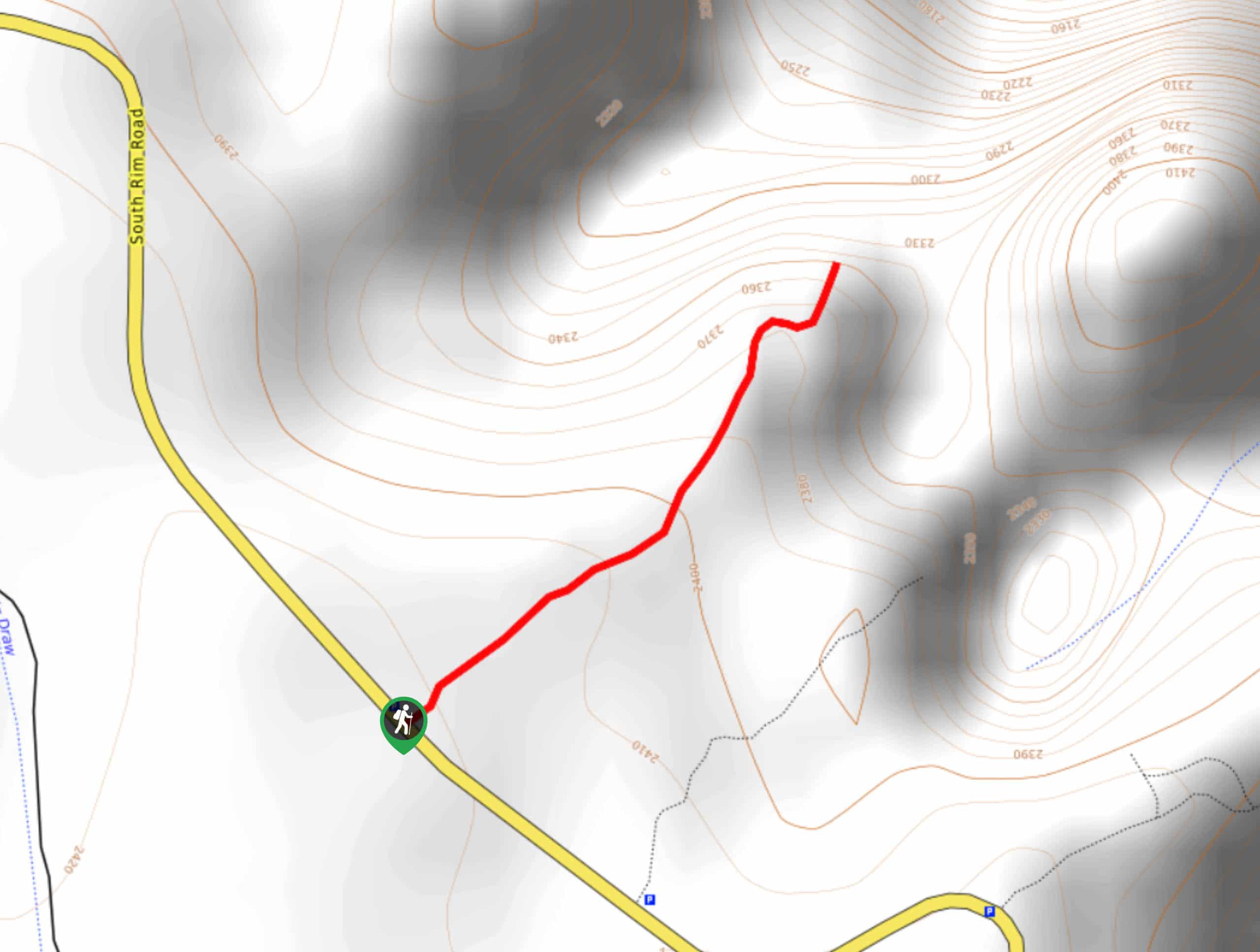
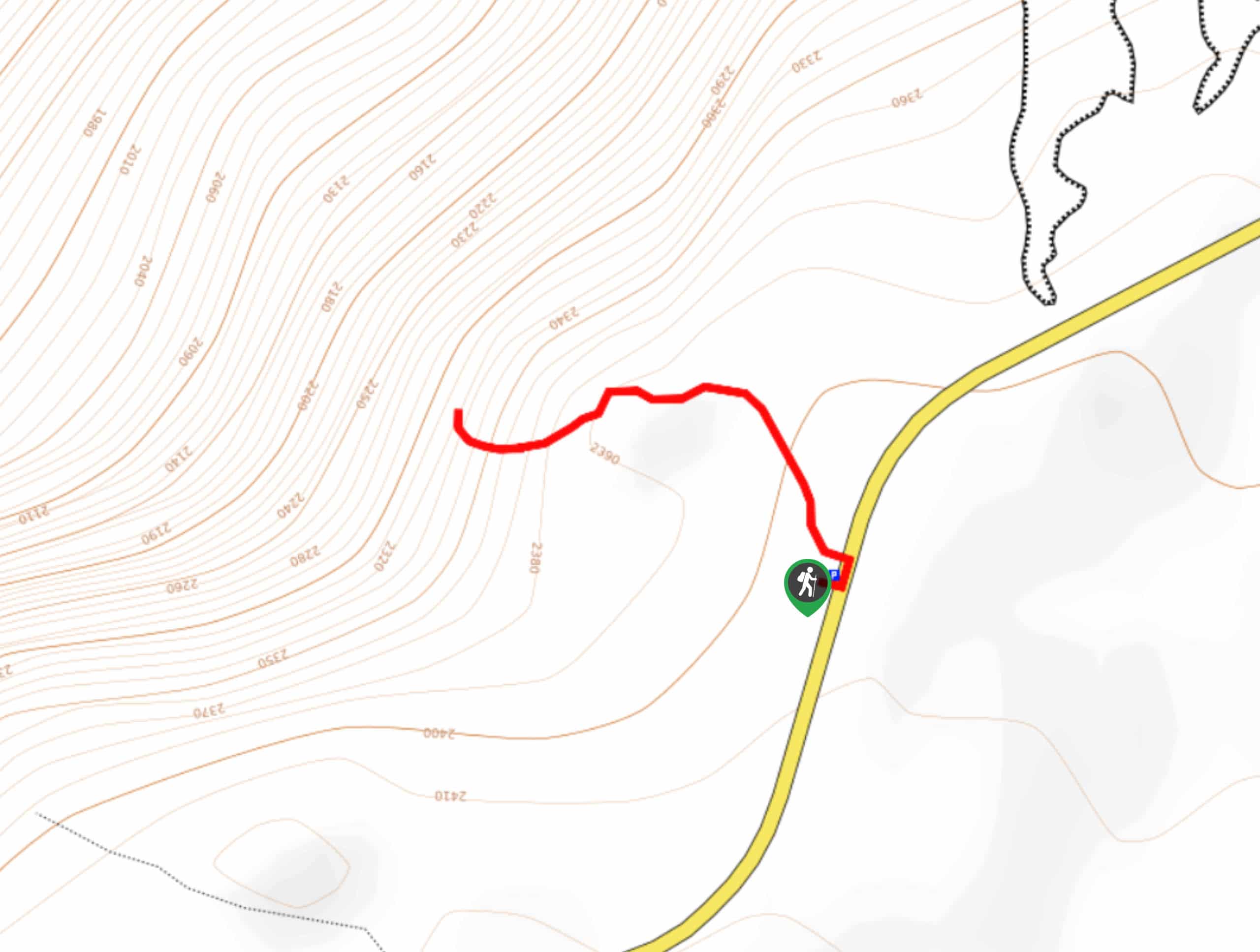
The Devil’s Lookout Trail is off of the South Rim Road in the Black Canyon of the Gunnison National Park. Passes are required and can be purchased at the Park’s entrance.

About
| Backcountry Campground | No |
| When to do | April-November |
| Pets allowed | No |
| Family friendly | Yes |
| Route Signage | Average |
| Crowd Levels | Moderate |
| Route Type | Out and back |
Devil’s Lookout Trail
Elevation Graph
Weather
Devil’s Lookout Trail Description
If you are searching for a quick trail to an impressive overlook, then you have come to the right place. The Devil’s Lookout Trail is quite literally on the edge of the Black Canyon cliffs. This short trail is well marked, and the terrain is easy, but do not fool around at the viewpoint. Guarded by a fence the lookout sits on the edge of the rocky ledge, so stay on the maintained trail at all times.
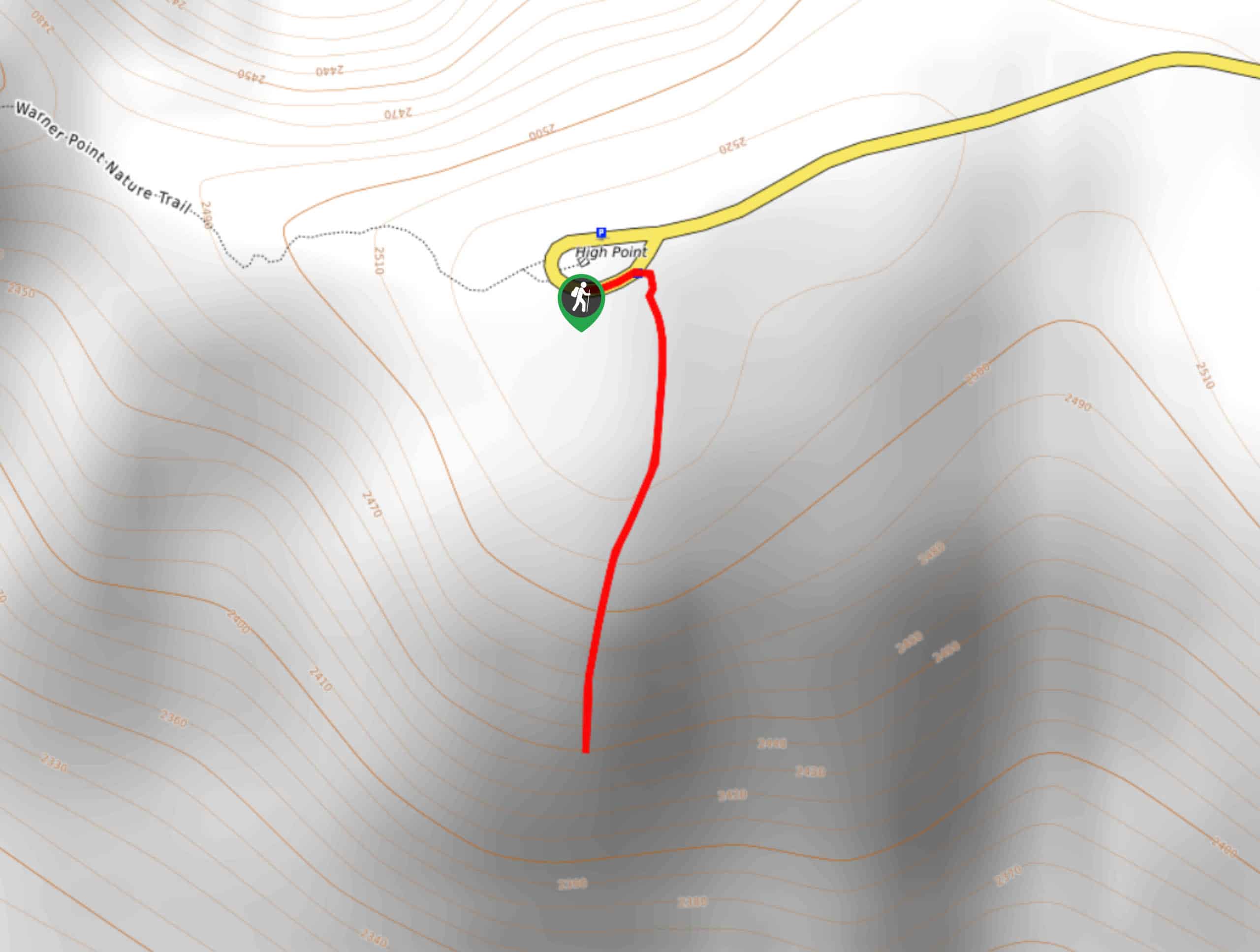
Begin this short walk from the Devil’s Lookout Parking Lot. From the lot head northeast on the Devil’s Lookout Trail. This path will guide you through a serviceberry and sagebrush field before culminating at the lookout. Bask in the unique perspective of the rugged cliffs and broken walls that hem the Gunnison River below.
Revel in the scenery before retracing your steps back to the parking lot.
Similar hikes to the Devil’s Lookout Trail hike
Oak Flat Loop Trail
The Oak Flat Loop is a great little hike in the Black Canyon of the Gunnison Wilderness. This loop will…
Cedar Point Nature Trail
Adventure the Cedar Point Nature Trail towards breathtaking views of the Painted Wall and surrounding steep walled cliffs. Positioned on…
High Point Trail
The High Point Trail is another breathtaking lookout in the Black Canyon of the Gunnison National Park. Walk along the…
Comments