
Angon Waterfall
View Photos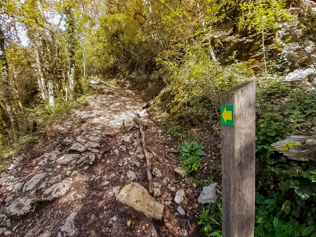

Angon Waterfall
Difficulty Rating:
This hike is packed with interesting stops — a vertiginous waterfall, a picturesque fairy bridge, breathtaking views over Lake Annecy, cultural sights and a possible dip in the lake to cool down at the end. The hike combines several popular tracks into one larger circuit that fits in as many of the local highlights as possible.
Getting there
Drive, take the bus, or cycle along the dedicated cycle path around the lake to Angon village. There is a car park at the entrance of this walk on Route des Vignes, which is accessible from either end of the small village.

About
| When to do | March - November |
| Backcountry Campsites | No |
| Toilets | No public toilets |
| Family friendly | Yes |
| Route Signage | Good |
| Crowd Levels | High |
| Route Type | Circuit |
Angon Waterfall
Elevation Graph
Weather
Route Description for Angon Waterfall
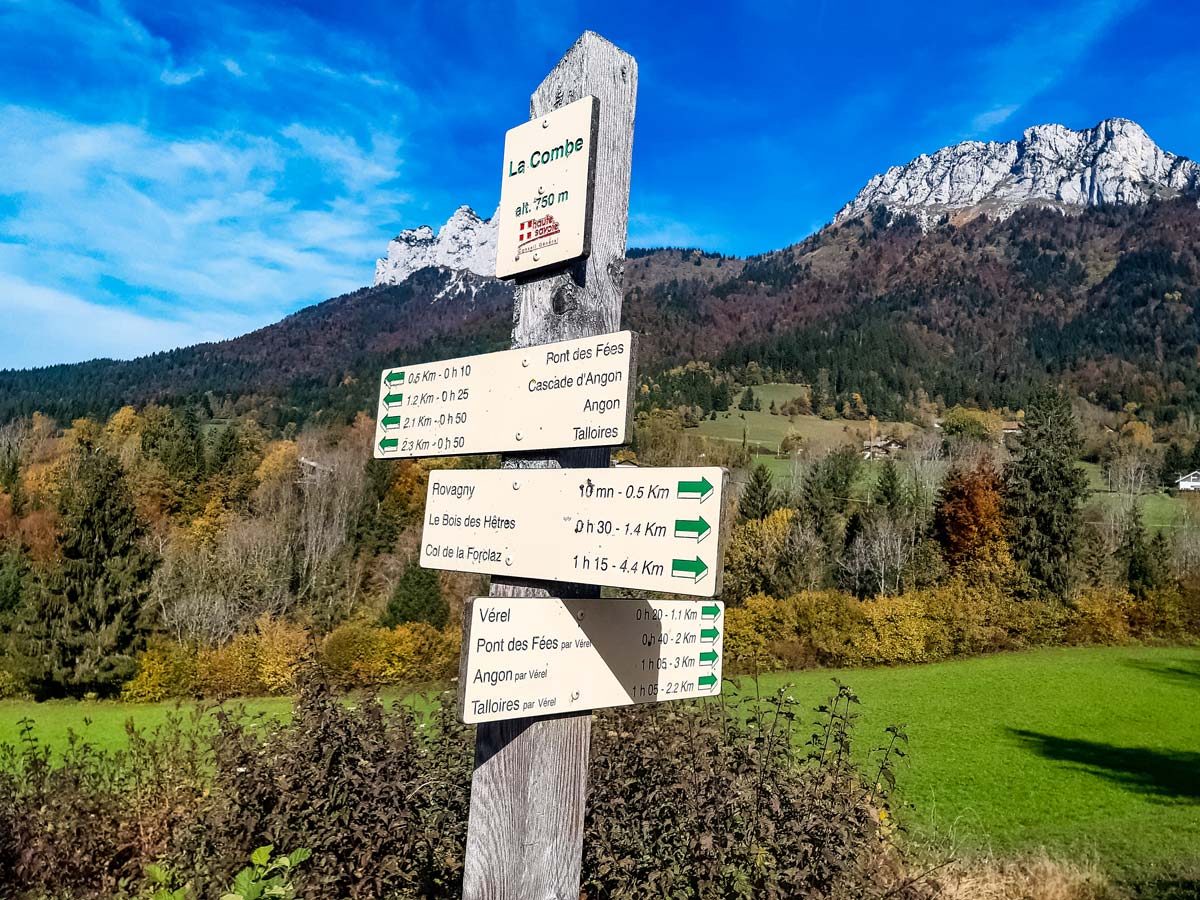
From Angon, walk along the Route des Vignes until you see the car park with a signpost labelled ‘Vignes de la Croix’, taking the paved road up the hill for Cascade d’Angon (waterfall).
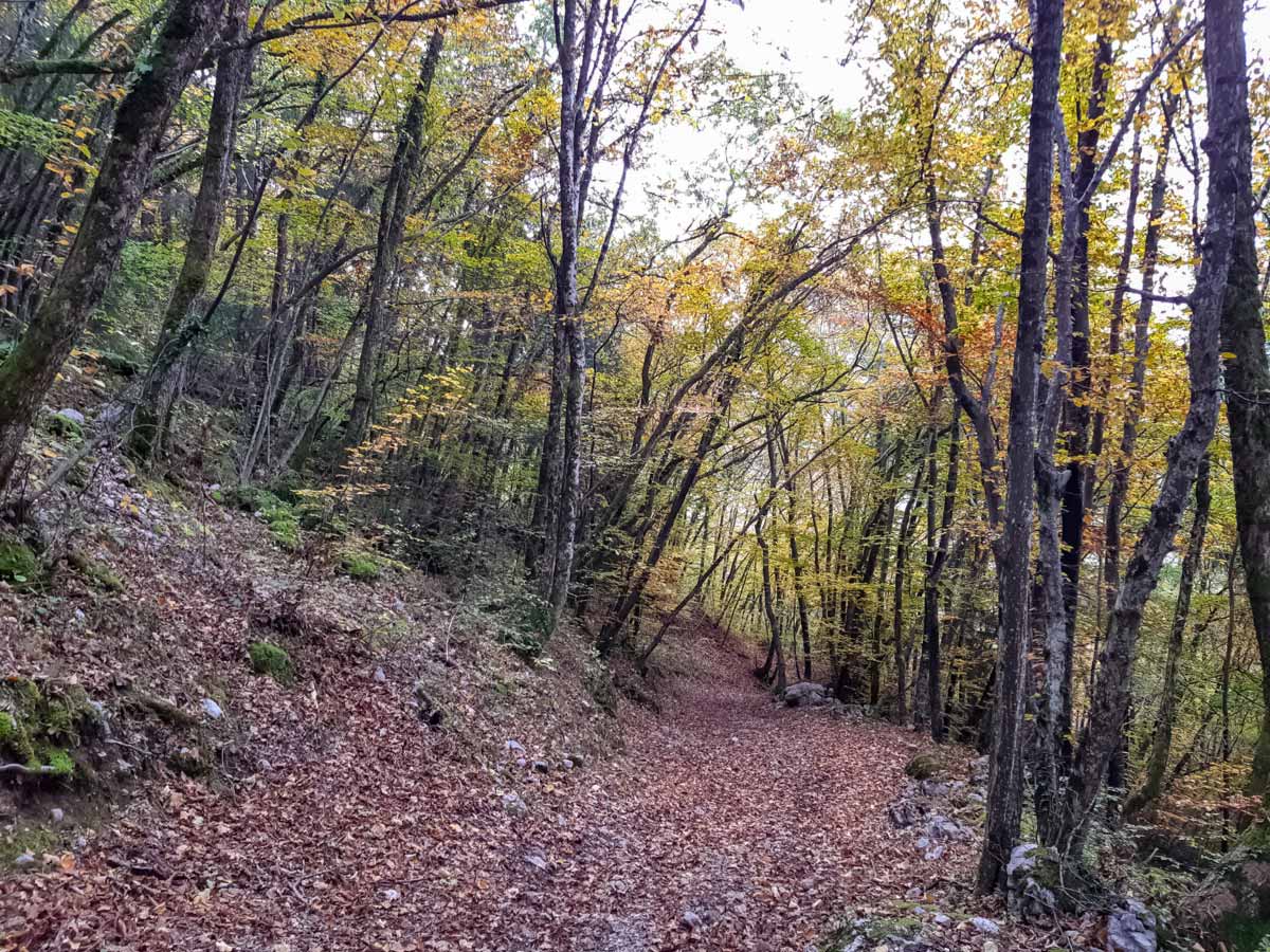
The road soon turns into a stony path in a dense forest, inclining steeply for most of the way. When the path splits, turn right and stay on the wider path. There are arrows and red crosses painted on rocks and a tree trunk to indicate the correct trail. Along other parts of the route, you’ll see a yellow arrow on a green background on wooden posts.
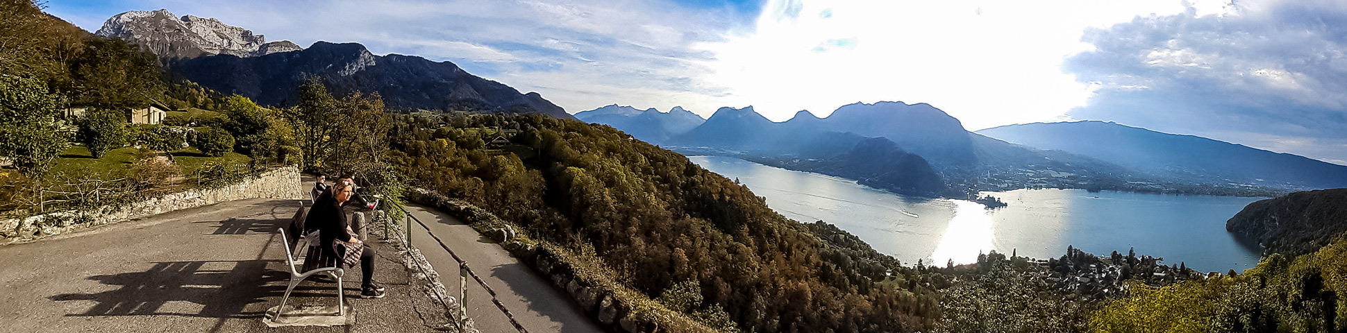
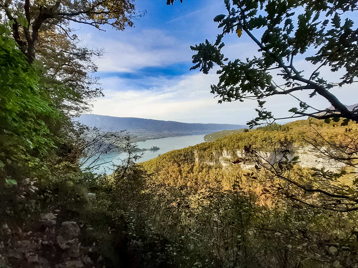
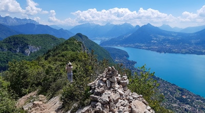
Further up near the top of the incline, keep an eye out for the viewpoint to the right, over Lake Annecy (marked with a wooden post with a yellow viewpoint symbol on a green background).
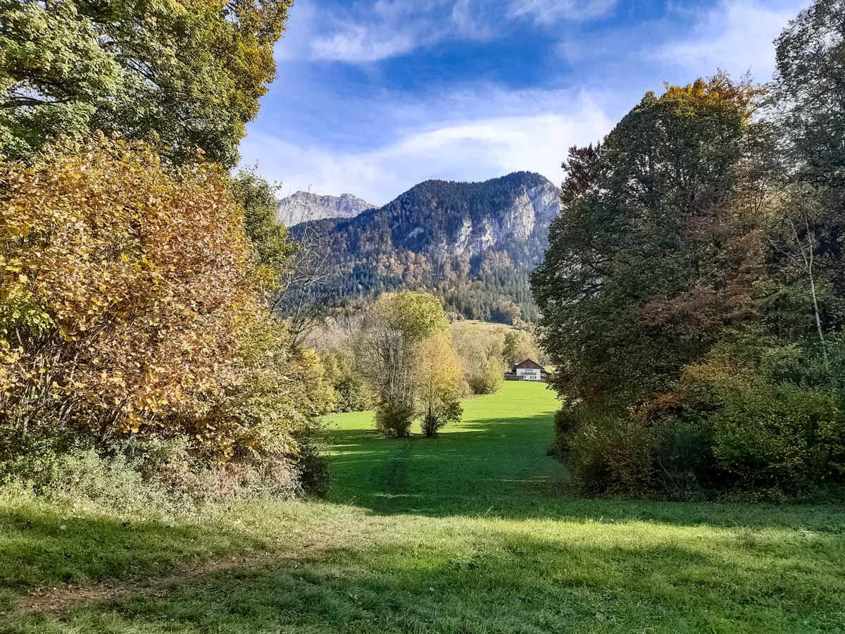
Continue up the hill, which soon opens to grassy fields. Follow the narrow dirt path past a couple of trees in the middle of a field and alongside a shallow stream near some houses to a signpost for Les Mouilles. Turn left as indicated on the signpost for Cascade d’Angon and follow the paved road for a few minutes, which then turns into a wide dirt track.
After a few more minutes, the track narrows and leads to the first interesting stop — the fairy bridge. On the bridge, look for the moss-covered trees and a small waterfall on the lower side. On the other side of the bridge, walk upstream if you wish to dip your toes in the cool mountain water.
Continue along the path from the bridge, following the sign to the cascade and the yellow arrows on wooden posts along the route. When the track opens up, keep walking away from the fairy bridge — a little to the right (the left leads to a cliff!) — and walk over a small wooden bridge of a separate stream and along the trail past a rock climbing area for beginners and a large cross.
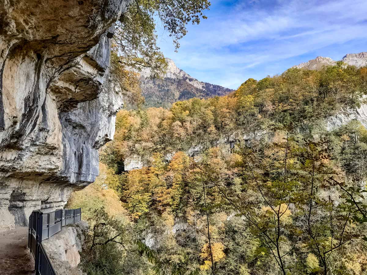
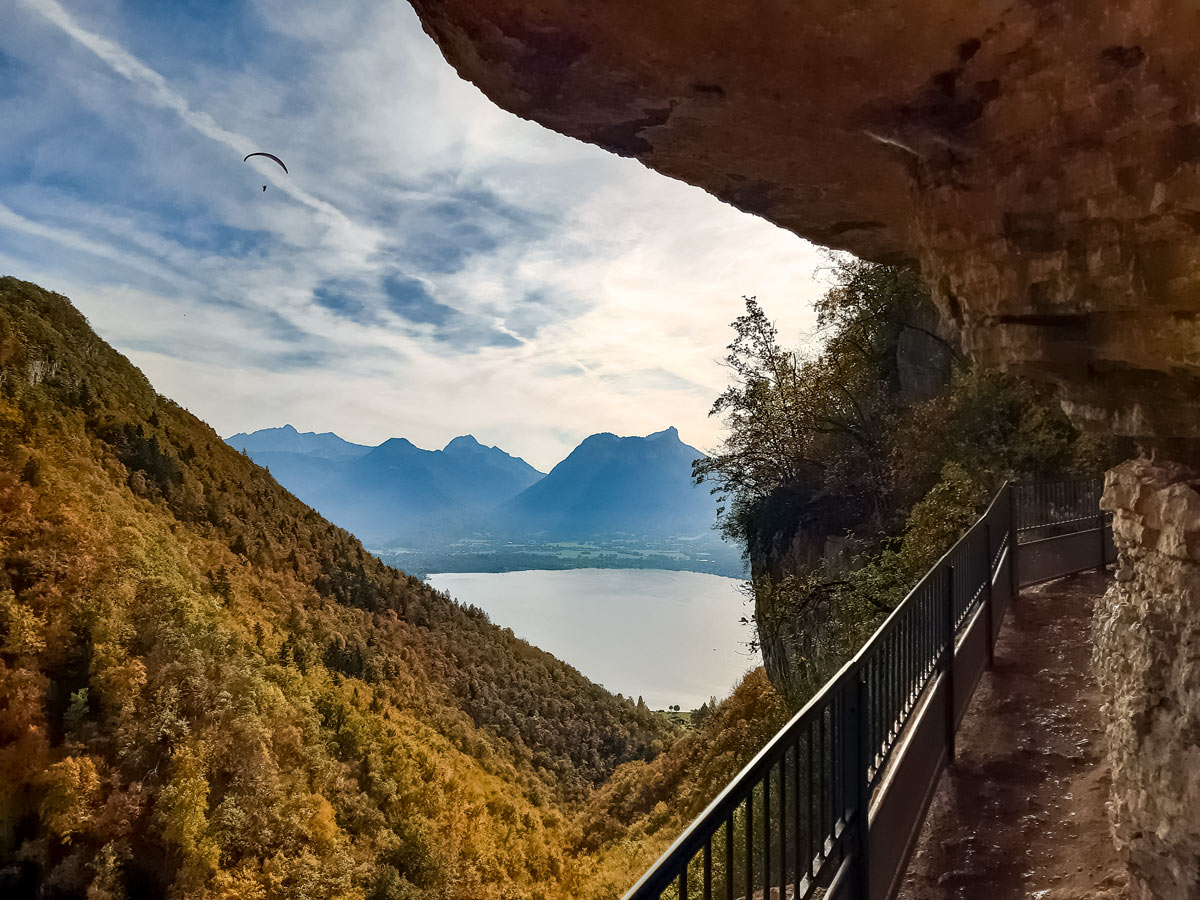
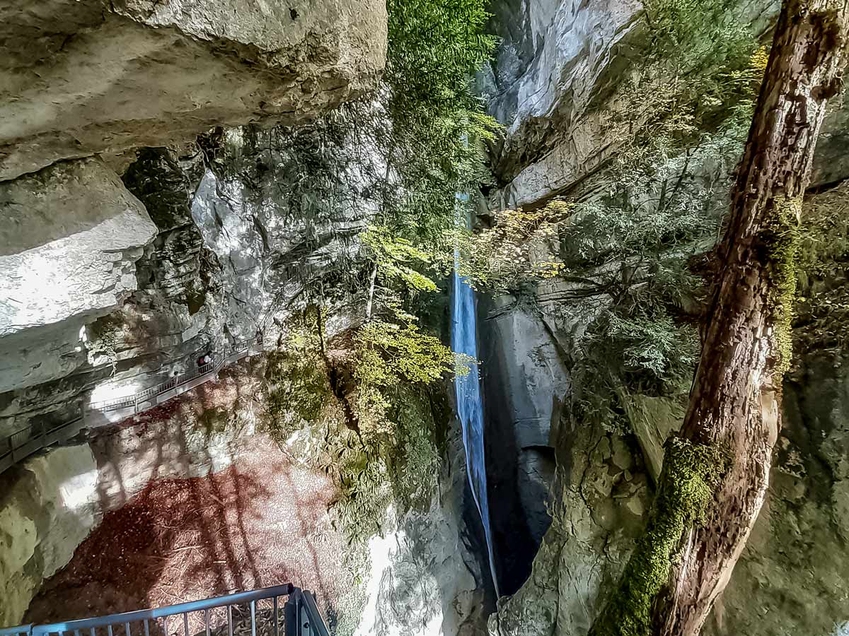
Continue along the track, which has another viewpoint and some rocks — a great place for a picnic. The waterfall path is just a few minutes further along at a t-intersection. When you reach it, turn left for the short dead-end walk to the waterfall. This track can be slippery and is dangerous, particularly for small children and dogs. The track is carved into rock, leading behind a small waterfall before ending by the main waterfall. The waterfall is used for canyoning, so you might see people in wetsuits zooming down to the pool below!
After the waterfall, go back up the track past the rock climbing area. When the track splits, take the track on the left towards the waterfall car park (called La Pirraz). At the car park, turn right onto the road, which leads to the main road.
Cross to the other side onto Chemin de la Pirraz and walk past the houses to a stop sign. Turn left, down the one-way road which runs parallel to the main road. Very carefully cross the narrow bridge for vehicles (wait for a break in the traffic) and take the road to the right immediately after the bridge.
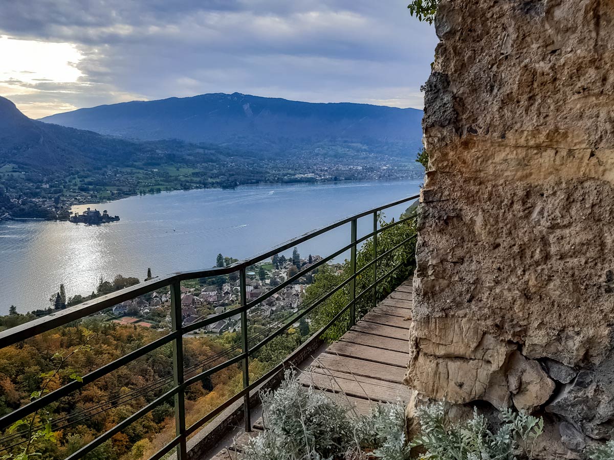
Go up the hill to where the road turns sharply to the right. Cross the road and go down the hill a little, heading for the Ermitage de St-Germain church which should now be in view. There is an excellent viewpoint for both Lake Annecy and the mountains behind the church, with the sky above often filled with paragliders.
Past the church, the dirt path splits. Take the short path to the right signposted for Belvedere de la Vierge — a religious monument in gold with another viewpoint over the lake — then return to the split in the dirt path. This time, take the path to the left, over gravestones. This is a religious path with fourteen crosses representing Stations of the Cross which crosses a small sealed road and leads to a curious grotto and more lake views.
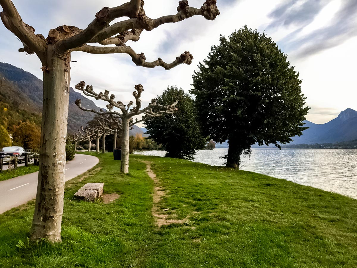
After the grotto, walk back to the small sealed road and walk down it (to your left after visiting the grotto). When it meets the main road and tunnel, turn around and look back at the rock between the small road and the tunnel to see a large face carved in the rock. Take the descending gravel track towards Talloires. The track winds down steeply to the lakeside village of Talloires. Here, cross the road and either head towards the lake to cool down or walk along the path next to the main road until you reach Angon where you started the hike.
Insider Hints
For a shorter circuit, follow the signs back to Angon from the waterfall t-intersection.
Bring your swimwear and a towel if you want to dive into Lake Annecy (said to be the cleanest lake in Europe).
There are no public toilets on this hike, so be prepared before you set off!
Similar hikes to the Angon Waterfall hike
Lac du Mont Charvin
It would be easy to overlook this hike on face value: the lake is small and green; the starting point…
Mont Baron
Mont Baron offers a sweeping 360° vista, with Lake Annecy to the west and the foot of the Alps to…
Lac de Lessy
Lac de Lessy is a classic place for wildlife spotting, and it’s well known for the loud calls of stags…
Comments