The Rockwall Trail backpacking trail
View Photos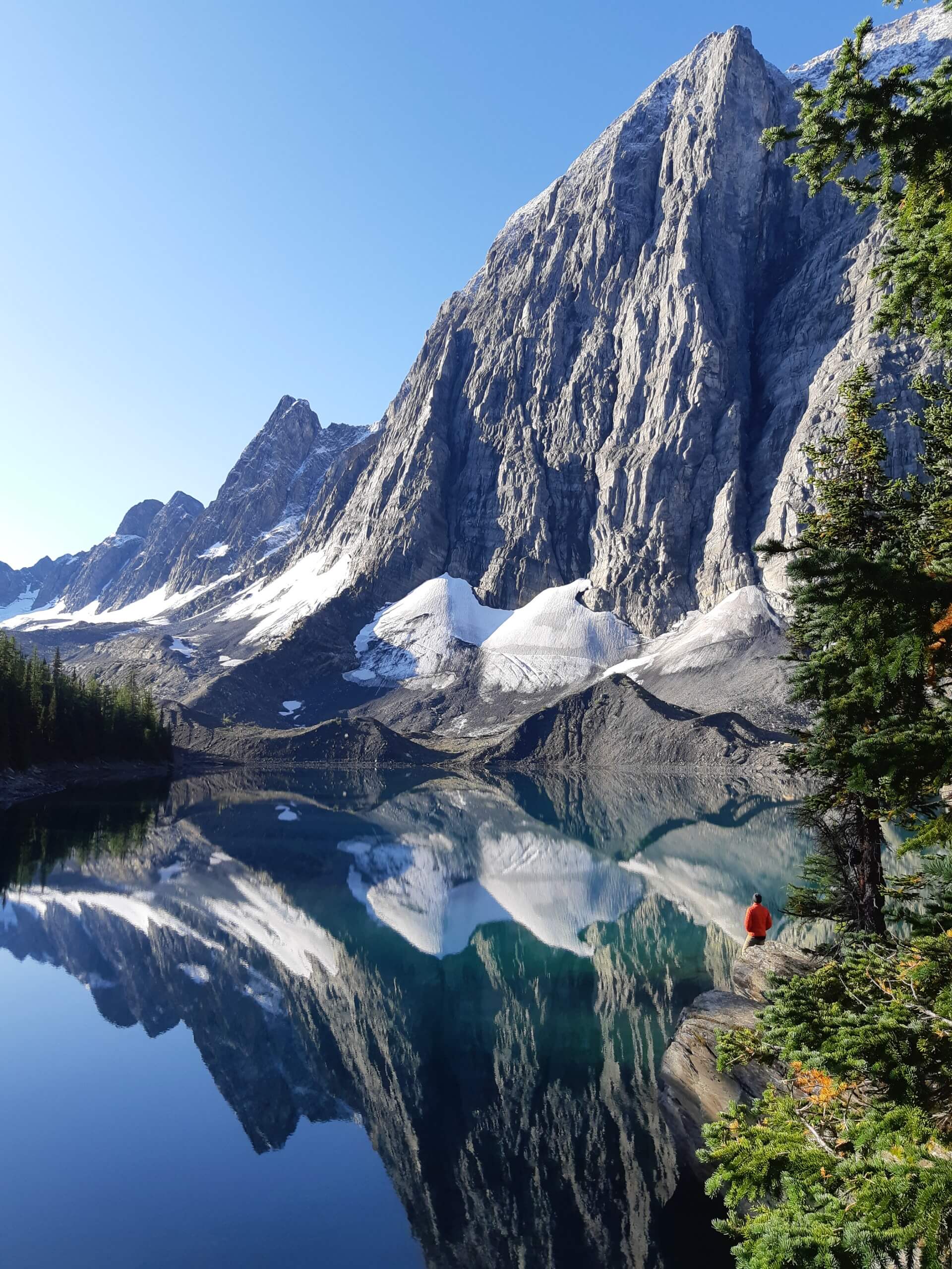
The Rockwall Trail backpacking trail
Difficulty Rating:
Kootenay National Park’s Rockwall Trail is one of the most popular, multi-day backpacks in the Canadian Rockies. The Rockwall is on most backpackers bucket lists, and for good reason. Not only does this trail contain the namesake Rockwall, but there are many lakes, waterfalls, glaciers, creeks, and wildlife to make it a perfect escape into the wild. Be careful, you may not want to come back!
Getting there
You can start either at the Paint Pots or Floe Lake trailheads. Your direction is often the result of what campgrounds are available. Both trailheads are on the 93S highway, which you get to from the Castle Mountain junction between Banff and Lake Louise. Paint Pots is about 12.4mi from the TransCanada highway, and Floe Lake 19.9mi.

About
| When to do | July - September |
| Backcountry Campsites | Floe Lake Campground, Tumbling Creek Campground, Helmet Falls Campground |
| Toilets | Trailhead |
| Pets allowed | Yes - On Leash |
| Accommodation Type | Tent |
| Family friendly | Older Children only |
| Route Signage | Average |
| Crowd Levels | Moderate |
| Route Type | One Way |
The Rockwall Trail
Elevation Graph
Weather
Route Description for The Rockwall Trail
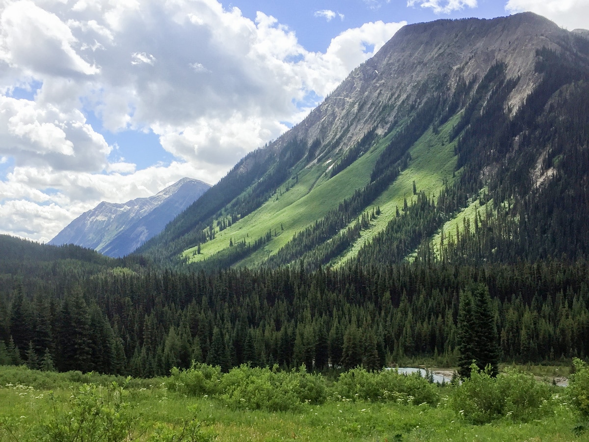
The Rockwall Trail is an epic backpack in Kootenay National Park. This 33.6mi trail is one of the most popular backpacks in the Canadian Rockies, and for good reason, it’s stunning. You walk beside a spectacular Rockwall, going over 3 epic passes: Numa Pass, Tumbling Pass and Rockwall Pass.
You can do the Rockwall as quickly as a 2-day/1-night trip, though that has big days. The more conventional route is a 4-day/ 3-night trek.
In planning which direction to hike the Rockwall, there are lots of discussions about whether to start at the south (Floe Lake Trailhead) or the North (Paint Pots Trailhead). To be honest, you’re direction is more likely to be dictated by when you can get a booking at Floe Lake backcountry campground, which is one of the most popular campgrounds in the Canadian Rockies.
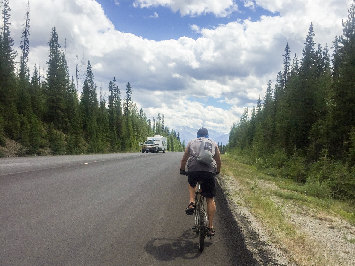
If you do have a choice, the main issue is that Paint Pots is 443ft higher in elevation. If you’re doing this without a car shuttle, that may mean you want to leave the car at Paint Pots and cycle down to Floe Lake. If you have two cars, you may want to start at Paint Pots as the trip will have 443ft less of elevation gain. Either way, you’ll have a wonderful hike on the Rockwall!
For our description, we will take the less conventional route going South to North.
Finally ,the Rockwall backpack is famous for rainy weather and cold nights. This means that you should definitely have a good raincoat, and also some sort of insulation while at camp, such as a synthetic down jacket. We last hiked the Rockwall in late July and it was quite cold in the evenings and the mornings.
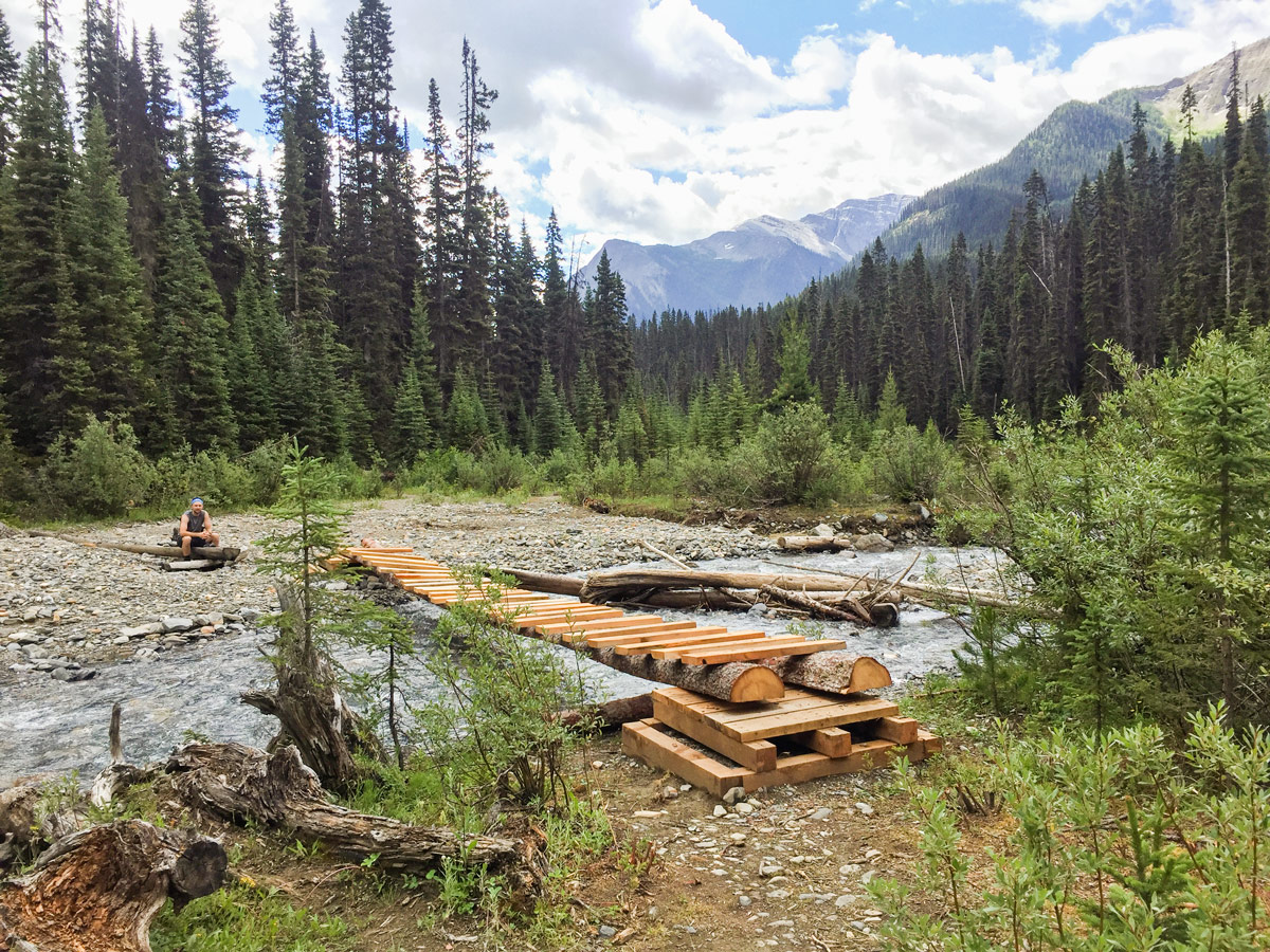
Finally, it should be noted that the Numa Creek bridge is still closed, which means you must walk the entirety of the Rockwall. We have used the Numa Creek to bail out before when there was terrible weather, so keep this in mind on your route.
Day 1
The first day of the Rockwall trail can start at either Paint Pots or Floe Lake. For our description we start at Floe Lake and end at Paint Pots.
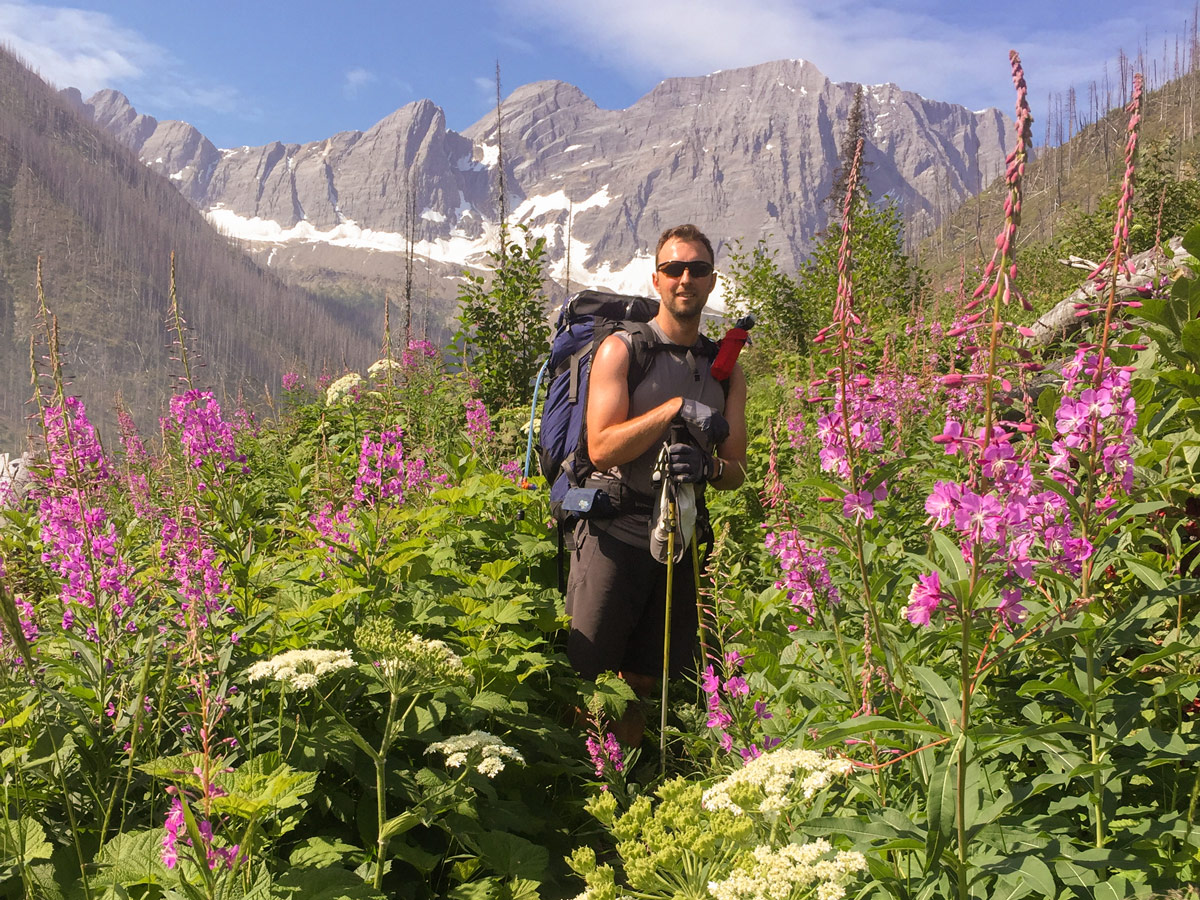
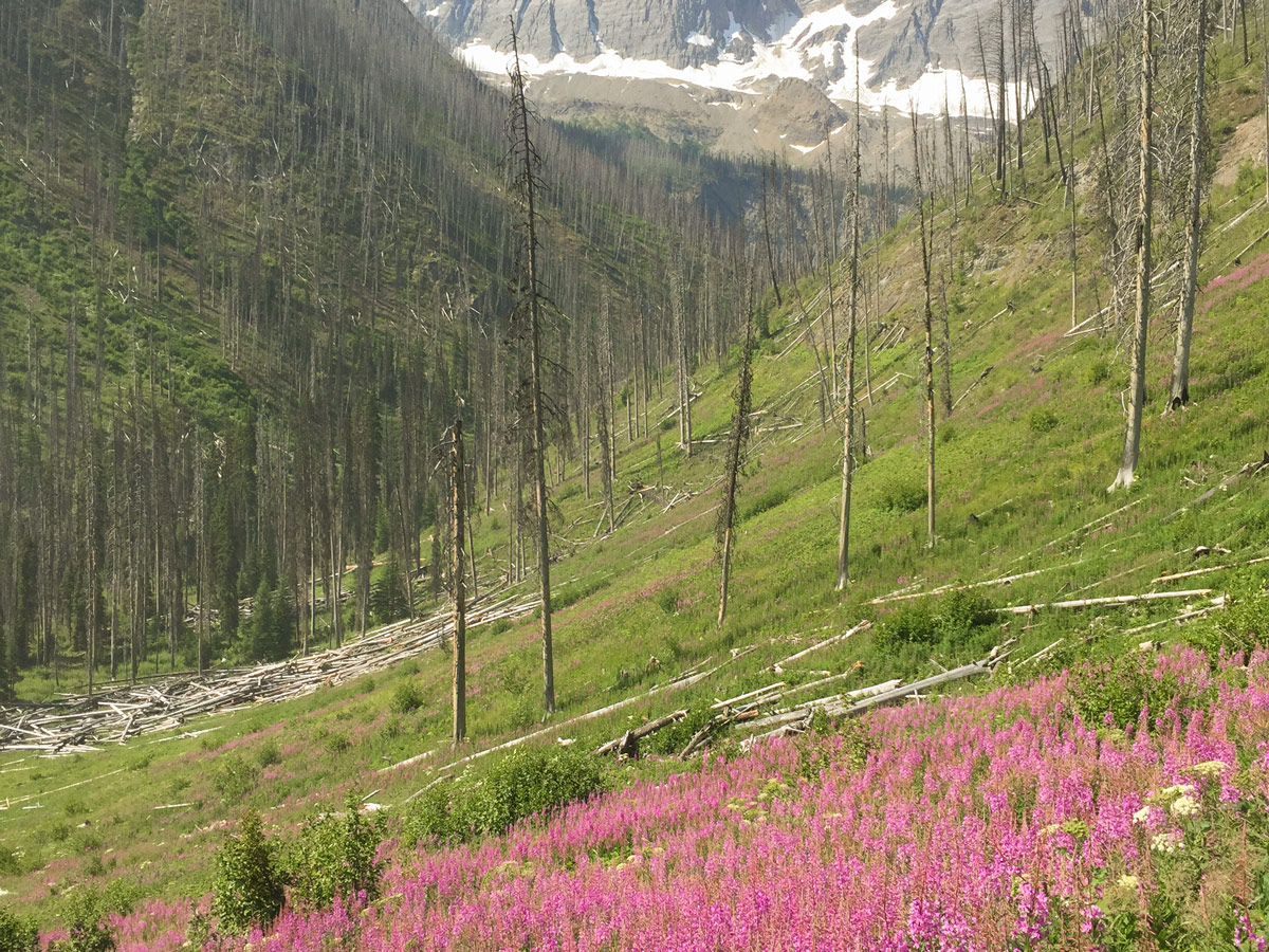
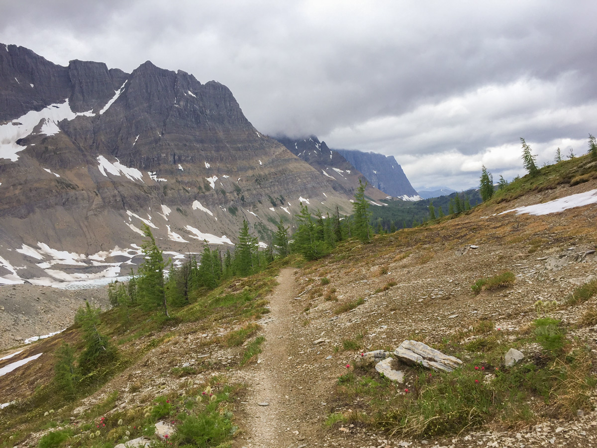
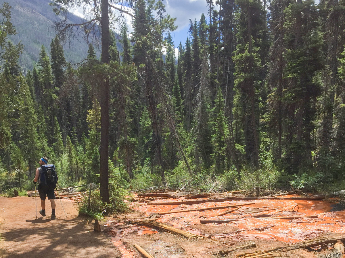
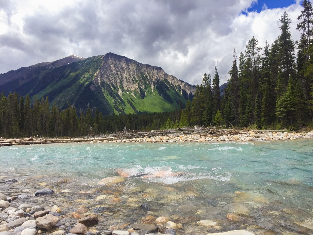
From the Floe Lake Trailhead today’s route is a stunning walk, first crossing the pretty Kootenay River and then hiking up on a good trail through a burnt-out forest.
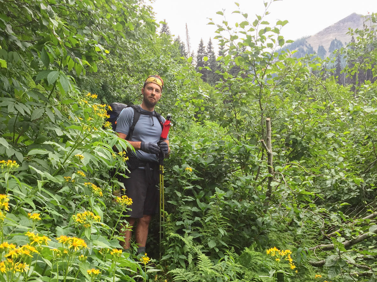
The views are spectacular, and the path goes through abundant wildflowers and berries. With all these berries, be very bear aware!
The hike into Floe Lake is a pretty simple trip, with the only real challenge being the last couple kms having a lot of elevation gain, which is tiring when you have 4 days’ worth of food on your back.
Overall, the Rockwall trail on Day 1 is a good trail, and the fireweed and other wildflowers in full bloom are pretty darned amazing.
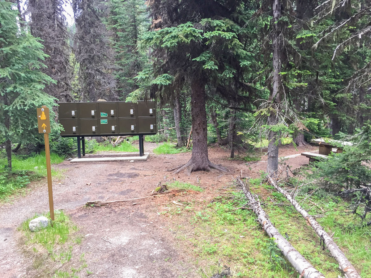
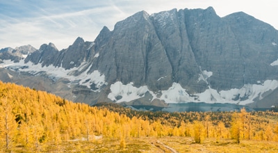
Once you get to Floe Lake the campground is very pretty, with some of the 18 campsites having a view of Floe Lake directly from the site. There is a good cooking area and picnic tables as well as a bear-proof food storage.
Looking at Floe Lake in the evening and morning light is gorgeous, and this is the best time to be at Floe Lake, as the tranquility is superb.
Day 2
Day 2 is the most challenging part of the Rockwall, going from Floe Lake to Tumbling Creek campground. The route is over 9.9mi with about 3445ft of elevation gain. If you have the time and don’t want such a challenging day, you could break this day into two, staying at Numa Creek Campground.
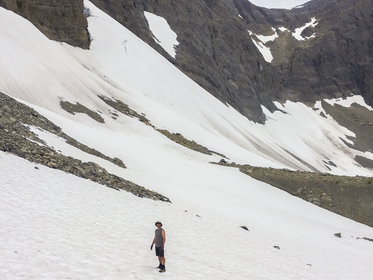
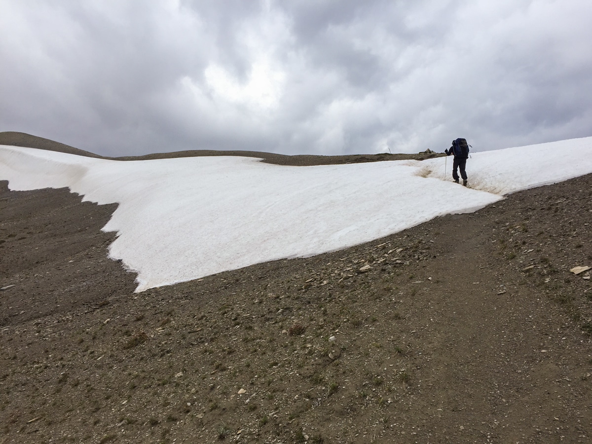
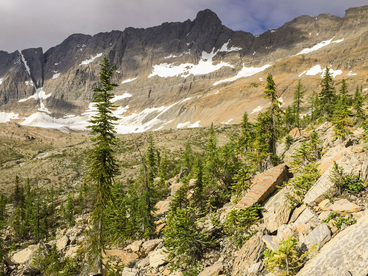
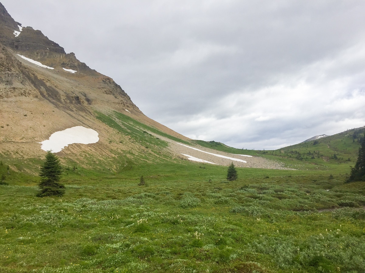
The day starts with an early exit from the Floe Lake campground and an ascent to Numa Pass. It is not rare for there still to be a reasonable amount of snow at Numa Pass in late July. The ascent to Numa Pass is difficult, as you are at a high elevation, the path is steep, early in the season the path is somewhat overgrown and it seems to rain every night on the Rockwall, so expect your feet to get wet.
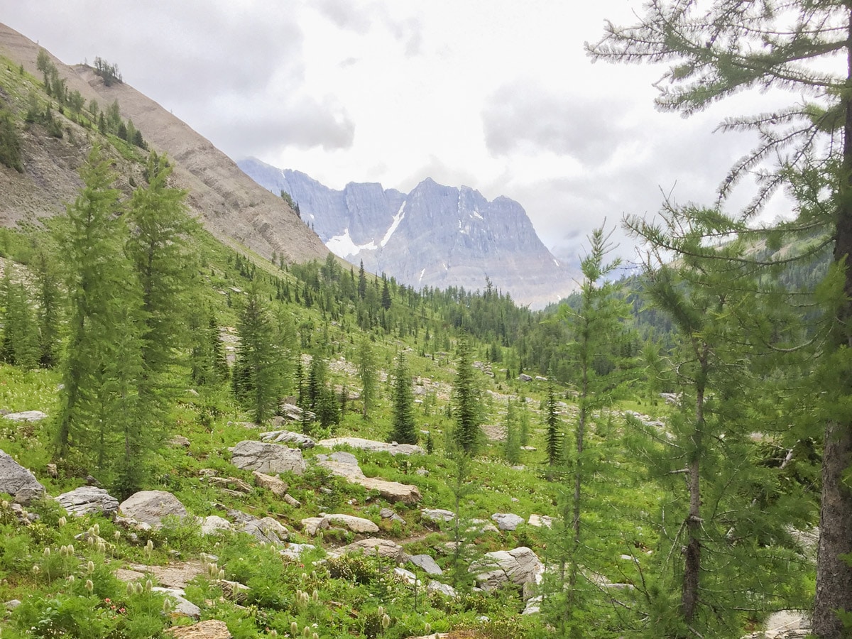
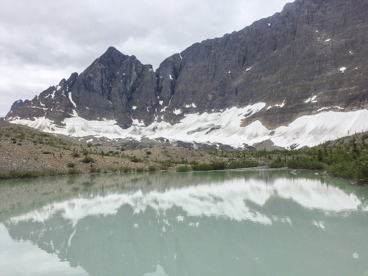
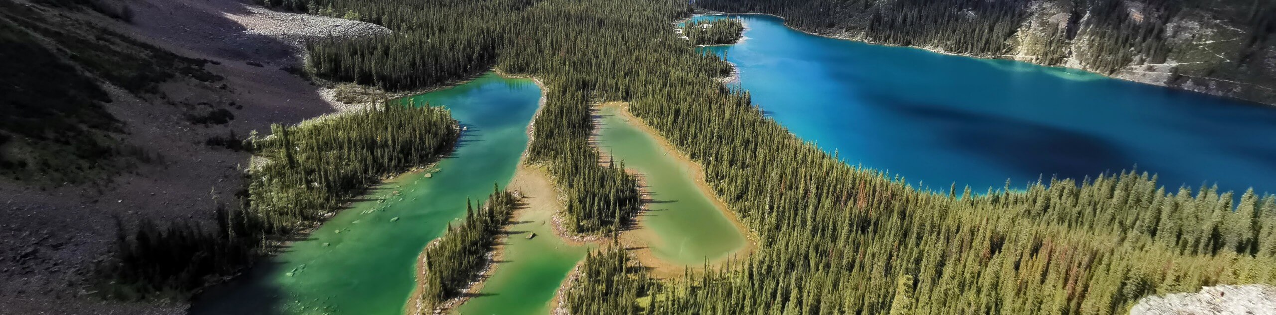
The views from Numa Pass are quite pretty, however the descent down to Numa Junction is more pleasant.
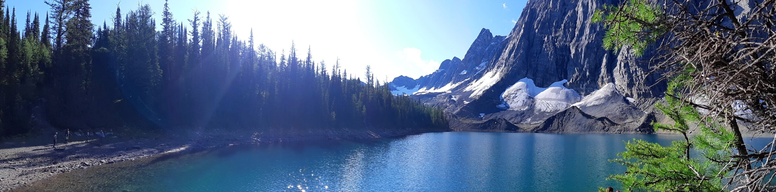
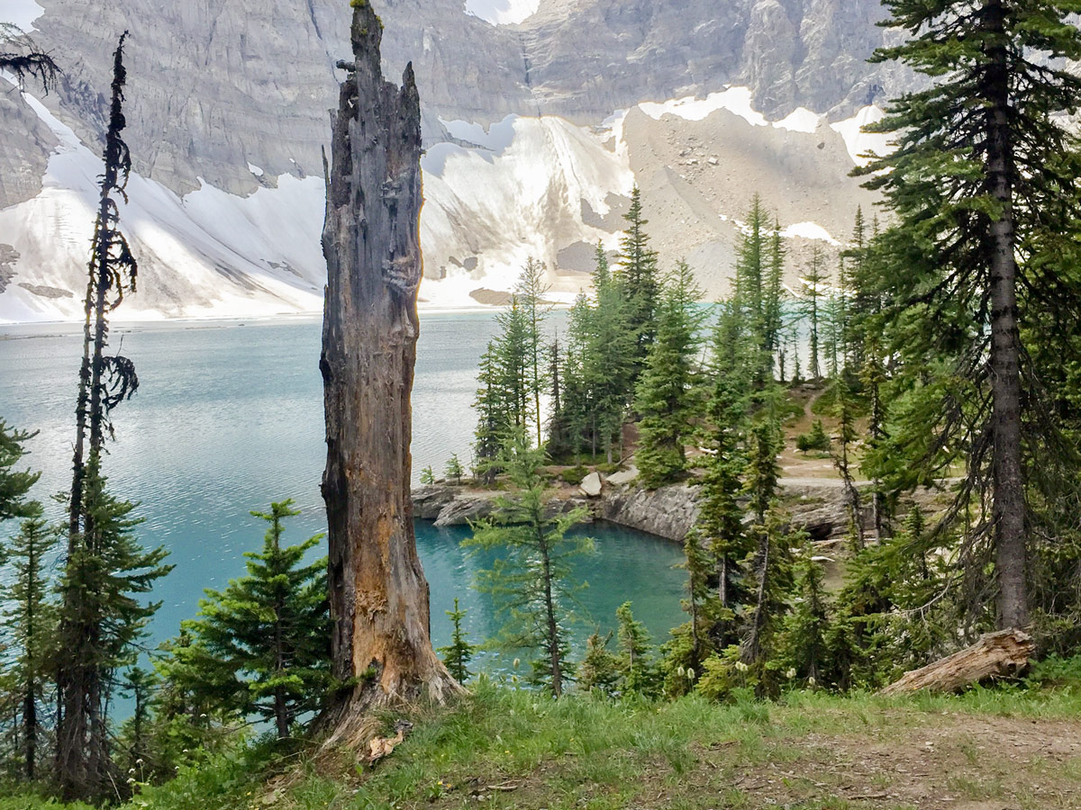
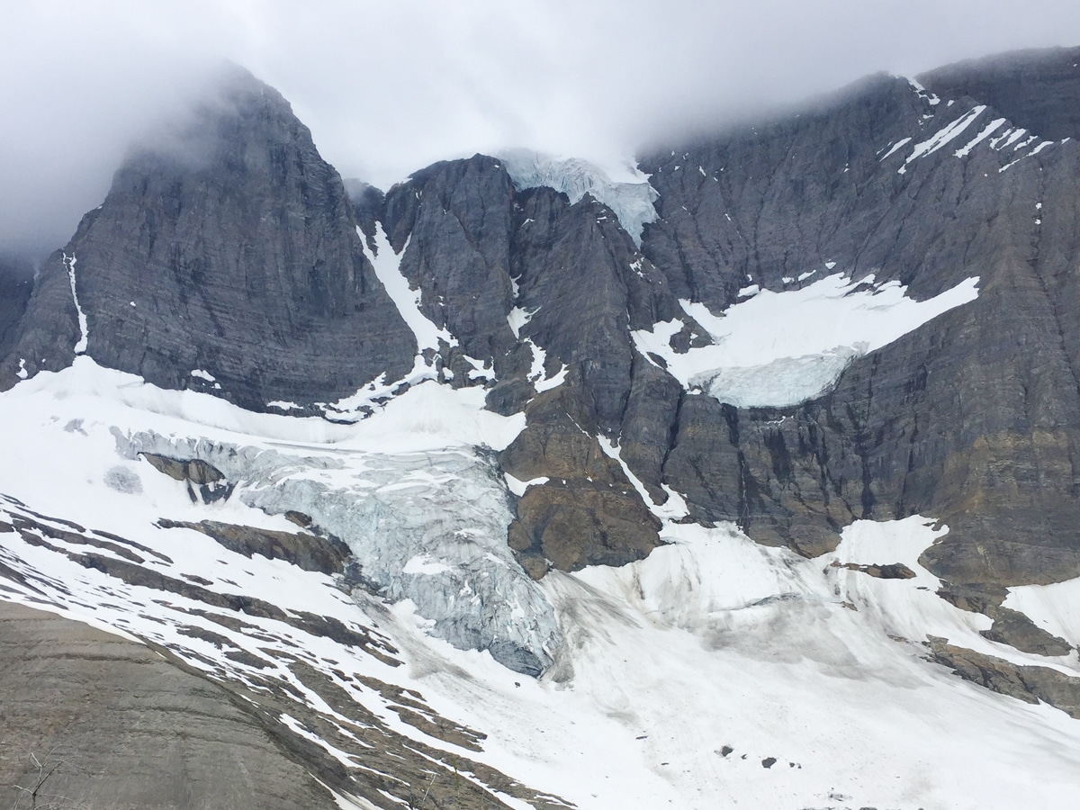
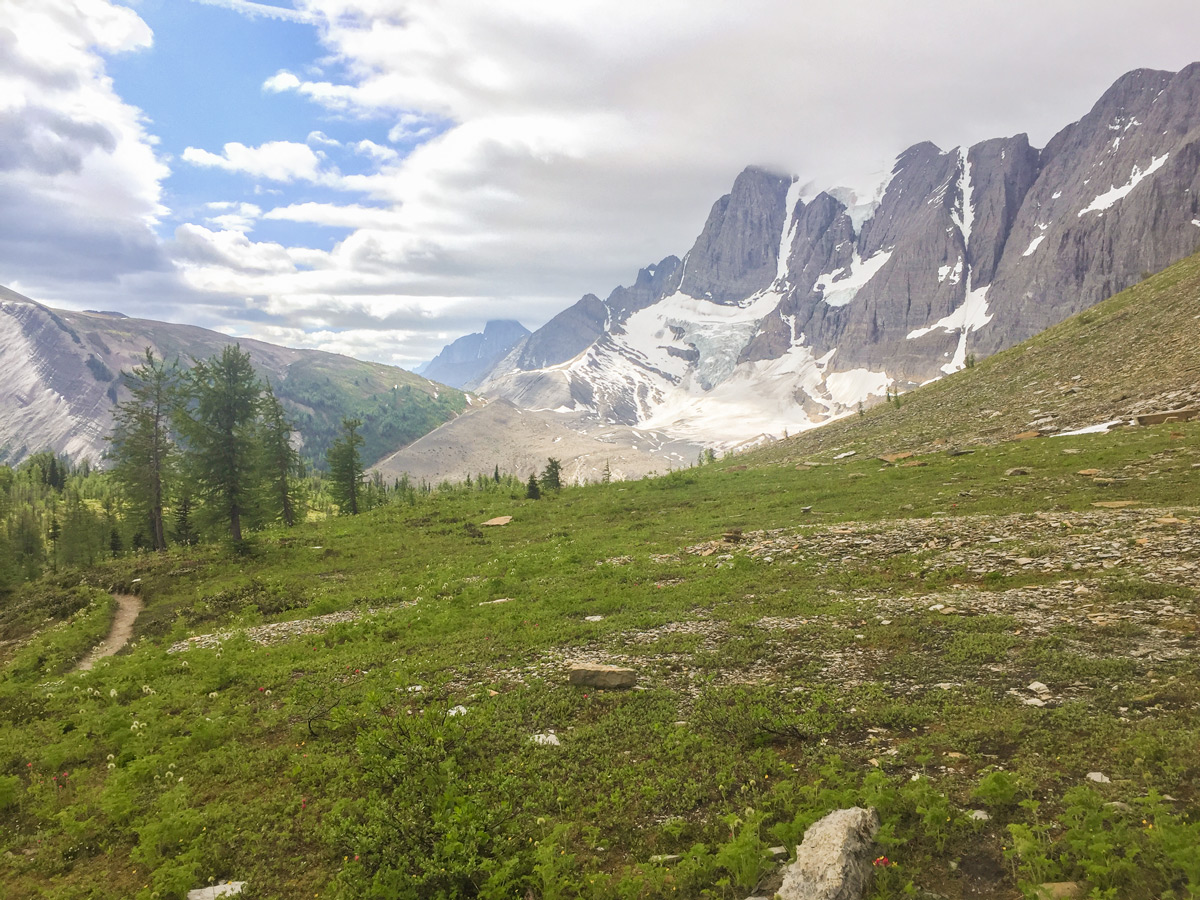
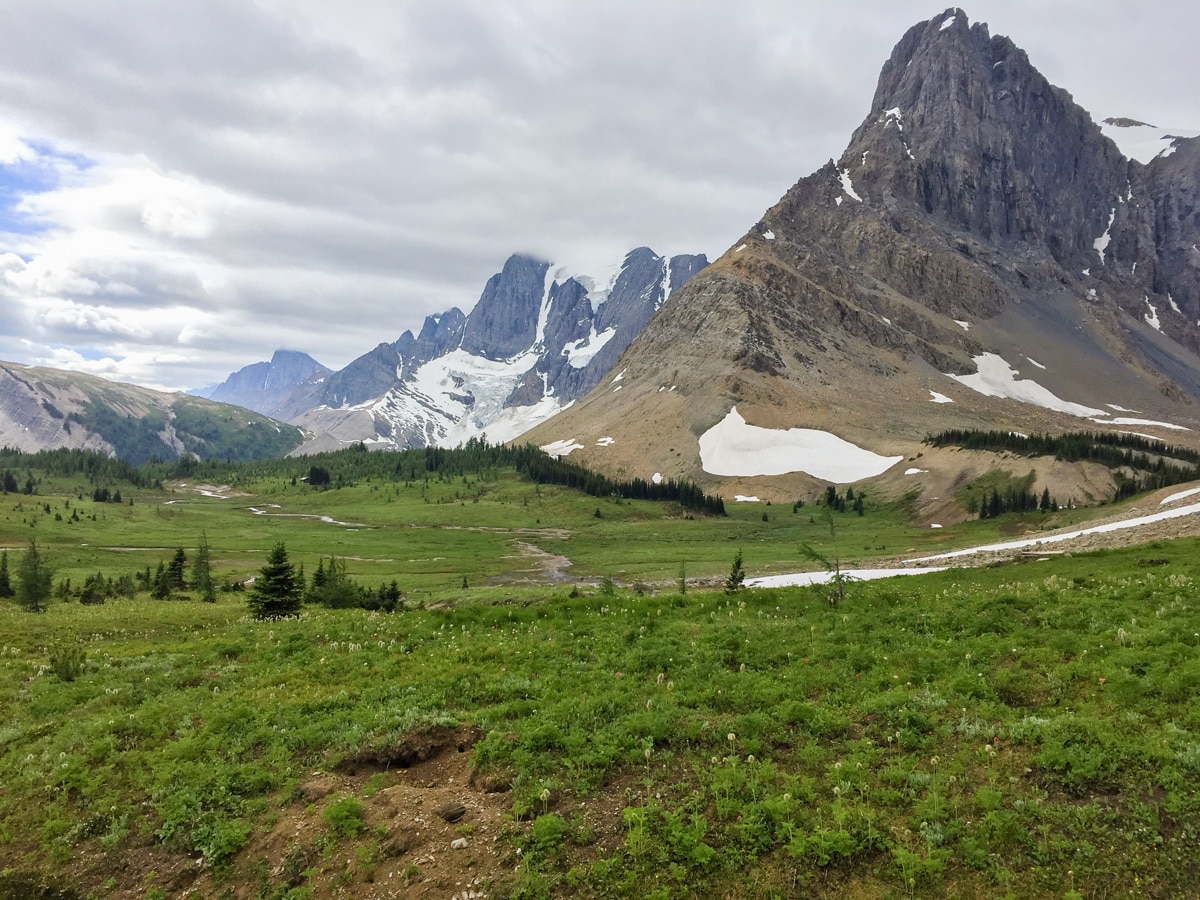
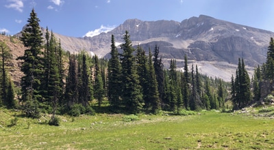
From Numa Junction you ascend up Tumbling Pass. Reaching Tumbling Pass is a relief after all the ascent. The reward for the hard work up to Tumbling Pass is traversing the slope and a stunning view of the lake below and the adjacent Rockwall and glacier.
Head into Tumbling Creek Campground, which has 18 sites in the trees.
Day 3
After a hard Day 2, Day 3 is a nice short day up to Helmet Falls Campground.
From Tumbling Creek Campground, a good side trip is up to Wolverine Pass. Follow the Rockwall trail north out of camp. It’s a relatively short climb up to the junction to Wolverine Pass, which is actually just half a km off the main path and worth a trip.
Wolverine Pass provides a gorgeous view of the valley below, while the meadow near the pass is often grassy and lush, which is amazing to see at such high elevations (just over 7218ft).
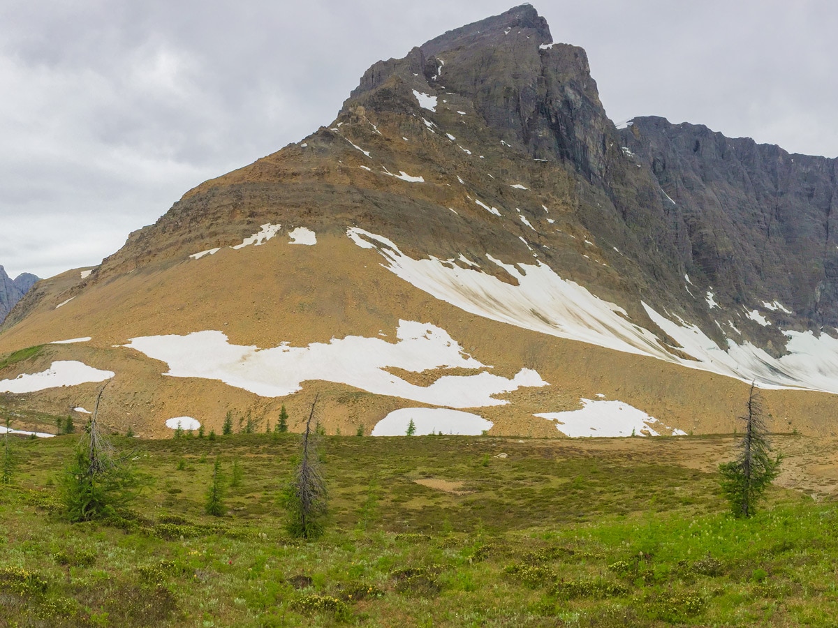
From Wolverine Pass return to the trail and continue onwards to Rockwall Summit. From here the views diminish, as you enter the trees.
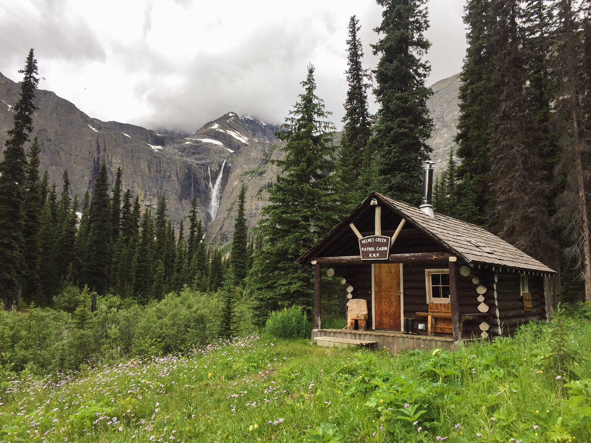
The decent down to Helmet Falls is steep but easy as it is quite rocky. Soon you arrive at Helmet Falls campground, another pleasant campground with 18 campsites.
In the evening at the Helmet Falls Campground you can take a short hike up to Helmet Falls, which is a very rewarding scramble after the days hike. The trip to Helmet Falls is definitely worth a trek up there to see one of the tallest free-falling waterfalls in Canada from the bottom and up close.
Day 4
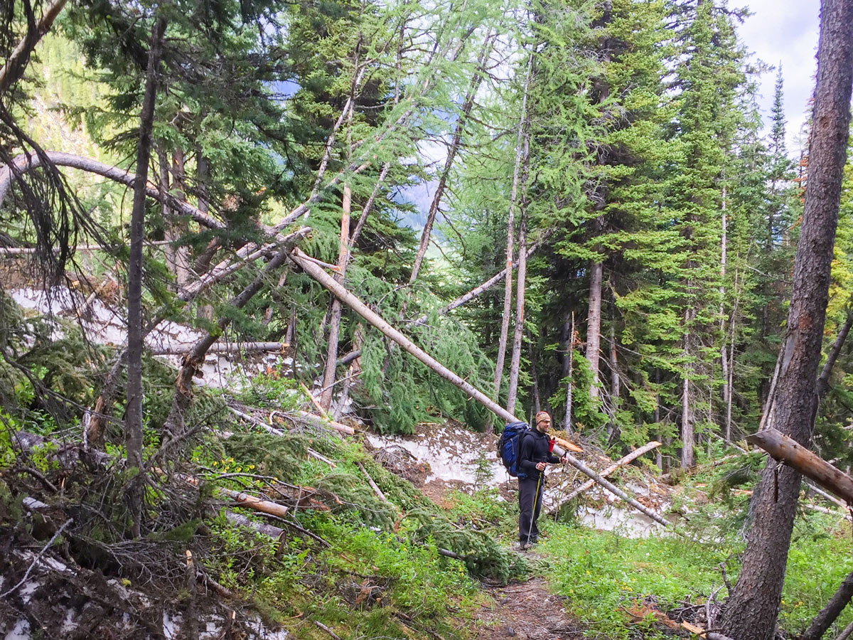
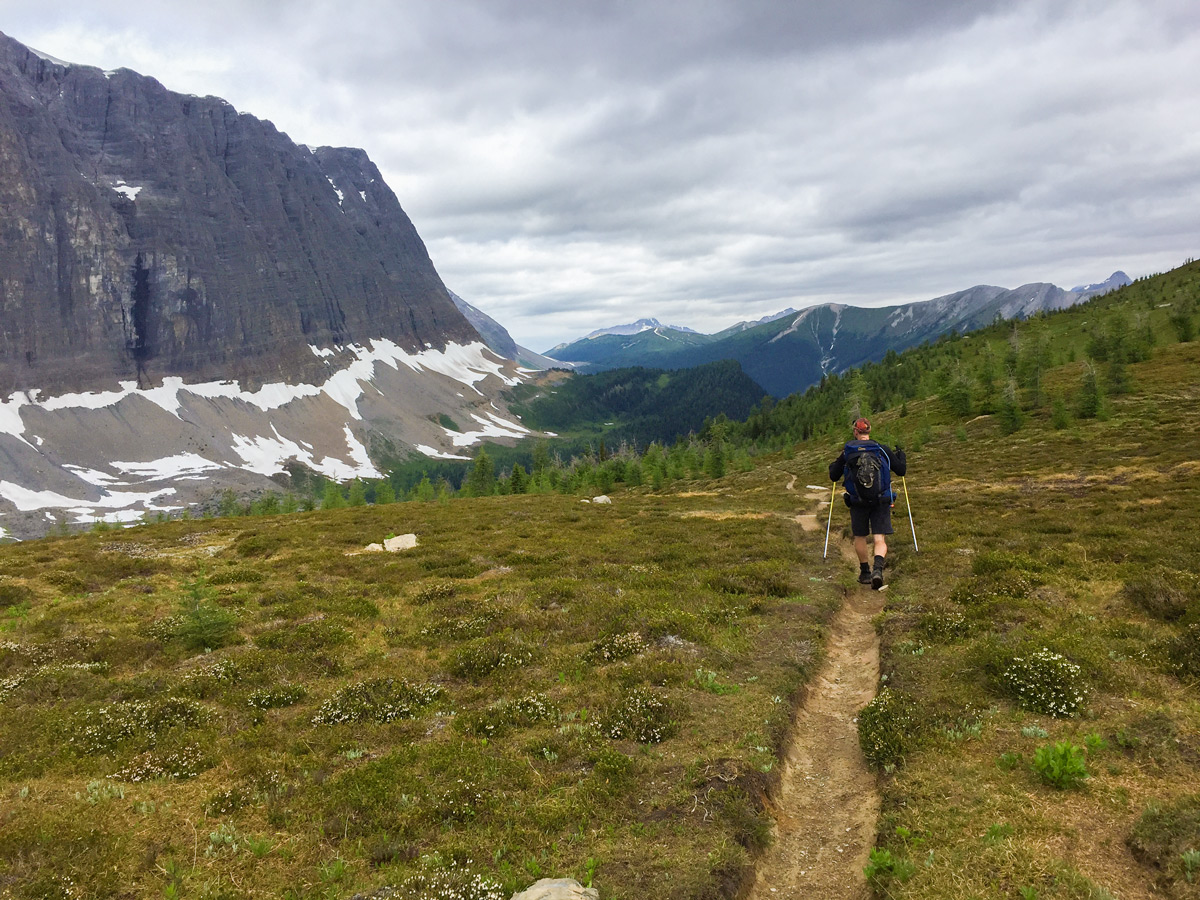
The final day is a fairly mundane trek out via the Paint Pots. The path is mostly through the trees, with glimpses up as you walk through avalanche paths. Your route out roughly follows Helmet Creek as it descends to Paint Pots.
Once you arrive at the Paint Pots trail the number of other people will increase. Before you know it, you’re back at your car, having just hiked the Rockwall Trail!
Sample Itinerary:
Standard Rockwall Itinerary: 4D/3N South to North
- Day 1: Floe Lake Trailhead to Floe Lake Campground: 6.6mi, 2625ft
- Day 2: Floe Lake to Tumbling Creek Campground: 10.3mi, 3428ft
- Day 3: Tumbling Creek to Helmet Falls Campground: 7.8mi, 2051ft
- Day 4: Helmet Falls Campground to Paint Pots trailhead: 8.8mi, 1033ft
- Note: Reverse nights if you want to go North to South. If you want to add a 5th day, you could break Day 2 up into 2 days, and stay at Numa Creek Campground.
Fast & Light 2D/1N Rockwall Itinerary
- Day 1: Paint Pots to Tumbling Creek Campground: 16.1mi, 4593ft gain, 3035ft loss
- Day 2: Tumbling Creek Campground to Floe Lake Trailhead: 16.7mi, 4934ft gain, 6749ft loss
- Note: For the 2d/1n trip it’s best to start at Paint Pots, as the elevation gain to Tumbling is only 4593ft, whereas going via Floe Lake means you have a day with 6775ft of elevation gain over 16.7mi.
Insider Hints
Book your campgrounds as soon as reservations open on the Parks Canada Backcountry page.
There are some auxiliary trail closures back to the highway due to downed bridges - at the time of writing the trail to Numa Pass trailhead was closed.
Interesting points to see were some of the avalanches that had wreaked havoc on the trail.
This is a point to point hike so be sure to drop a car at one end or else have a bike to connect the two trailheads.

Similar backpacking trails to the The Rockwall Trail backpacking trail
Floe Lake and Numa Pass
Floe Lake is one of the most photogenic lakes in the Rockies and the backpack to it and beyond to…
Ball Pass to Shadow Lake
The Ball Pass backpack starts in Kootenay National Park and leads you into Banff National Park and Shadow Lake. Hiking…
Lake O’Hara Backcountry
Explore the incomparable Lake O'Hara area of Yoho National Park on this backcountry trek that totally immerses you in western…
kristinoutdoors 4 years ago
AMAZING TRAIL!! Just completed the "fast + light" version of the Rockwall Trail, north to south route, staying one night at Tumbling Creek. We would've taken more time, but due to campsite availability, this was the only option. First of all, the scenery is absolutely unreal!! If these campsites are available, book them! The trail is not difficult technically—it's well-maintained—but it is physically demanding if you only take two days to complete it. Except for the wildfire smoke on day 2, the weather was ideal for hiking: not too hot and no rain, but bring layers for the passes where the wind doesn't relent! There were lots of spots to refill water bottles on day 1, but not as many on day 2 after Numa Creek campground, so make sure you have enough water when you start ascending Numa Pass. I highly recommend a glacial dip in Floe Lake—this gave our group that extra energy we needed to complete the last 10km! Overall, so worth it no matter how many days you have to do it. It's one of the best backpacking trips for a reason!
Slavik W. 5 years ago
I can easily say that this is one spectacular hike.