
Floe Lake and Numa Pass backpacking trail
View Photos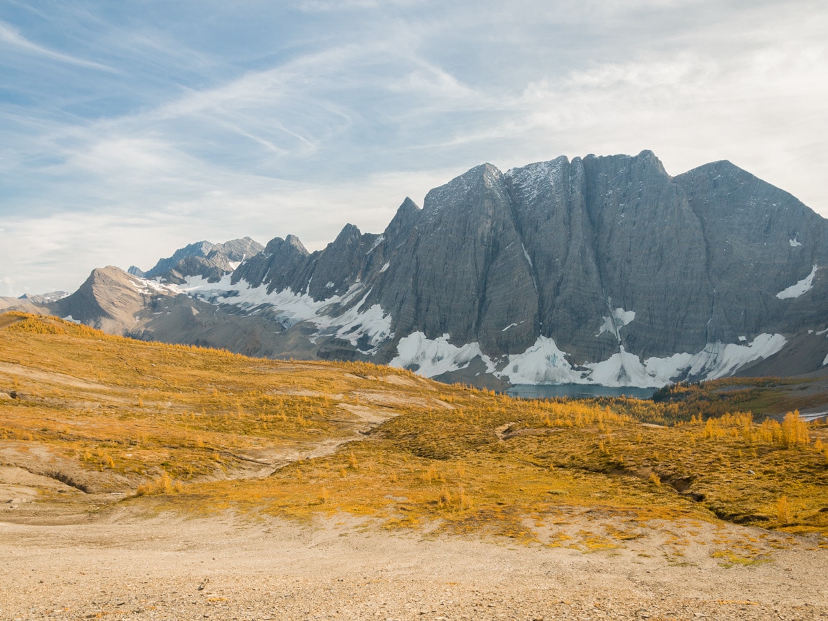
Floe Lake and Numa Pass backpacking trail
Difficulty Rating:
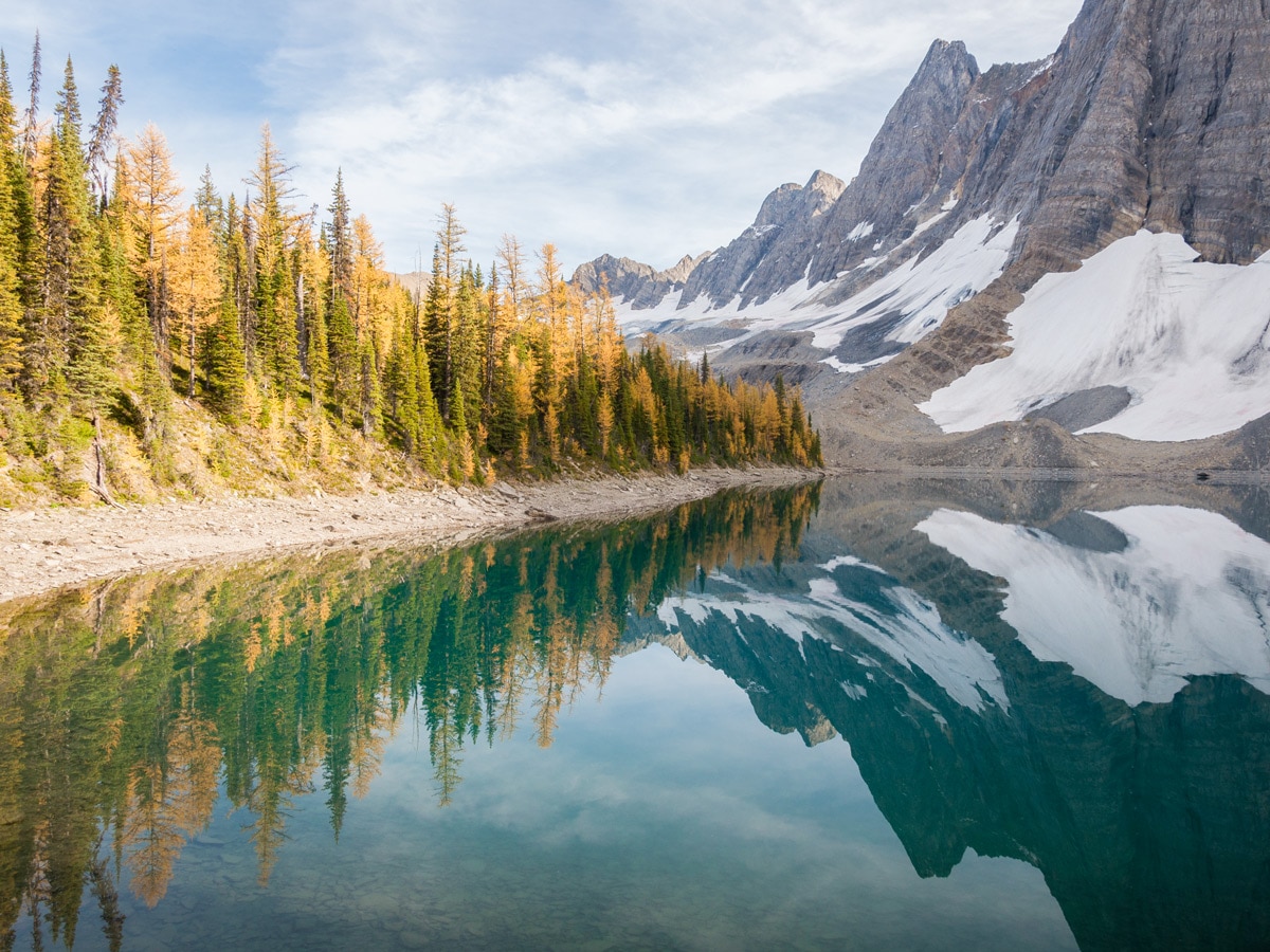
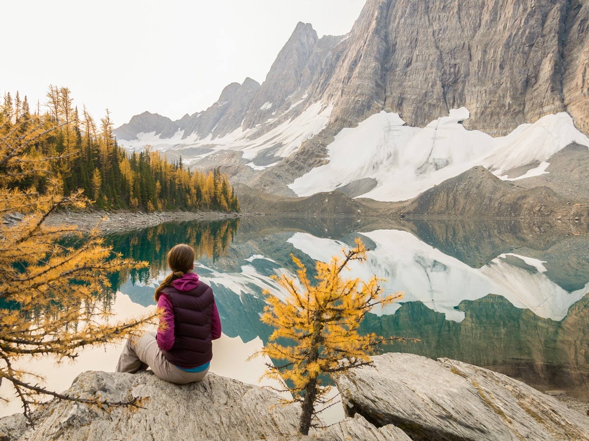
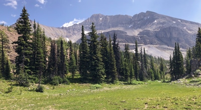
Floe Lake is one of the most photogenic lakes in the Rockies and the backpack to it and beyond to Numa Pass is one of the most colorful as wildflowers bloom in the summer and larch trees below the pass turn brilliantly gold in the fall.
Getting there
From Banff head west on the Trans Canada towards Lake Louise. At Castle Junction take the 93S towards Radium Hot Springs and continue 93S as you enter British Columbia. The Floe Lake trailhead will be well signed to your right, after about 19.9mi from where you turned onto the 93S.

About
| When to do | July - September |
| Backcountry Campsites | Floe Lake Campground |
| Toilets | Trailhead |
| Pets allowed | Yes - On Leash |
| Accommodation Type | Tent |
| Family friendly | Older Children only |
| Route Signage | Average |
| Crowd Levels | Moderate |
| Route Type | Out and back |
Floe Lake and Numa Pass
Elevation Graph
Weather
Route Description for Floe Lake and Numa Pass
Backpacking to Floe Lake in Kootenay National Park is a wonderful 1-night backpacking trip. While you could get to Floe Lake in a long day hike, doing it as an overnight means that you can also add on the trip to Numa Pass, a worthwhile addition.
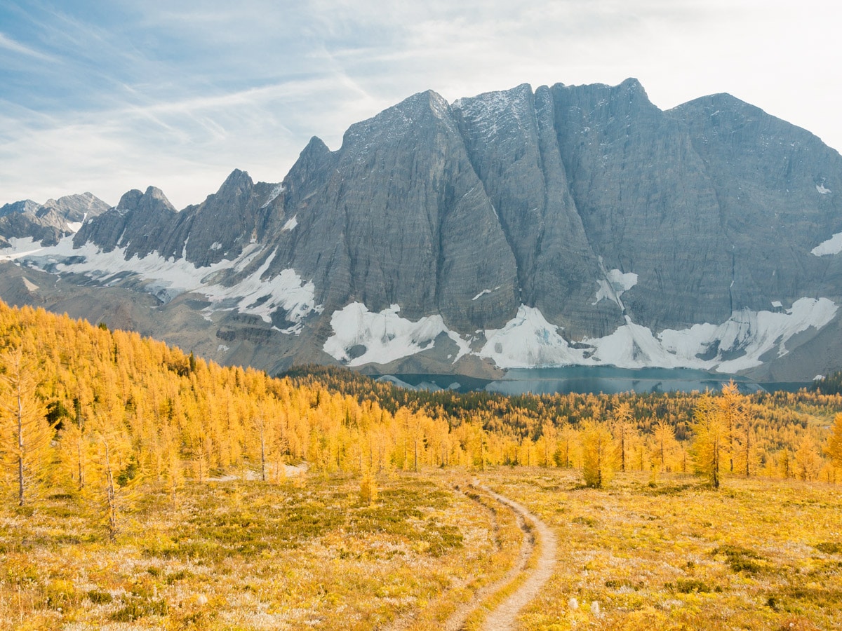
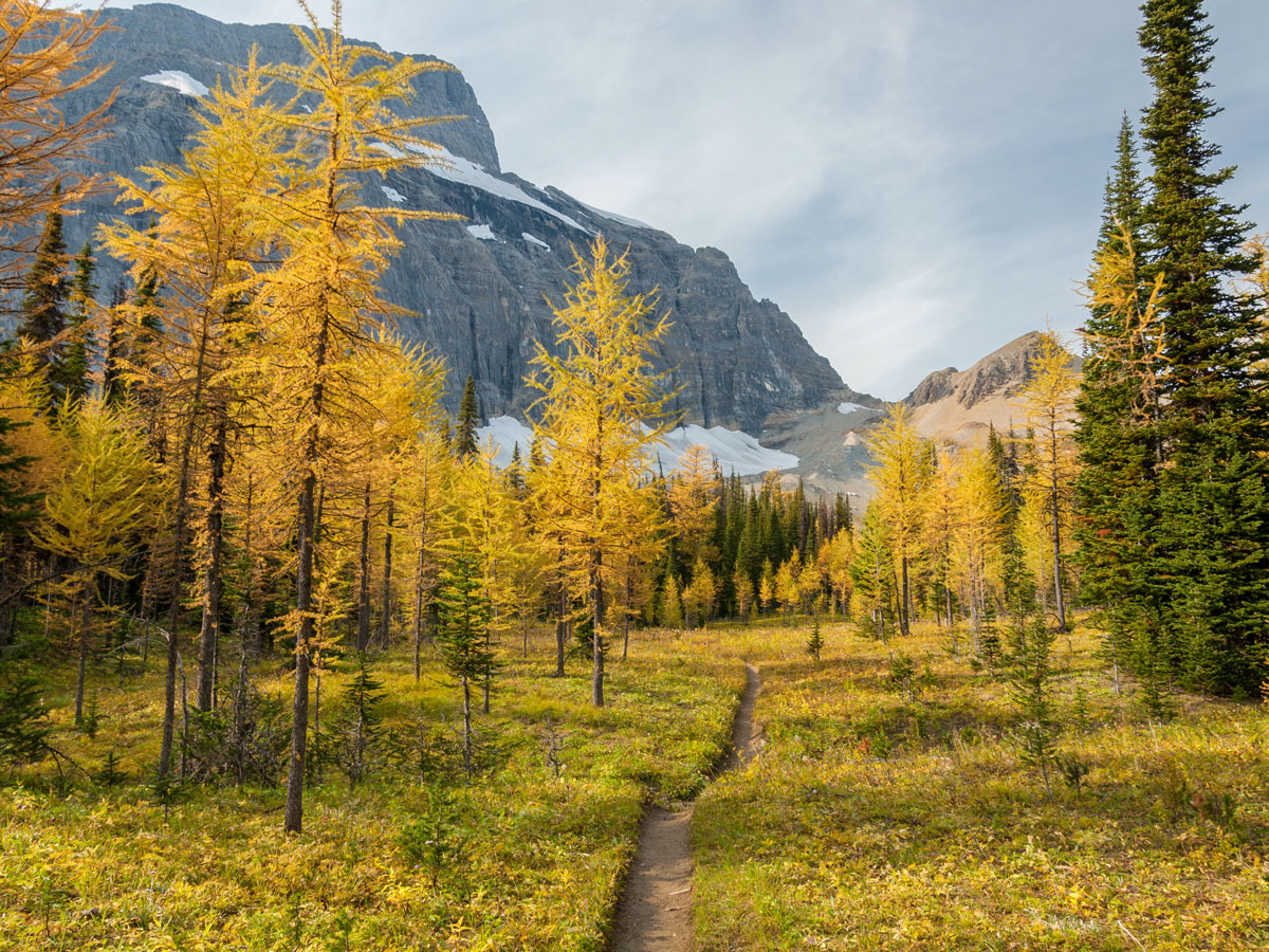
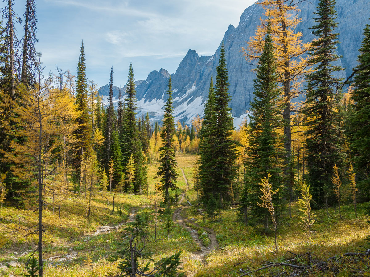
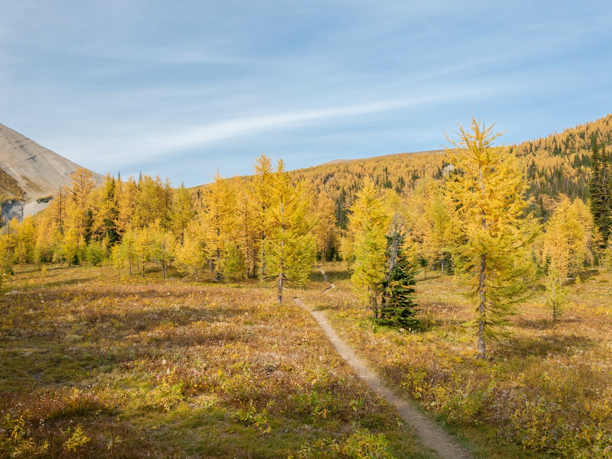
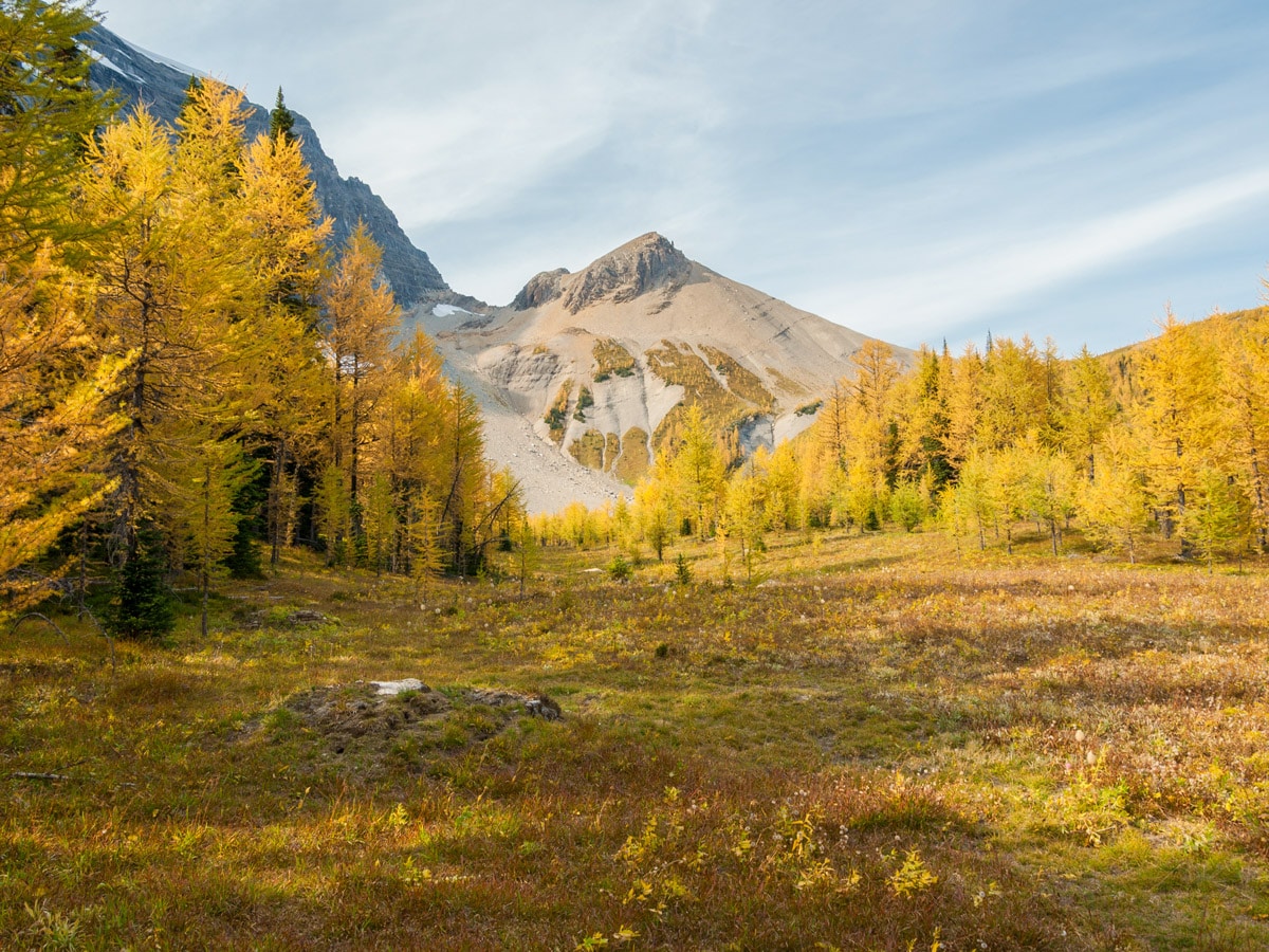
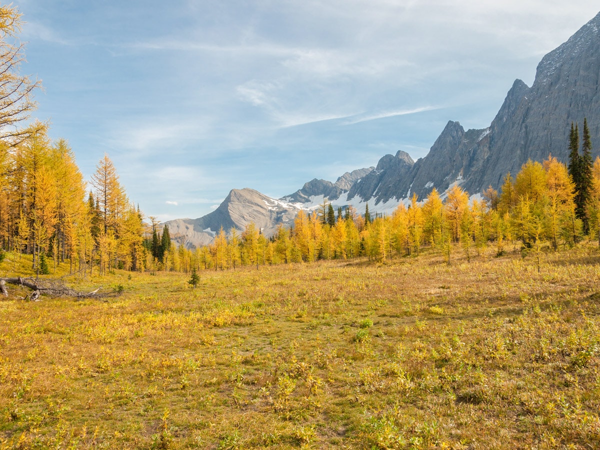
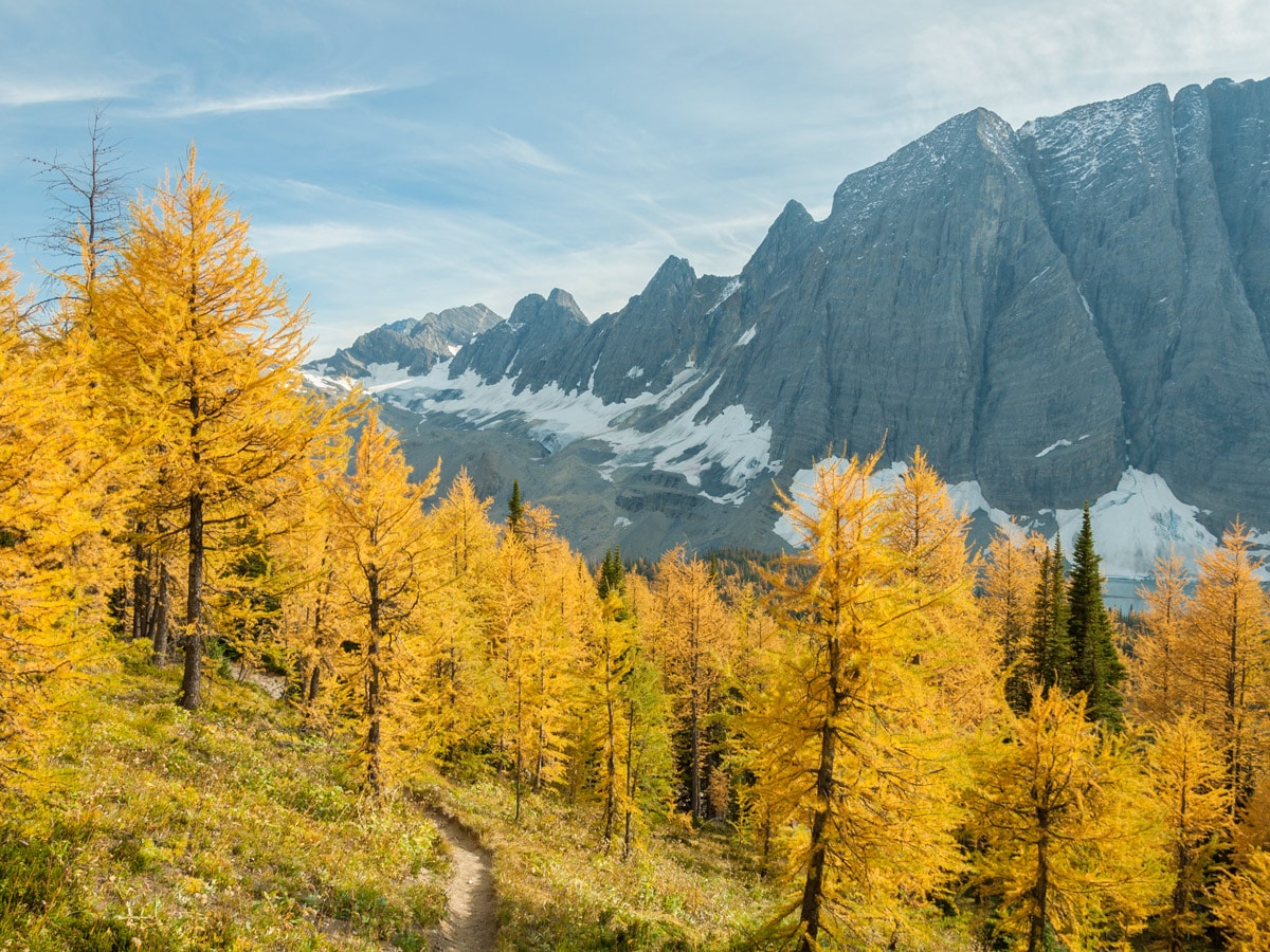
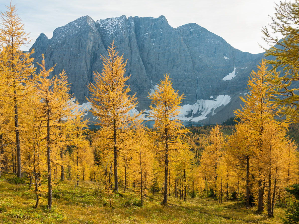
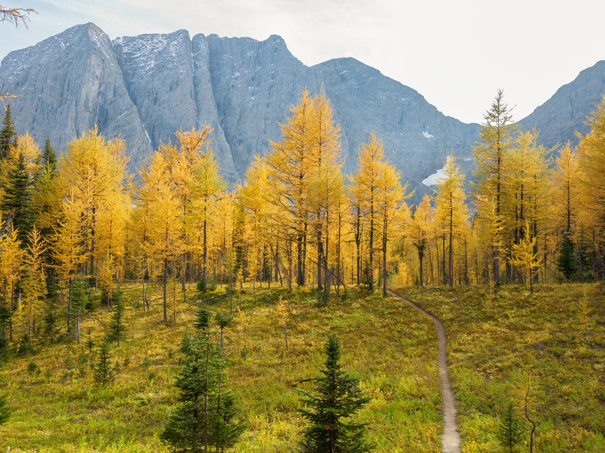
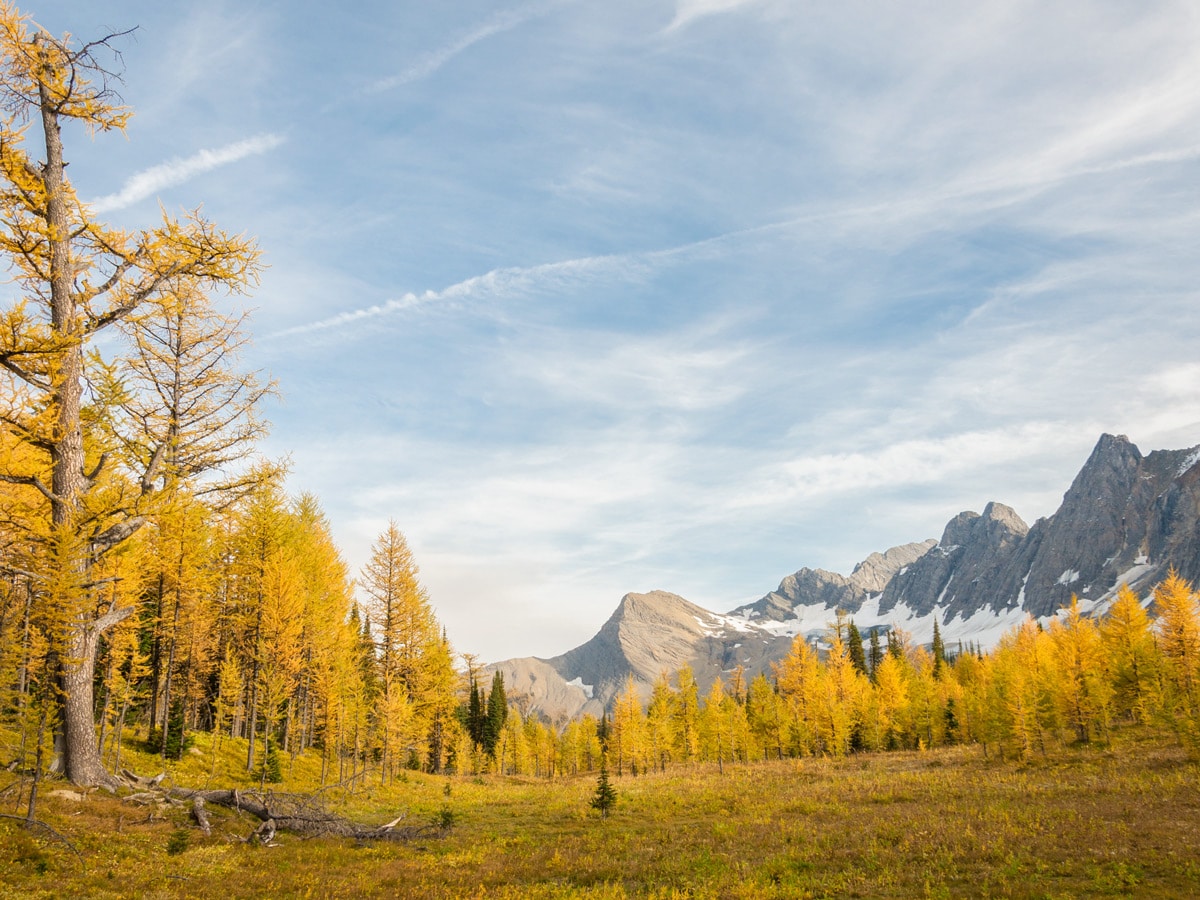
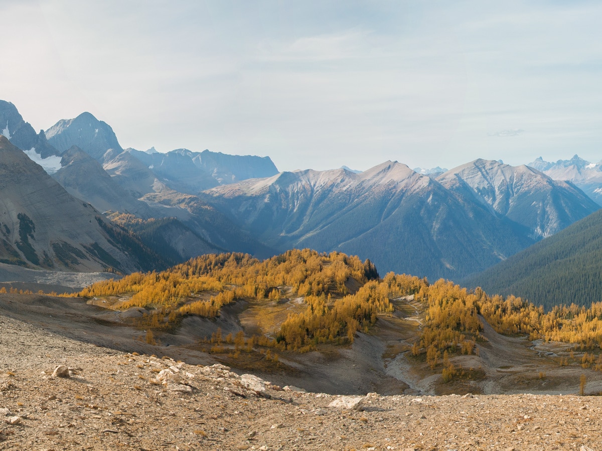
Going to Floe Lake in autumn, roughly the 3rd week of September is the perfect time to search out larches. As you can see from the photos, they are spectacular in Autumn.
The trail to Floe Lake starts at – where else – the Floe Lake trailhead, just off highway 93S. This parking lot is usually full with backpackers doing the longer Rockwall trail.
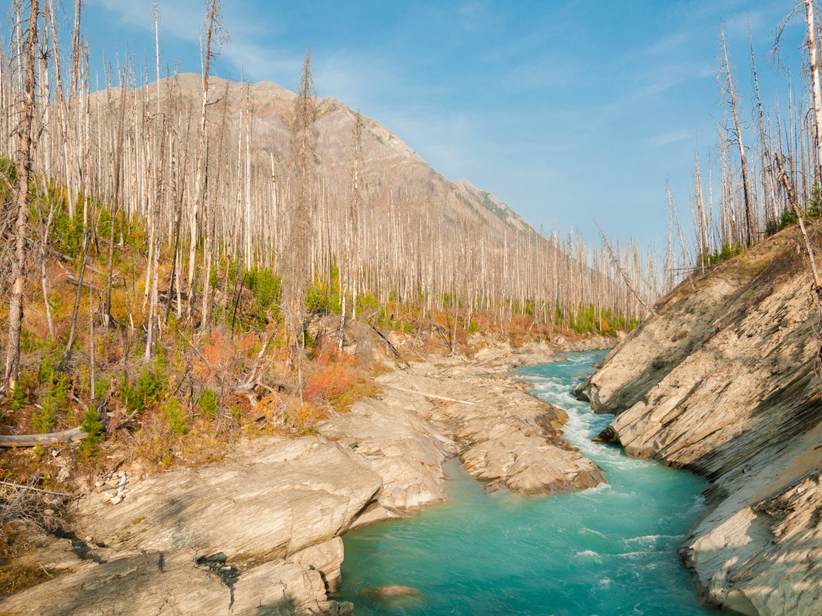
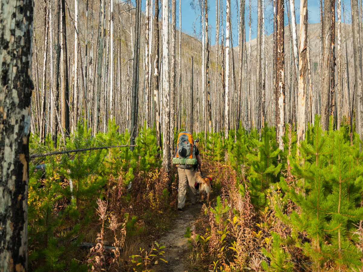
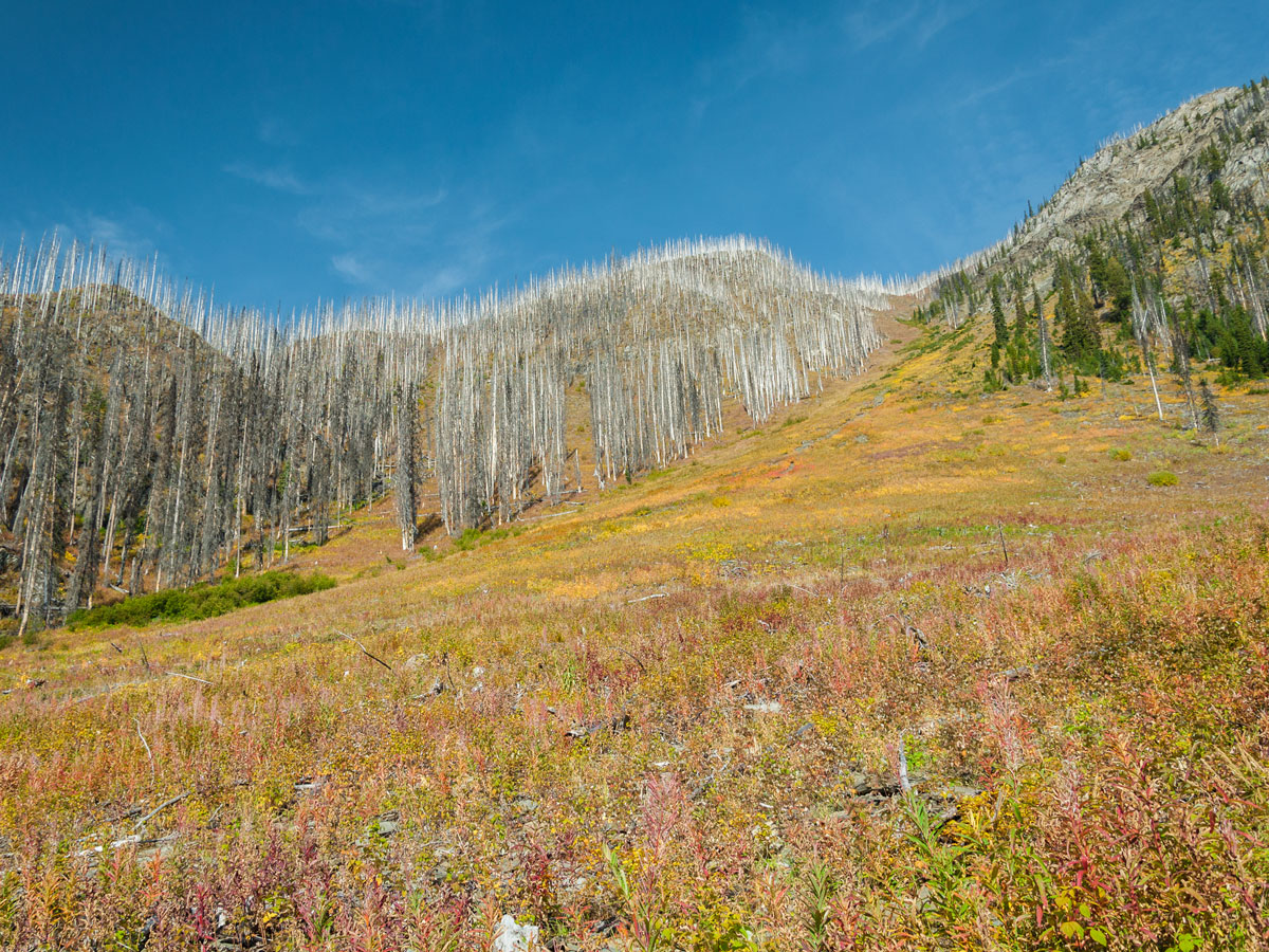
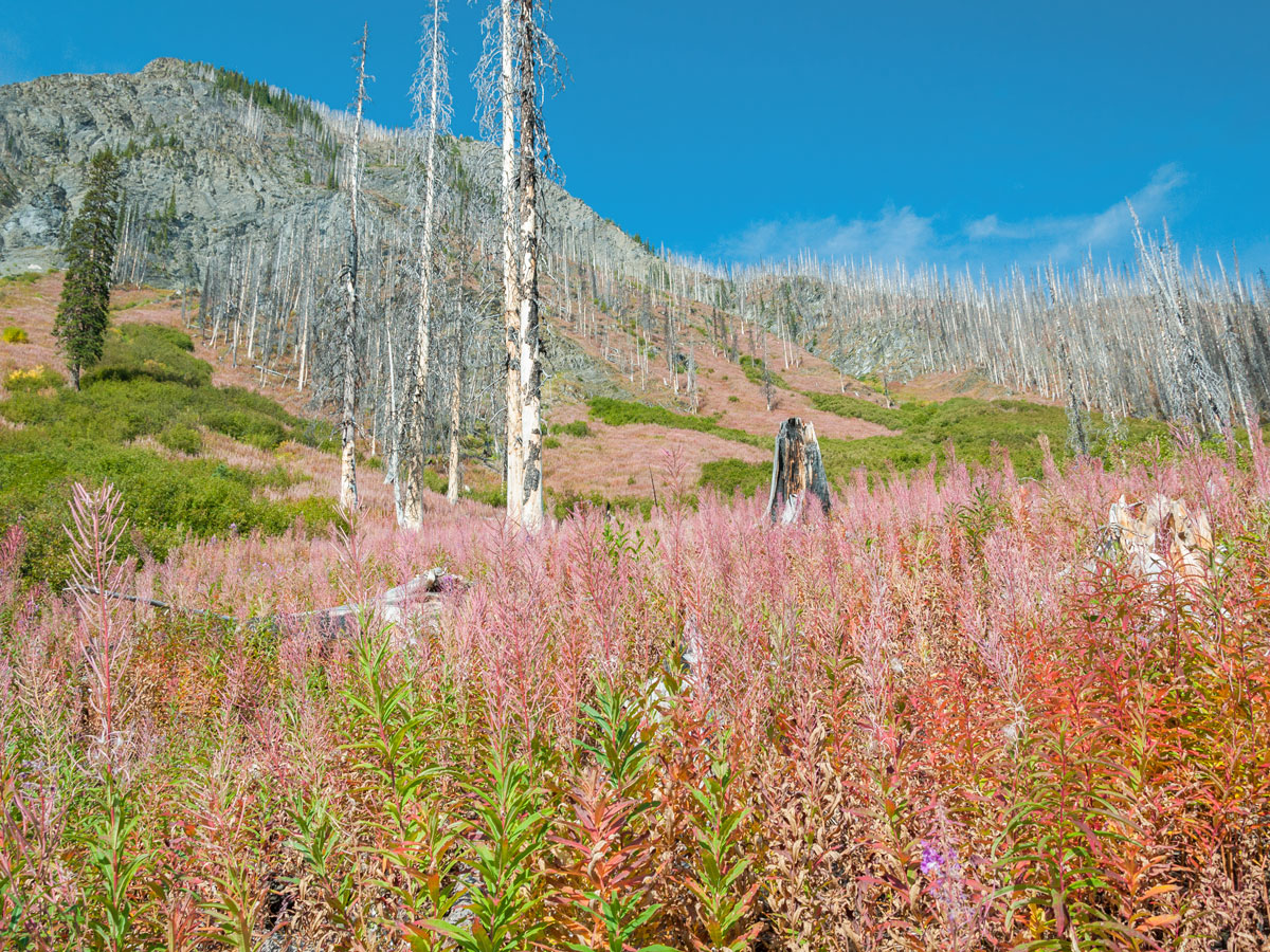
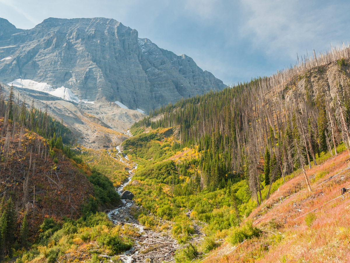
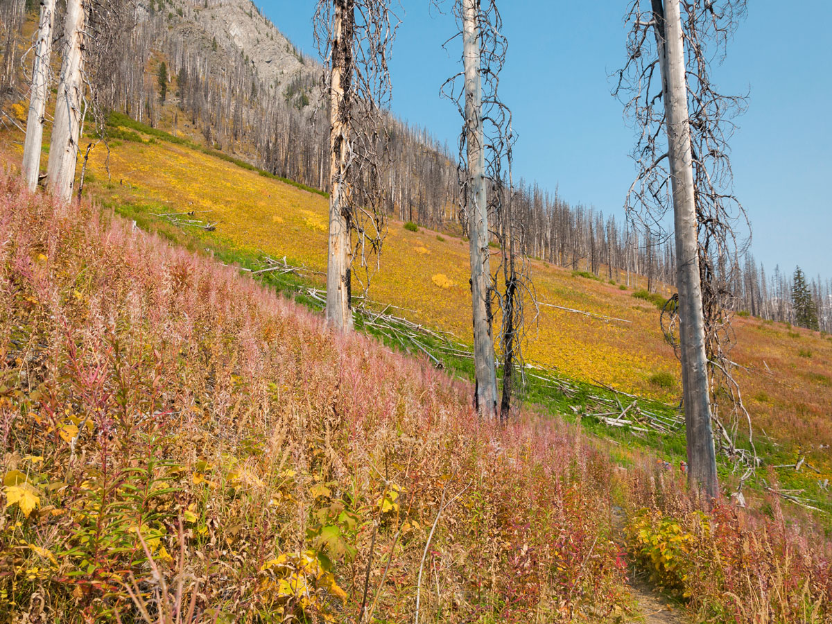
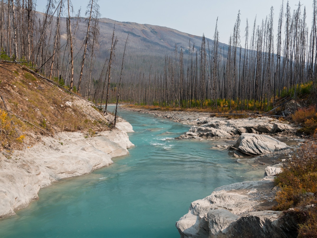
Initially, the Floe Lake trail heads southwest, crosses the bridged Kootenay River, then curves to the northwest. After crossing Floe Creek (bridged) and ascending moderately the trail turns to the southwest, contouring around the southern side of Numa Mountain and gently ascending alongside Floe Creek. This entire area was burned in 2003, but lush vegetation that changes to a variety of intense fall colors has since taken over.
The slope you’re hiking on is in the sun for most of the day, so any early snow should melt off quickly.
After about 5.6mi of relatively easy hiking you encounter the headwall guarding Floe Lake. This switchbacked trail next to a loud cascade ascends 1312ft over a very short distance and is certainly the most difficult part of the trip. The trail is well graded and the actual distance is short, and once reaching the top Floe Lake is just a few hundred meters further.
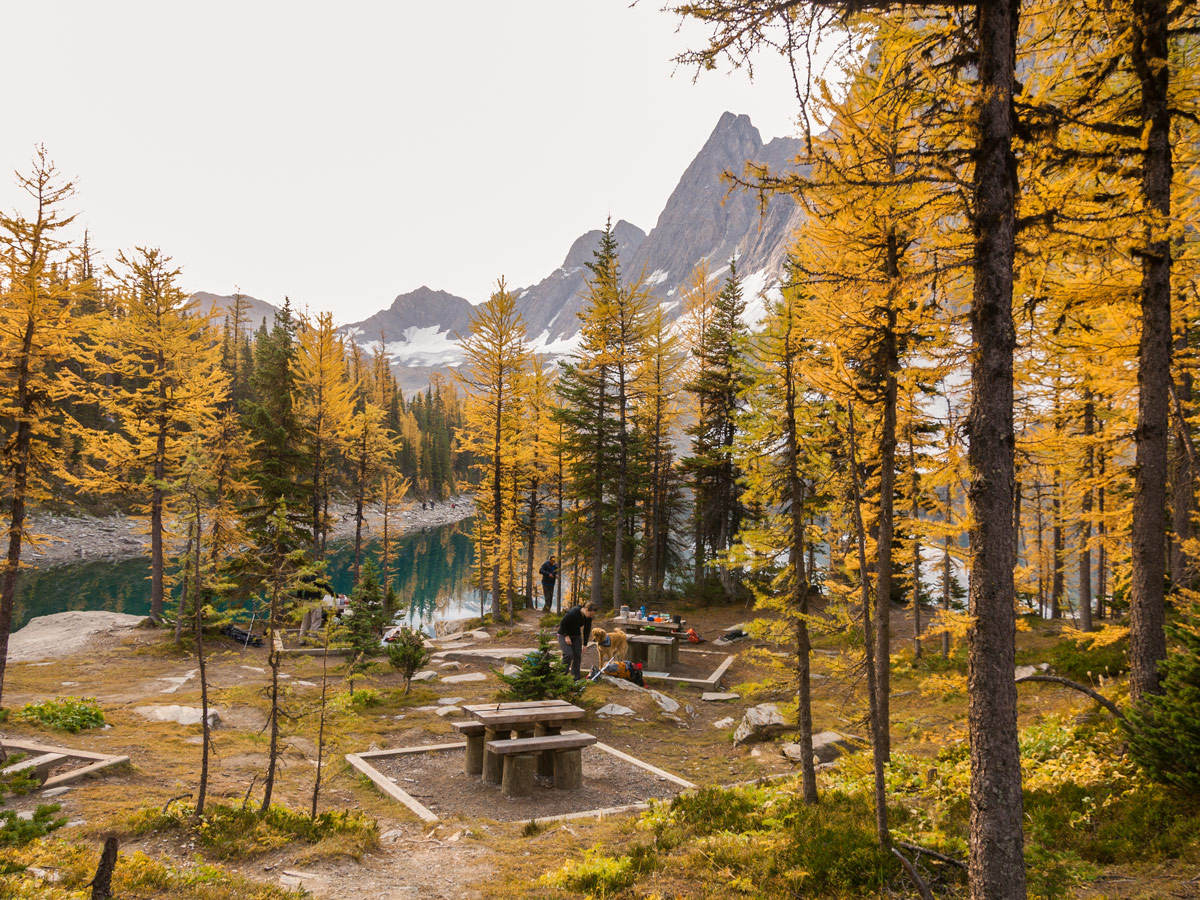
Floe Lake campground is wonderful and is located on the north side of Floe Lake; a warden campground lies just to the west of the campground. If backpacking, the first two campsites you encounter are by far the best.
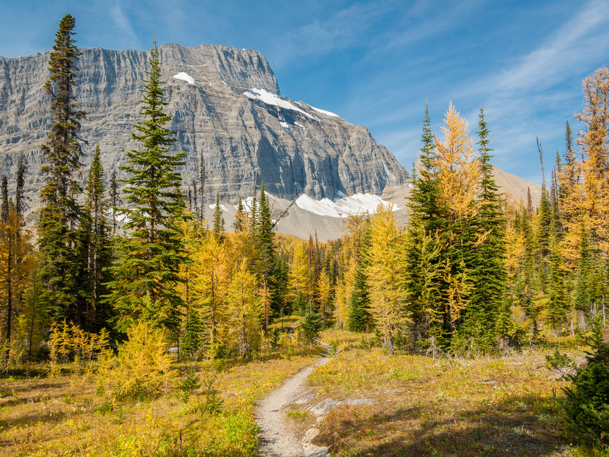
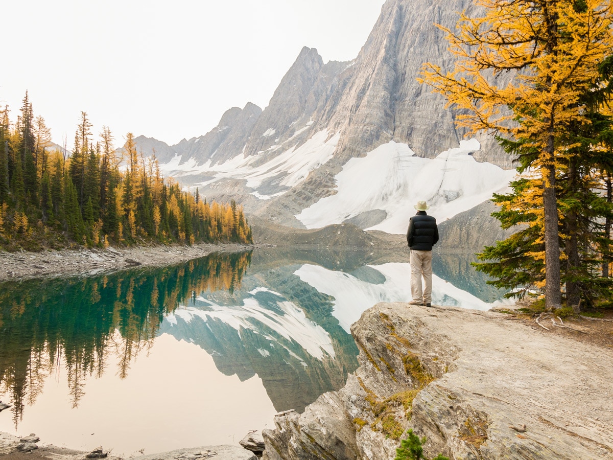
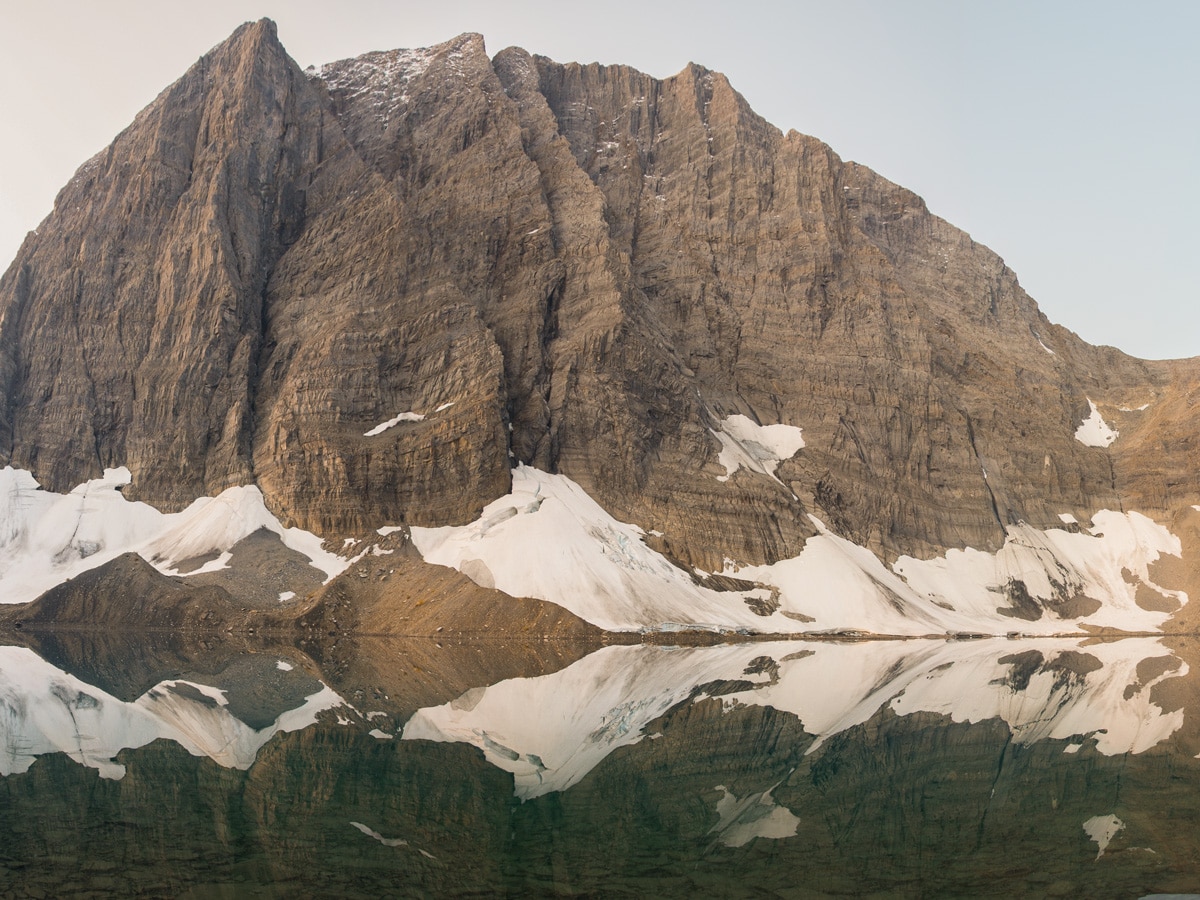
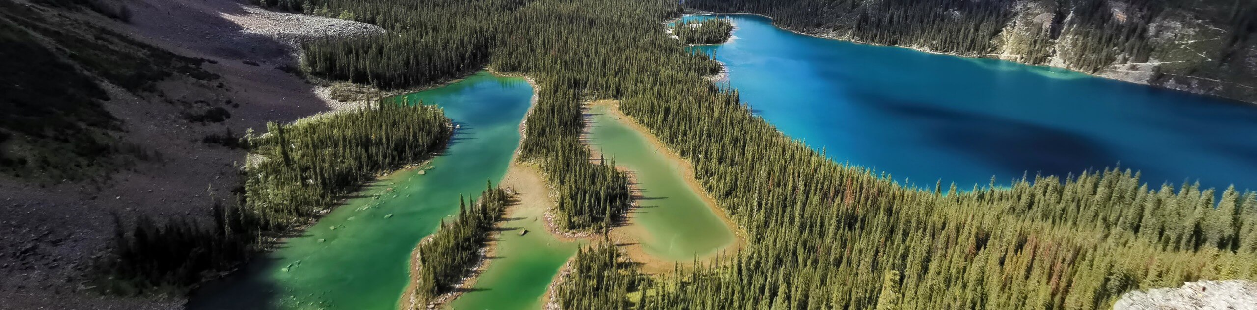
Floe Lake is stunning and several larch trees dot the treed shoreline and campground, which is pretty in fall. However, if you want to see larches, almost all the larches lie just north of the campground, on the path that goes to Numa Pass.
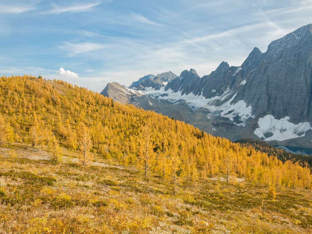
While Numa Pass is 1.7mi distant and 984ft higher, the elevation gain is gradual and nearly 0.9mi of the distance is through full larch forest.
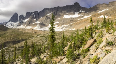
Numa Pass itself is broad and treeless and there are many small peaks/bumps nearby that are worth exploring and ascending.
Return to the Floe Lake campground once you’ve explored Numa Pass, and then retrace your steps out to the Floe Lake Trailhead on Day 2.
Sample Itinerary:
- Day 1: Trailhead to Floe Lake (one way): 6.6mi, 2264ft
- Day 2: Floe Lake to Numa Pass: 3.4mi, 1017ft and then hike back to car (6.6mi, 2264ft of descent).
Insider Hints
At the time of writing the Numa Creek bridge was closed, and is scheduled to be closed for all of 2019. Once the Numa Creek Bridge is open, you could camp at Numa Creek Campground for a 2nd night, and make a weekend circuit on this route.
Book your campgrounds as soon as reservations open on the Parks Canada Backcountry page.

Similar backpacking trails to the Floe Lake and Numa Pass backpacking trail
The Rockwall Trail
Kootenay National Park’s Rockwall Trail is one of the most popular, multi-day backpacks in the Canadian Rockies. The Rockwall is…
Ball Pass to Shadow Lake
The Ball Pass backpack starts in Kootenay National Park and leads you into Banff National Park and Shadow Lake. Hiking…
Lake O’Hara Backcountry
Explore the incomparable Lake O'Hara area of Yoho National Park on this backcountry trek that totally immerses you in western…
mallorykirzinger 4 years ago
Simply the most beautiful trail in the fall when the larches turn. Well worth the time and effort!
candycane 5 years ago
We had a fun walk through the woods. Some section was a bit muddy, it's quite annoying, but it's manageable.
tiara29 5 years ago
For us, it's not just the lake that we enjoyed. The whole trail was a treat. The surroundings were breathtaking.
souly 5 years ago
Nice walk through the forest. The Lake was stunning!
Teddy Lumber 5 years ago
This place is mesmerizing! No matter how many photographs I take, I know I won't be able to capture the essence of being there.