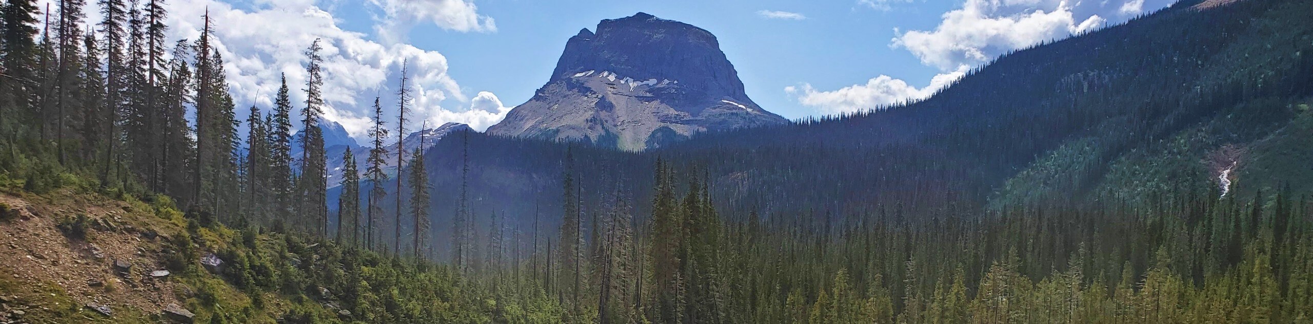
Lake O’Hara Backcountry
View Photos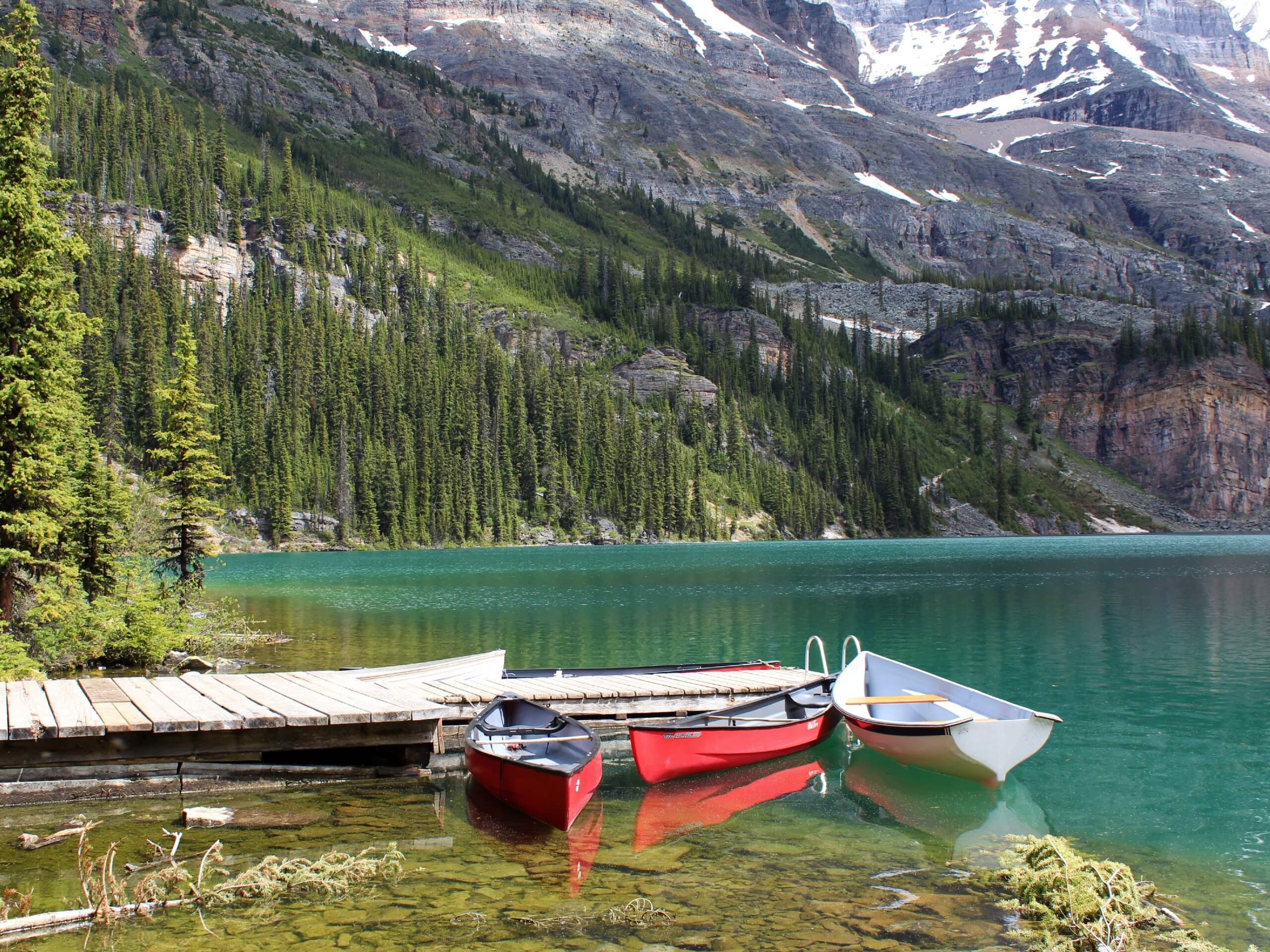
Lake O’Hara Backcountry
Difficulty Rating:
Explore the incomparable Lake O'Hara area of Yoho National Park on this backcountry trek that totally immerses you in western Canada's backyard. This adventure-based hike has you camping for two nights in Lake O'Hara campground, propelling the authenticity of your outdoor experience. Meanwhile, the hiking trails and alpine routes lead to sparkling glacial lakes and spectacular views in the Canadian Rockies.
Getting there
To get to the Lake O’Hara area, take a park shuttle on the 6.8mi access road. Advance reservations for the shuttle are needed, but a camping reservation at the Lake O’Hara campground also secures you a seat on the bus. Cycling on the access road is not allowed, but hiking along the road is permitted.

About
| When to do | June, July, August, September, October |
| Backcountry Campsites | Lake O’Hara campground |
| Pets allowed | No |
| Family friendly | No |
| Route Signage | Average |
| Crowd Levels | Low |
| Route Type | Circuit |
Lake O’Hara Backcountry
Elevation Graph
Weather
Route Description for Lake O’Hara Backcountry
Day 1: Lake McArthur (5.2mi / 1017ft elevation)
Find the trailhead by the Le Relais day shelter and start walking uphill into the forest. At the junction, continue straight toward the Elizabeth Parker ACC Hut rather than turning left onto the Big Larch trail. Pass the hut, which is beautifully situated in a meadow. The hut itself is also wonderful, but only ACC (Alpine Club of Canada) members with reservations can go inside.
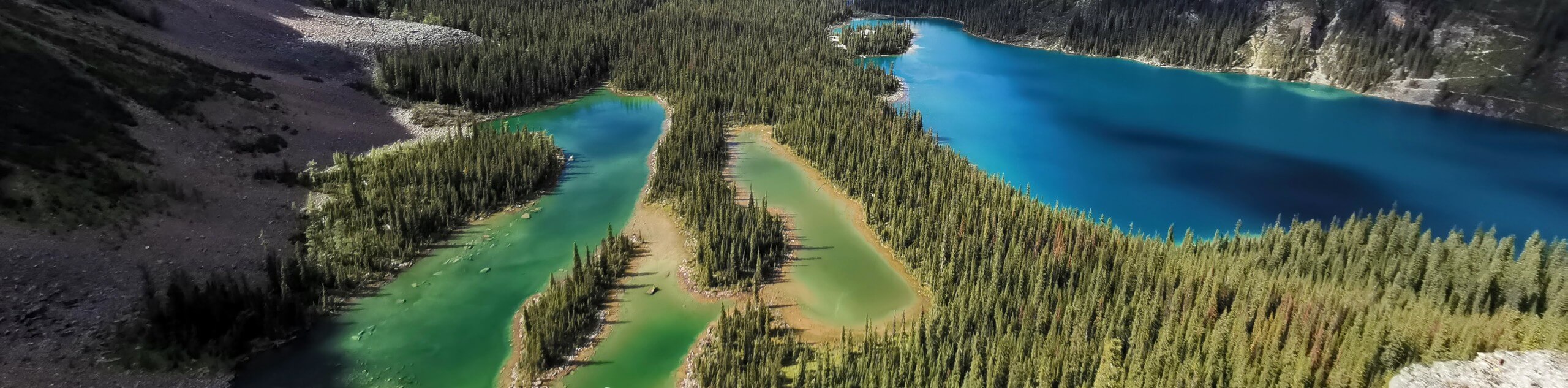
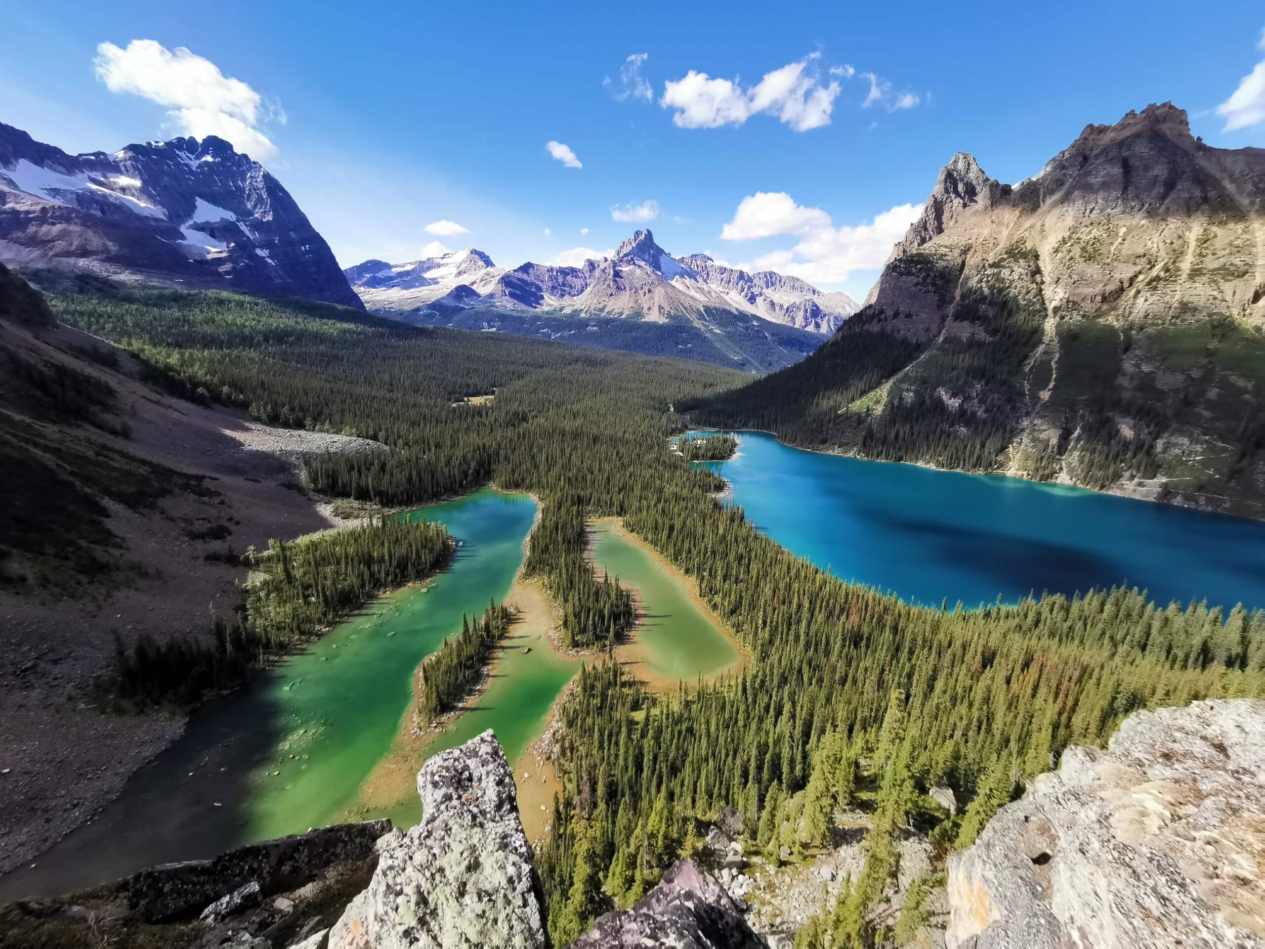
From here, the trail to Schaffer Lake is clear and well-maintained. When you reach Schaffer Lake, walk around the lake and be careful not to turn left onto the All Souls route. At the fork, stay to the right and cross a wonderful boulder field, which leads to alpine meadows. There is a trail junction here for the Odaray Highline trail on the right, but do not follow this trail.
The trail climbs now up to McArthur Pass where the trail splits. Both trails lead to Lake McArthur and loop around, so whichever trail you don’t take, here is the one you will take back to return to this point. Some prefer to take the Low Level trail then come back on the McArthur Highline trail to complete the circuit. As you get closer to the lake, stop to appreciate the beautiful view of the sparkling blue waters of Lake McArthur below you. Continue down to the shores of the lake and take a break here to enjoy this amazing area.
When you’re ready to start hiking again, continue on the trail to complete the circuit and return to McArthur Pass. Follow the same route back to Schaffer Lake. From here, you can choose to retrace your path past the Elizabeth Parker ACC Hut or take the Big Larch trail. The Big Larch trail is not as scenic as the trail past the hut, but it should not be missed late in the season as the leaves begin to change colours. Both trails connect just above the Le Relais day shelter. Return to the shelter then continue about 1640ft to reach the Lake O’Hara campground.
Day 2: All Souls Alpine Route (5.9mi / 2605ft elevation)
You can do today’s hike in a clockwise or counter-clockwise direction. This guide follows the counter-clockwise route since that is the recommended way. Leave the campground and walk past the Le Relais day shelter toward the Lake O’Hara Lodge. Take the well-marked West Opabin path past the lodge. You’ll come to a trail junction about 2953ft beyond the Lake O’Hara Lodge. Continue following the trail toward West Opabin, passing Mary Lake on the right. This view is especially beautiful in the morning.
The trail begins to climb, gaining about 410ft of elevation to reach the grassy Opabin Plateau. On the right, you’ll see the All Souls Prospect alpine route connector that leads from Schaffer Lake to the Opabin Plateau. To the left, there is an optional side trail to see a spectacular view from the Opabin Prospect overlook. Otherwise, continue straight ahead on the Highline trail.
The Highline trail follows the Opabin Creek and leads toward Hungabee Lake. Climb over a knoll, and as you crest it, you will find a breathtaking view of Opabin Lake. The Opabin glacier feeds this brilliant lake, which is beautifully framed by rugged peaks. Your circuit route continues as you walk on the opposite side of the valley toward the Yukness Ledge alpine route. Crossing the boulder field here while gaining elevation is a challenging section of trail. Be sure to watch carefully for the blue squares with two yellow lines that indicate you are on the alpine route. Continue climbing to reach a path that hugs Yukness Mountain. The views here are exceptional in all directions, so be sure to stop and look behind you.
As you come around to the northwest side of Yukness Mountain, continue to climb through another boulder field. You’ll pass several pretty lakes in this area, and we particularly recommend taking a break at Lake Oesa if it’s not too windy.
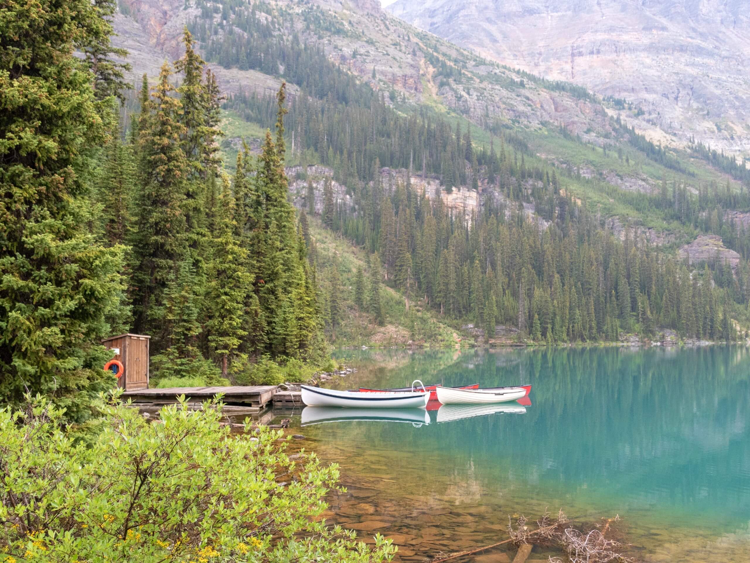
You can choose to follow the Huber Ledges alpine route up to Wiwaxy Gap, but this trail feels much more exposed than the Yukness trail. Our preference is to descend on the Lake Oesa Trail. Pass Lake Victoria and Yukness Lake as you return to Lake O’Hara. When you reach Lake O’Hara, follow the shoreline trail to return to the Le Relais shelter and the Lake O’Hara campground.
Spend one more night in the incredible Lake O’Hara campground and take the shuttle bus out of the area in the morning.
Making a Reservation at Lake O’Hara Campground
The beauty of the Lake O’Hara area is preserved in part by limiting the number of visitors to the area. The Lake O’Hara campground is one of the most popular campgrounds in the Canadian Rockies, and getting a reservation can be challenging. Reservations are accepted first-come, first-served through the online Parks Canada Reservation Service. Stays at Lake O’Hara campground are limited to three nights.
To increase your chances of getting a reservation, create your Parks Canada online account ahead of time if you don’t already have one. Be as flexible as possible on dates and log in to book your site as soon as they begin accepting reservations. There are only 30 sites available at this campground, to begin with, so reservations fill up fast – often within the first 15-20 minutes after the reservation window opens.
Insider Hints
If you can’t reserve the same campsite for both nights at the Lake O’Hara campground, don’t hesitate to book different campsites and move your tent in the morning.
The Le Relais day use shelter is the info centre for the Lake O’Hara area. It also has a small museum, coffee shop, and gift shop. They only accept cash so be sure to have some with you.
Similar backpacking trails to the Lake O’Hara Backcountry backpacking trail
Yoho Valley Backpacking Route
With waterfalls, mountain lakes, and stunning views in all directions, this Yoho Valley backpacking tour is both challenging and rewarding.…
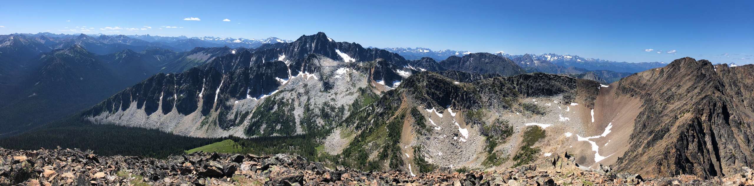
Frosty Mountain Loop Backpacking Trail
The Frosty Mountain Loop Backpacking Trail is a 16.8mi loop through E.C. Manning Provincial Park that takes hikers…
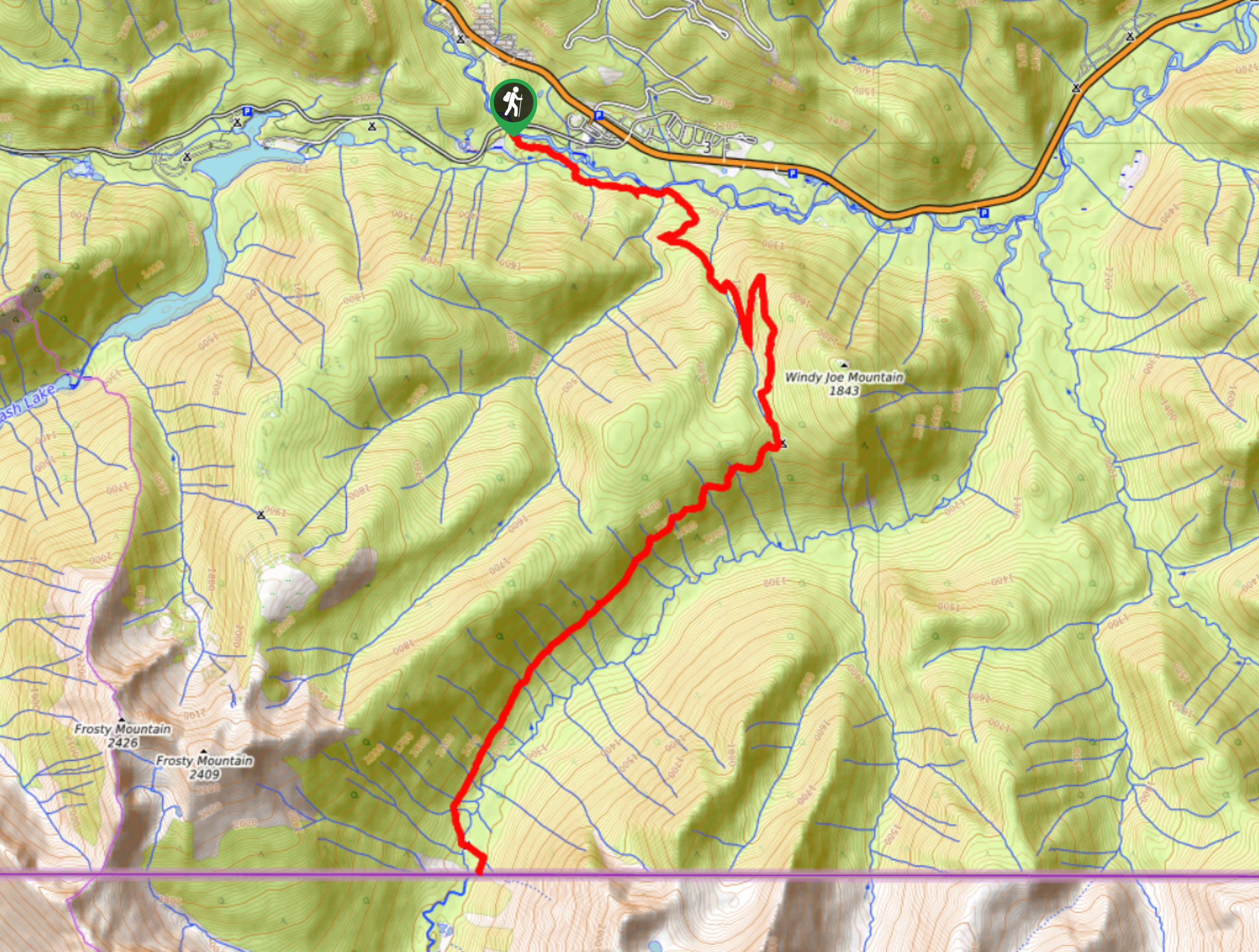
PCT Northern Terminus Backpacking Trail
The PCT Northern Terminus Trail is an amazing hike within E.C. Manning Provincial Park that takes hikers to the northern…
Comments