
PCT Northern Terminus Backpacking Trail
View Photos
PCT Northern Terminus Backpacking Trail
Difficulty Rating:
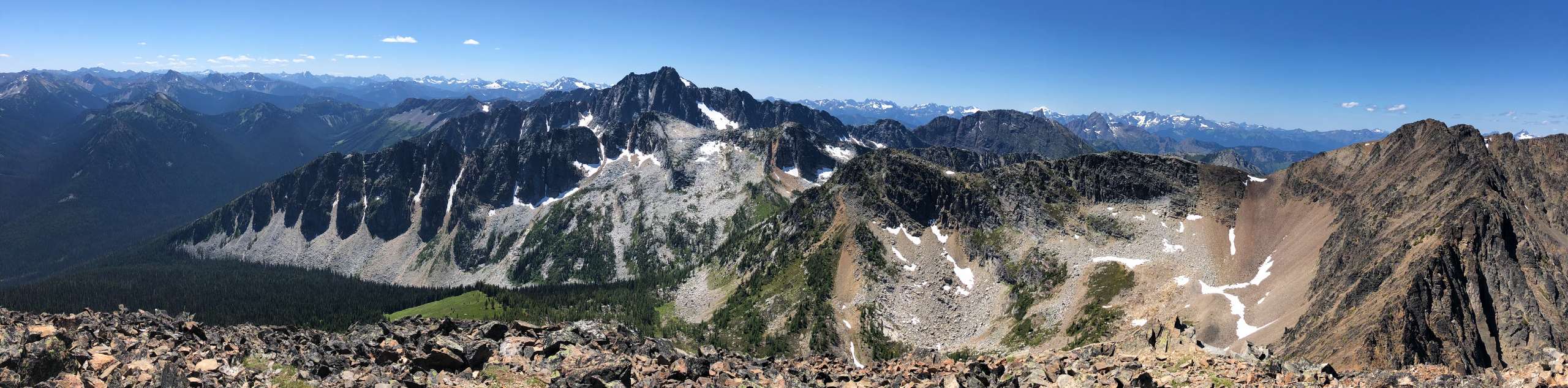
The PCT Northern Terminus Trail is an amazing hike within E.C. Manning Provincial Park that takes hikers to the northern tip of the Pacific Crest Trail, a legendary route through the United States that spans a 2650.1mi distance from Mexico to the border with Canada. While you won’t be able to legally cross the border into the United States, this trail will bring you right up to the monument marking the beginning of the famous hiking route. Along the way you will be surrounded with scenic views of the rugged mountains and picturesque stretches of forest that characterize the landscape along the border.
Getting there
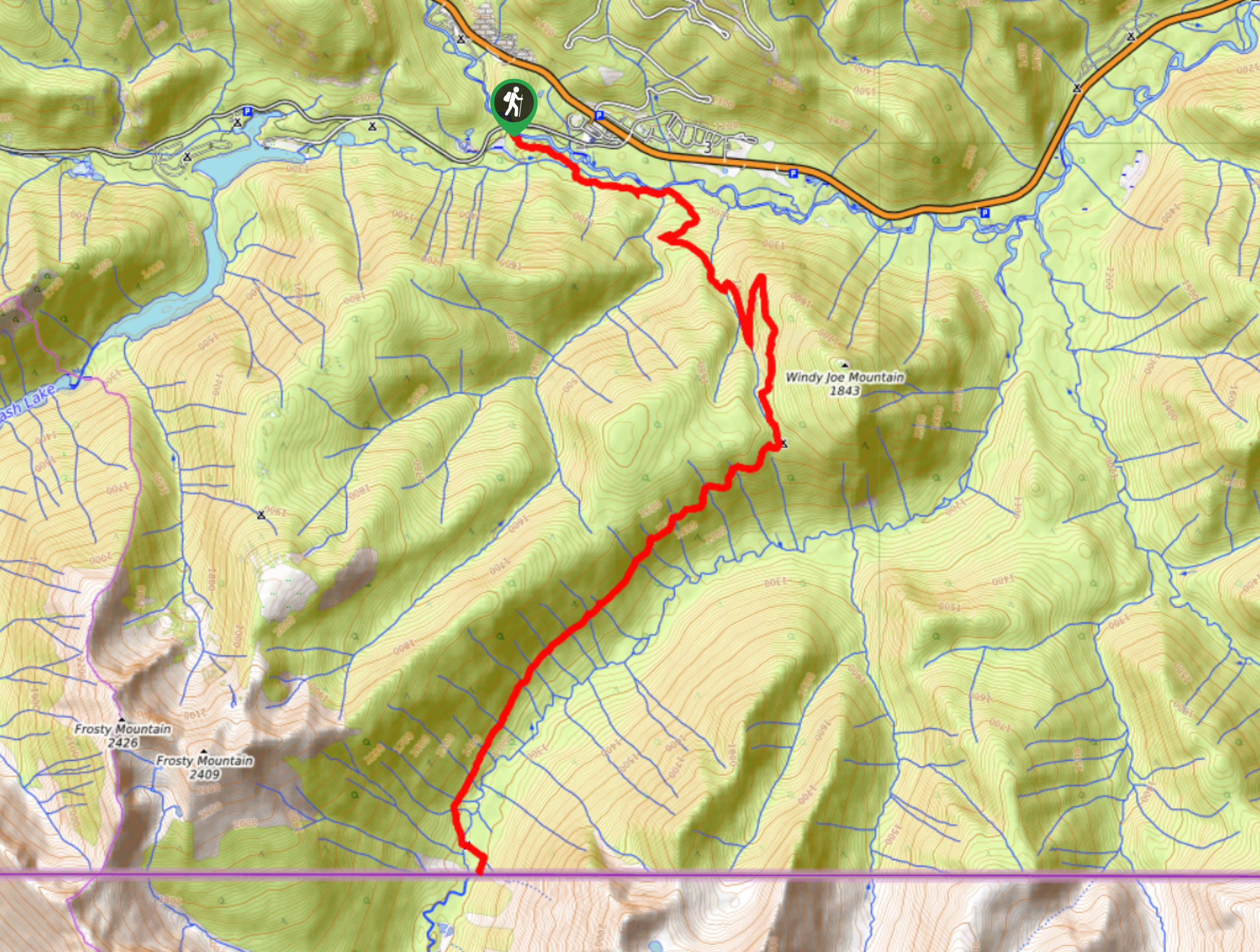
To access the trailhead for the PCT Northern Terminus from Hope, head east along BC-3 E for 37.3mi and a right turn to get onto Gibson Pass Road. After 0.7mi you will cross over the Similkameen River and find the trailhead on the left.

About
| When to do | July-October |
| Backcountry Campsites | Monument 78 Camp |
| Pets allowed | Yes - On Leash |
| Family friendly | No |
| Route Signage | Average |
| Crowd Levels | Moderate |
| Route Type | Out and back |
PCT Northern Terminus Backpacking Trail
Elevation Graph
Weather
PCT Northern Terminus Trail Description
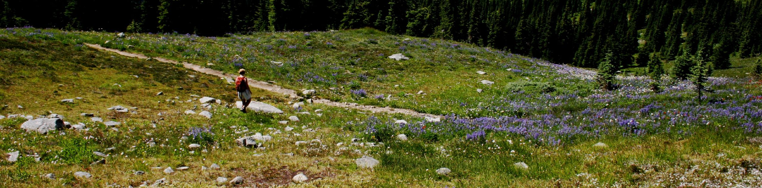
The PCT Northern Terminus Trail is a 16.6mi out-and-back hiking route that is best completed as a multi-day trip with an overnight stay at the Monument 78 Camp. The route features a good variation in terrain, including dense tree cover and more exposed sections of trail. This, in addition to rapidly changing weather patterns in the region, means that hikers should come prepared for a variety of trail conditions and pack accordingly for the long duration of the hike. Another thing to note is that there is no official border crossing at the end of this hike. Anyone looking to set off on the Pacific Crest Trail will need to cross the border at an official government checkpoint to properly enter the United States, at which point they will need to make their way to the Northern Terminus from the American side.
Setting out on the trail off of Gibson Pass Road, make your way east along the Windy Joe Trail as it skirts alongside the Similkameen River. Take the junction to the right to climb uphill and past Windy Joe Mountain on a course south towards the Canada-U.S. border. This section of forested trail will cross over countless streams on the way to Monument 78 Camp, where you will be able to set up camp for the night. Just beyond the camp to the south, hikers will be able to make their way to the PCT Northern Terminus that straddles the border. After exploring the area and spending a few moments in two different countries at the same time, make your way back along the trail to return to your vehicle at the trailhead off Gibson Pass Road.
Similar backpacking trails to the PCT Northern Terminus Backpacking Trail backpacking trail
Frosty Mountain Loop Backpacking Trail
The Frosty Mountain Loop Backpacking Trail is a 16.8mi loop through E.C. Manning Provincial Park that takes hikers…
Heather Trail to Nicomen Lake Backpacking Trail
The Heather Trail to Nicomen Lake is a beautifully scenic multi-day hike that climbs through the alpine meadows of E.C.…
Lake O’Hara Backcountry
Explore the incomparable Lake O'Hara area of Yoho National Park on this backcountry trek that totally immerses you in western…
Comments