Ball Pass to Shadow Lake backpacking trail
View Photos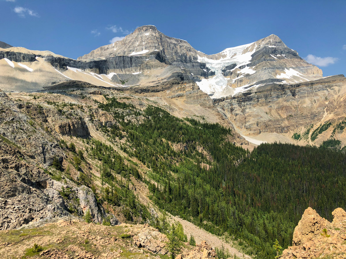
Ball Pass to Shadow Lake backpacking trail
Difficulty Rating:
The Ball Pass backpack starts in Kootenay National Park and leads you into Banff National Park and Shadow Lake. Hiking up and over Ball Pass to either the Ball Pass Junction Campground or Shadow Lake Lodge is a great overnight trip, and there are numerous options to extend this trip.
Getting there
The Ball Pass trailhead is the same trailhead as the Floe Lake hike. From Banff head west on the Trans Canada towards Lake Louise. At castle Junction take the AB - 93S towards Radium Hot Springs and continue onto BC-93S as you enter British Columbia. The trailhead will be well signed to your right, after about 13.7mi from the AB/BC border.

About
| When to do | July - September |
| Mountain Huts | Shadow Lake Lodge |
| Backcountry Campsites | Ball Pass Junction (RE21), Shadow Lake (RE14) |
| Toilets | Trailhead |
| Pets allowed | Yes - On Leash |
| Accommodation Type | Tent or hut |
| Family friendly | No |
| Route Signage | Poor |
| Crowd Levels | Low |
| Route Type | Out and back |
Ball Pass to Shadow Lake
Elevation Graph
Weather
Route Description for Ball Pass to Shadow Lake
We love this backpack, as it gives you a lightly visited way to get into Shadow Lake. While we describe this as a 2-day, 1-night backpack, this could easily be extended, either by going east and exiting at Sunshine Village or making a lollipop loop that goes to Egypt Lake for night 2 and then does a Lollipop back to Ball Pass Junction via Shadow Lake Lodge for night 3.
Day 1
To start this backpack, park at the Floe Lake parking lot. From here you will cross the highway and catch a trail on the other side of the road and go left. Soon you come to a path going off to right, heading up the valley.
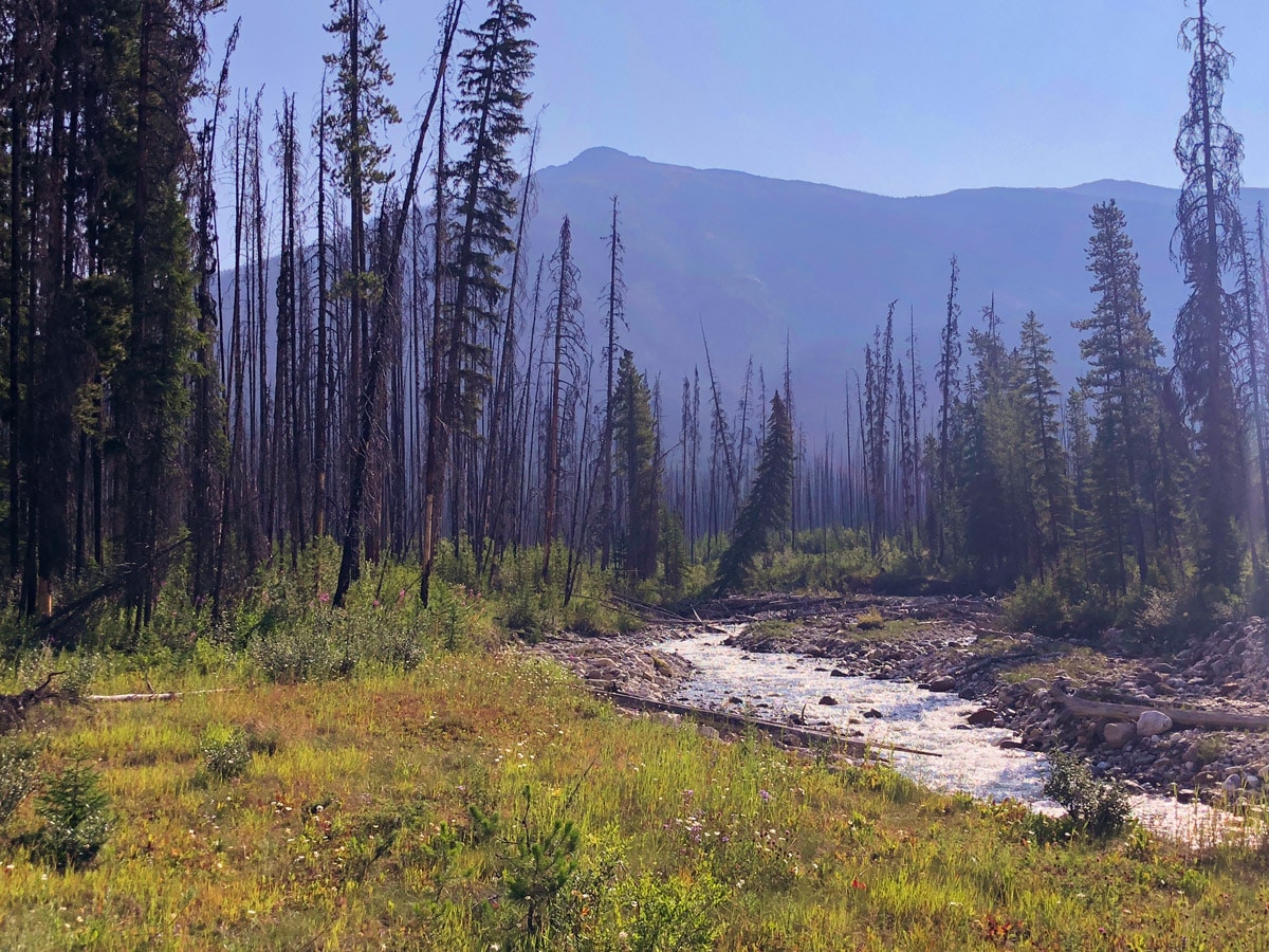
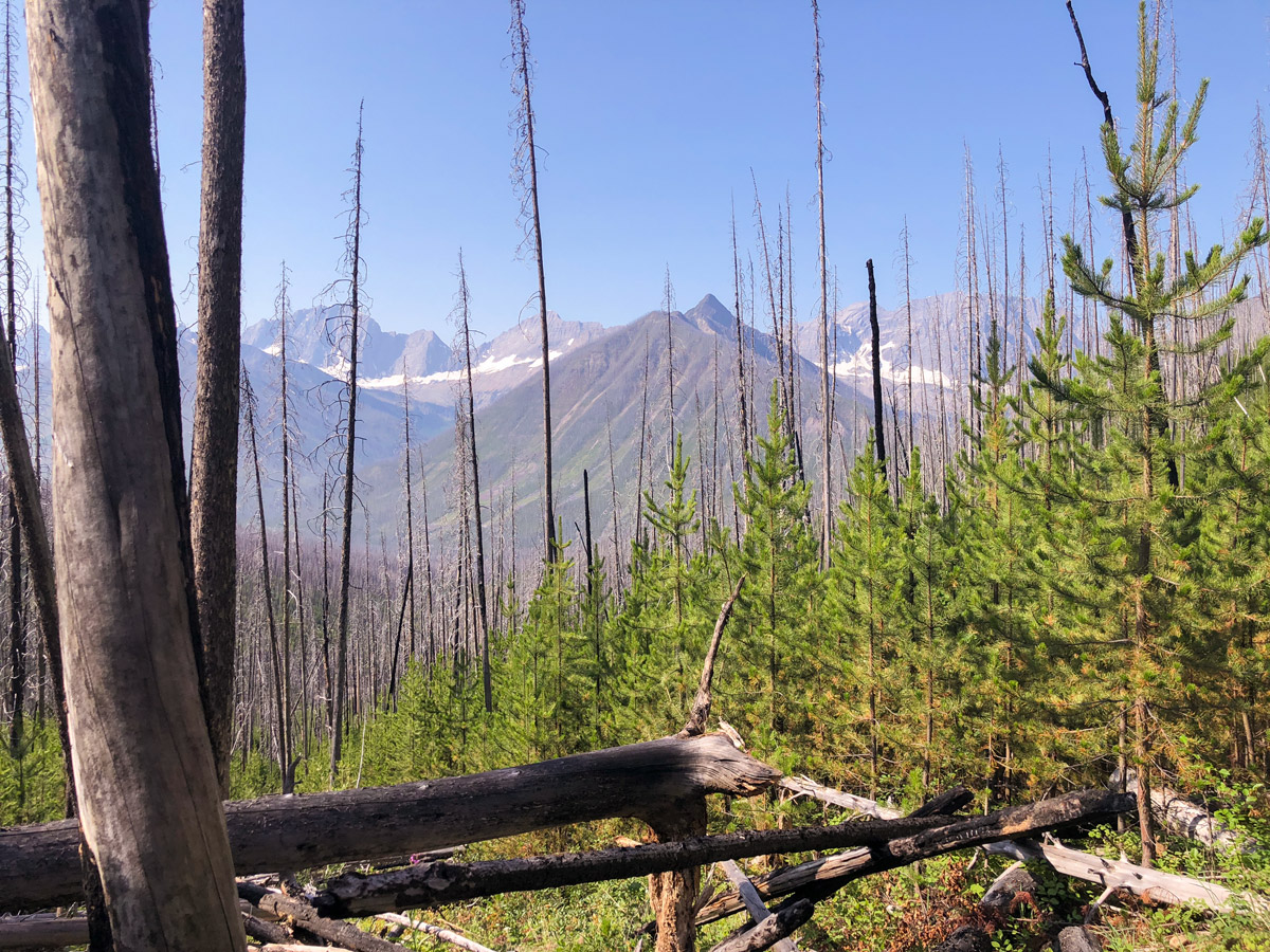
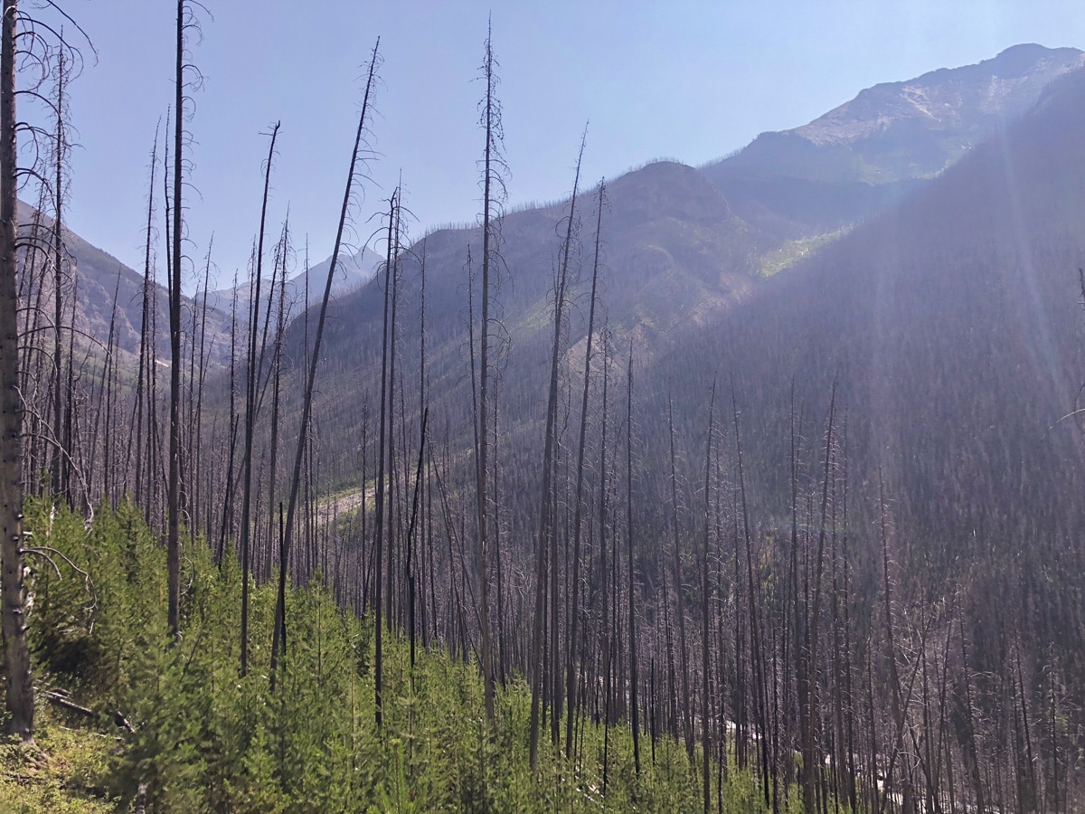
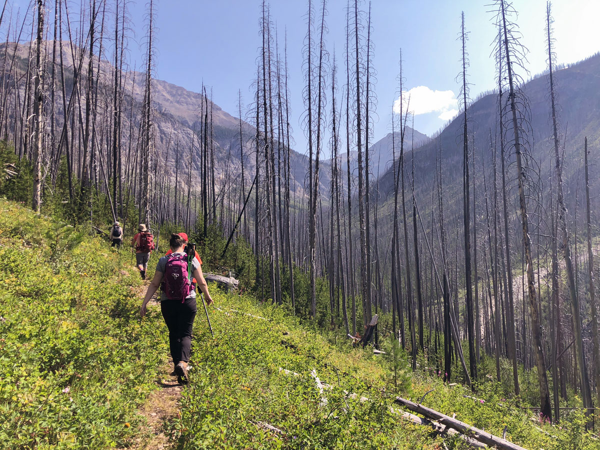
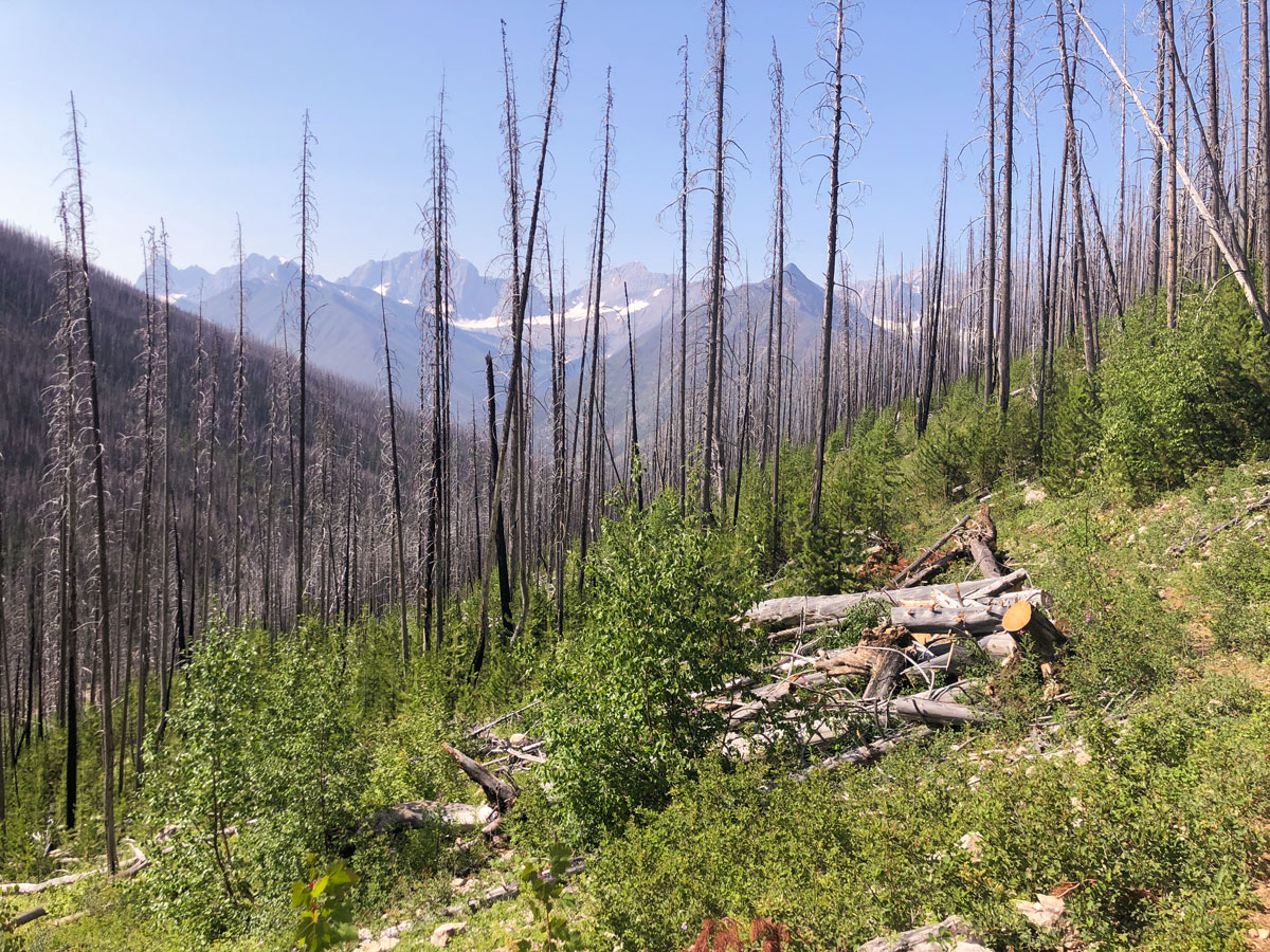
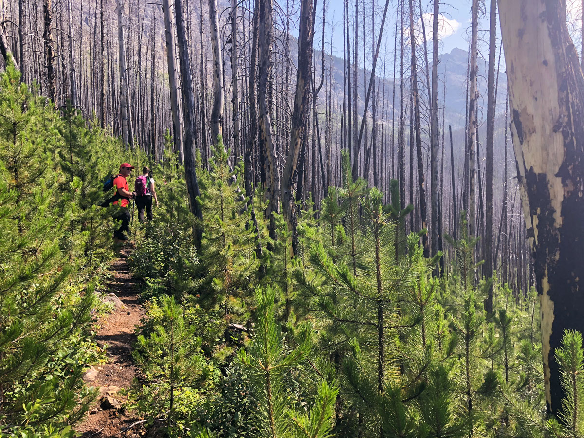
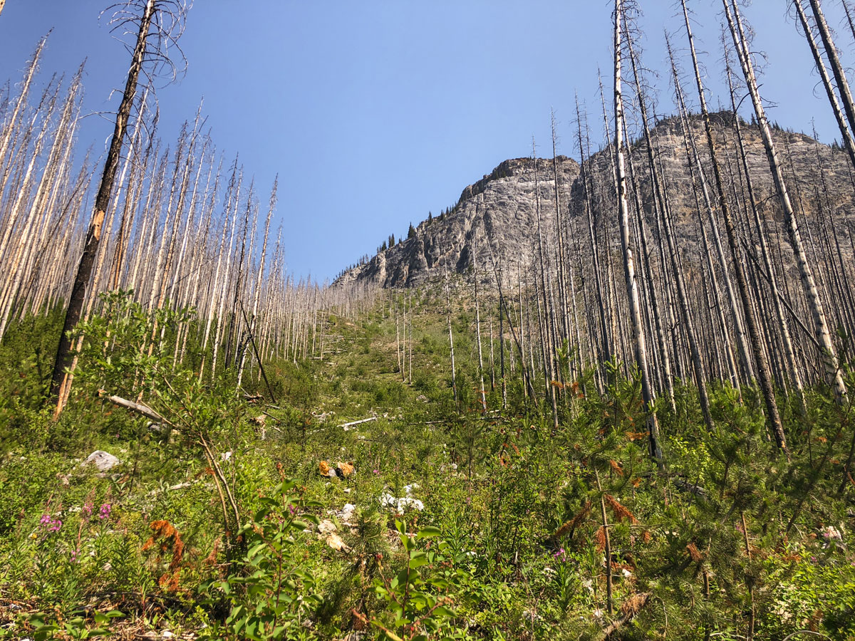
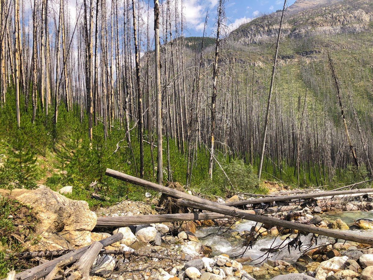
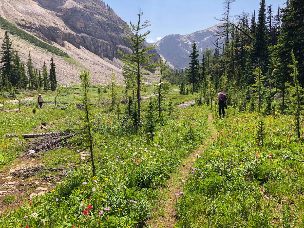
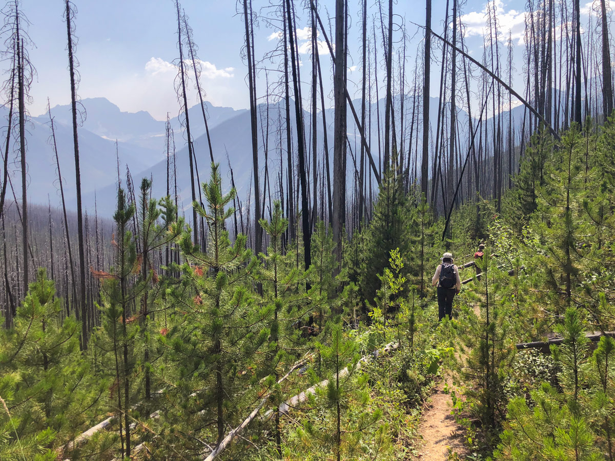
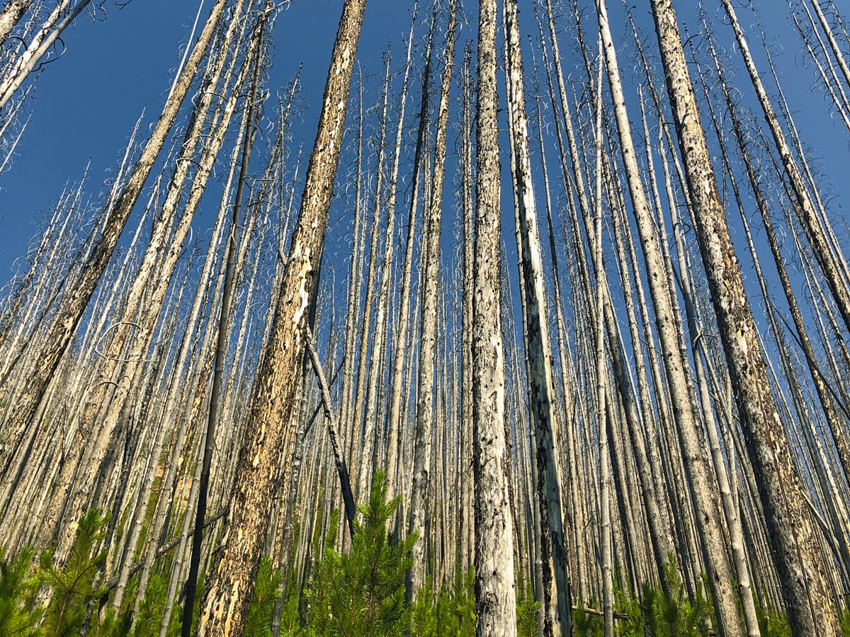
This trail goes through a re-growing forest from a past forest fire. There are lots of downed trees over the trail, which can be a pain with a big pack. The solution is to pack light for this trip, as you’ll hate the 100+ trees you need to go over or under on this trip.
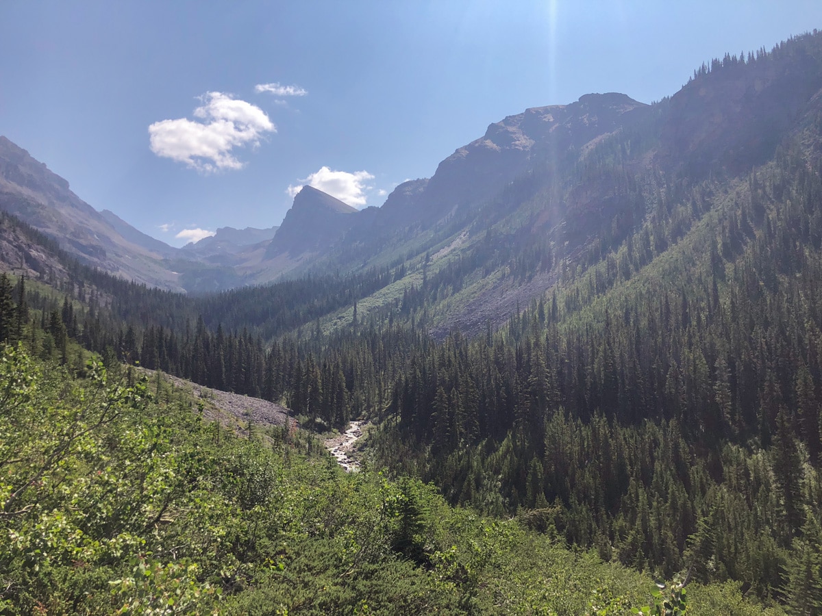
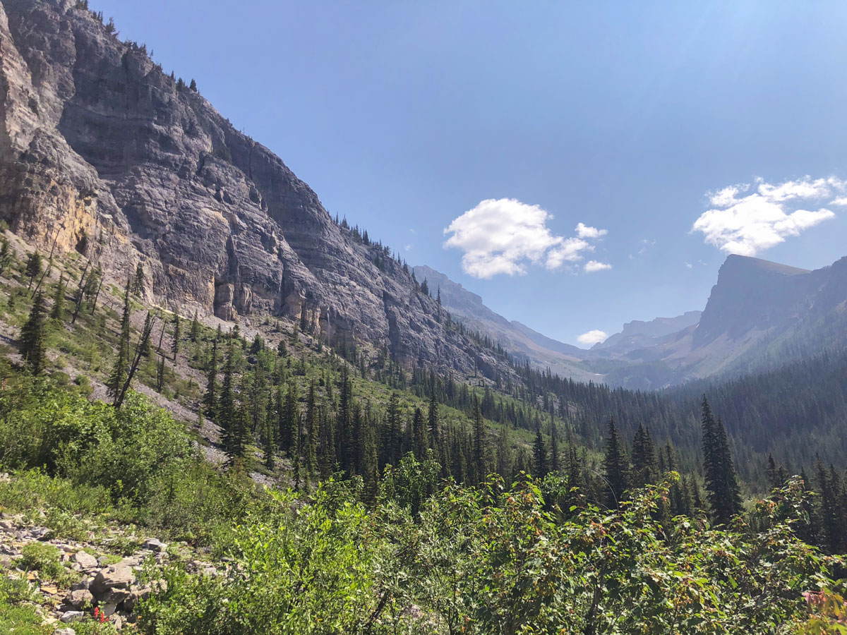
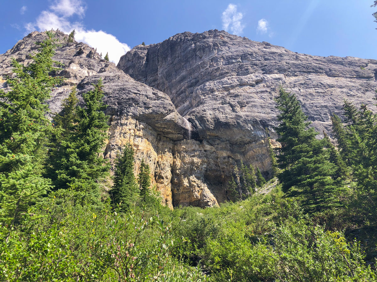
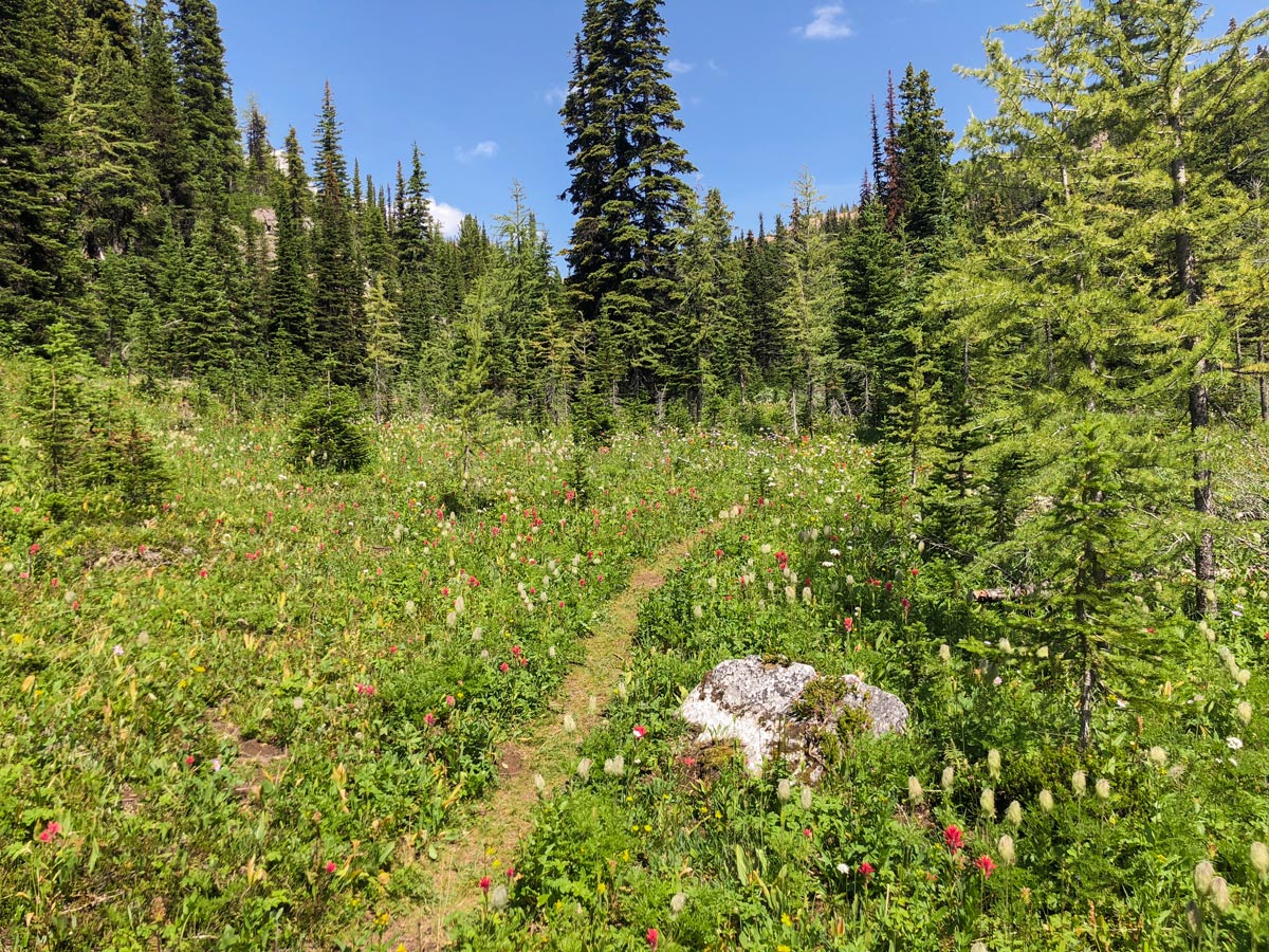
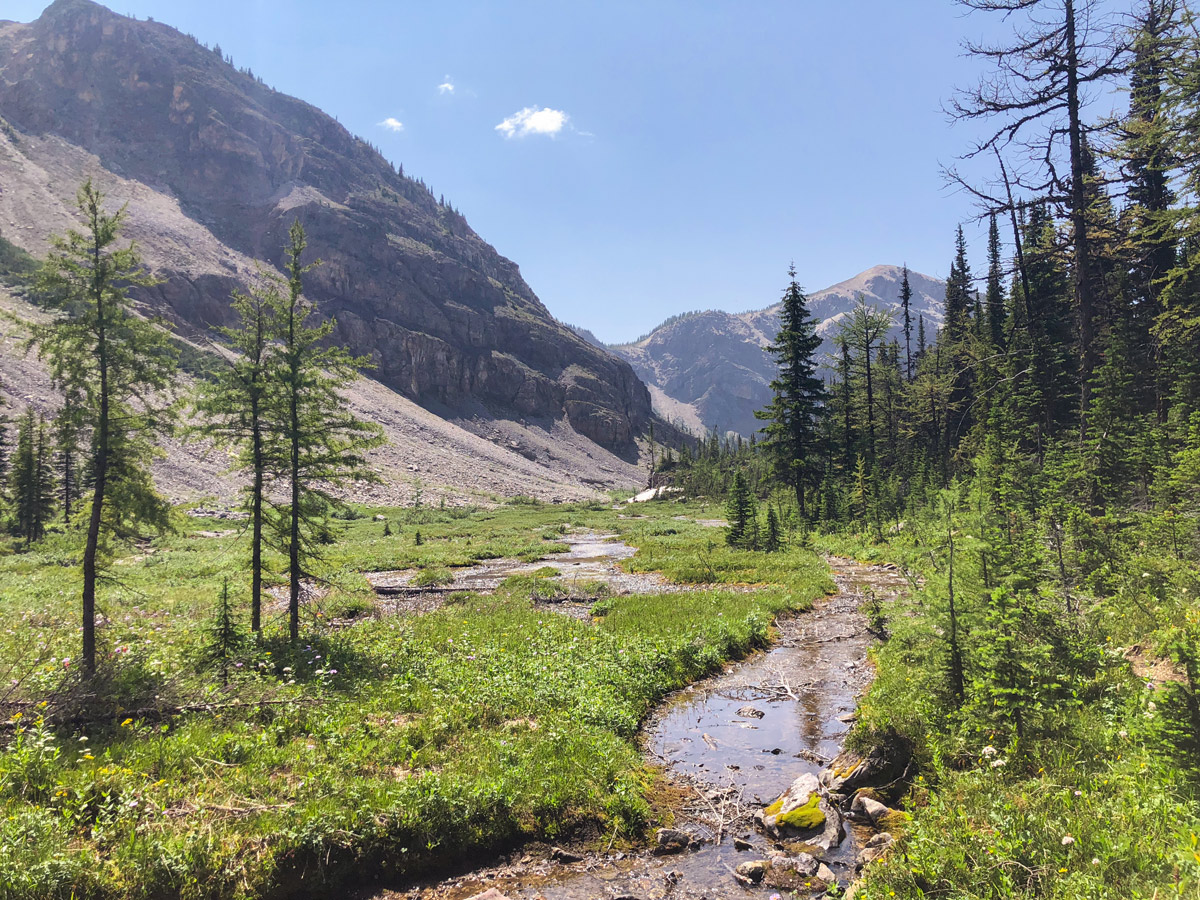
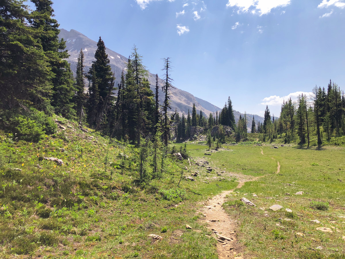
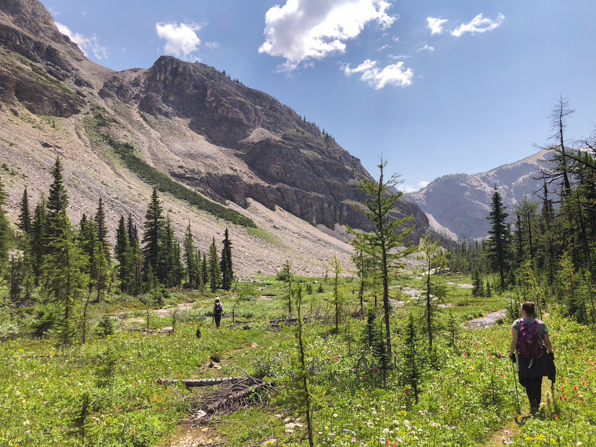
The trail to Ball pass stays on the left-hand side of the valley, soon crossing over a fast-moving stream with a mini waterfall. This is a good place to fill up any water bottles. The trail then trends to the right and goes up a pretty valley, and there are some spectacular views. You pass some small streams that were mostly dry in the summer of 2018.
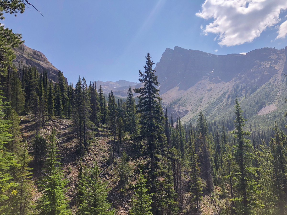
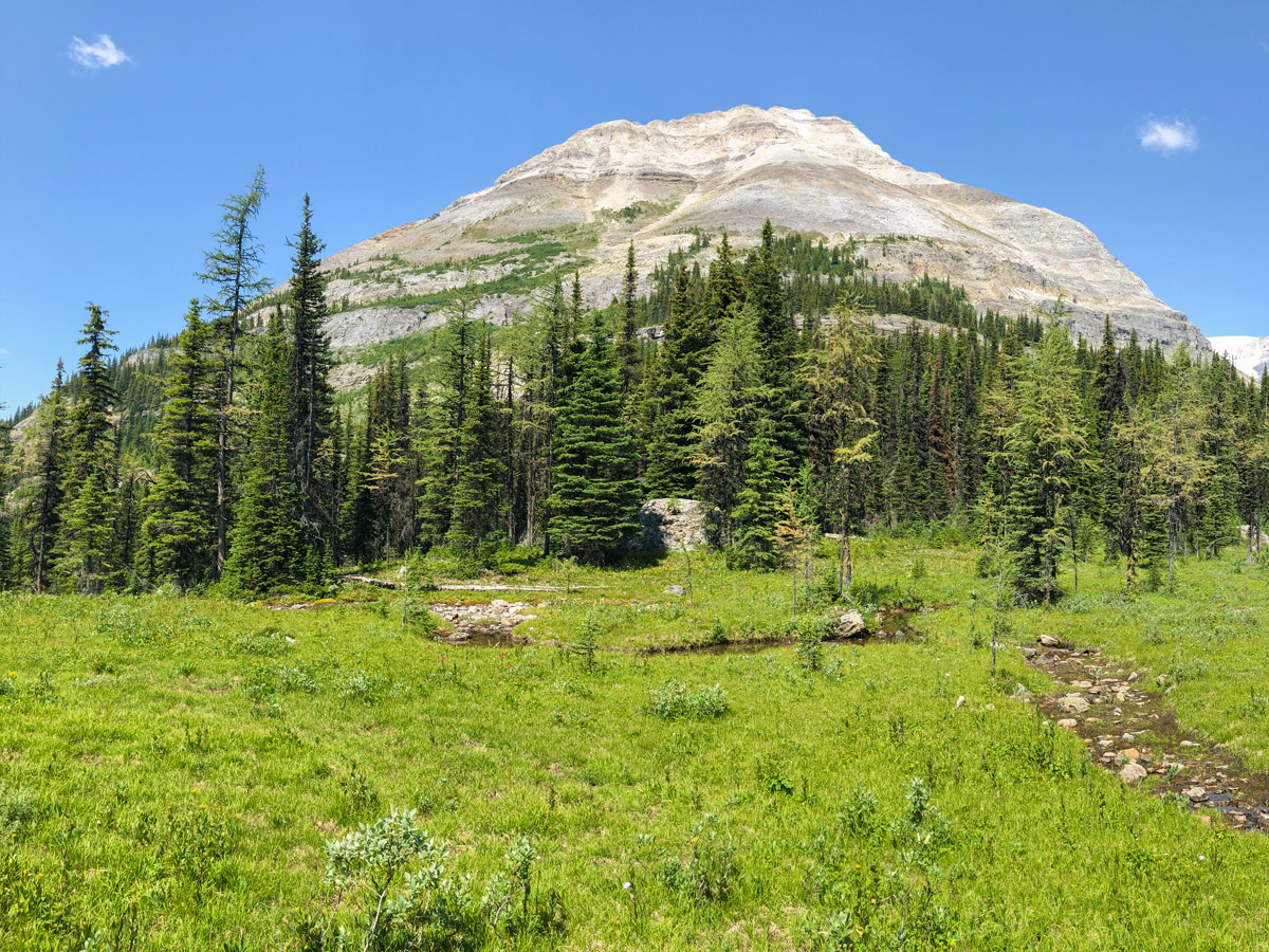
Continue along, with a rock wall on your left, and eventually come back into light forest 4.0mi from the parking lot. Follow the trail through forest for 984ft and when you reach a creek the trail goes sharply left and uphill. This is a pretty area, and you’ll enjoy the shade.
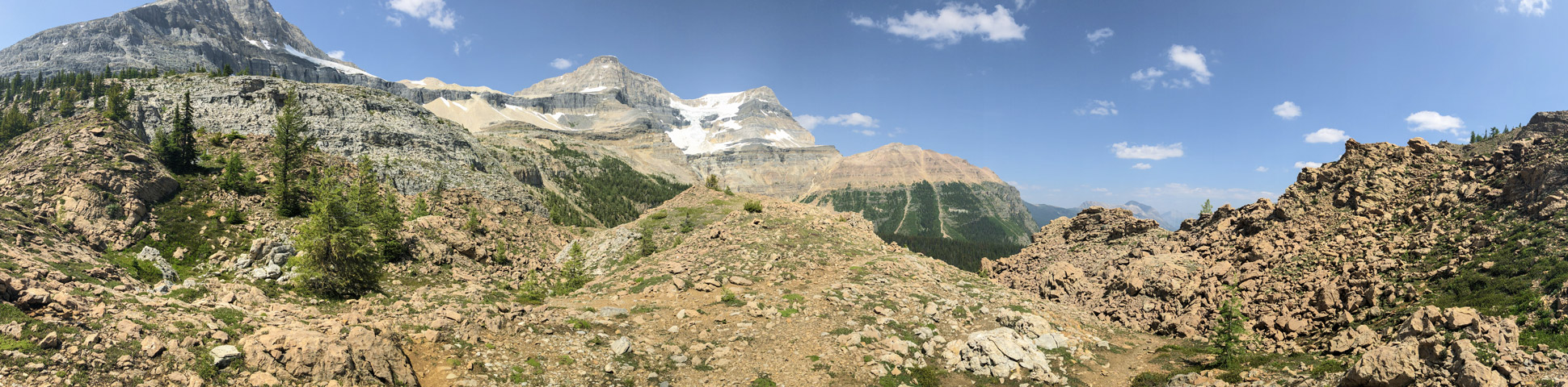
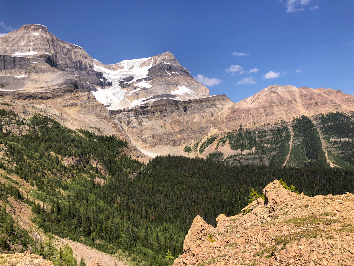
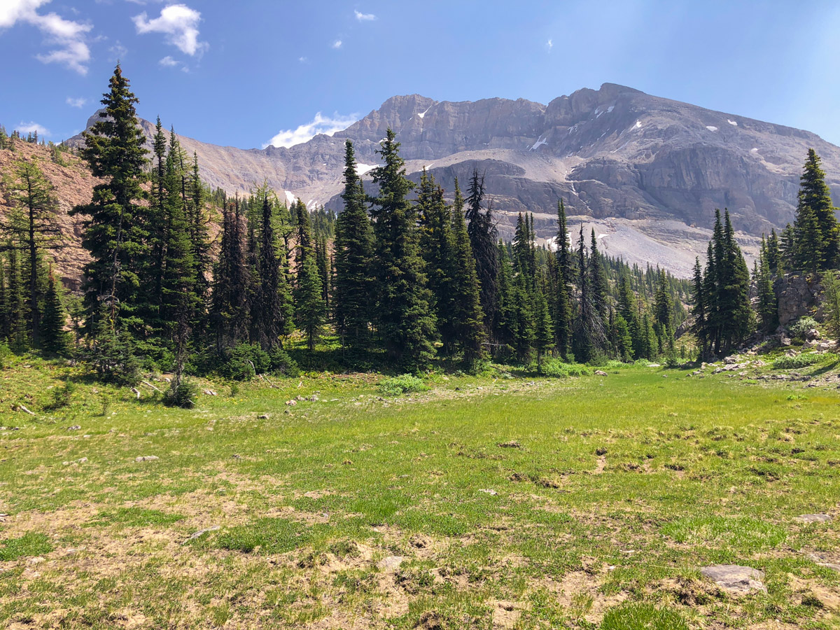
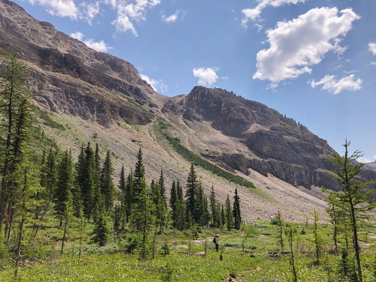
Once up this steep bit of trail, you’ll come to a stunning meadow, which is just about at tree line. This meadow is spectacular, and while you may want to take a break here, continue on and push to Ball Pass.
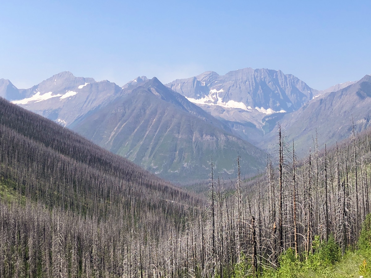
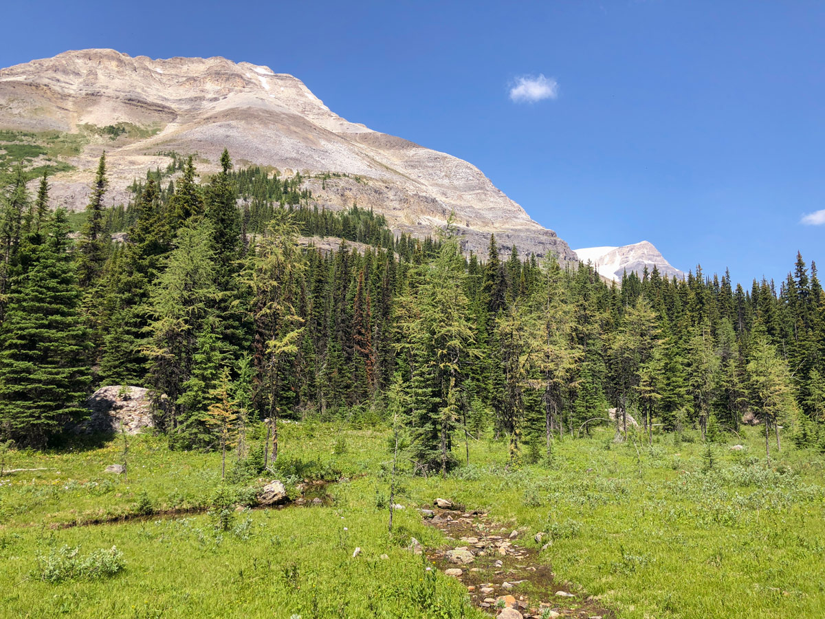
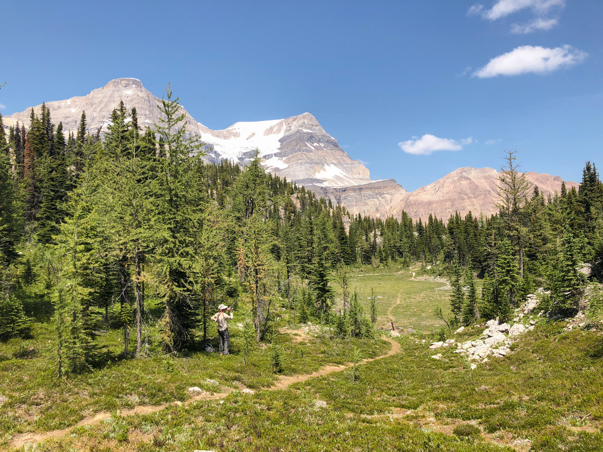
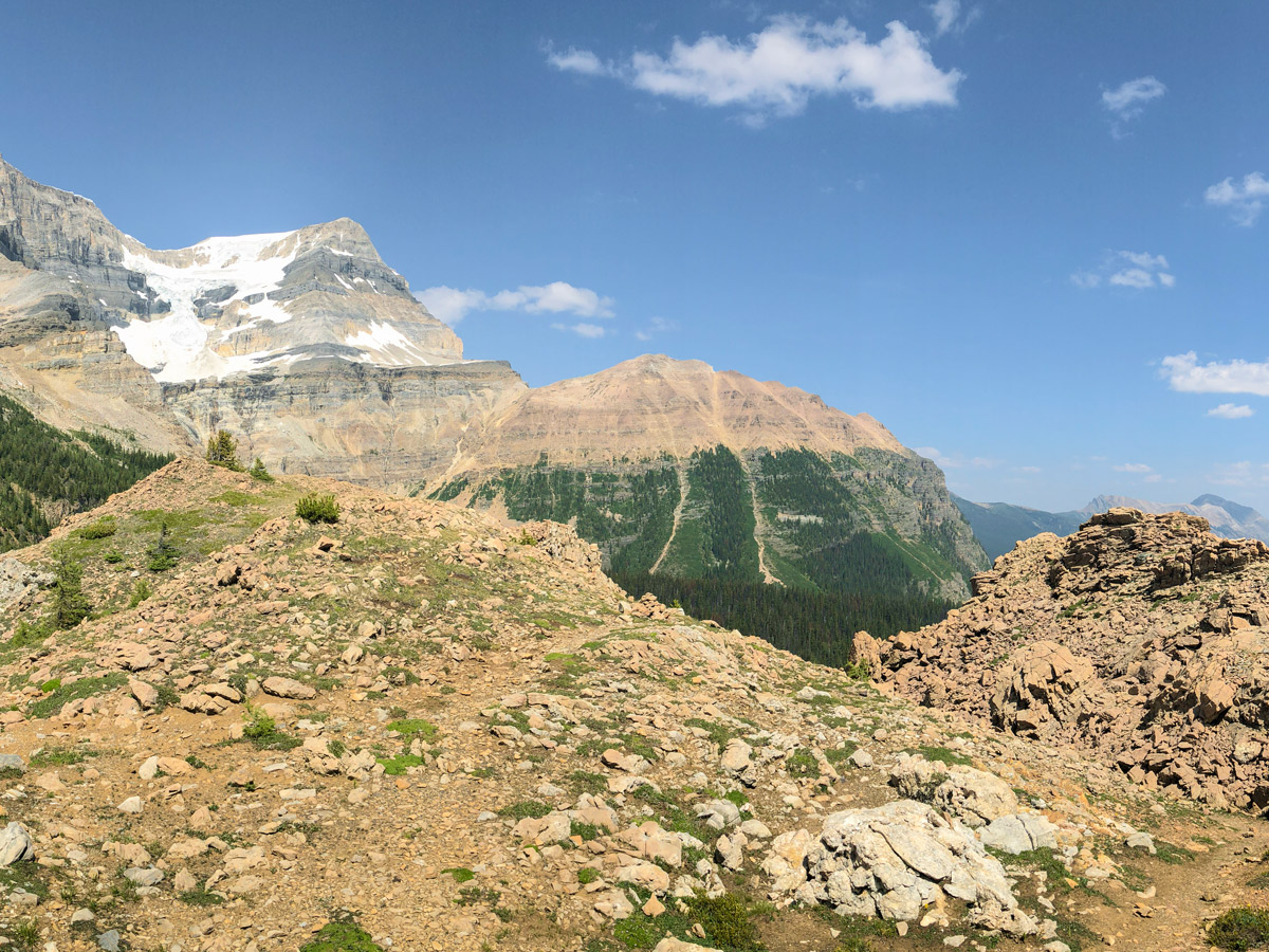
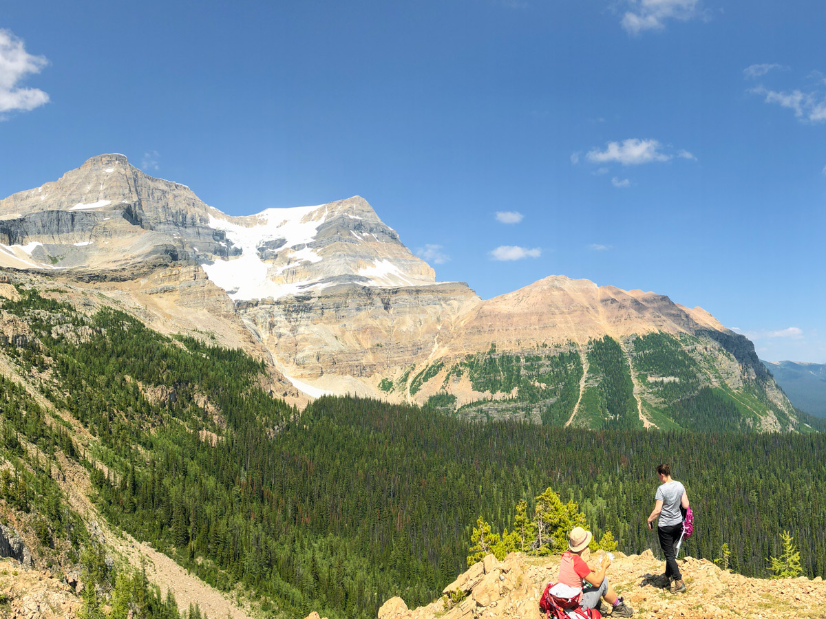
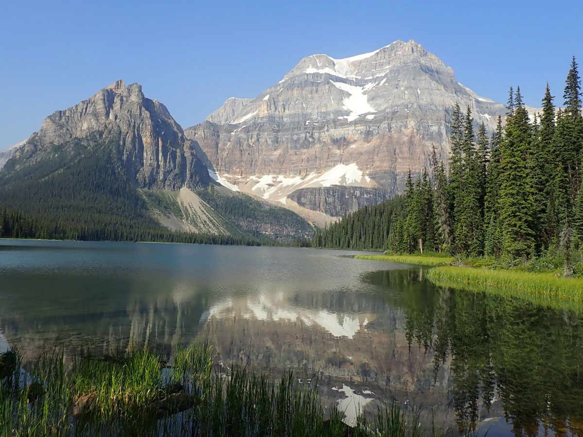
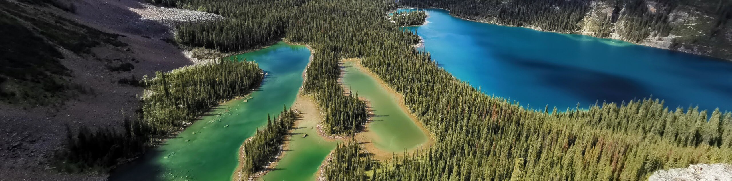
Once at Ball Pass prepare to be amazed, but don’t stop right at the pass. Continue forward a few minutes and get even better views. The views of Mount Ball, Isabelle Peak and down to shadow Lake are spectacular.
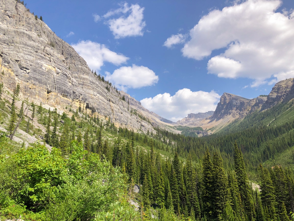
From Ball Pass, head down towards Ball Pass Junction, where there is the Ball Pass Junction campground. The path is initially steep and then mellows out to a more gradual grade. In 1.7mi you will reach the Ball Pass Junction Campground, which has 5 sites and is a pleasant campground. Unfortunately fires are not permitted here.
Once setting up camp at Ball Pass Junction, leave your pack and we suggest a 2.7mi (one way) walk to Shadow Lake. Once there, you can walk up to 1.2mi one-way along the northern edge of Shadow Lake or else walk 0.6mi (one-way) to go and see the pretty Shadow Lake Lodge. You can also stay at Shadow Lake Lodge, which is a luxurious, backcountry lodge with a variety of cabins completed in 1929 for the CPR.
After exploring the pretty Shadow Lake, walk 2.7mi back to Ball Creek Junction and spend the night.
Day 2
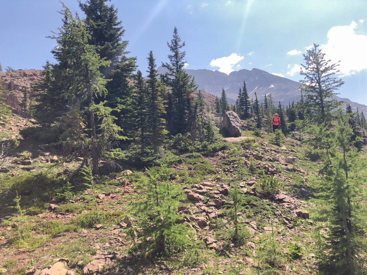
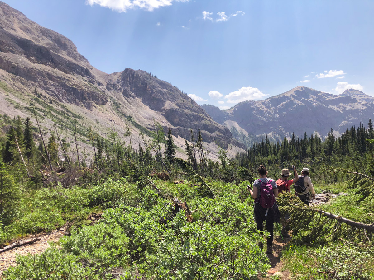
Day 2 is typically a return to your car, however you start the day with a diversion to explore the Whistling valley. It’s almost a no-brainer to hike 1.7mi (one-way) to reach Haiduk Lake. This is on the trail that eventually goes to Egypt Lake.
If you’re feeling very fit, you could explore all the way up the Whistling Valley to Whistling Pass. This will take you roughly 3.4mi each way, with a gain of 1312ft. The hardest part of heading to Whistling Pass is not descending down to check out Scarab Lake, Mummy Lake and Egypt Lake. You can hike 0.8mi past Whistling Pass to the tree line to get better views of all 3 lakes. Once you’re ready to head back, return to Ball Pass Junction campground and pick up your gear and retrace your steps up to Ball Pass and down the other side into Kootenay National Park and your car.
If you have more time, the trip to Whistling Pass could be done as a day trip and you return to Ball Creek Junction for another night at the campground. This would extend the trip into a 3d/2n trip, with both nights at Ball Creek Junction Campground.
Sample Itinerary
Our standard route is a quick one-night backpacking trip:
- Day 1: 7.4mi, 2953ft to Ball Pass Junction Campground. Optional trip: 5.3mi to 8.7mi with 410ft of elevation gain (return) to Shadow Lake and Shadow Lake Lodge
- Day 2: 7.0mi from Ball Pass Junction Campground to Trailhead. Optional trip of 3.5mi–6.7mi with 1312ft of elevation gain (return) up Whistling Valley. This could also be done as a 2nd day and spend 2 nights at Ball Creek Junction Campground.
Alternative Itinerary
If you want a longer itinerary, you could make a lollipop route. We have shown a 4d/3n route, though Day 3 and 4 could be combined for strong backpackers.
- Day 1: Trailhead to Ball Pass to Shadow Lake Campground (10.2mi, 3150ft up, 1542ft down)
- Day 2: Shadow Lake Campground to Egypt Lake with trip to Pharaoh Lake (9.9mi, 2297ft up, 1772ft down)
- Day 3: Egypt Lake to Ball Pass Junction: 5.4mi, 1237ft gain, 1506ft loss
- Day 4: Ball Pass Junction to Trailhead:7.4mi, 1148ft up, 2953ft down
Insider Hints
Book your campgrounds as soon as reservations open on the Parks Canada Backcountry page.
A longer trip would be to start at Sunshine Village and go to Egypt Lake and then come out via Ball Pass. You could even continue and connect to the Rockwall from Floe Lake and exit at Paint Pots. This would likely be a 6d/5n trip staying at Egypt Lake, Ball Pass Junction, Floe Lake, Numa Creek, Helmet Falls.
Beware there is a lot of deadfall on the trail to Ball Pass, so be prepared for it.

Similar backpacking trails to the Ball Pass to Shadow Lake backpacking trail
The Rockwall Trail
Kootenay National Park’s Rockwall Trail is one of the most popular, multi-day backpacks in the Canadian Rockies. The Rockwall is…
Floe Lake and Numa Pass
Floe Lake is one of the most photogenic lakes in the Rockies and the backpack to it and beyond to…
Lake O’Hara Backcountry
Explore the incomparable Lake O'Hara area of Yoho National Park on this backcountry trek that totally immerses you in western…
Slavik W. 5 years ago
The extra effort is definitely worth the heart stopping scenery.