
Egypt Lake to Twin Lakes Backpacking Trail
View Photos
Egypt Lake to Twin Lakes Backpacking Trail
Difficulty Rating:
Choosing the Egypt Lake to Twin Lakes route is a great way to dive into Banff’s expansive backcountry without settling for a single destination. Many hikers stop at Egypt Lake as it is one of the most sought-after destinations in the area, but continuing to Twin Lakes connects multiple passes, alpine lakes, and incredible wildflower meadows along the route. This is a must-do.
Getting there
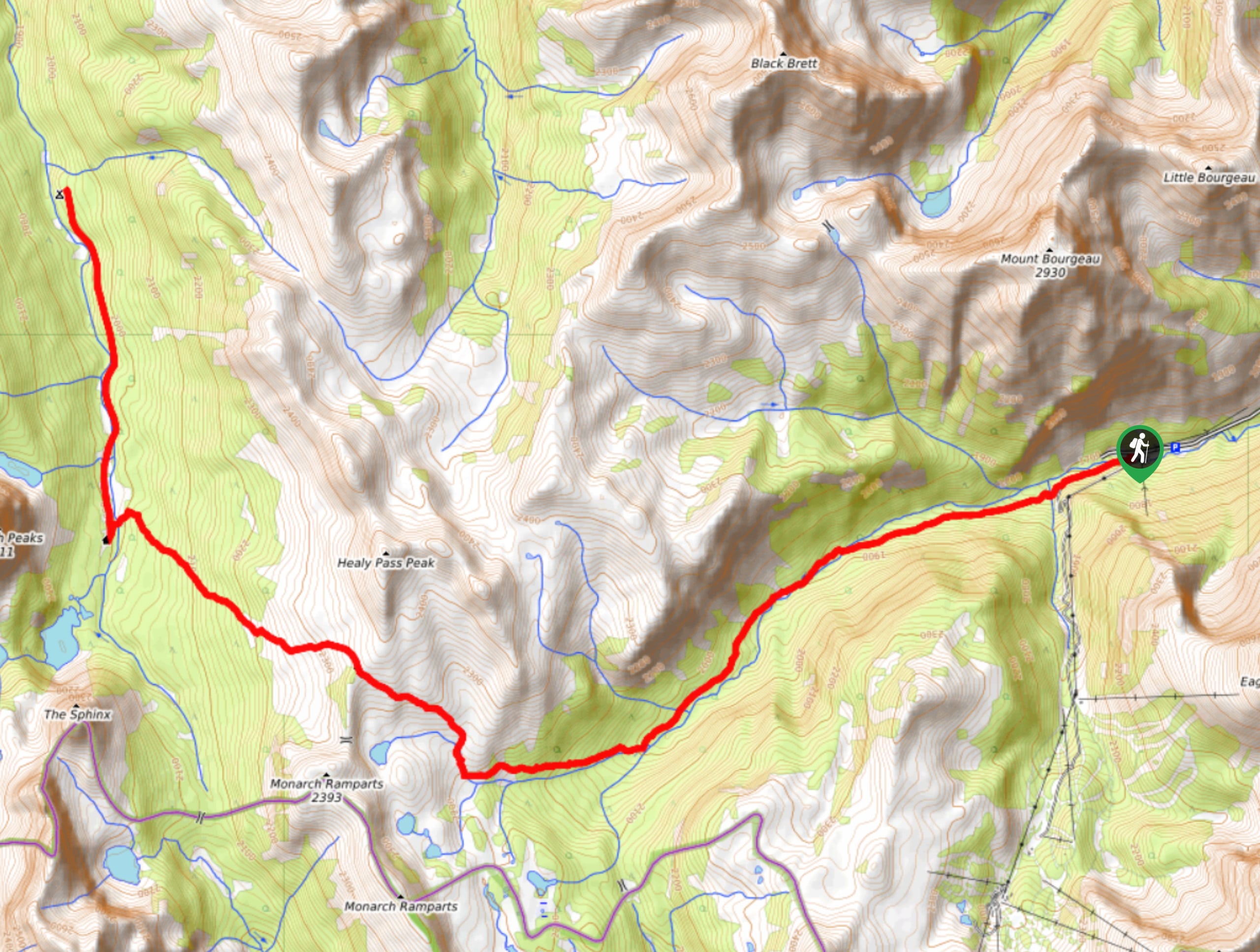
To get to the Egypt Lake trailhead, take the Trans-Canada Highway westbound from the Town of Banff. Take the exit for Sunshine Village and follow the access road until you reach the parking lot. Walk around the right side of the main gondola station and lodge to the rear parking lot, where you will find a trail sign for Healy Pass on the left under the gondola line.

About
| When to do | July-September |
| Backcountry Campsites | Egypt Lake E13, Ball Pass Junction Re21, Twin Lakes Tw7 |
| Pets allowed | Yes - On Leash |
| Family friendly | Older Children only |
| Route Signage | Average |
| Crowd Levels | Moderate |
| Route Type | One Way |
Egypt Lake to Twin Lakes Backpacking Trail
Elevation Graph
Weather
Egypt Lake to Twin Lakes Backpacking Trail Description
The Egypt Lake to Twin Lakes route is an excellent option for those looking to extend their route to Egypt Lake and avoid an out-and-back trip by creating a one-way point-to-point route. These campsites must be reserved in advance due to their popularity. We recommend doing this trip over three days; however, there are many other options if you would like to customize the route to meet your needs.
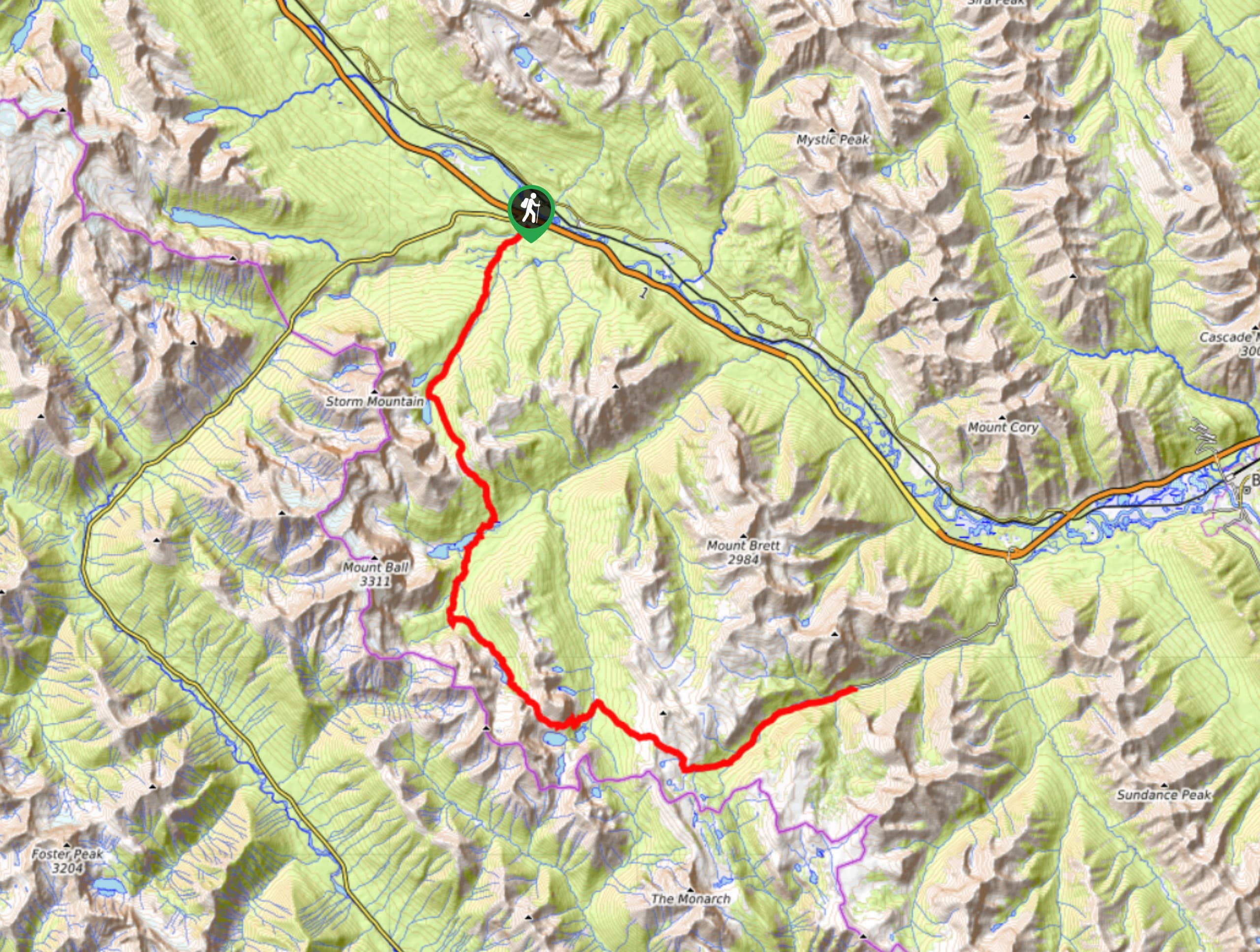
Our itinerary suggests that hikers begin at Sunshine Village and proceed to Egypt Lake campground for the first night and Twin Lakes campground for the second night. The trip will finish at the Vista Lake parking lot on the 93S highway. Hikers will need to leave a second vehicle at this trailhead or arrange a shuttle for their return.
Starting at Sunshine Village, you will make your way up Healy Creek, crossing multiple avalanche paths that may leave debris behind into the early summer. Fireweed is abundant in these areas due to the turned-up soil and break in the forest. There will be a junction at 3.1mi to your left that leads to Simpson Pass. Stay on the main trail and come to a campground around 6km, which is commonly used for those looking to lessen their daily distance and those travelling with children.
Continue through the forest, admiring the views as they appear through slight openings. You will reach a second junction for Simpson Pass as the trail opens up and leaves the forest. The main trail will lead you up through wildflower meadows to Healy Pass. Enjoy a break at the pass and expect views of the stunning Monarch Ramparts, the Ball Range, Egypt Lake and surrounding peaks, lakes, creeks, and meadows. Descend the pass, following switchbacks to Pharaoh Creek, where you will cross a footbridge. After the footbridge, you will find yourself at the campground.
Our itinerary will take you over the high route along Whistling Pass and through the Whistling Valley for better views and more exciting trails.
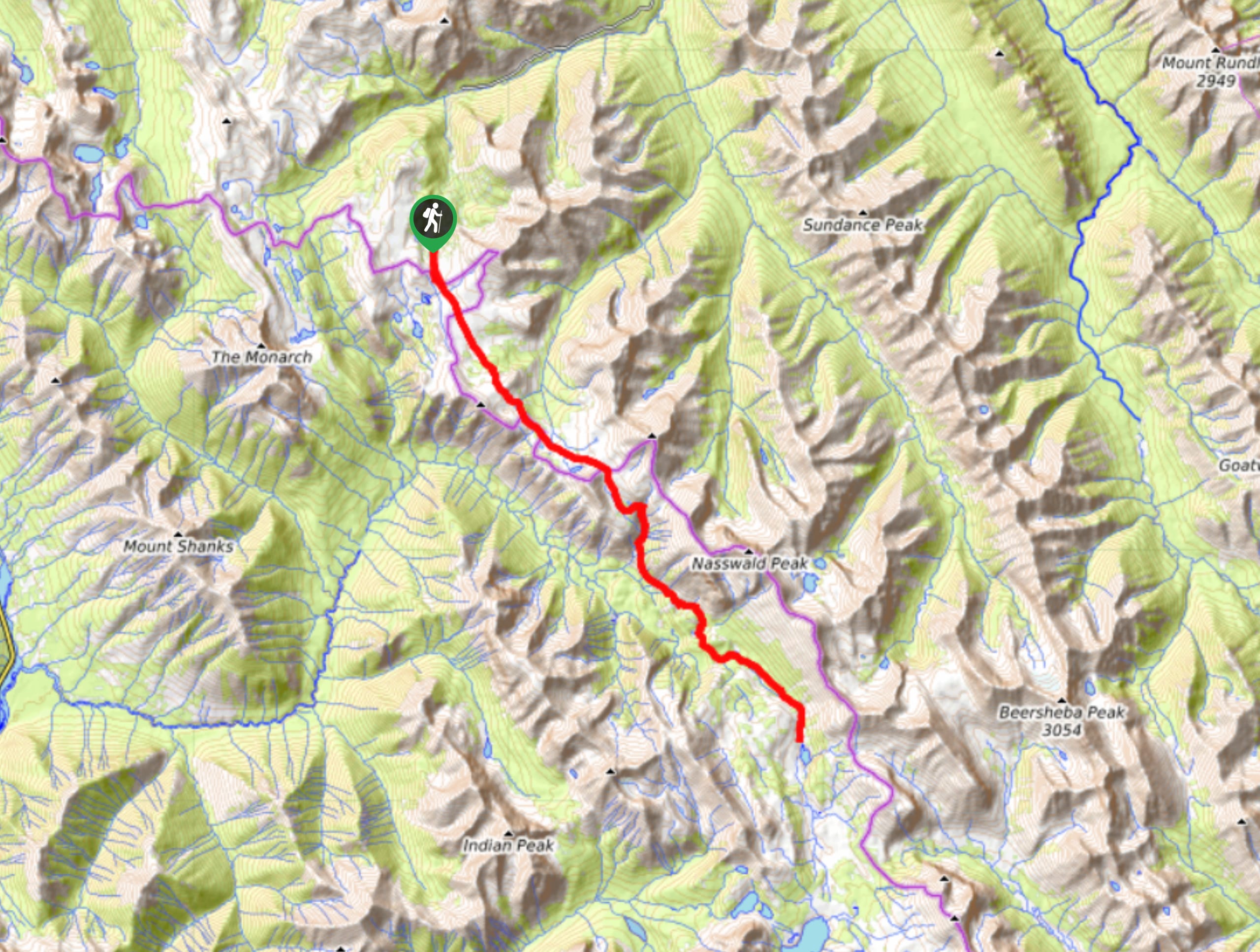
Set up camp and be sure to explore the roughly 1km trail to Egypt Lake. There are endless options for exploration here, which is why this area is so popular. Day two will take hikers to Twin Lakes campground. Two routes will take you to your destination. One is a high route that climbs Whistling Pass before descending into Whistling Valley to reach Shadow Lake and climb Gibbon Pass to reach Twin Lakes. The other option is a low route that follows the mild Pharaoh Creek trail through the forest in the valley to the Red Earth Creek junction before reaching Shadow Lake to then climb Gibbon Pass on route to Twin Lakes.
Pick your route, high or low, depending on how it feels and make sure you have a map in hand. Once you have reached Twin Lakes for your second night on the trail, relax and enjoy the views before your final day. Day three will be spent descending from Upper Twin Lake to Arnica and Vista Lakes before a final short climb to the parking lot.
Sample Itinerary:
- Day 1
Trailhead to Egypt Lake Campground
Distance: 7.6mi
Elevation gain: 2323ft
Campground: Egypt Lake E13 - Day 2
Egypt Lake to Twin Lakes
Distance: 12.2mi
Elevation gain: 2703ft
Campground: Twin Lakes Tw7 - Day 3
Twin Lakes to Trailhead
Distance: 4.2mi
Elevation gain: 889ft
Campground: N/A
Similar backpacking trails to the Egypt Lake to Twin Lakes Backpacking Trail backpacking trail
Pharaoh Creek Backpacking Trail
The Pharaoh Creek backpacking trail follows the same route that many take to reach Egypt Lake and it’s cascading counterparts.…
Og Lake Backpacking Trail
The Og Lake backpacking trail is a great option for those who can’t make a reservation at the busy Lake…
Merlin Lake Backpacking Trail
The backpacking route to the Merlin Lake Trail follows the main Skoki route and covers all the popular landmarks in…
Comments