
Wonder Pass Loop Backpacking Trail
View Photos
Wonder Pass Loop Backpacking Trail
Difficulty Rating:
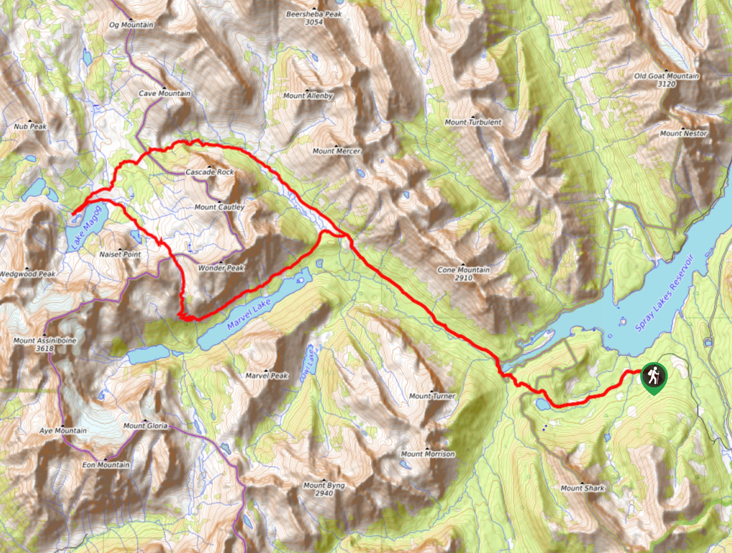
Backpacking the Wonder Pass Loop is an excellent way to see the Mount Assiniboine area. Rather than taking a point-to-point route, many hikers choose this superb lollipop trail. Backpackers can work their way up Bryant Creek and take Assiniboine Pass right into the heart of Assiniboine Provincial Park. From here, the trail gains Wonder Pass and descends to the magnificent Marvel Lake below before rejoining Bryant Creek. The roughly 32.3mi lollipop is best spread out over four days.
Getting there
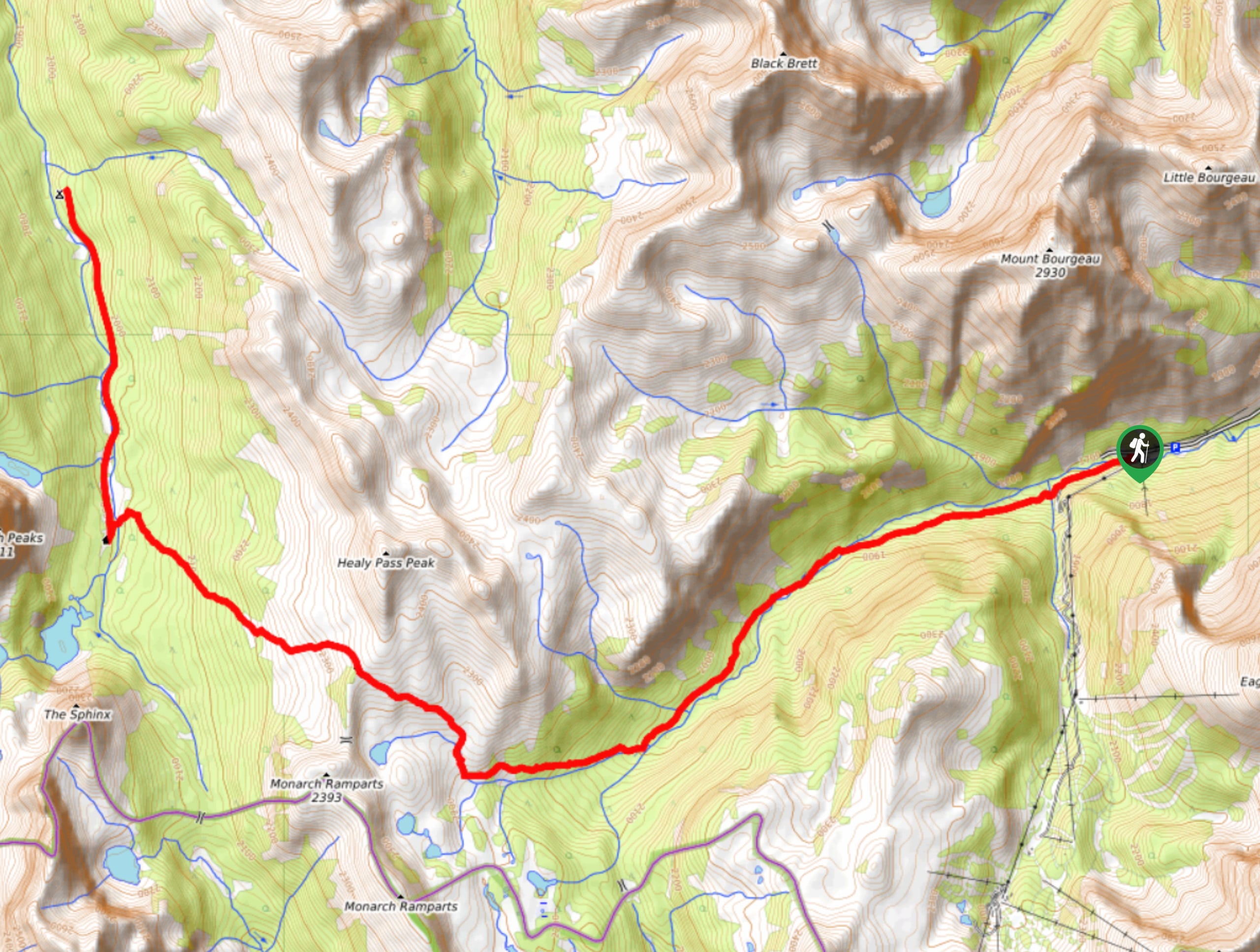
From Canmore, navigate your way to the Canmore Nordic Centre.Continue past the Nordic Centre onto the Spray Lakes Road, which soon turns to gravel. This is also called the Smith-Dorrien Spray Trail. You won’t need a 4x4 vehicle; this is a well-maintained road. Follow this road for 23.0mi until you see a sign for Mount Shark. Turn right and continue beyond Mount Engadine Lodge until the parking lot.

About
| When to do | June-September |
| Backcountry Campsites | Big Springs Br9, Marvel Lake Br13, McBride’s Camp Br14, Allenby Junction Br17, Magog Lake |
| Pets allowed | Yes - On Leash |
| Family friendly | Older Children only |
| Route Signage | Average |
| Crowd Levels | Extreme |
| Route Type | Lollipop |
Wonder Pass Loop Backpacking Trail
Elevation Graph
Weather
Wonder Pass Loop Backpacking Trail Description
The lollipop loop of Wonder Pass can be done in either direction, but we recommend the east-to-west option. This ensures an easier elevation gain to begin and much more desirable views. The trail takes hikers through four prominent sections: Bryant Creek, Assiniboine Pass, Lake Magog at Assiniboine, and Wonder Pass.
Starting at the Mount Shark Trailhead, make your way along the wide fire road trail. This is a popular cross-country ski destination in winter, so be sure to stay on the main trail when passing various junctions. After about 6km, the trail narrows and leads hikers to the first established camp: Big Springs. Stay on the main trail here, following signs to Br14 McBride’s Camp. You will pass junctions for Owl Lake, Br13 Marvel Lake, and Bryant Creek Shelter before reaching your first destination at McBride’s Camp. McBride’s camp is located near an open meadow where many trails join. It is a popular junction for a multitude of routes leading to the Mount Assiniboine area.
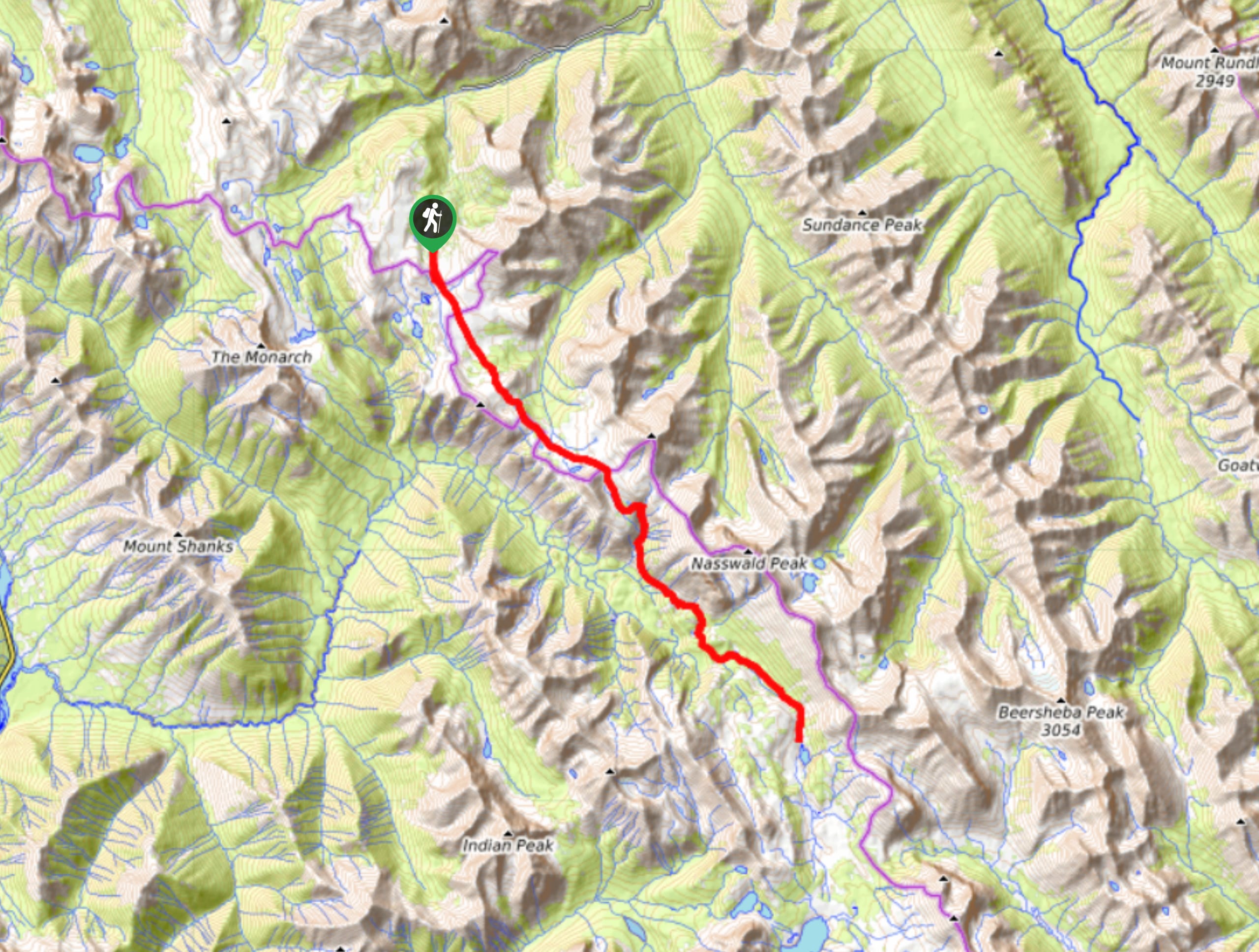
Take the trail to Assiniboine Pass on your second day. This section has a gentler rise than Wonder Pass and will provide more gratifying views of Mount Assiniboine as you reach the top. This pass descends down to the heart of Mount Assiniboine Provincial Park, Assiniboine Lodge and Lake Magog. The Lake Magog campsite is operated by BC Parks, so you will need a separate reservation for this night. It can be difficult to align booking, so plan accordingly.
Many day hikes leave from the Lake Magog area, most notably, The Nub. There is a myriad of options along the Nub, such as the Niblet, the Nublet, Nub Peak, and just the Nub. Gaining the ridge to any of the visible viewpoints will give hikers surreal views of Mount Assiniboine and Sunburst Peak.
Day three takes hikers from Lake Magog past Assiniboine Lodge and up to Wonder Pass. There are options to scramble Wonder Peak and The Towers from the pass, but on a four-day backpacking trip, you probably won’t be looking to add any more mileage than needed. The short climb up Wonder Pass parallels a flowing creek and passes a waterfall before the final climb to the top. If you take this trip in the fall, expect a golden larch forest here. Crest the pass and descend down the steep trail where Marvel Lake will reveal its true marvel: crystal blue waters. The trail traverses above the lake before dropping down to Marvel Lake camp for your final night. Return along Bryant Creek trail for your last day to finish at Mount Shark Trailhead.
Sample Itinerary:
- Day 1
Mount Shark to McBride’s Camp Distance: 8.3mi
Elevation gain: 922ft
Campground: McBride’s Camp Br14 - Day 2
McBride’s Camp to Lake Magog via Assiniboine Pass Distance: 7.6mi
Optional afternoon hike Elevation gain: 1325ft
Campground: Lake Magog Campground - Day 3
Lake Magog to Marvel Lake via Wonder Pass Distance: 8.9mi
Elevation gain: 860ft
Campground: Marvel Lake Br13 - Day 4
Marvel Lake to Mount Shark Trailhead Distance: 8.8mi
Optional afternoon hike Elevation gain: 669ft
Campground: None
Similar backpacking trails to the Wonder Pass Loop Backpacking Trail backpacking trail
Pharaoh Creek Backpacking Trail
The Pharaoh Creek backpacking trail follows the same route that many take to reach Egypt Lake and it’s cascading counterparts.…
Og Lake Backpacking Trail
The Og Lake backpacking trail is a great option for those who can’t make a reservation at the busy Lake…
Merlin Lake Backpacking Trail
The backpacking route to the Merlin Lake Trail follows the main Skoki route and covers all the popular landmarks in…
Comments