

Borea Canyon via Daley Canyon Road Hike
View PhotosBorea Canyon via Daley Canyon Road Hike
Difficulty Rating:
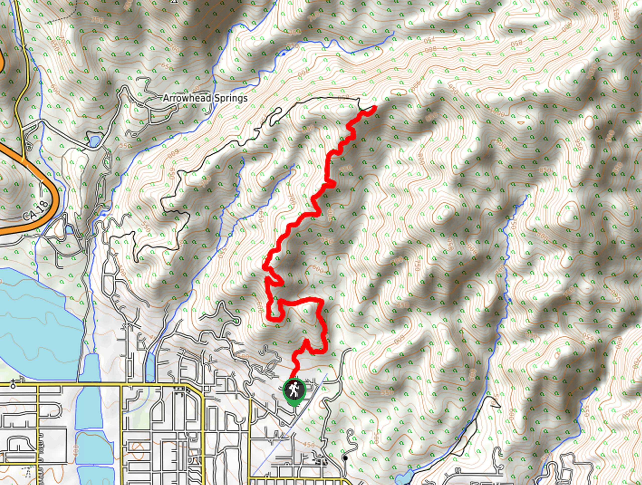
The Borea Canyon via Daley Canyon Road Hike is a challenging journey into the San Bernardino Mountains that will see you climb sharply uphill for views over San Bernardino. While out hiking this route, you will traverse a dirt road leading uphill through the undulating terrain of Borea Canyon, where you will experience some gorgeous views of the surrounding mountains and hills. Hikers should take note that this trail is exposed to the sun for the entirety of its length, so make sure to wear sunscreen/protective clothing and bring plenty of water.
Getting there
The trailhead for the Borea Canyon via Daley Canyon Road Hike can be found at the corner of Daley Canyon Road and N Chiquita Lane, just northeast of San Bernardino.
About
| Backcountry Campground | No |
| When to do | Year-Round |
| Pets allowed | Yes |
| Family friendly | Older Children only |
| Route Signage | Average |
| Crowd Levels | Moderate |
| Route Type | Out and back |
Borea Canyon via Daley Canyon Road Hike
Elevation Graph
Weather
Borea Canyon via Daley Canyon Road Hike Description
Whether you want to take in the gorgeous San Bernardino views or are trying to push yourself with an intense workout, the Borea Canyon via Daley Canyon Road Hike is a challenging adventure that will reward you for your efforts on the trail. Be sure to display a valid adventure pass in your vehicle prior to setting out, or else you will be fined.
Setting out from the trailhead, you will follow along Daley Canyon Road as it leads north towards Borea Canyon. Here, the terrain will begin to steepen, as you work your way up the hillside along the winding road to gain a better perspective over the surrounding area.
The entire trail is exposed to the sun, and with the elevation gain along the road, you will want to make sure that you stop for frequent water breaks. Take some time to appreciate the beautiful views overlooking San Bernardino as you continue uphill along the road, before arriving at a junction marking the end point of the route. At this point, you can pause for a quick rest, before heading downhill along the same route to return to the trailhead where you started.
If you are looking for a similar route in the area to change up the views, try heading a bit to the northwest for the Cloudland Truck Trail off Devil’s Canyon Road.
Similar hikes to the Borea Canyon via Daley Canyon Road Hike hike

Palm View Peak Trail
The Palm View Peak Trail is a great hiking route in the San Bernardino National Forest that features a solid…

Cram Peak Ridge Trail
The Cram Peak Ridge Trail is a fantastic, albeit difficult, hiking route in the San Bernardino National Forest that will…

Highway 138 VOE Trail
The Highway 138 VOE Trail is a fantastic hiking route north of the Valley of Enchantment that will see you…


Comments