

Paul Peak Trail
View PhotosPaul Peak Trail
Difficulty Rating:
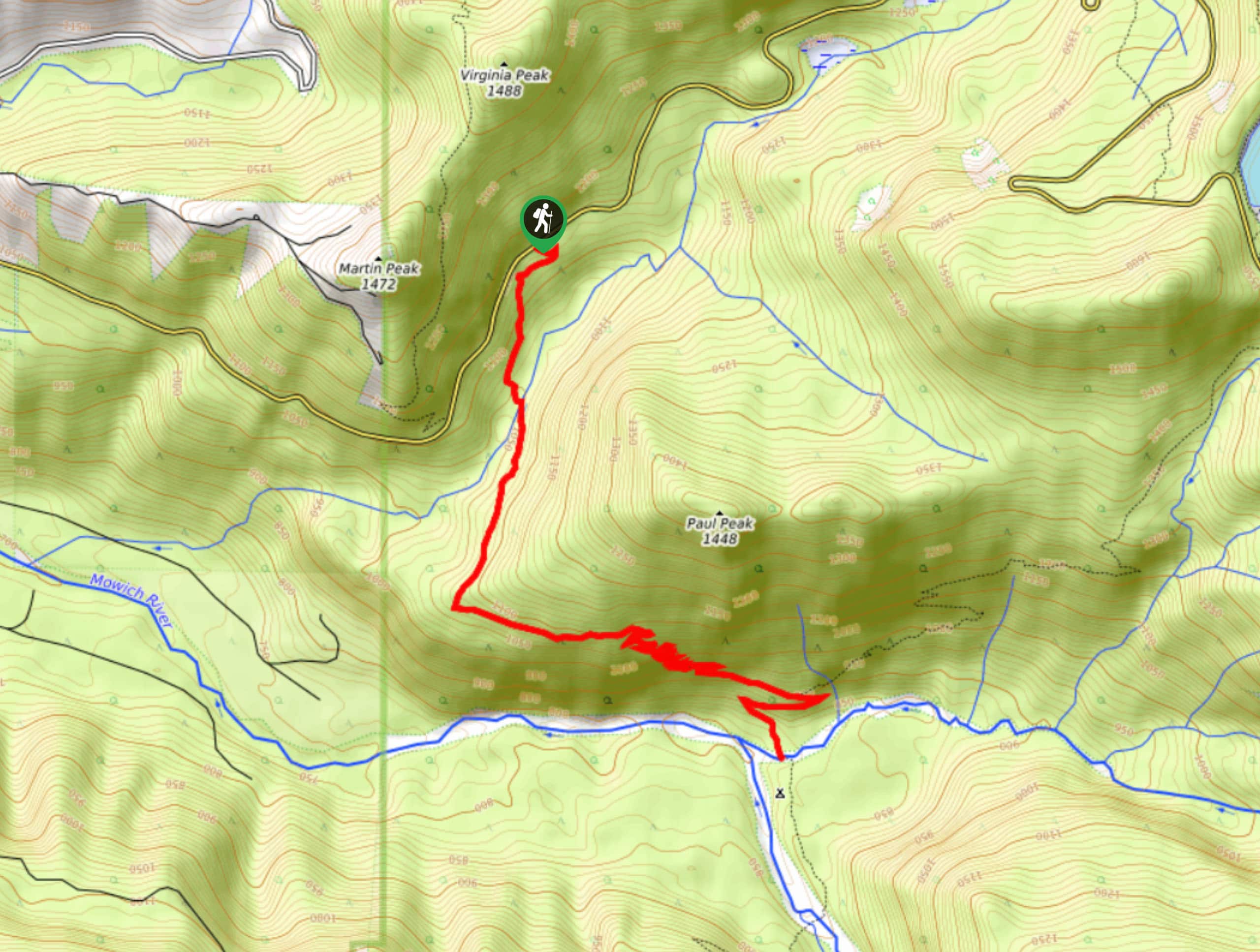
The Paul Peak Trail is a 6.3mi lightly trafficked out and back trail in Mount Rainier National Park that is rated as moderate. This trail is mostly through the shaded forest and leads to a river that’s wonderful to cool down in. While there aren’t many mountain views on this one, it’s perfect for hot days or trail running.
Getting there
The trailhead for the Paul Peak Trail is off Mowich Lake Road just inside the western boundary of the park. Look for the parking area on your right if you’re coming from the west.
About
| Backcountry Campground | No |
| When to do | June-October |
| Pets allowed | No |
| Family friendly | Older Children only |
| Route Signage | Average |
| Crowd Levels | Low |
| Route Type | Out and back |
Paul Peak Trail
Elevation Graph
Weather
Paul Peak Trail Description
Shrouded in trees, shady, and cool, Paul Peak Trail is ideal in the heat of the summer. Because of its constant undulations, it’s a popular pick for trail runners. The river at the end of the hike is a nice spot to skip some stones and cool off.
From the parking area on the road, take the trail heading roughly south. Cross Meadow Creek and enjoy the serenity of the mature forest all around you. The trail curves and then switchbacks, culminating in two broad hairpin turns before reaching the North Mowich River.
To return, retrace your steps.
Similar hikes to the Paul Peak Trail hike

Narada Falls to Mazama Ridge Loop
The Narada Falls to Mazama Ridge loop is an 7.4mi moderately trafficked route in Mount Rainier National Park…

Camp Summerland via Wonderland Trail
The hike to Camp Summerland on the Wonderland Trail is a 8.4mi moderately trafficked out and back trail…

Eastside Trail to Deer Creek Camp
The Eastside Trail is a 8.8mi lightly trafficked trail in Mount Rainier National Park that provides access to…


Comments