
The Onion Scramble
View Photos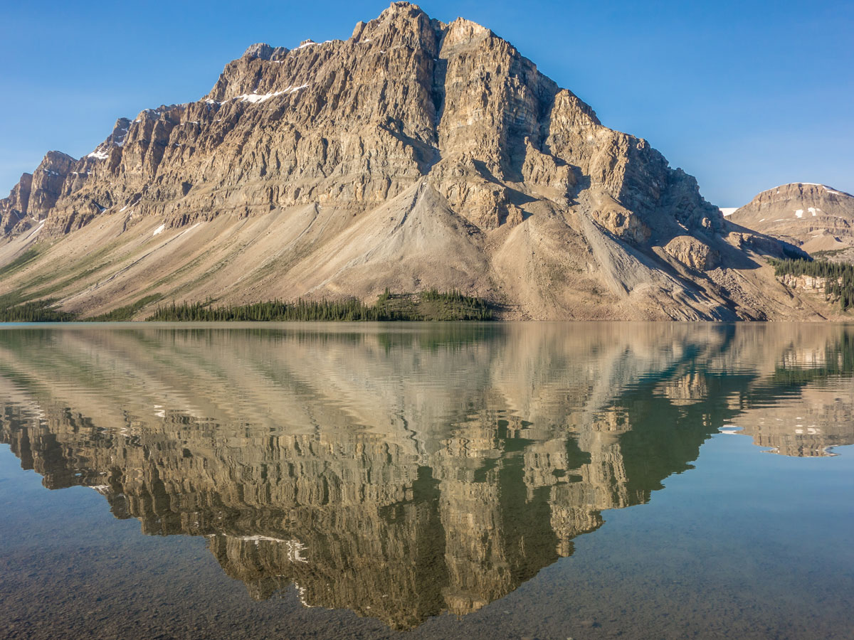
The Onion Scramble
Difficulty Rating:
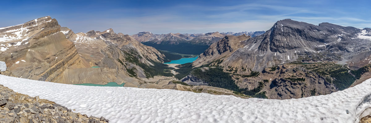
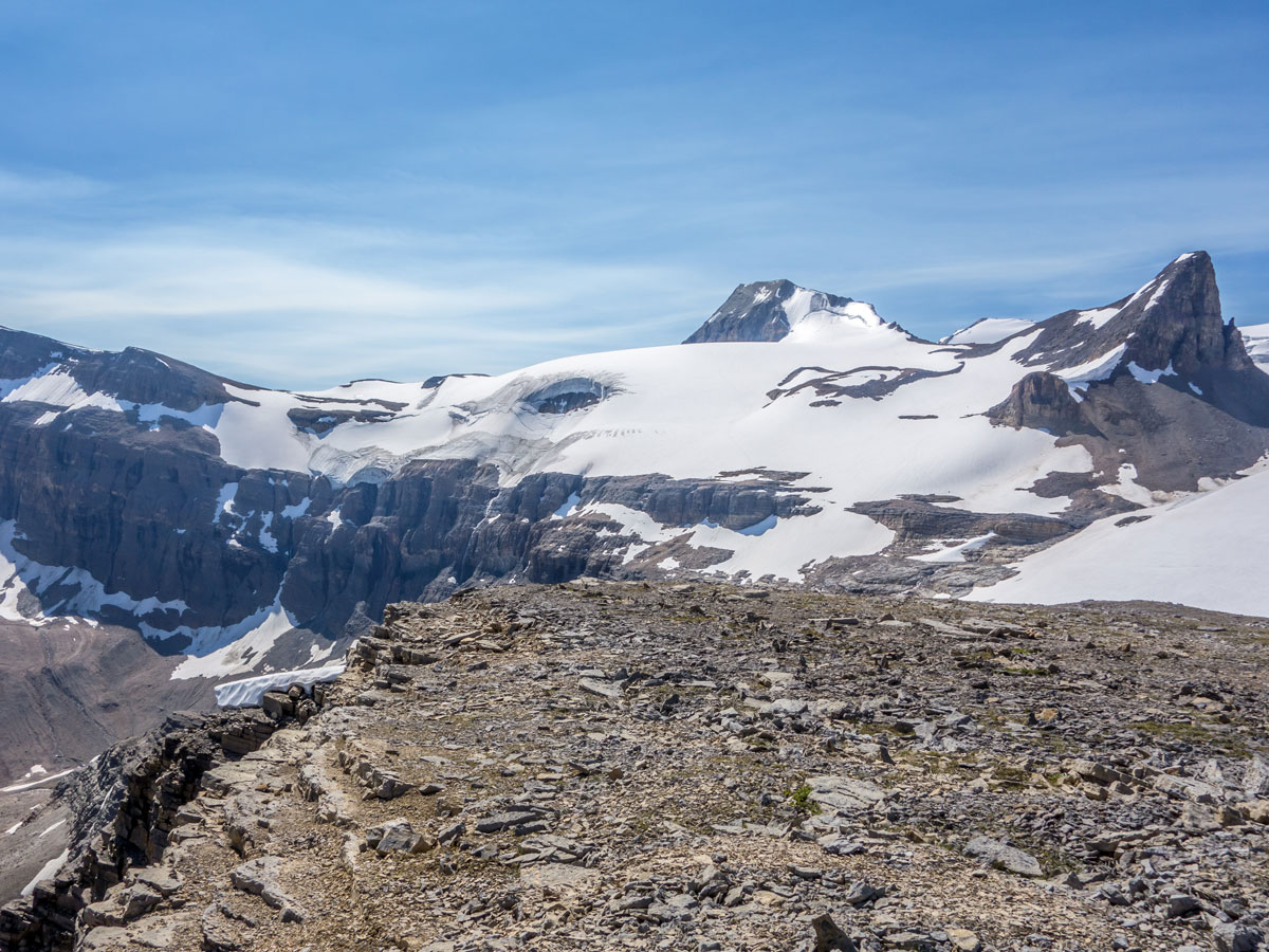
The scramble up to the Onion brings you incredibly close to the Wapta Icefield which is (the source of Calgary’s drinking water! Scrambling the Onion is a very rewarding day out that has everything including tarns, glaciers, and great rock formations! Add on a stop at pretty Iceberg Lake for a great day in the Canadian Rockies.
Getting there
Drive on Highway 93 north towards Jasper for roughly 21.7mi and park in the Bow Lake lot and Num-Ti-Jah Lodge. There is also campground and HI Hostel nearby.

About
| When to do | Late July - September |
| Backcountry Campsites | ACC Bow Hut |
| Toilets | Trailhead |
| Pets allowed | Yes - On Leash |
| Scarmbling Rating | Grade 1 |
| Exposure | None |
| Family friendly | No |
| Route Signage | Poor |
| Crowd Levels | Moderate to High |
| Route Type | Out and back |
The Onion
Elevation Graph
Weather
Route Description for The Onion
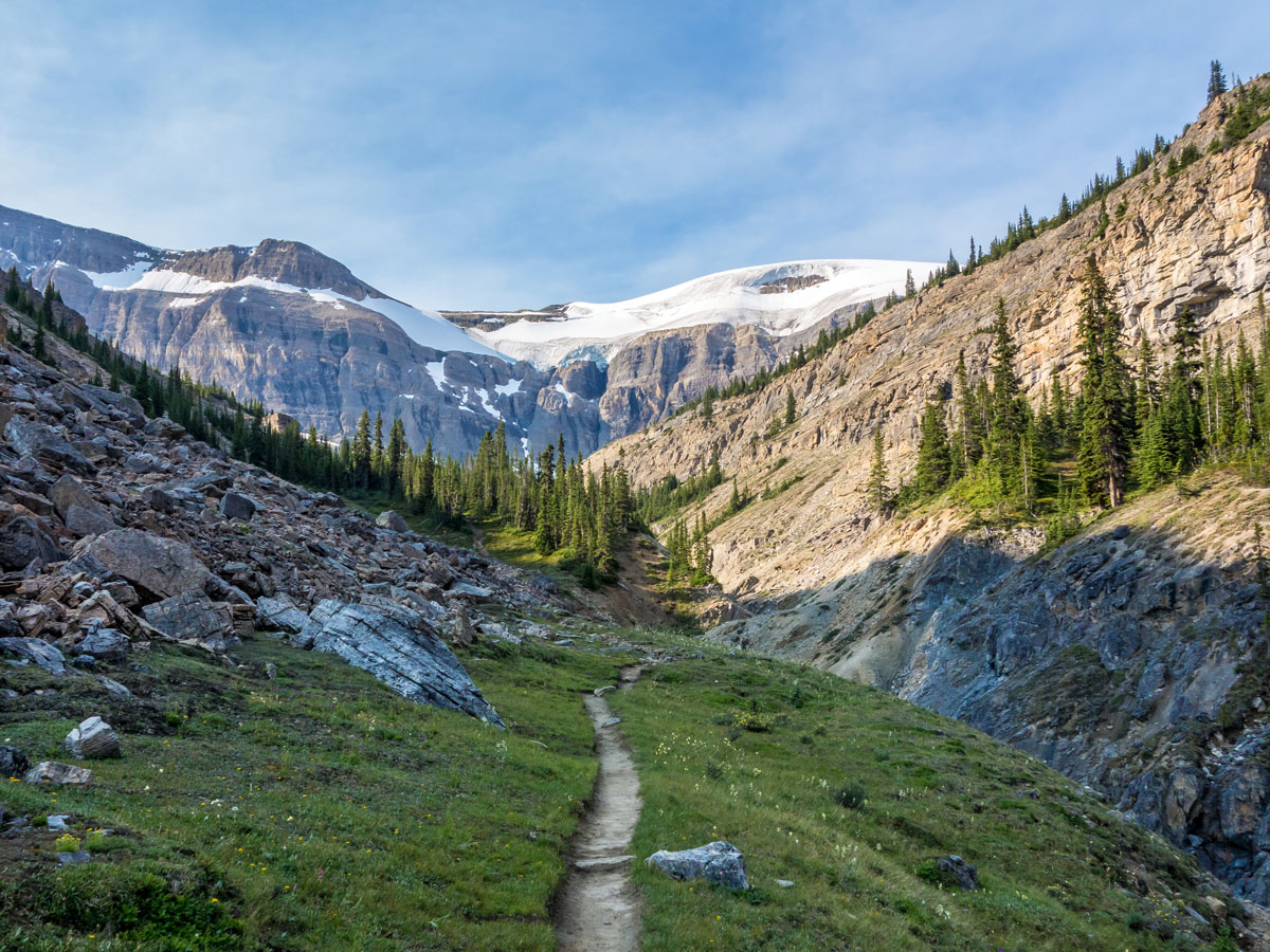
From the Num-ti-Jah parking lot, start out and pass Num-ti-Jah lodge and hike on a decent trail around Bow Lake. Follow the trail at the end of Bow Lake before heading up the stairs, looking out for the junction where the trail splits. At the junction take the left-hand trail to Bow Hut (the right-hand trail goes to Bow Glacier Falls).
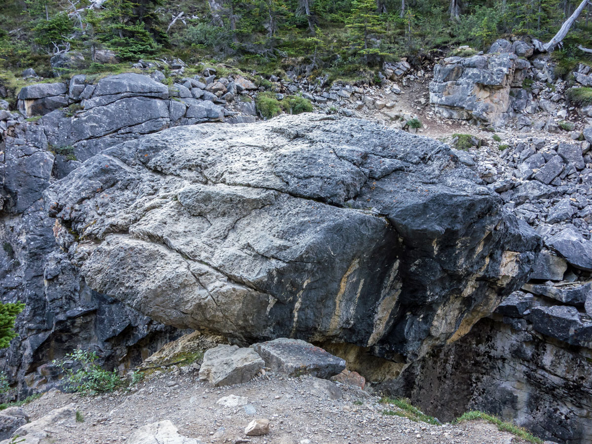
After going left to Bow Hut, you will shortly have to cross a large boulder bridging the gorge with the beginnings of the Bow River below you. The boulder is mildly exposed and intimidating. The most difficult part, especially for those with short legs, is getting up onto the boulder (and down on the way back). Here, it always helps to get a boost from a long-legged scrambling partner.
Once past the boulder continue on the trail to Bow Hut. The trail here involves a lot of hopping over boulders and roots – not terribly hard, but a bit tiring if your legs are sore from a previous days hike! A cautionary note – this is not a route to take while there is still snow, as there is serious avalanche risk on this section. Also, in early summer there are many little streams to cross, which can be running high and be tricky to cross after a rain. These become even worse later in the day, especially if it has been hot and they are running higher.
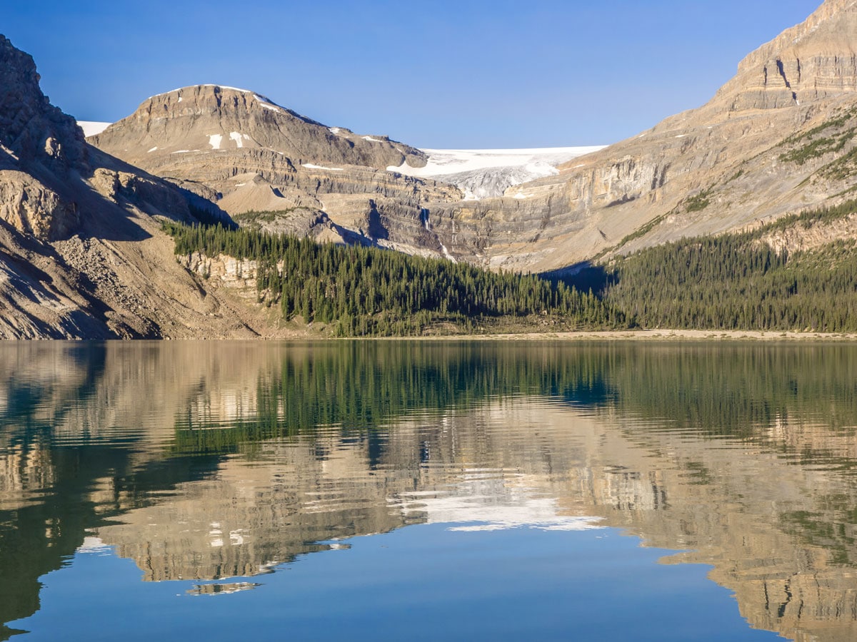
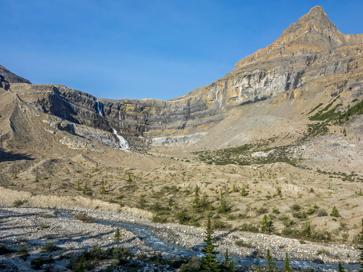
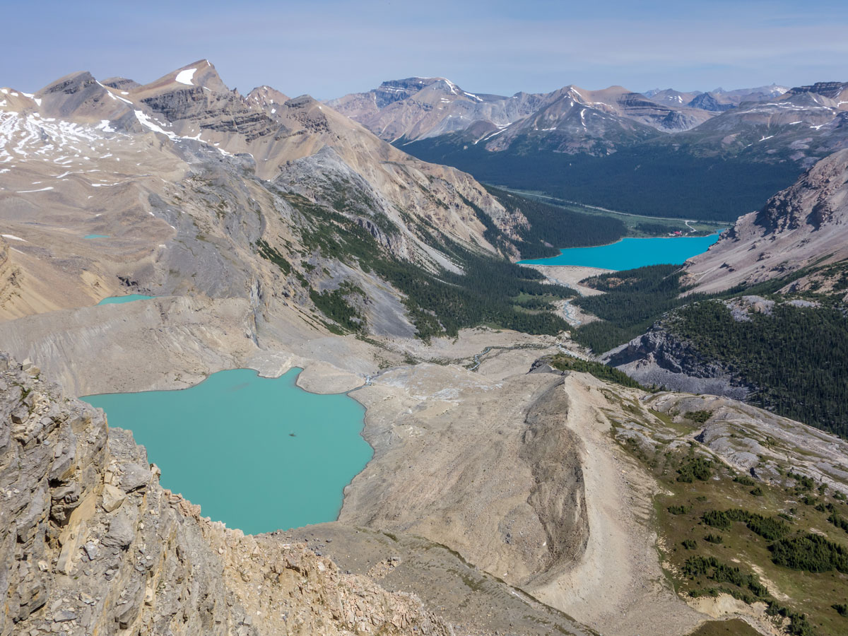
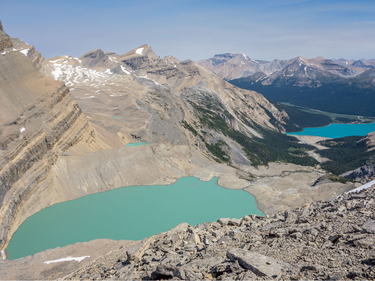
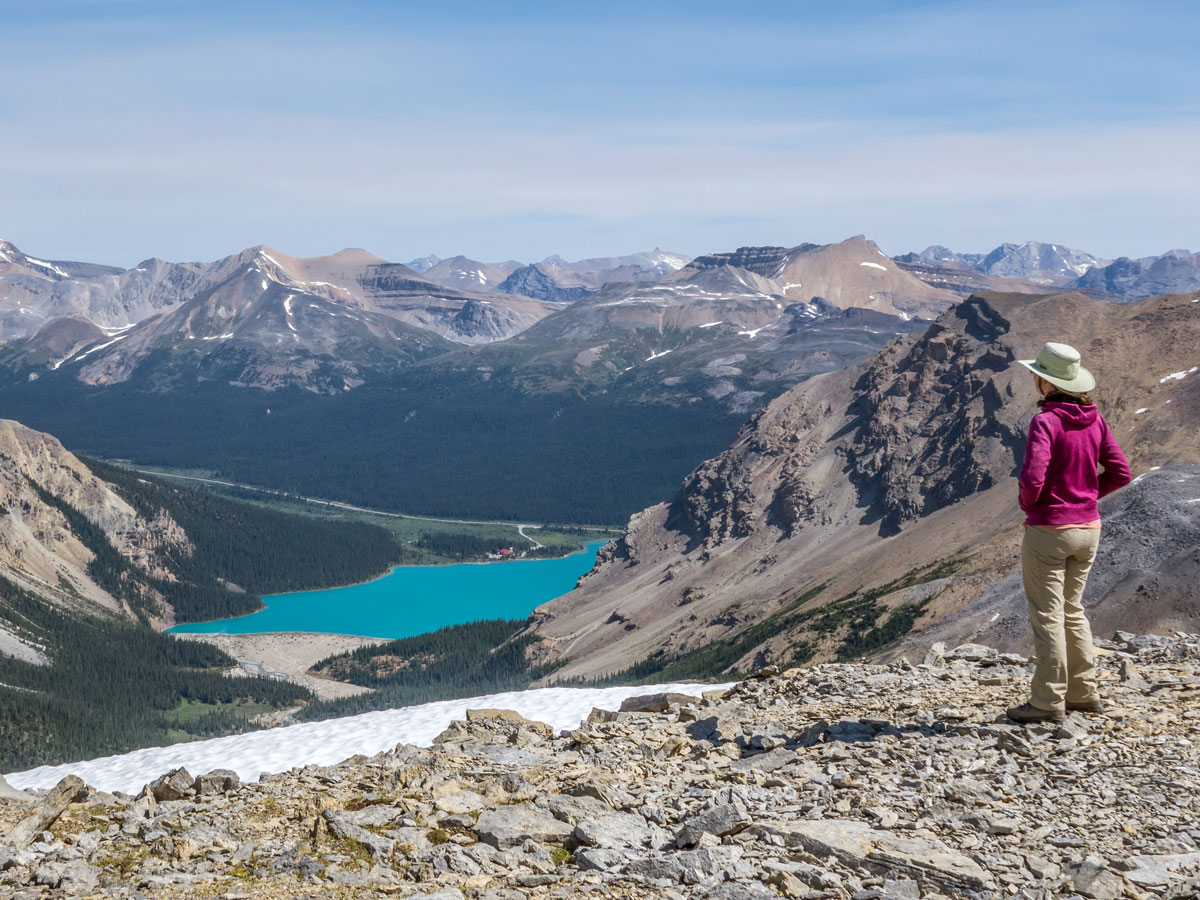
Continue along the path, hike up over a hill and emerge into a stunning moraine-basin filled with rubble. There is a dramatic glacier at the far end of the basin. Bow Hut is eventually up to the right on a rock ledge. Continue on the obvious path, with cairns used when the path disappears. You may have additional creek crossings (depending on the season and recent rainfall) as you head up the left-hand side of the valley.
You will notice your path now drops down and you get to cross over the creek to the right side of the valley in order to ascend to Bow Hut. The creek crossing can be tough, and there are several routes marked out by cairns. Choose the one you are most comfortable with and if possible, use hiking poles which are a great help here.
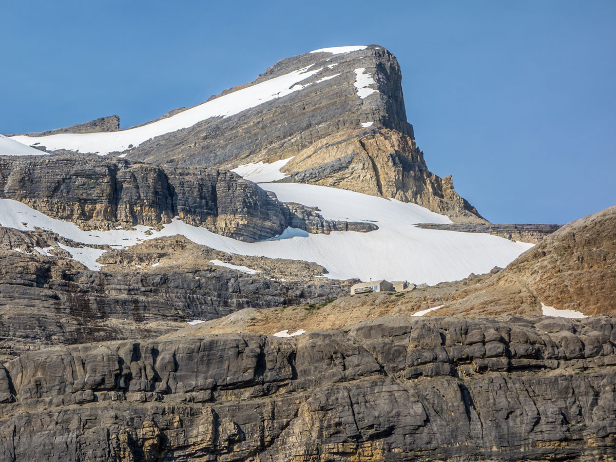
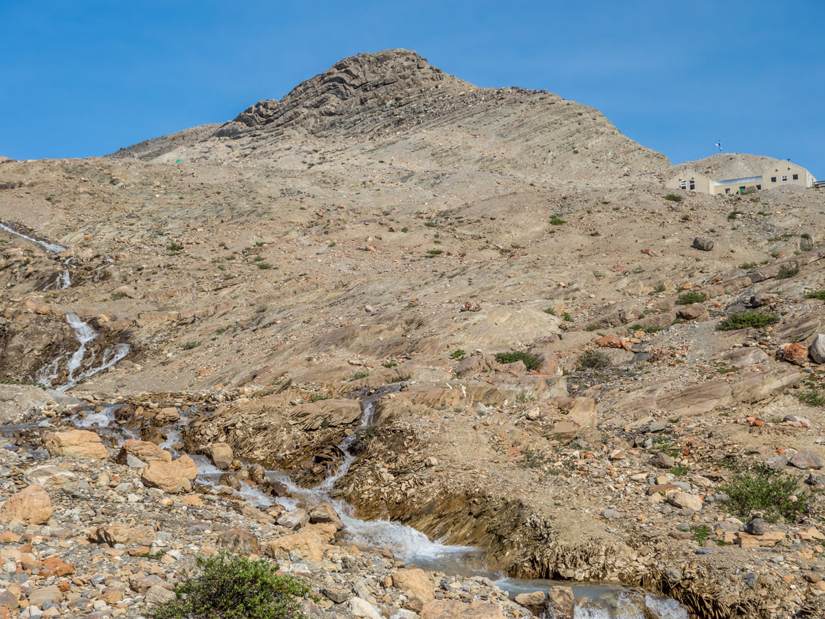
Once across the creek, you can choose any of the braided hiking paths headed up towards Bow Hut, checking it’s a safe route up. You soon reach Bow Hut, which is not the most attractive mountain hut, but resilient for the challenging weather it endures year-after-year. It should take between 2.5 – 3 hours of hiking to reach this point. Don’t go into Bow Hut unless you have a reservation, as there has been plenty of damage from careless hikers. If the custodian is present, then they may let you have a look. Inside it is really cozy and spending the night here can be a lot of fun.
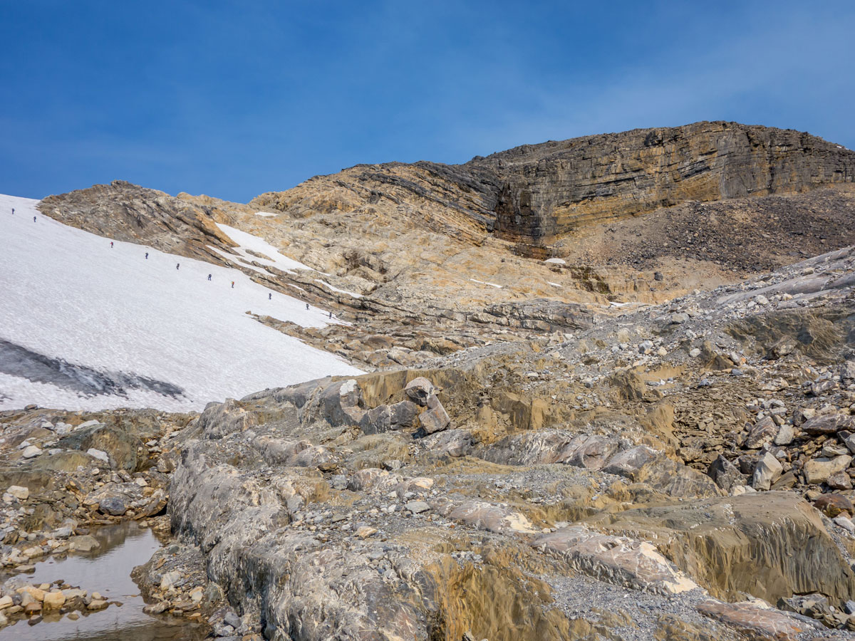
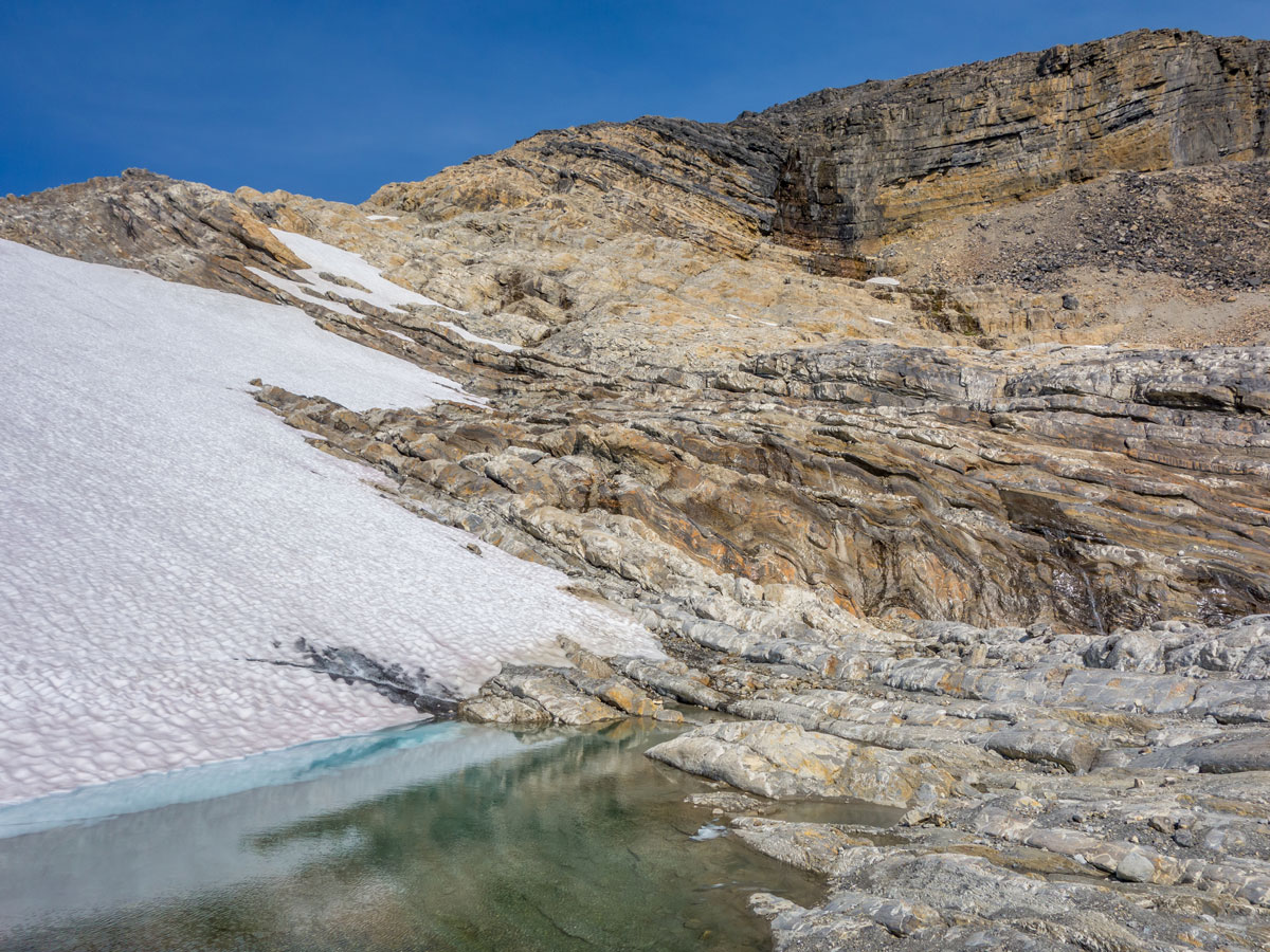
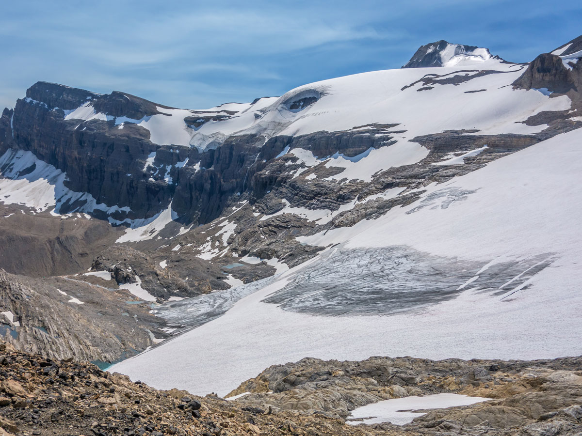
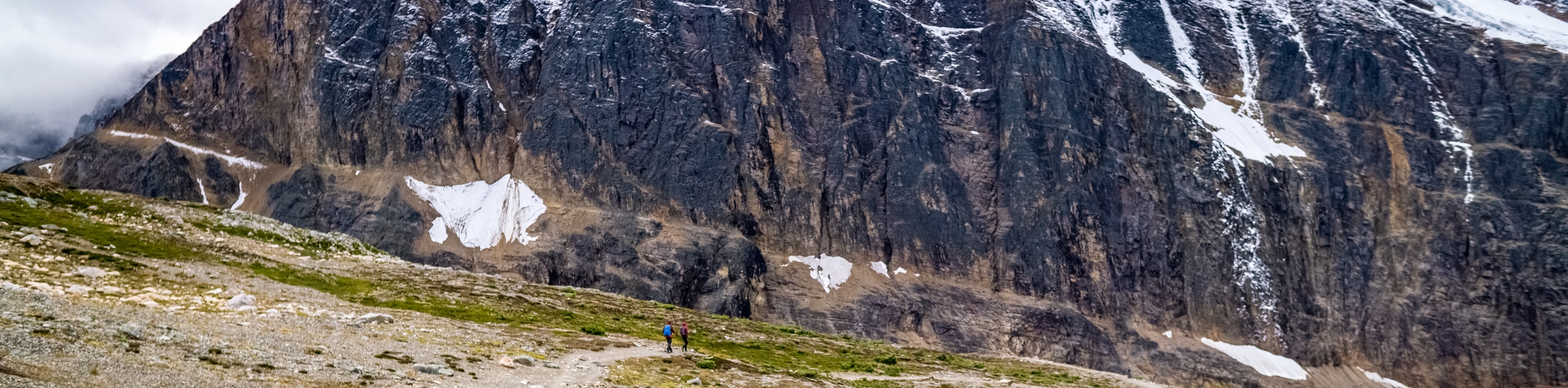
Pass Bow Hut and continue towards the toe of the glacier and to the base of The Onion. You will make your way over, along, and around dozens of glacially-scoured rock ribs, tiny pools, and little streamlets. This part is slow going, but surprisingly fun and scenic and not much more difficult than an off-trail hike. A short distance later you will see cairns marking various routes through the maze, and while it is advised to follow them for the most part, it is also enjoyable looking for routes on our own.
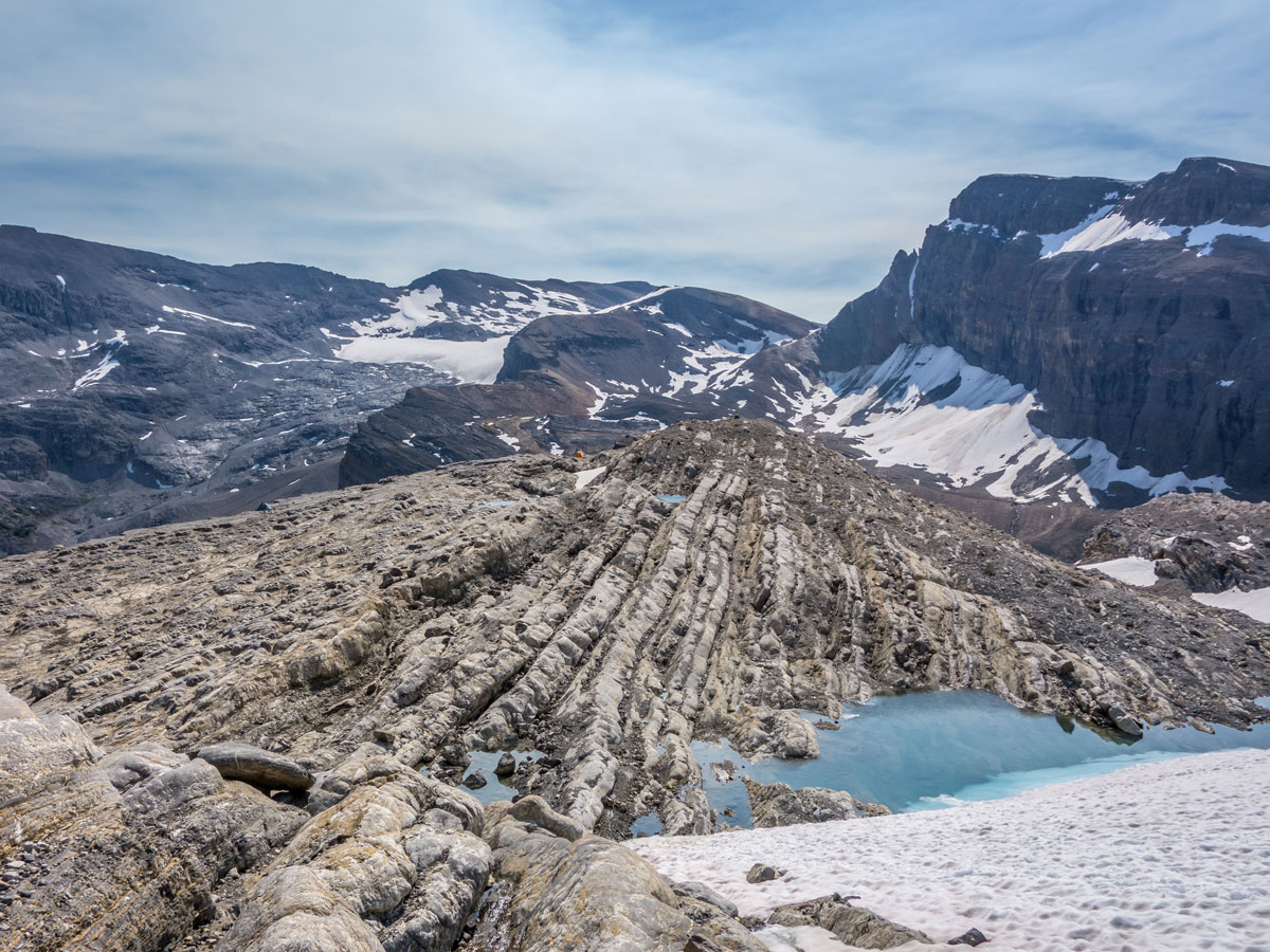
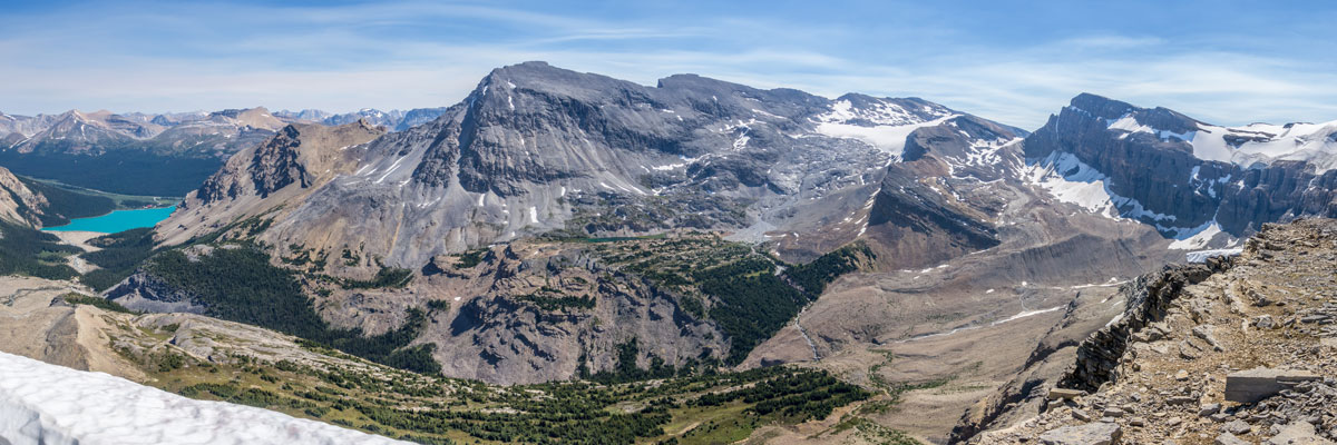
It will take approximately 1 hour to navigate through the enormous summit plateau. It is possible to cut that time down if you took a more direct route, but this would involve additional scrambling. Once on the summit it is nice to spend some time wandering around the plateau to see the surrounding valleys and glaciers.
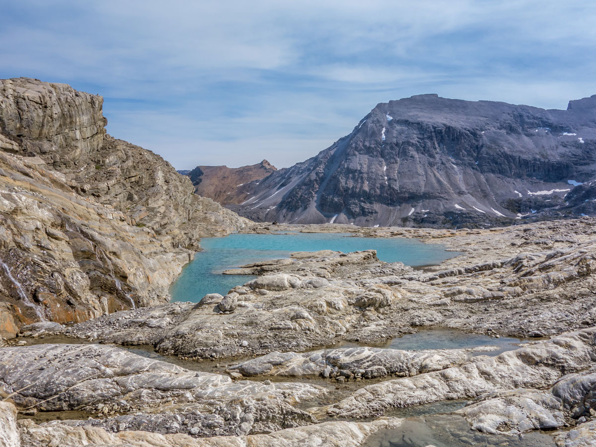
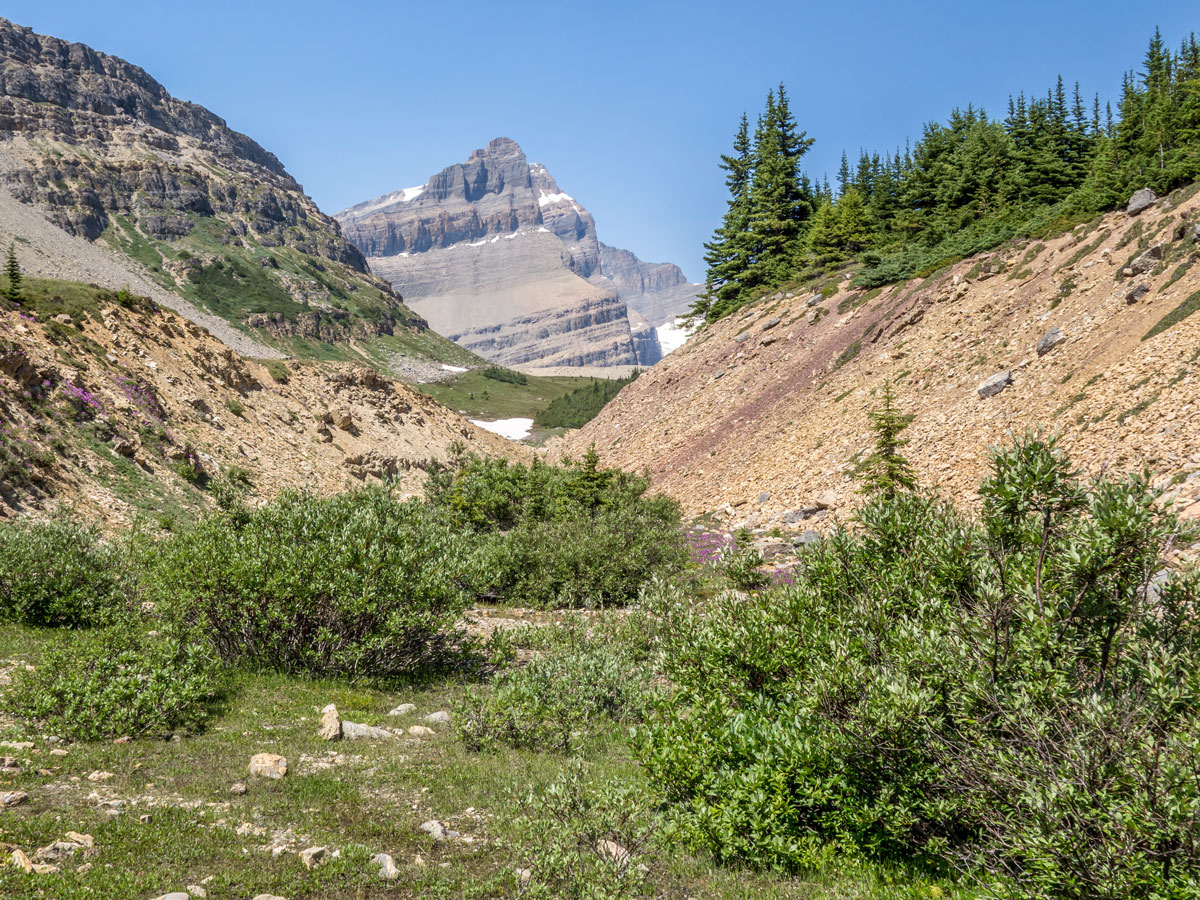
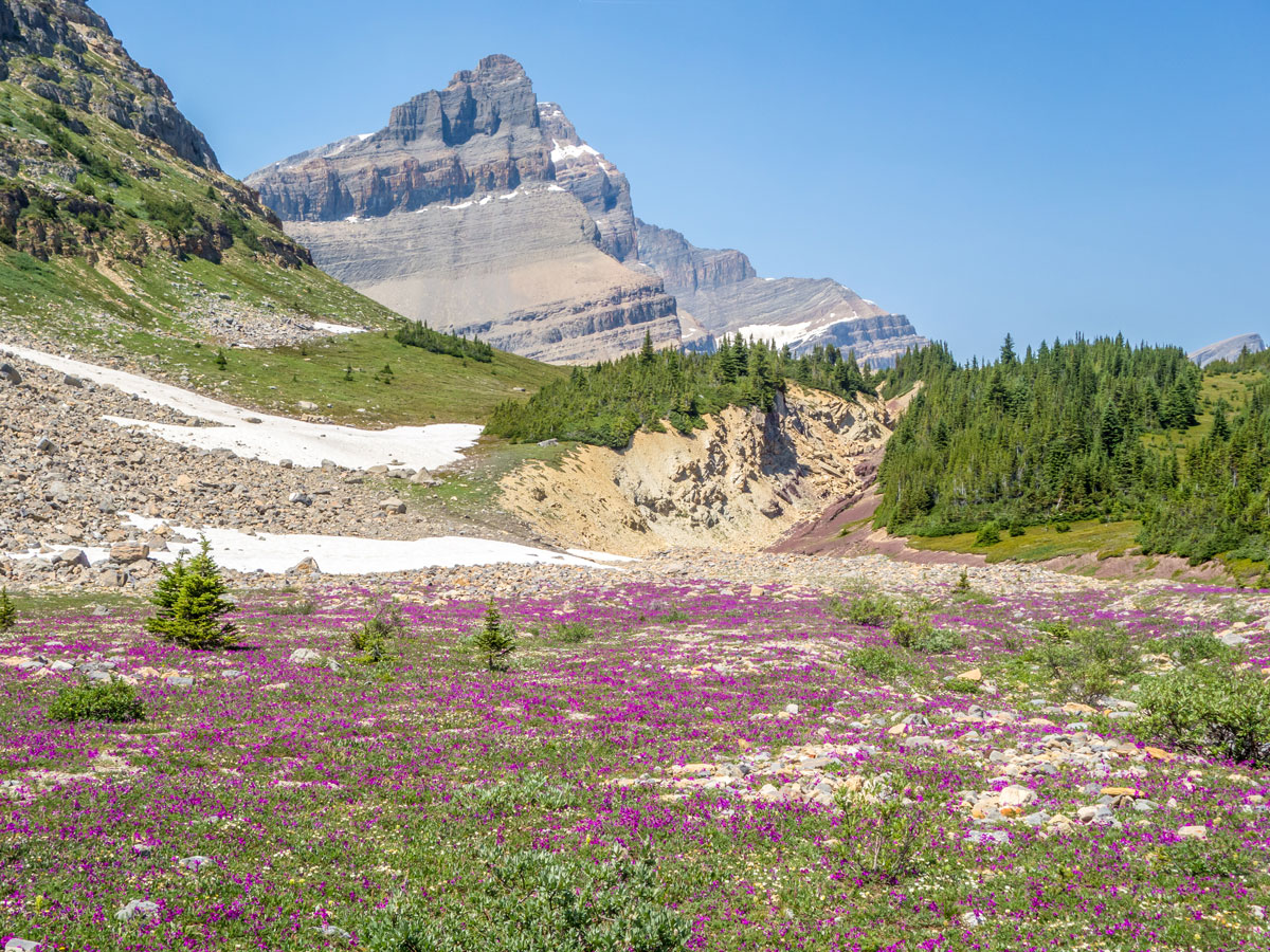
To get back, follow your path to the valley directly below Bow Hut. Instead of continuing along the trail you came up from, turn left and head directly for Iceberg Lake. Your route will initially cross a large rubble field, but travel will be surprisingly simple, and a few cairns indicated others take this route often. Rubble soon transitions to easy travel up a minor creek, then lovely wandering through a meadow at the base of The Onion. You may have some concern regarding the large lateral moraine looming at the end of the meadow, however a gap between it and The Onion permits easy passage, albeit on unstable rubble. From here, you will soon find yourselves overlooking Iceberg Lake.
Descend to the lake shore and make your way to the outlet stream which is the very beginning of the Bow River.
From Iceberg Lake, take a path that initially goes east before heading north-east on a descending path that eventually meets up with the initial trail you came in on. From here it’s the same route back down to Bow Lake and then to your car.
Insider Hints
This is a long-day, consider staying a night at the ACC’s Bow Hut to break this journey into two days.
Consider a stay at Num-Ti-Jah Lodge if you want to do other great hikes in the area or just relive how the Rockies used to be.
There are so many other great day hikes in the area - find one here that will fit your needs for the day!

Similar Scrambles to the The Onion Scramble
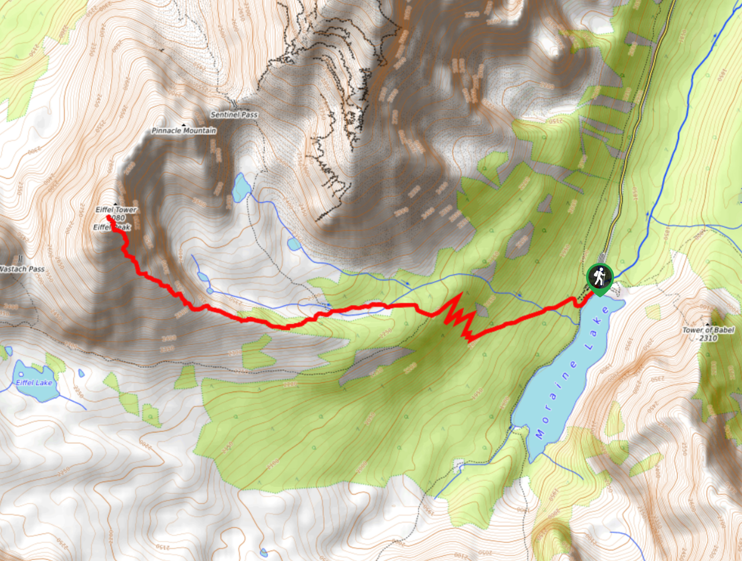
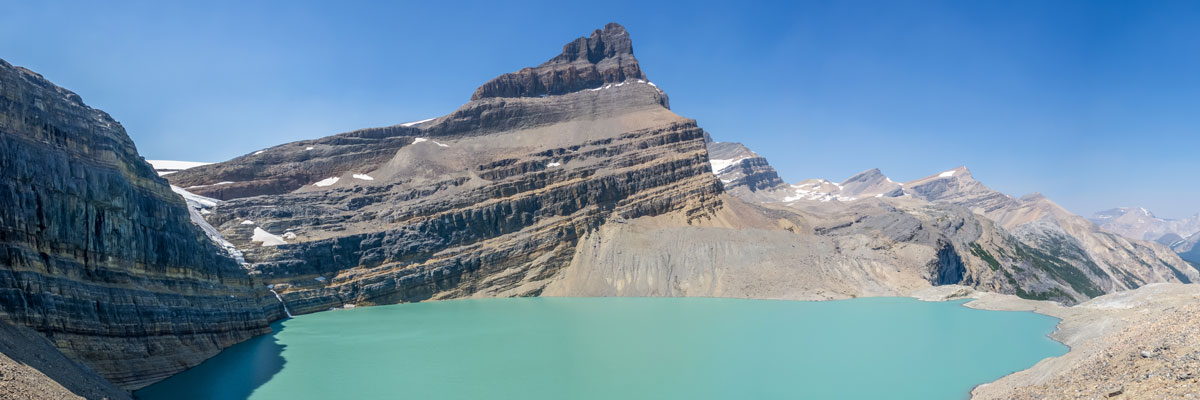
Eiffel Peak
Eiffel Peak isn’t frequented by many who make their way to Moraine Lake. It is a difficult scramble with less…
Mount Edith
Mount Edith scramble begins with the unsuspecting Cory Pass hike before branching off to the right to begin gaining Mount…
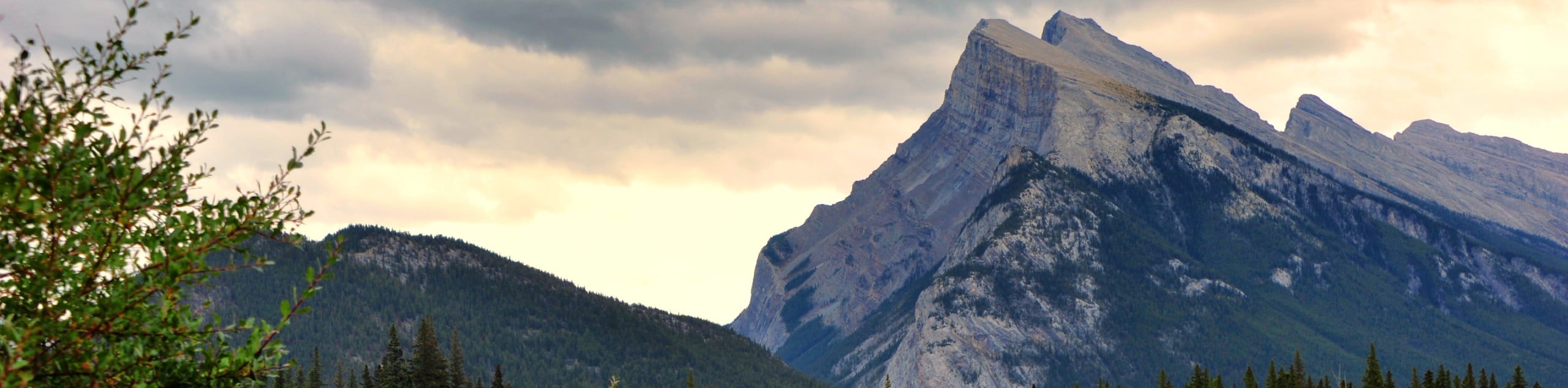
Mount Rundle
Locals stare at Mount Rundle day in and day out, enough to acquire a personal relationship with the impressive feature.…
bigfootJOE 5 years ago
This is worth doing just for the views. there aren't many locations that will open up such fantastic sights
Wicked T 5 years ago
Great scramble. I love the name
SJ 5 years ago
Loved this scramble up The Onion!