Tuolumne River Loop
View Photos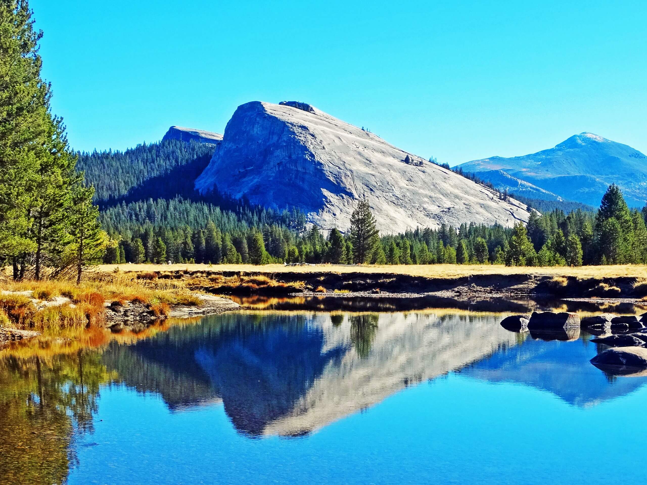
Tuolumne River Loop
Difficulty Rating:
The Tuolumne River Loop is a wonderful half-day hike that is ideal for a spontaneous adventure in Yosemite National Park. Boasting breathtaking views of Tuolumne Meadows and the Sierra Nevada Mountain Range as you wander along the river, this trek packs a punch!
Getting there
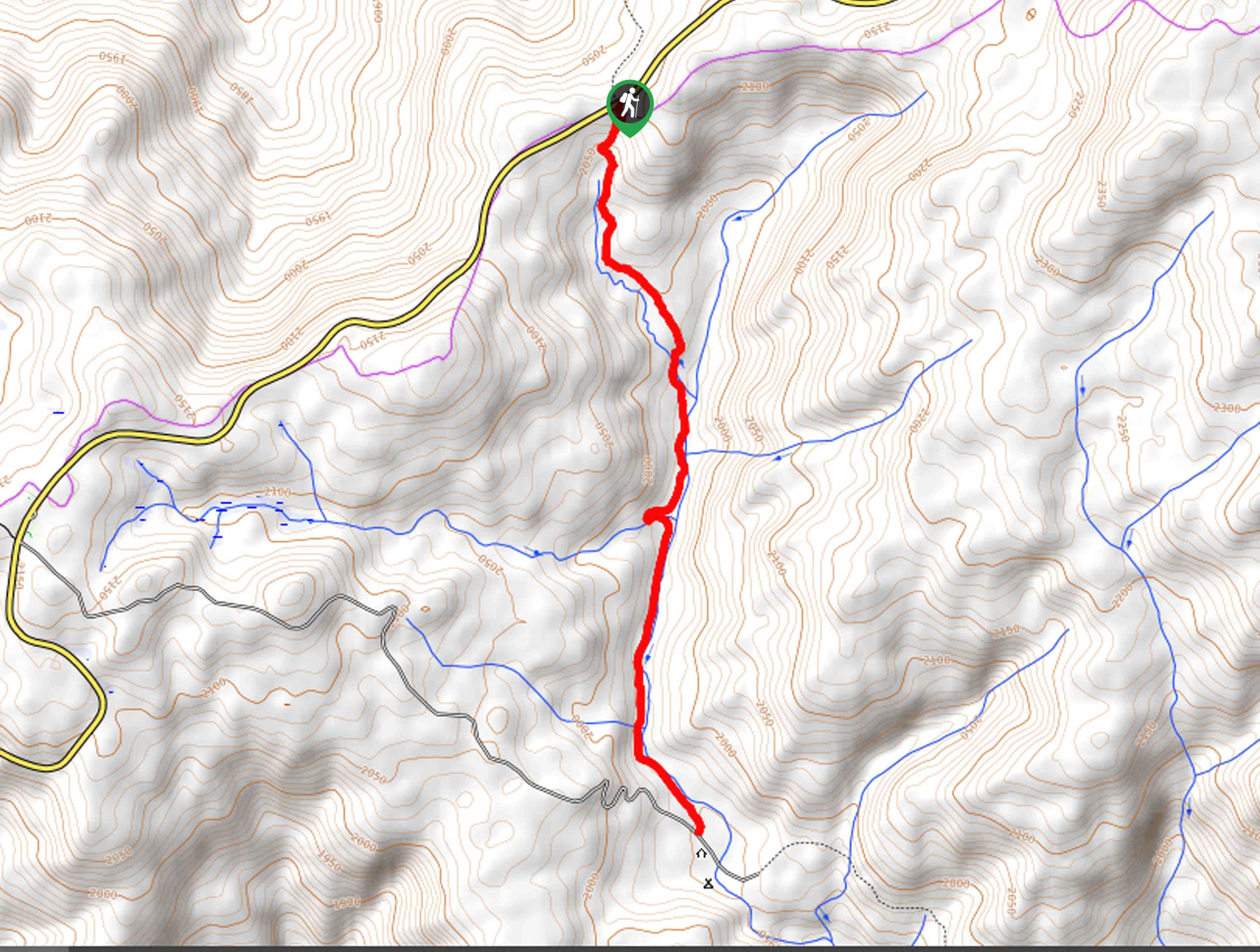
The Tuolumne River Loop departs from the Pacific Crest Scenic National (PCT) Trailhead in the Dog Lake Parking Lot off Tuolumne Meadows Lodge Road.

About
| Backcountry Campground | No |
| When to do | May-October |
| Pets allowed | No |
| Family friendly | No |
| Route Signage | Average |
| Crowd Levels | Moderate |
| Route Type | Circuit |
Tuolumne River Loop
Elevation Graph
Weather
Tuolumne River Loop Description
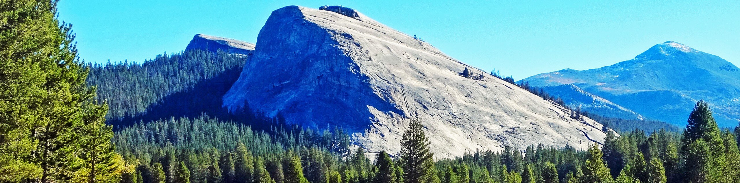
The Tuolumne River Loop is an unassumingly scenic adventure that exhibits breathtaking scenes of the Sierra Nevada Mountain Range, including up-close and personal views of Lembert Dome, a lovely riverside setting, and the lush atmosphere of the Tuolumne Meadowlands. Easy-going and short, this trek can be enjoyed by hikers of all skill levels and ages! Note: the path weaves between exposed meadowlands and tree shade, so wear layers and bring sun protection. The National Park charges an entrance fee; refer to the NPS website for additional information.
Embark on your adventure along the Tuolumne River Loop from the Dog Lake Parking Lot. From here, track the leftmost PCT Trail southeast over Dana Fork and through the woodlands. Eventually, you will cross the Twin Bridges over Lyell Fork, before being redirected west along the John Muir Trail. This section of the route will guide you through the meadowlands and along the gurgling waters of Lyell Fork. As you wander, revel in the scene of the Sierra Nevada Mountain Range’s quintessential granite peaks.
Soon you will have to hop off the John Muir Trail and onto Loop A Road. Hike this route up to Tioga Pass Road, where you will cross the bridge over the creek and take a sharp right onto an unmarked route that travels east along the northern side of Lyell Fork. Follow this path all the way back to the trailhead.
Similar hikes to the Tuolumne River Loop hike

Chain Lakes Hike
Explore one of the more secluded trails in Yosemite National Park along the Chain Lakes Hike. This wonderful trail exposes…
Cascade Creek Trail
The Cascade Creek Trail is a great adventure atop Yosemite Valley’s northern rim that boasts breaking views of the lush…
Tamarack Creek Trail
The Tamarack Creek Trail is an easy-going, family-friendly hike in Yosemite that boasts wonderful scenes of vibrant wildflowers in the…
Comments