Lower Gaylor Lake Trail
View Photos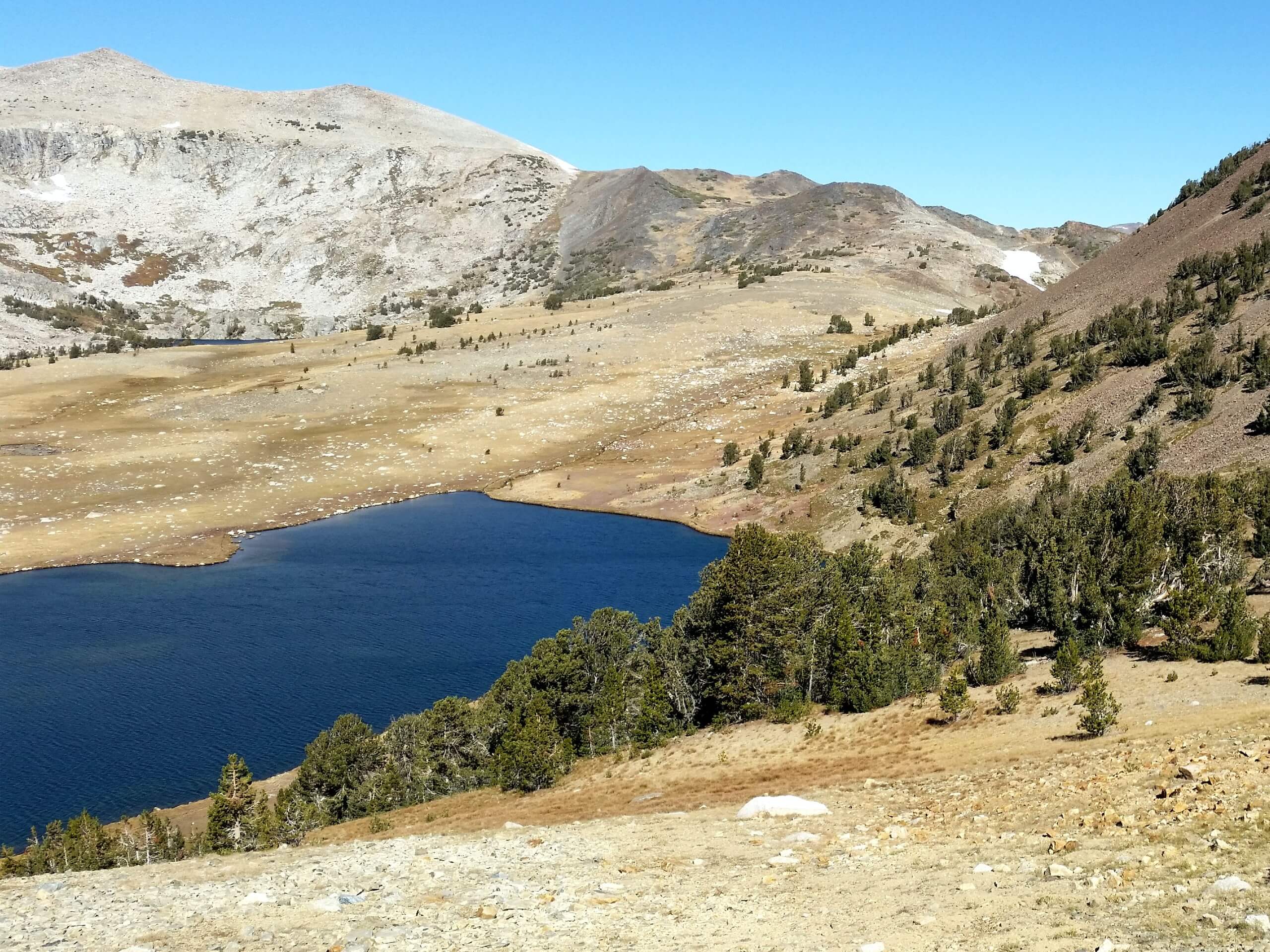
Lower Gaylor Lake Trail
Difficulty Rating:
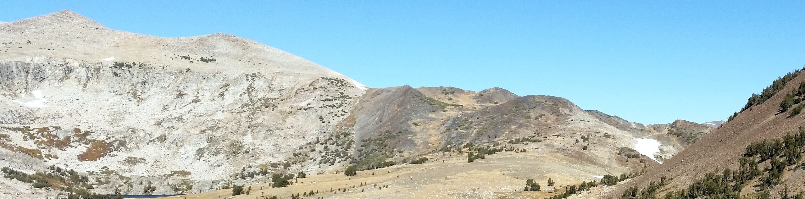
Wander through golden meadowlands and mixed pine forests as you make your way up to Lower Gaylor Lake Trail. This scenic adventure culminates at the shimmering lake that exhibits breathtaking panoramas of the quintessential granite domes that line the horizon. This sequestered trail is a must add to your Yosemite itinerary.
Getting there
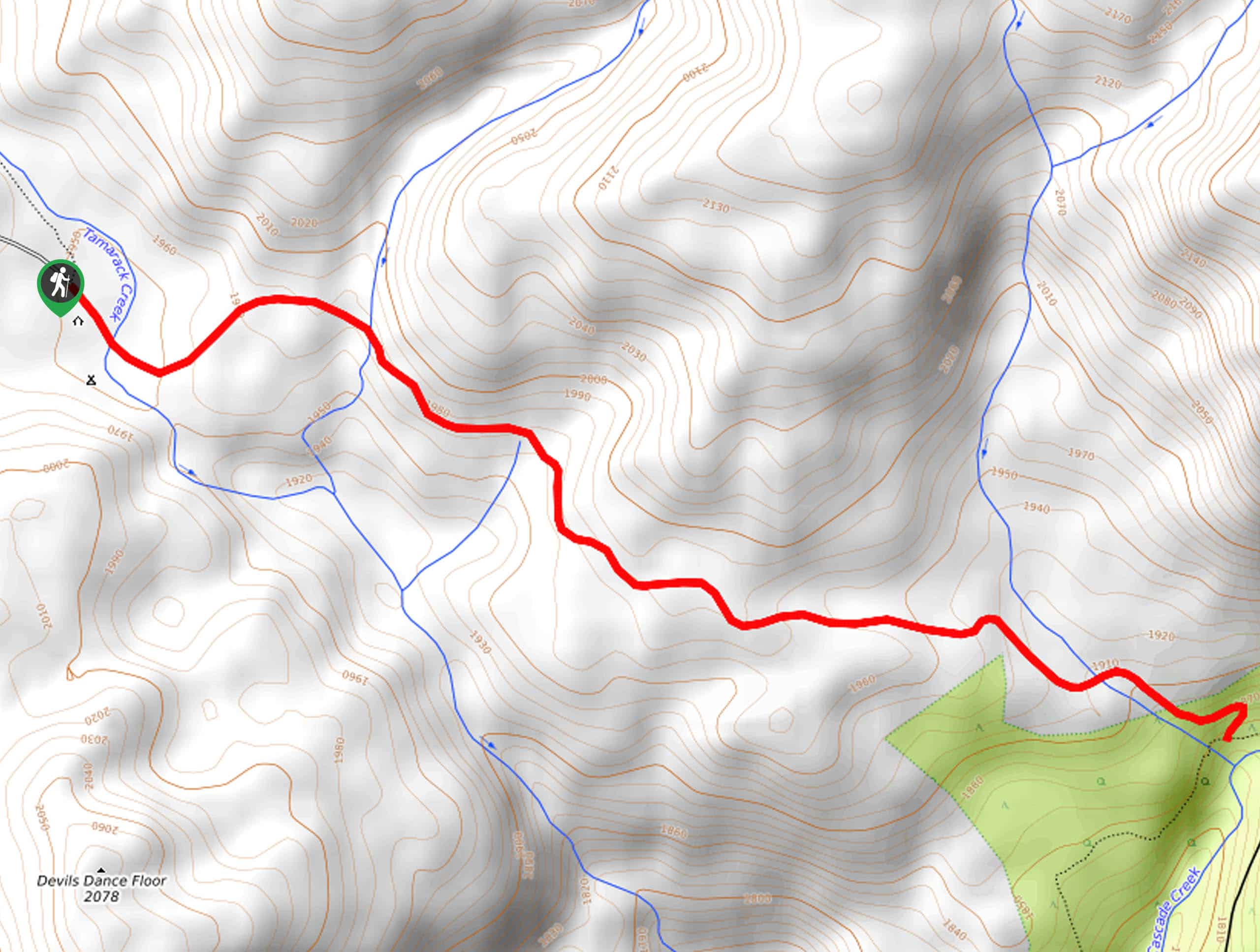
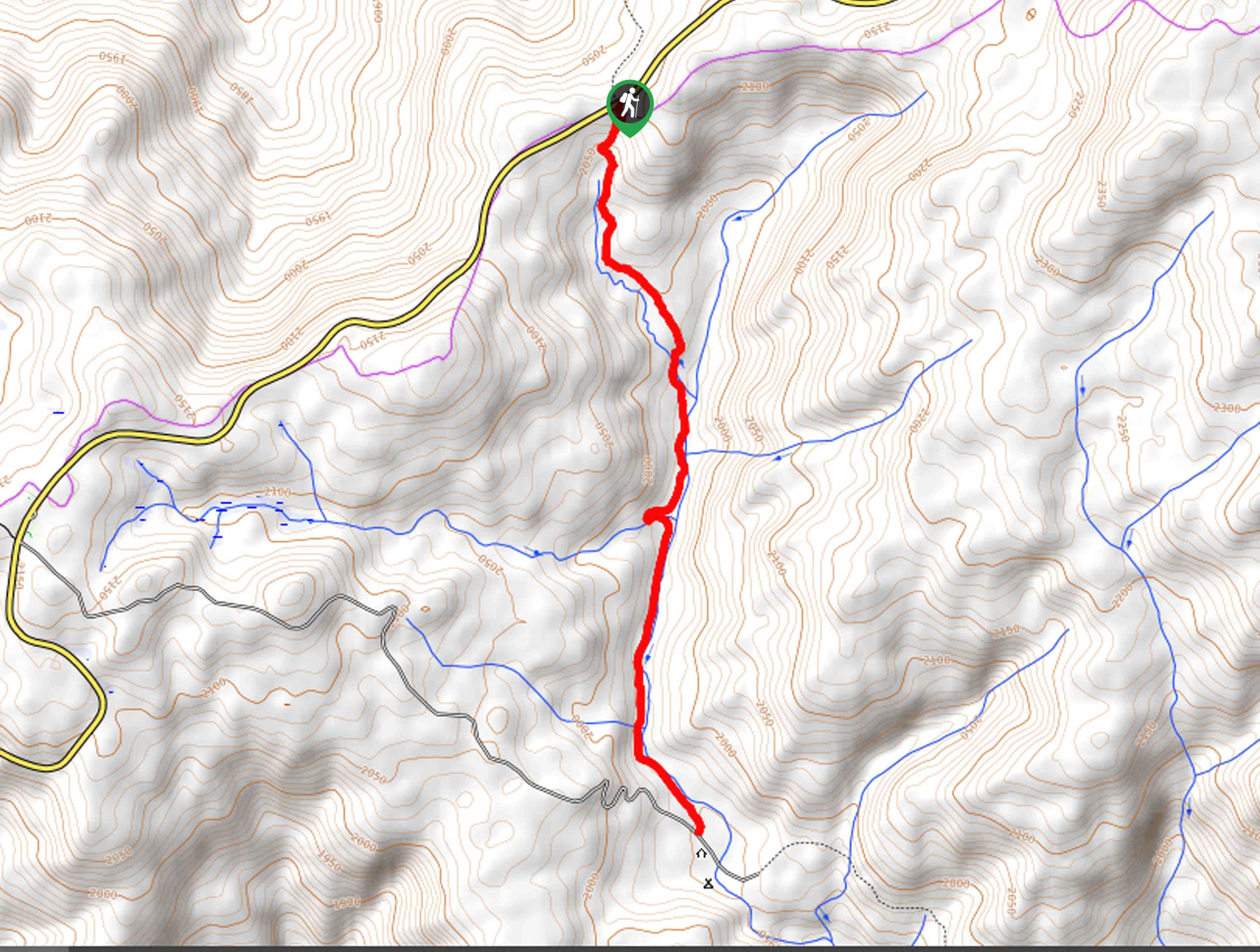
The Lower Gaylor Lake Trail is accessed via the trailhead off Tioga Pass Road.

About
| Backcountry Campground | Dispersed Backcountry Camping, Wilderness Permit Required. |
| When to do | May-October |
| Pets allowed | No |
| Family friendly | Yes |
| Route Signage | Average |
| Crowd Levels | Moderate |
| Route Type | Out and back |
Lower Gaylor Lake Trail
Elevation Graph
Weather
Lower Gaylor Lake Trail Description
The Lower Gaylor Lake Trail is a wonderful, family-friendly adventure above Tuolumne Meadows. If you are seeking a more isolated experience in Yosemite, then this trek is an excellent option. Meander through diverse terrains along a babbling creek and up to the shimmering lake that reveals humbling panoramas of the Sierra Nevada Range. Note: the path is rocky in sections, so mind your footing and wear sturdy footwear. Additionally, it is important to note that Tioga Pass Road is subject to seasonal closures. Yosemite National Park charges an entrance fee, check out the NPS website for additional information.
Embark on your adventure along the Lower Gaylor Lake Trail from the trailhead off Tioga Pass Road. From the trailhead, track the Lower Gaylor Lake Trail heading north. As you wander north, the path will approach a babbling creek running off from the alpine lakes. Let the sounds of the gurgling waters lull you into a state of relaxation, as you weave between exposed meadows and mixed pine forests. As you near the lake the trail will plateau, guiding adventurers through the meadowlands to Lower Gaylor Lake.
Rejuvenate your tired feet in the chilly waters of the lake as you revel in the beauty of the encompassing granite peaks. Take the time to admire the scenery and, when you are ready, backtrack along the path to the trailhead.
Similar hikes to the Lower Gaylor Lake Trail hike

Chain Lakes Hike
Explore one of the more secluded trails in Yosemite National Park along the Chain Lakes Hike. This wonderful trail exposes…
Cascade Creek Trail
The Cascade Creek Trail is a great adventure atop Yosemite Valley’s northern rim that boasts breaking views of the lush…
Tamarack Creek Trail
The Tamarack Creek Trail is an easy-going, family-friendly hike in Yosemite that boasts wonderful scenes of vibrant wildflowers in the…
Comments