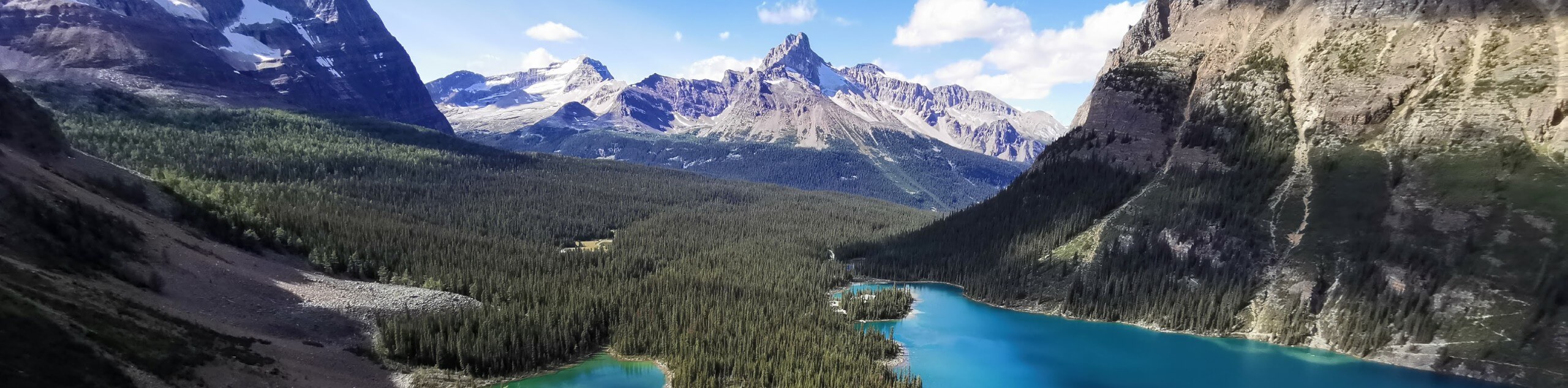
Hamilton Lake hike
View Photos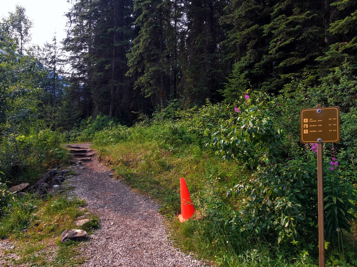
Hamilton Lake hike
Difficulty Rating:
Hamilton Lake is a fantastic Yoho hike that is a bit of a secret. This high alpine lake is tucked away in a spectacular hanging valley at the end of a steep, relentless trail from Emerald Lake. The challenge of hiking to Hamilton Lake might scare some people off, but we think the extra work is worth it.
Getting there
From Banff take the Trans Can Hwy west. Just after the turn for Field, BC, turn right on Emerald Lake Rd 1.1mi past Field. Continue 5.6mi down. Park in the Emerald Lake parking lot. The trailhead is at the opposite corner of the parking lot to the lake.

About
| When to do | July to September |
| Backcountry Campsites | No |
| Toilets | Yes, at trailhead |
| Family friendly | No |
| Route Signage | Average |
| Crowd Levels | Low |
| Route Type | Out and back |
Hamilton Lake
Elevation Graph
Weather
Route Description for Hamilton Lake
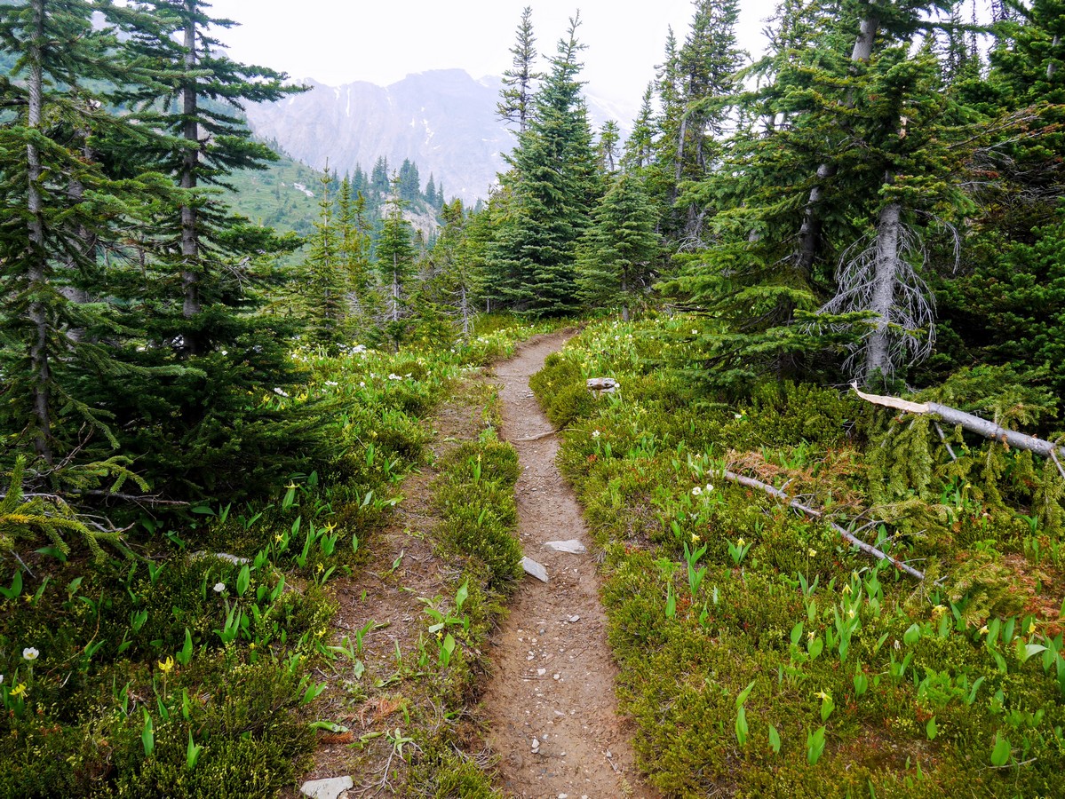
From the southern end of the Emerald Lake parking lot, start the hike by taking a trail heading west through the forest.
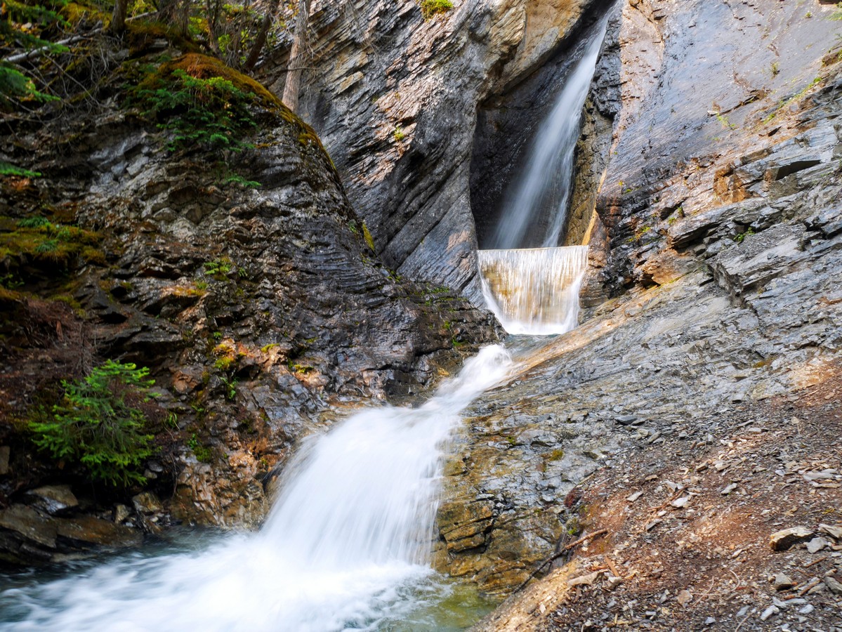
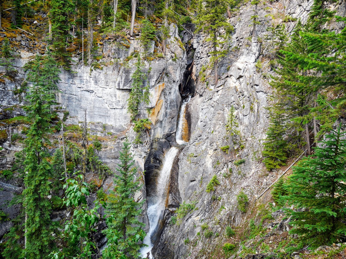
The first 2297ft of this hike are a gentle ascent through the forest to Hamilton Falls. While not the only waterfalls on Hamilton Creek, they are certainly the only accessible ones. Many tourists spending the day at Emerald Lake visit the falls, but few venture further up the trail. Hamilton Creek was the original water supply for Emerald Lake Lodge, and old wooden pipes can still be seen along the banks – as well as a retaining wall built at the bottom of the falls.
After, two switchbacks up the trail, you’ll see the main trail switchbacks up, while a less defined trail continues straight. Take this detour (with caution) for an airy, cliff top viewpoint over the falls and out to Emerald Lake. Here you can see the power of the water, cutting through the limestone and creating potholes for a series of cascading falls. For those less inclined to stand on cliff edges, there is a fenced viewpoint further up the trail.
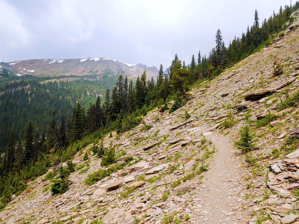
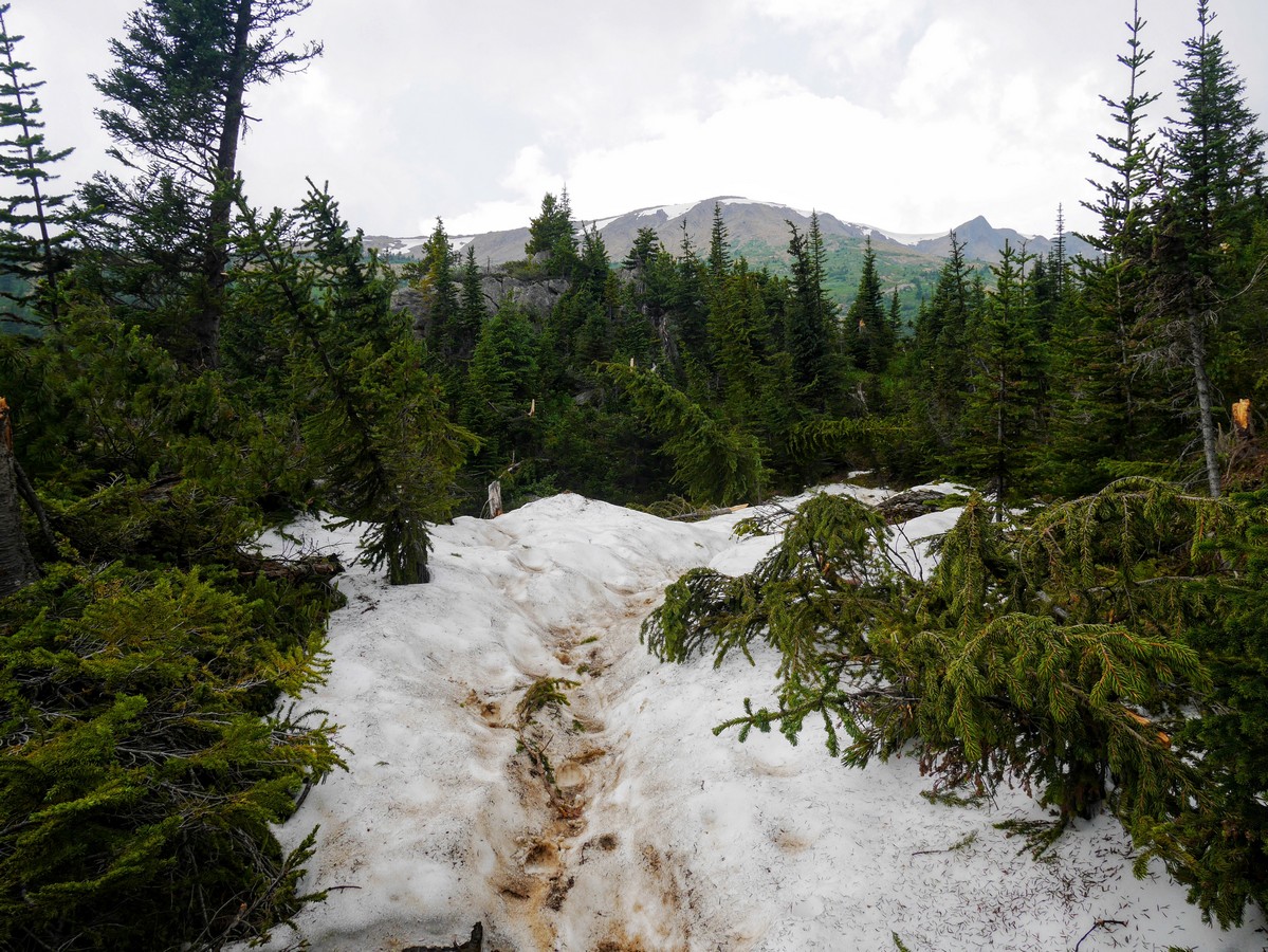
Hike up the main trail as it switchbacks alongside the canyon for about 0.6mi then veers off into the forest. As you gain elevation the moist, “interior rainforest” vegetation of western red cedar, Douglas fir, and western hemlock gives way to the more typical mountain forest of Engelmann spruce and subalpine fir. The trail maintains a steep but steady grade, making it easier to focus on keeping a solid pace uphill.
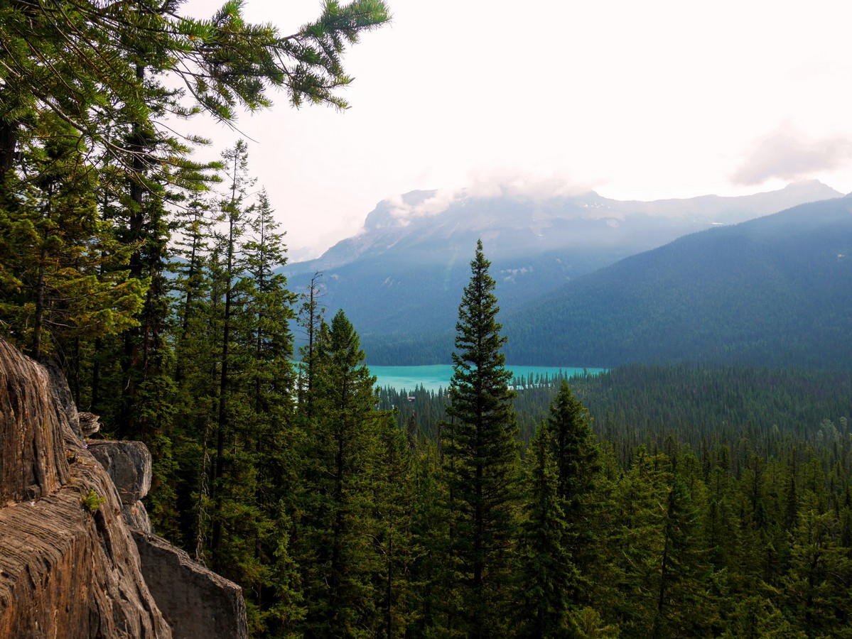
When you reach an opening in the forest that allows a view to Emerald Lake, rejoice in the fact that you have covered half your distance and elevation. For those who want to count, there are 45 total switchbacks you’ll hike up before the grade lessens and you begin your traverse across the avalanche slopes of Emerald Peak.
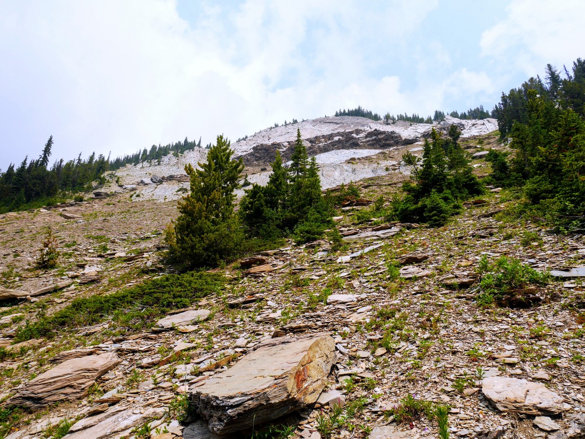
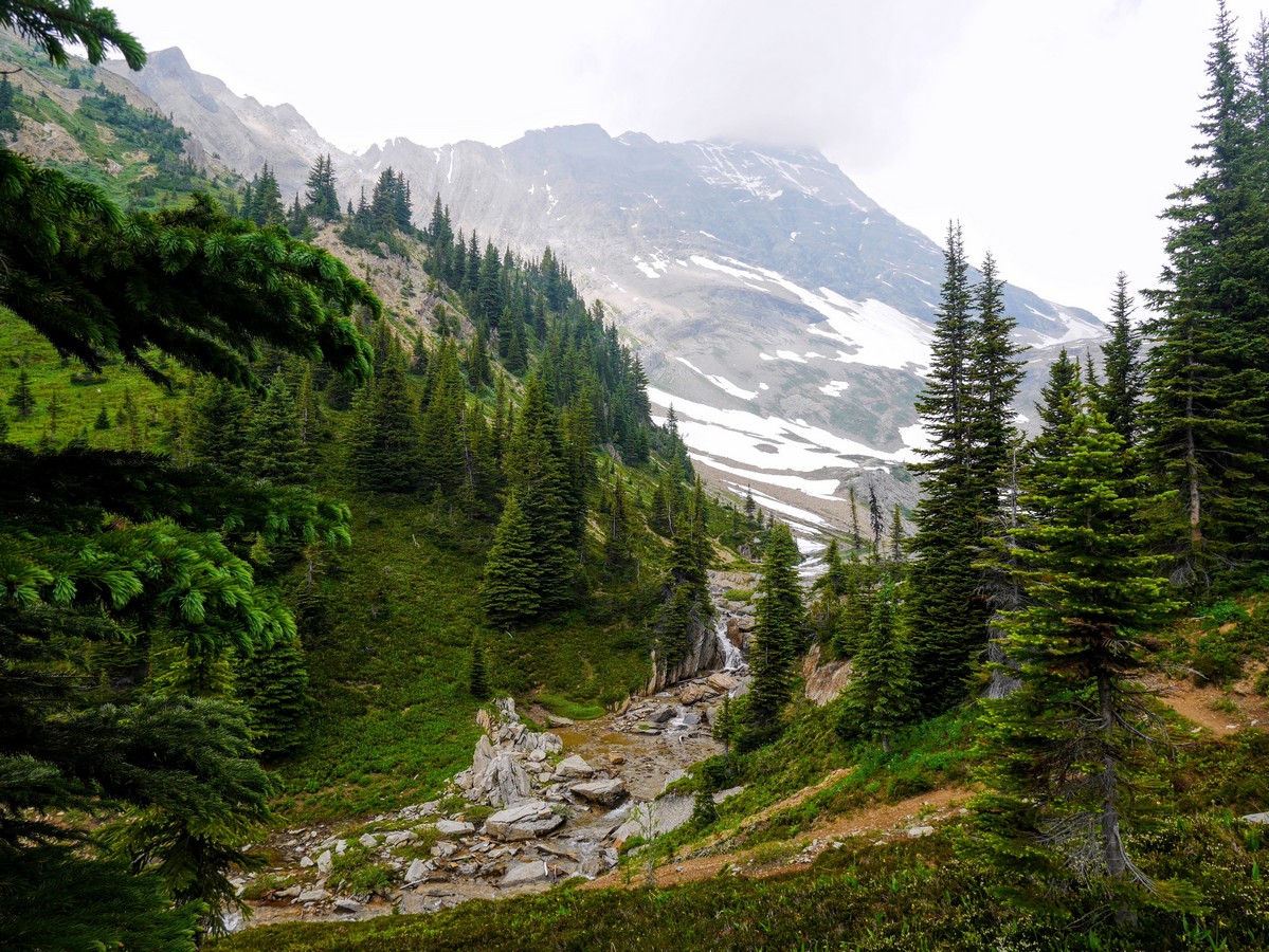
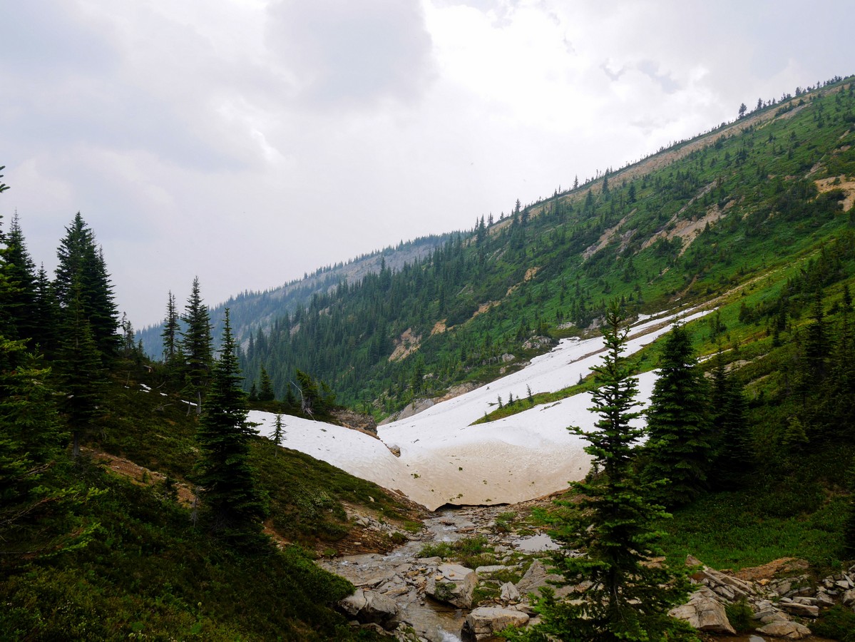
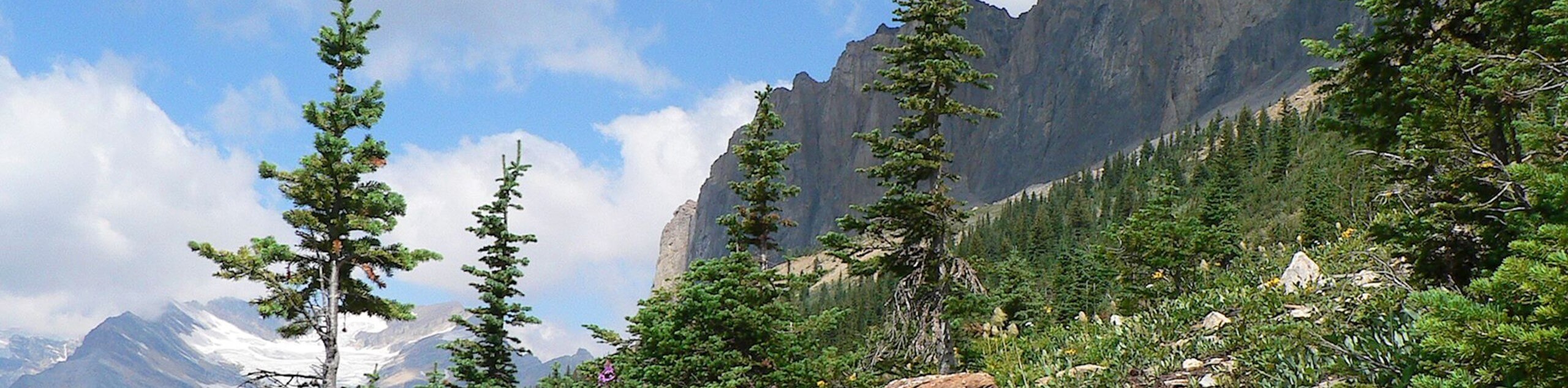
Gaps in the trees along this traverse allow wide views across the Kicking Horse Valley to the Ottertail Range, and the distant twin peaks of Mt Goodsir – the highest peak in Yoho National Park at 11703ft. Suddenly, you pop out onto a wide scree slope. Ahead of you is the ridge of Mt Carnarvon. Above you are the buff quartzite & dolomite cliffs of Emerald Peak, looking ready to release more of the boulders that lay scattered around you. It is wise not to linger long here.
Back in the forest, two more switchbacks take you up the final steps to the Hamilton Lake cirque. At the corner of one switchback is a massive Engelmann Spruce, more than a meter diameter at its base and over 115ft tall. We have seen bear scat on the trail here. Bears frequent the area looking for the numerous glacier lilies that grow at the edges of avalanche debris piles. The protein rich plant is a favourite snack of grizzly bears.
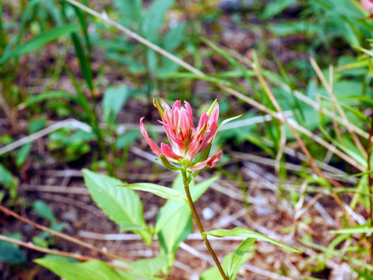
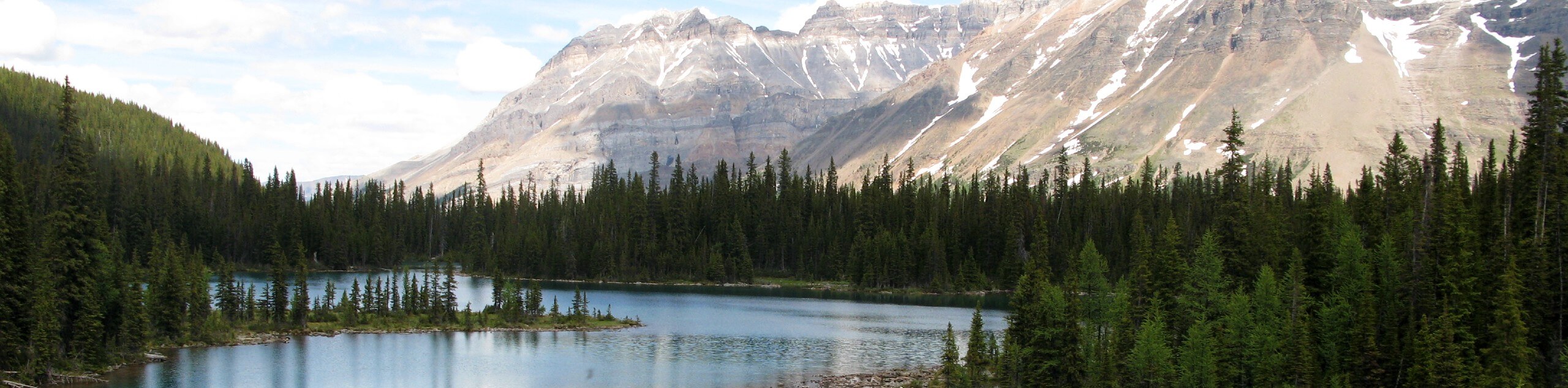
You will notice that multiple trees are bent, cracked and torn out of the ground, showcasing the power of avalanches in this high snowfall environment. When we reached the ridge alongside the Hamilton Creek valley, we traversed a deep section of avalanche snow that had come down off Mt Carnarvon, to the valley bottom and up the other side where the trail is. The valley forms a relatively protected subalpine meadow, rich with alpine globeflowers, glacier lilies, and white mountain heather. This place is also an excellent home for pika, marmots and bighorn sheep.
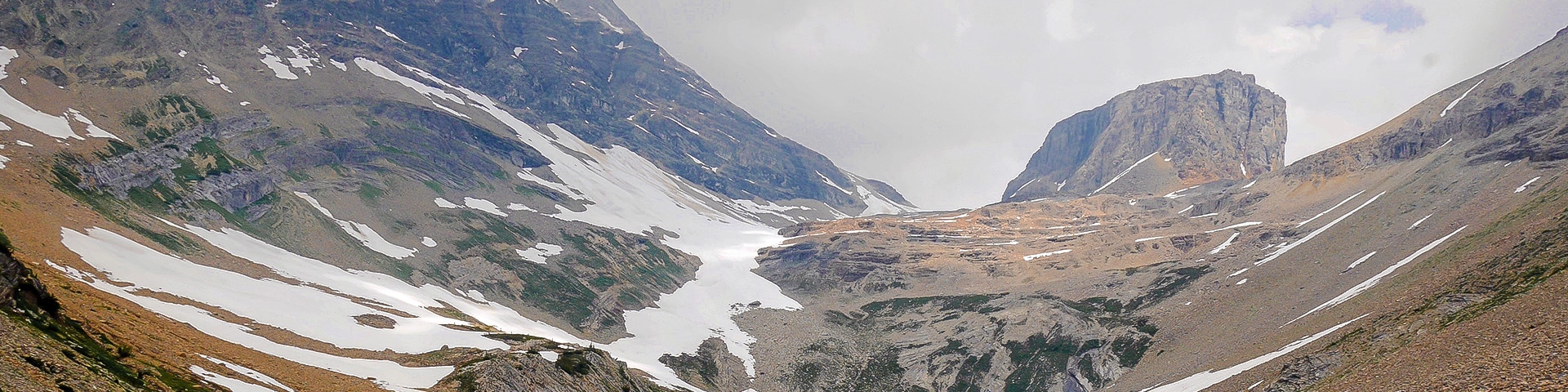
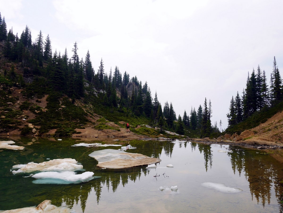
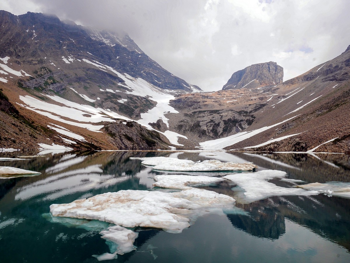
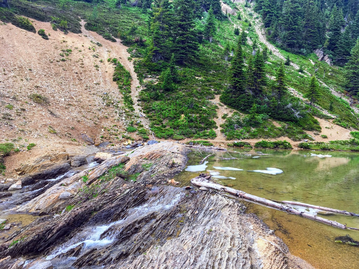
The outlet of Hamilton Lake is blocked by an upturned lip of shale – a precise boundary between the eastern main ranges and the western main ranges of the Canadian Rockies. You can follow this layer of rock up to where it bisects Mt Carnarvon and forms the backdrop of the lake. To the right is Emerald Peak, and the small blocky peak between them is known locally as the Top Hat. Scree, snow, and cliffs plunge directly down into the dark green waters of Hamilton Lake, and when we last visited in mid-July, many icebergs were floating serenely on the lakes surface.
For an optional extension of your hike, a scramblers trail continues on the west side of Hamilton Lake, accessed by rock hopping across the outlet stream. Mountain goats are known to frequent the grassy slopes here. Exploring the east side leads swiftly to cliffs and loose scree. What few plants do have a hold on this terrain don’t need hiker’s boots disturbing them!
You’ll certainly enjoy the relaxing return hike downhill on the same trail; although, the further you descend, the more you notice the humidity.
Insider Hints
Bring plenty of water. The trail is steep and travels through areas of higher than usual humidity, with little opportunity to collect water along the way.
Gelato from Cilantro on the Lakes Window (at Emerald Lake Lodge) makes for an excellent post-hike refreshment. We also think the patio here, with the yellow umbrellas is the best in the Rockies!
We love stays at Emerald Lake Lodge, and the tranquillity when tourists leave make it a highlight we have enjoyed many times.
Arrive early, before 9am, especially in July and August, to beat the summertime tourist crowds and get a parking spot in the lot.
The Emerald Lake basin traps storms, and precipitation here is higher than in other parts of the Park, leading to the interior rainforest-like microclimate.

Similar hikes to the Hamilton Lake hike
Burgess Shale Hike
The Burgess Shale Hike is an amazing experience that will take you uphill along the slopes of Wapta Mountain for…
Lake O’Hara Alpine Circuit
Hiking the Lake O’Hara Alpine Circuit is an amazing experience that will see you traverse the rugged, yet beautiful terrain…
Linda Lake Hike
The Linda Lake Hike is a fantastic excursion that will lead you through some beautiful terrain in Yoho National Park…
SophieM. 4 years ago
This is one of the top gems of lakes in the Canadian Rockies.
Aleysha C. 4 years ago
This was a great trail to hike. The hike is moderate and has a very quick reward for not a lot of work.
hikertom12 4 years ago
The steep bit is well worth it. We were here on a Wednesday and the crowds were quite light. Great hike!
WendyMag. 4 years ago
Well-worth the hike. You have to go up the steep part of the trail to get a great view of the falls.
Meighan 4 years ago
A well maintained trail. Gorgeous trail at the end of the hike to keep you determined.
Eric Parats 4 years ago
Great hike to do during summer. It's really steep so bringing some trekking poles would be nice and you will greatly benefit from it!
Jude L. 4 years ago
The trail was not that intense and i was able to enjoy it.
Tara Green 4 years ago
Finally got the chance to do this fantastic hike in September. all of us were amazed because of the lakes and nature
matsuomako 4 years ago
It is very challenging because the steps are slippery sometimes, but the views are nice so It is good.
Nadeem Medulla 5 years ago
Beautiful hiking destination! Definitely on the tougher side of moderate.